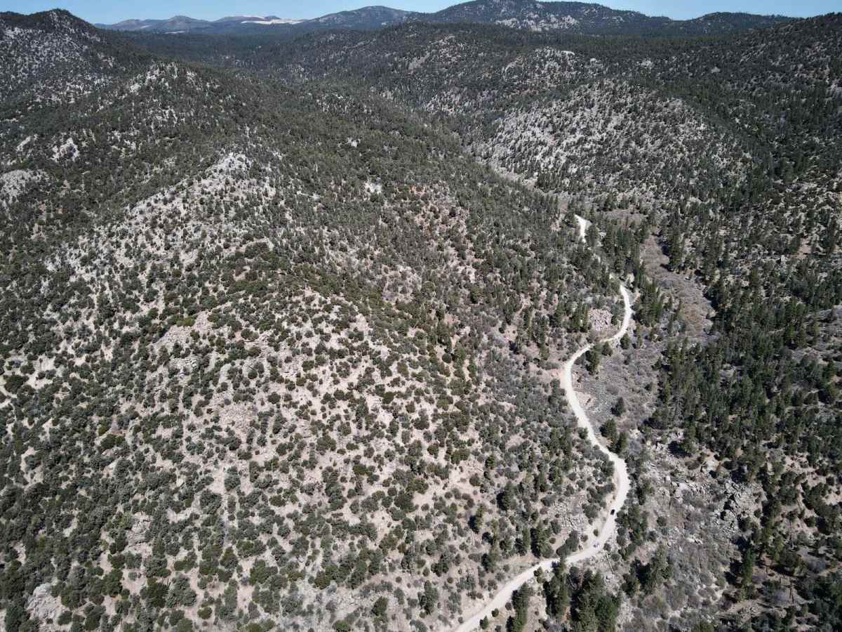
Trail Overview
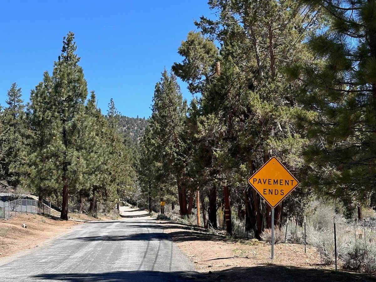
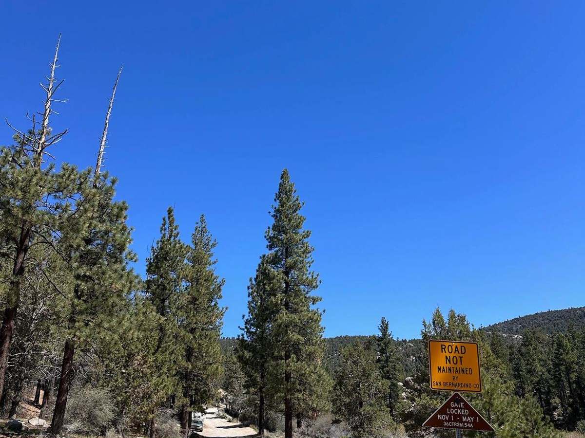
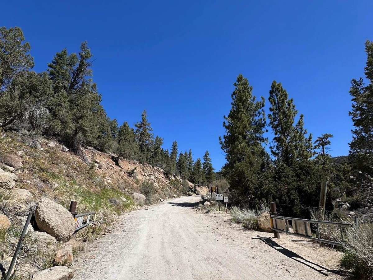
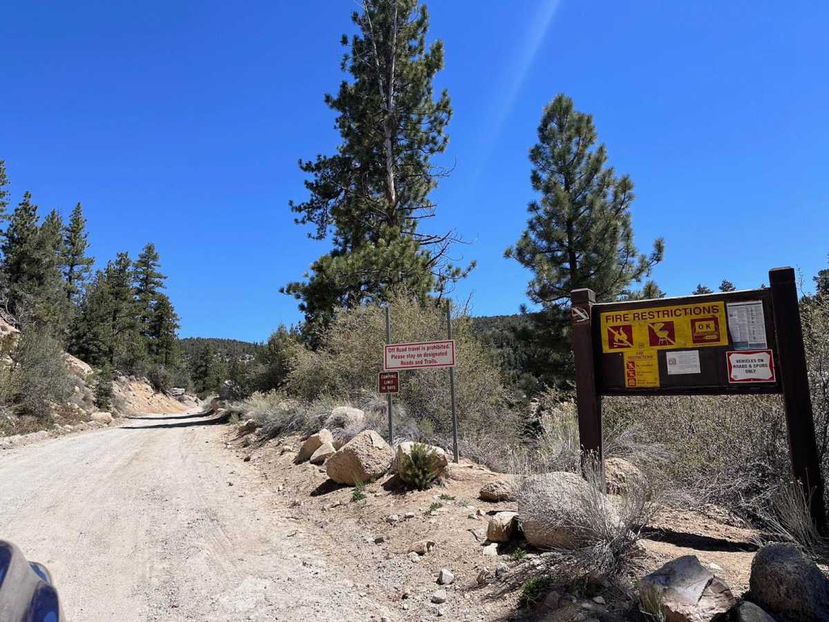
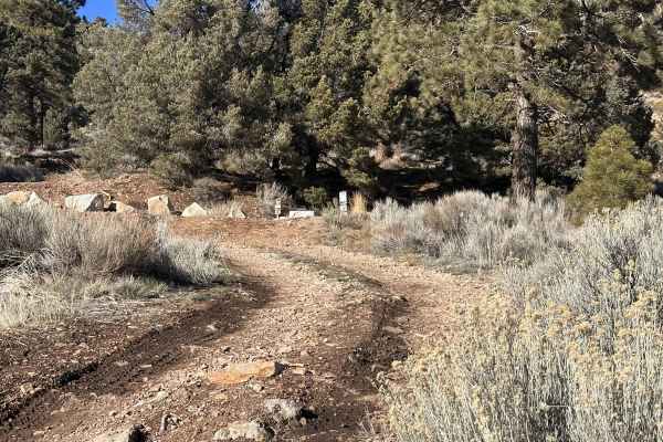
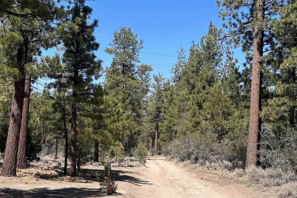
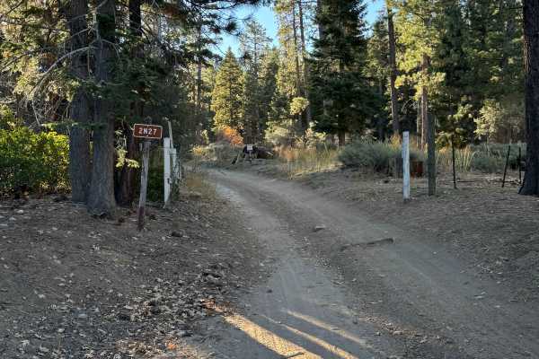
Gate locked Nov 1 - May 1: The typical start of this trail begins just off Highway 38 from the South, transitioning from pavement to dirt shortly after passing through a quiet residential neighborhood. A gated entrance marks the start of the trail, where several informative signs and a stretch of barbed wire on the northeast side signal the beginning of this forest road. The route starts with a mild incline and offers a relatively smooth drive. Drivers should remain aware of a section with cliffs on one side and potential rock slide areas on the other. Occasional puddles may appear after rainfall, but the trail generally remains passable. This route is ideal for a scenic, low-difficulty ride through wooded terrain, with expansive views of the surrounding forest and nearby valleys.
Difficulty
This route is rated easy due to its well-maintained dirt surface and minimal technical challenges. The trail features a slight incline at the start and remains mostly smooth, with only minor concerns such as puddles after rain and a short section with potential rock slides and mild exposure. Suitable for stock high-clearance vehicles under dry conditions, this is a scenic and approachable trail ideal for beginners or relaxed exploration.
History
Van Dusen Canyon Road in Big Bear, CA, holds historical significance as a path that connected the Holcomb Valley, a gold rush area, to the outside world. It was built by Jed Van Dusen, a blacksmith in Belleville, a mining town in Holcomb Valley, who was paid $2,000 in gold to create a road down the canyon to the Mojave Desert. This road was crucial for transporting supplies and equipment to the mining operations in Holcomb Valley.