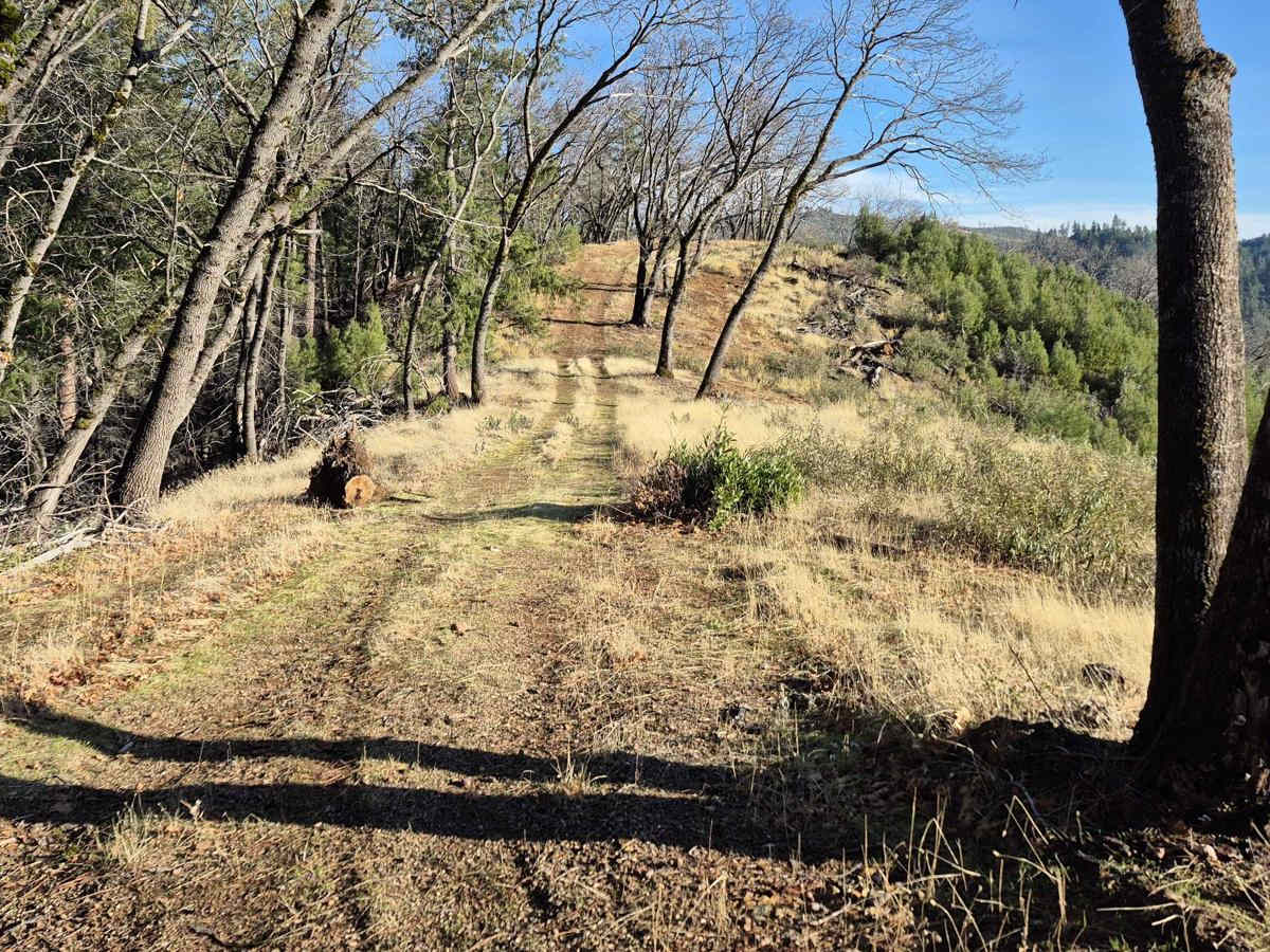
South Volcanoville (13N56)

Total Miles 4.6
Technical Rating
4 Moderate
Best Time Spring, Fall, Summer
Trail Type Full-Width Road
Accessible By
Open Trail Map

Trail Overview

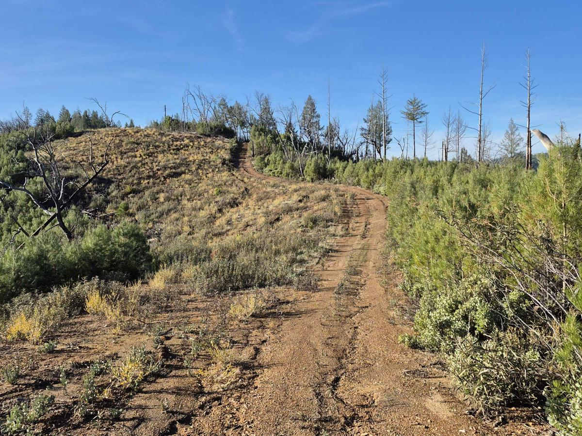
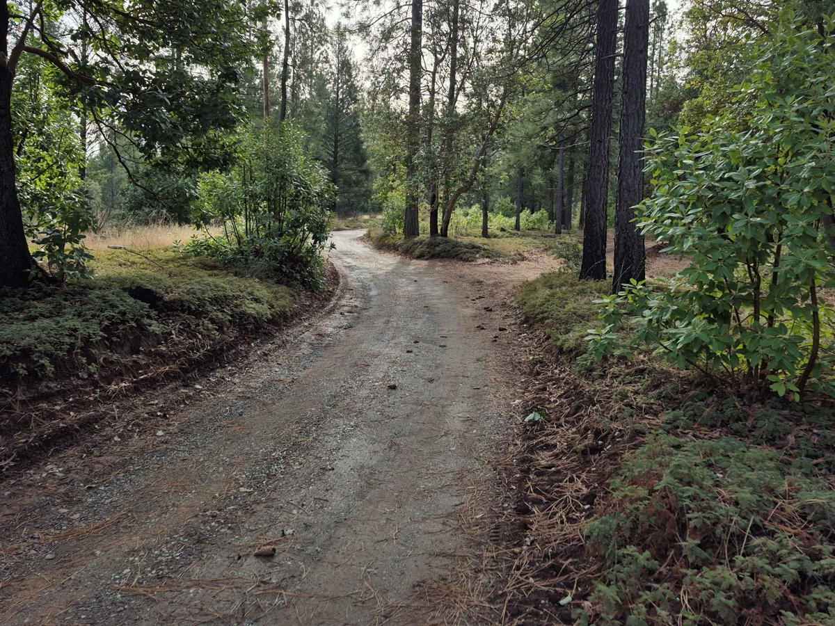
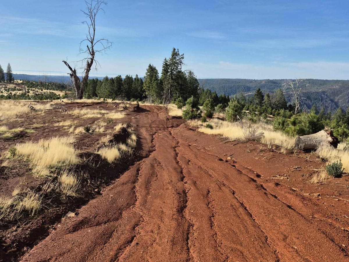
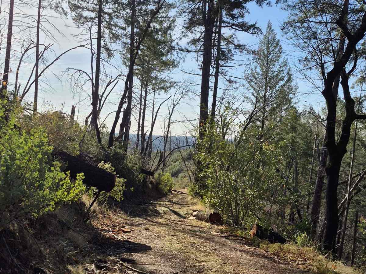
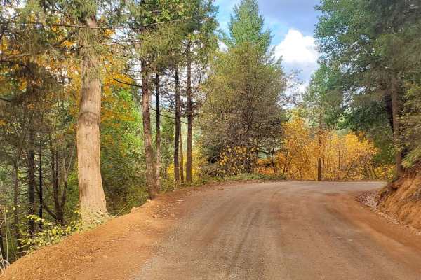
South Volcanoville (13N56) is a 4.7 mile trail that ends atop Cock Robin Point. The drive in takes about an hour and a half, while the drive back only takes about an hour. Trail width and surface varies throughout, with easy passing through the first 3 miles. After that the trail becomes narrow with fewer spaces to pull off or pass, and is not nearly maintained as well as the beginning. It is a great trail to help beginners gain confidence in climbing and descending hills. The steepest hill on the trail is 28 degrees (53% slope), with minimal roll, and a decent sized turn-around spot just before the climb. During summer this trail can be completed with high clearance AWD vehicles on all-terrain tires. Rain during spring and autumn makes the hills slippery with sticky mud that packs into all-terrain tires fairly quickly.

Photos of South Volcanoville (13N56)

Difficulty

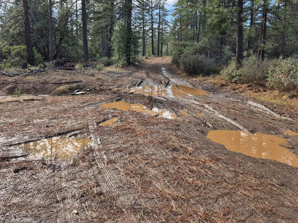
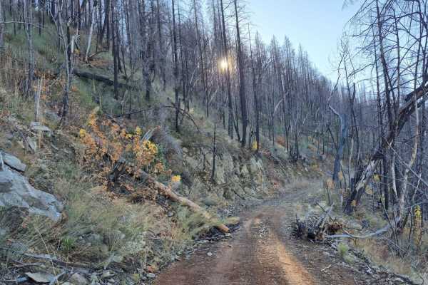
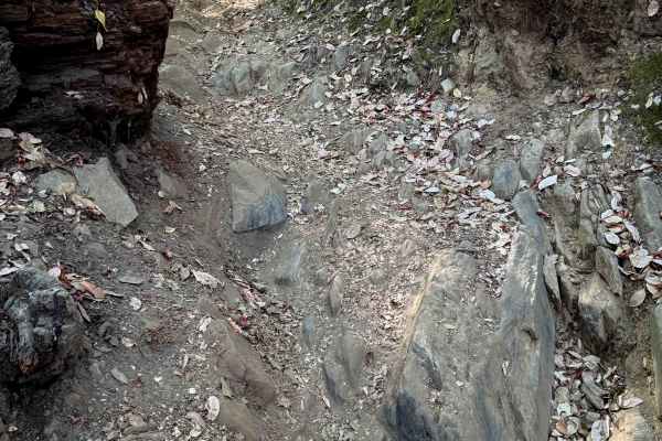
The first 3 miles of South Volcanoville (13N56) are predominantly a technical rating 3 once seasonal maintenance has been completed in the spring. Once the trail enters the Trailhead Fire (2016) scar area, it becomes uneven with obvious signs of erosion. There are a few mud holes, and small stretches of washboarding. The last mile and a half has obstacles that quickly meet technical rating 4, such as loose rock and mud on hills as steep as 28 degrees (53% grade); as well as a much narrower trail with few places to pull off or pass.

Technical Rating

4

Status Reports

Add Status Report
Nick C 916
May 23, 2026
Open
Surprisingly easy. Was really prepped for the big hill but didn’t have to sweat it. Moved the log off the trail to get to C$&@ Robin Point. Great day!
Anna P
May 16, 2026
Open
A great route with beautiful views. Short and quick
Christian Wright
Mar 14, 2026
Open
Did this in conjunction with S Volcanoville. We preferred this trail over South trail. Good views and overall more beautiful. We cleared 5 or 6 fallen trees and made it to the end where there are great views along with an abandoned RV. Very easy dirt road stock 4x4 or even SUV would be fine.
Ongchai Thao
Sep 07, 2025
Open
Dylan Escobar
Jul 28, 2025
Open
Easy ride all the way to the end, the down tree is still there but is easy to pass over. Trail gets tight in a few areas but is manageable.
Ian W
Jun 14, 2025
Open
Small downed tree near the end of the trail. Easily removed if I had brought a saw. Trail had a good amount of washout but no problem for stock 4WD. Some narrow spots where the bushes and fallen trees encroach on the trail, wouldn’t recommend a full size truck unless you don’t care about your paint or bodywork.
Chris Weddle
May 24, 2025
Open
Windy road with amazing views. When you finish the trail, go down the hidden trail ahead and to the left to get to a small point with left over shooting targets and river views.
Floppa Flopper
Mar 29, 2025
Open
mark brooks
Mar 09, 2025
Open
If you have never offroaded before, this is a good beginner trail - but if you have any experience, you will find it very boring. It's a dirt road with no challenging/technical areas, and the views are nothing to write home about. A 2wd vehicle could do this "trail" with ease ... and the steepest incline was only about 14 degrees, very tame. I ended up going to Bottle Hill after this, which was a much more enjoyable drive

South Volcanoville (13N56) Trail can be accessed by the following ride types:

  • Single Track
  • 50 Inch
  • 60 Inch
  • High Clearance
  • Full Width

South Volcanoville (13N56) Map

The onX Offroad Difference

onX Offroad combines trail photos, descriptions, difficulty ratings, width restrictions, seasonality, and more in a user-friendly interface. Available on all devices, with offline access and full compatibility with CarPlay and Android Auto. Discover what you're missing today!

Open Trail Map