Mitchell Cole
Nov 01, 2025
2023 Tesla Cybertruck
Open
Muddy/Wet
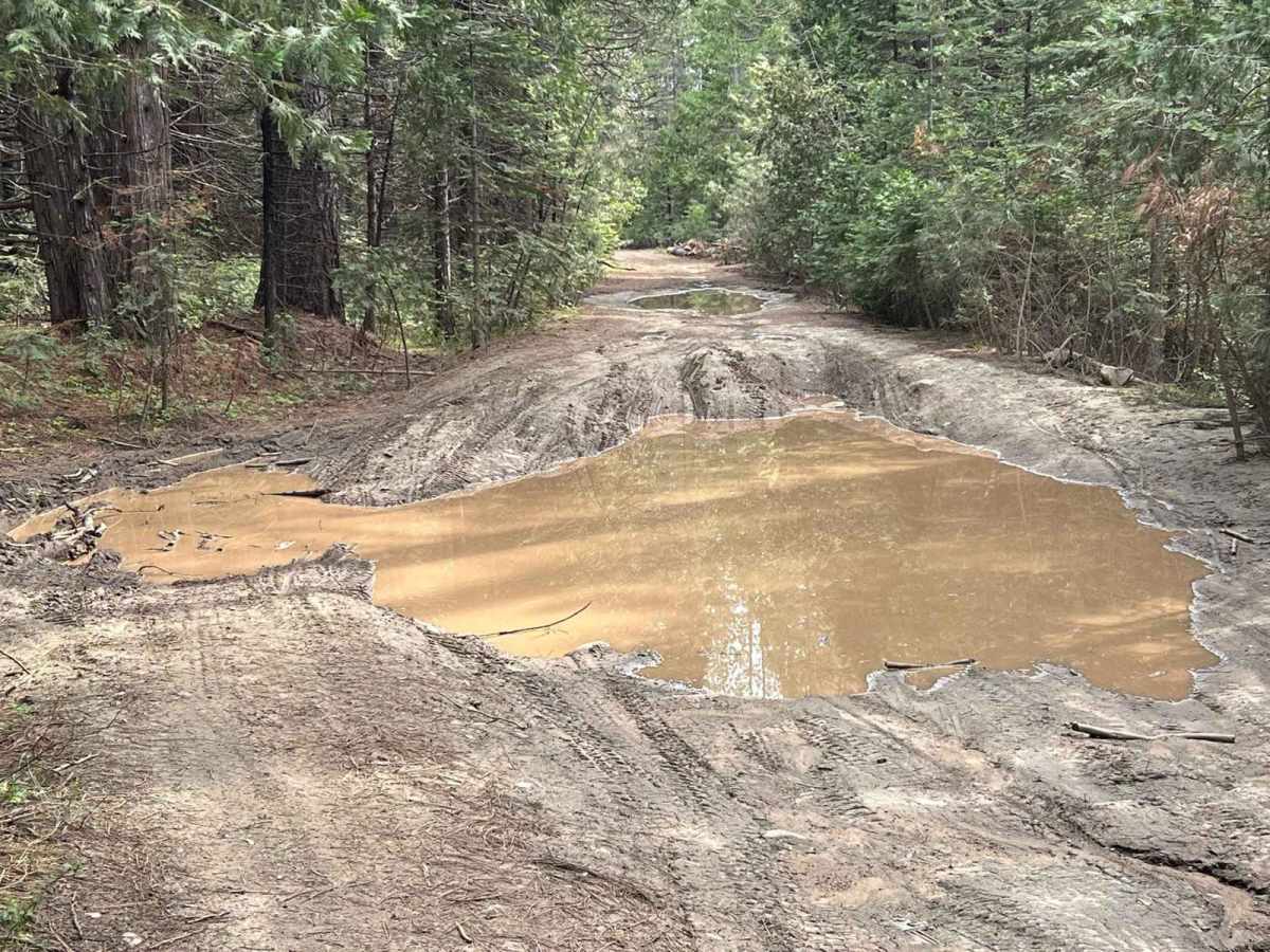
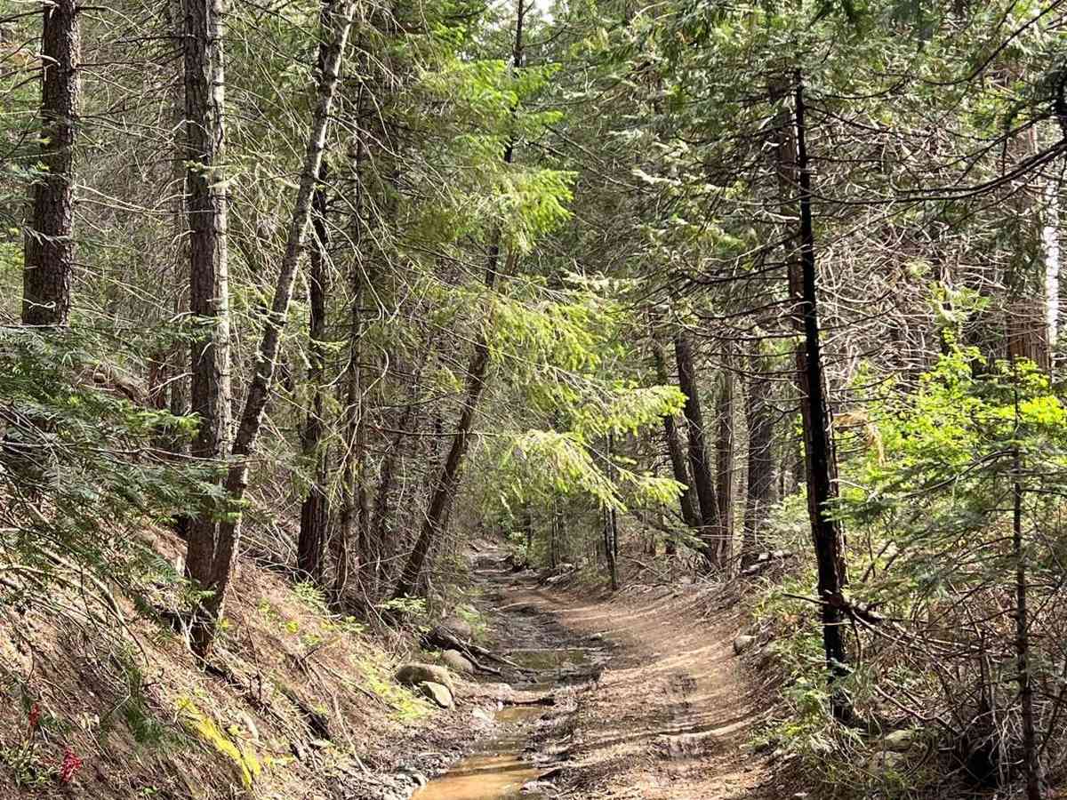
Spent the weekend camping at a spot right off the trail about 3/4 of the way to the end. there were two firepits there waiting for us. Trail was muddy and there was a mudhole right before the turn off to the campsite. if you have a foot of clearance youll be fine and if you are careful picking a line youll be fine with less. It is about 10 degrees cooler than the forecast right now so if camping overnight bring the appropriate gear, we came a little unprepared
Alberto Ocegueda
Sep 28, 2025
Open
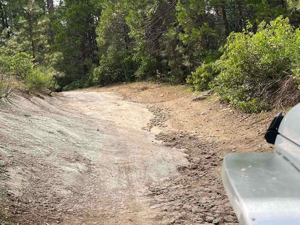
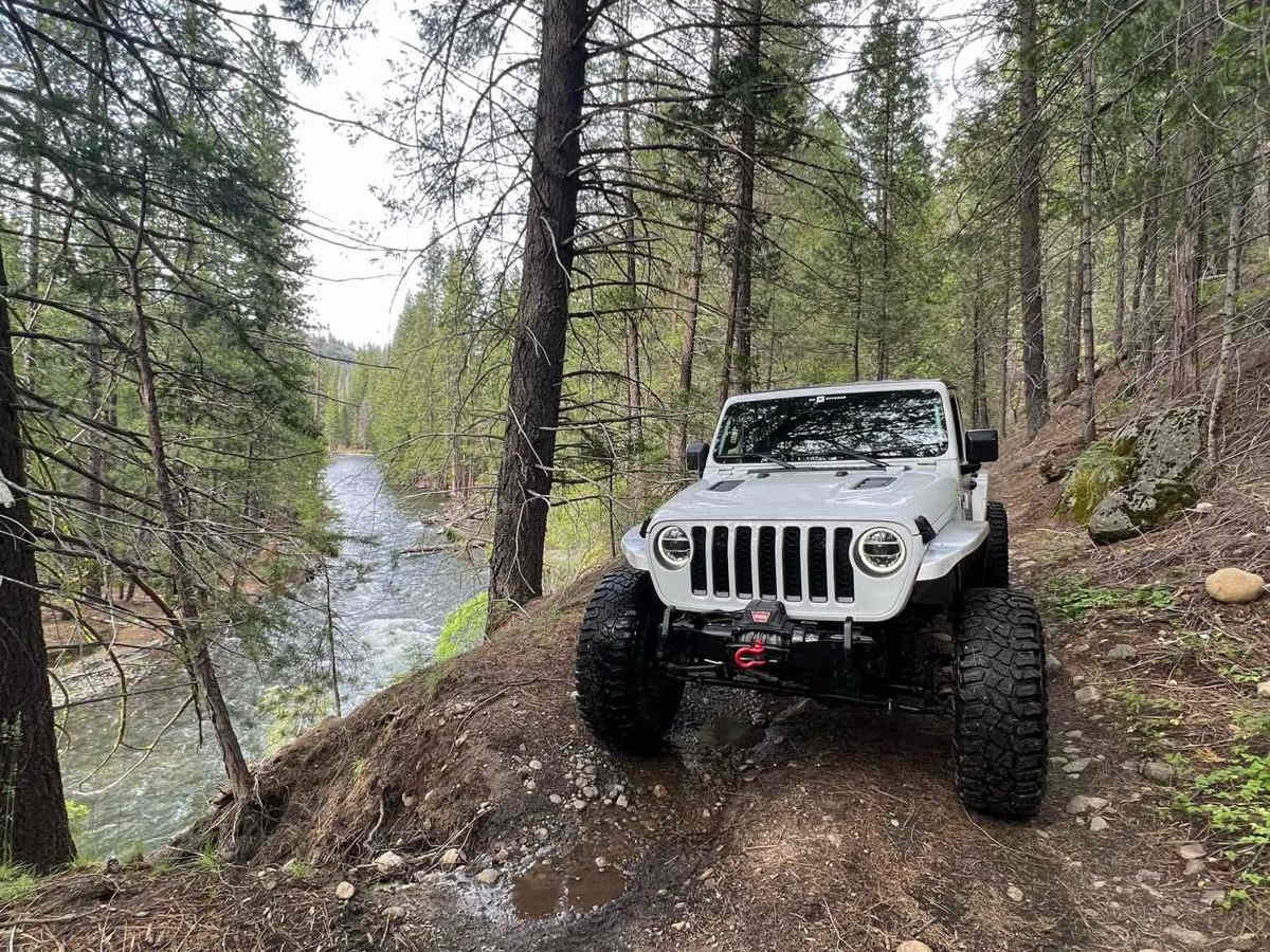
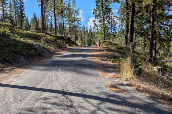
This is a great trail overall. Most of it is paved and easy to navigate, but there are about three sections toward the end that become moderately challenging and will require a high-clearance 4x4. Those rougher spots are short and only near the end, so the majority of the route stays pretty simple. If you make it through to the finish, you’ll be rewarded with a beautiful riverside spot that’s perfect for relaxing.
J Zr2
Sep 05, 2025
2024 Chevrolet Colorado
Open
Dusty
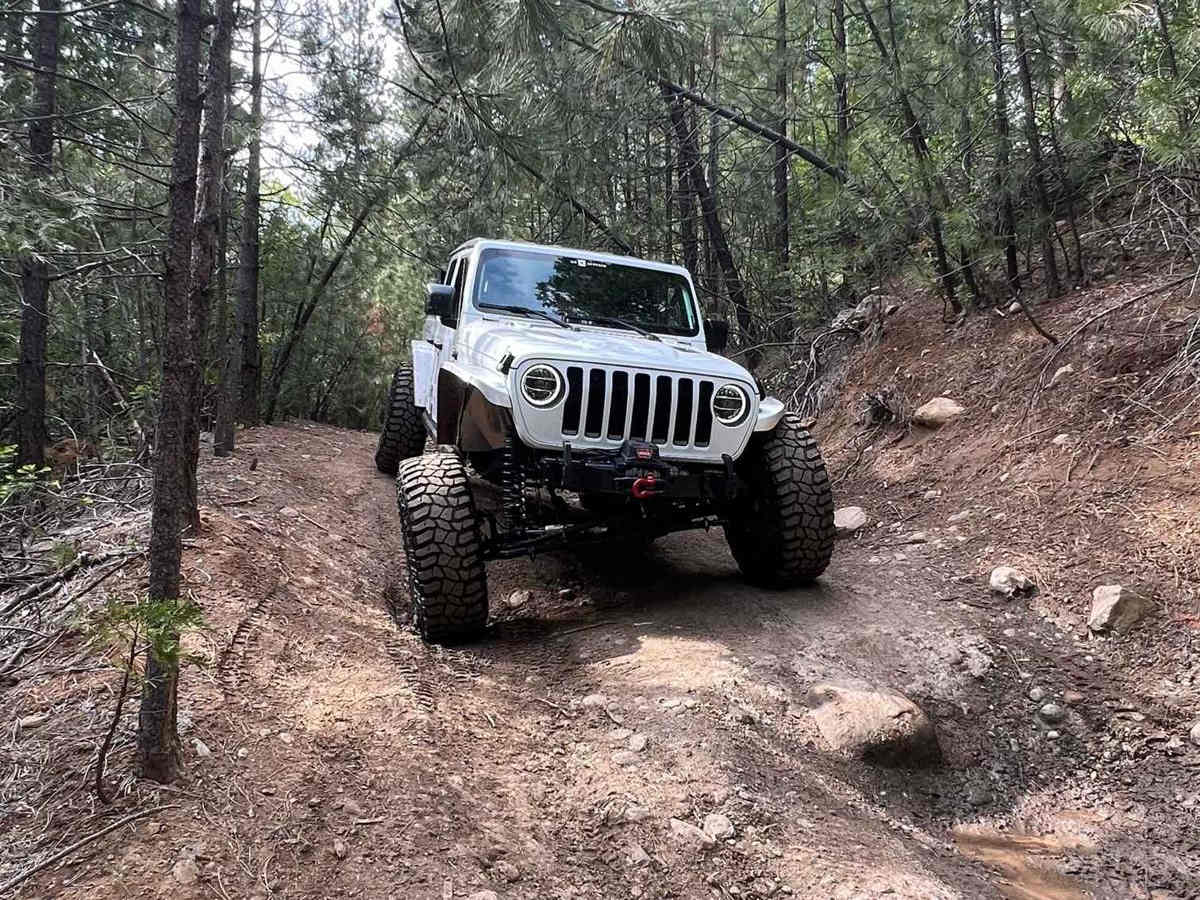
Nice quick trail camped here a handful of times over the years. Multiple great campsites along the river. 3 slightly technical sections that would be easy for any high clearance vehicle. Didn’t air down the tires wasn’t needed. Unfortunately the site I stayed had a good number of scattered cans/ bottles which I collected. Also noticed a couple bio bags which i didn’t pick up due to obvious reasons. First time I’ve seen noticeable trash. Pack out your stuff!!
Panamint Valley
Jul 27, 2025
Open
NormalDusty
There were a lot of people leaving their campsites mid-day. Most of the road is accessible by stock car or SUV, but there is a small uneven section near the end just before you get to the larger campsites closer to the river.
Adrian's Jeep
Jun 13, 2025
Open
NormalDustyMuddy/WetWashboard
Please pack everything you brought in. This trail is to and back route only. I went on this trail thought I can go through the Lyons dam (end is closed). Theres muddy parts towards the end. Three technical part of trail that made me use 4-Lo. Lots of dispersed camping sites.
Nate Layton
May 24, 2025
2001 Ford F-Series Super Duty
Open
DustyMuddy/Wet
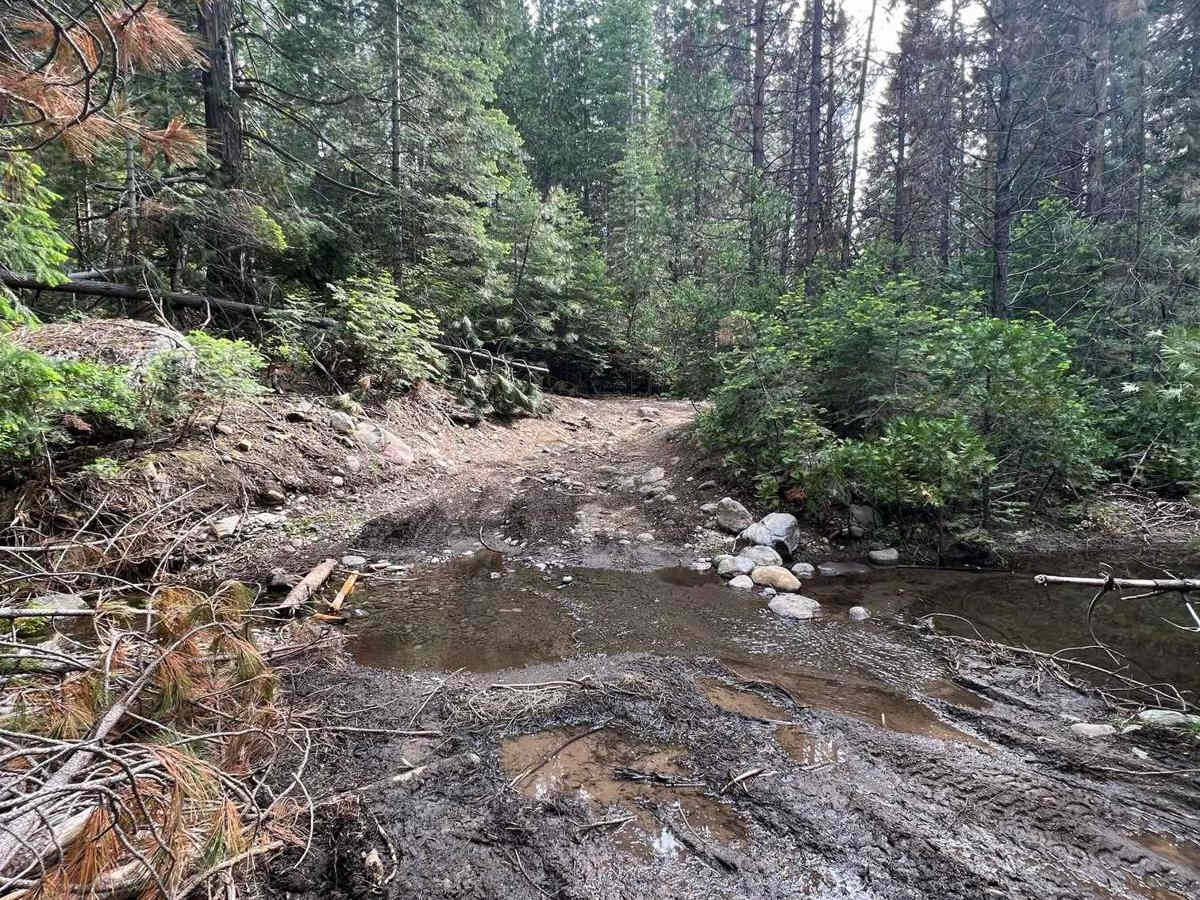
You’ll see the trail report of the red tacoma, you’ll hit that articulated spot about half way in. Easy forest road until then. Not hard but small vehicles would walk it no problem. I was alone so I turned around. Nice camping spots off the trail too.
Joey H
May 10, 2025
2010 Jeep Wrangler
Open
DustyMuddy/Wet
Lots of beautiful places to stop by the river to camp. Saw a few people out there camping and a couple of people hitting the trail. There was some pretty narrow spots with some downed trees that were cut out of the way. Also a few really muddy sections as well as one deep mud pit. A few technical areas as well. I really enjoyed it, I’ll be back 😎
Jacob Marshall
Jan 01, 2025
Temporarily Closed
ac james
Dec 16, 2024
Open
Muddy/Wet
trail was open all the way to the end. You can see where a tree had fallen but somebody cut it up and dragged it out of the way. broke a spindle on my first gen Sequoia, daughter and I had to hike out 3 mi to Lyon's dam to get cell signal & get picked up... came back the next day with a generator and welder, jacked it up and got it welded up.. Great adventure!
Ahsan Uddin
Nov 18, 2024
Obstructed
Downed Tree
Fairly easy trail that I did without airing down with some snow on the ground. There were two spots that stock 4x4 might struggle a little bit but the rest is very easy trail. About three quarter way in, there’s a small downed tree which can be easily taken care of with a chainsaw. I was loosing light so didn’t attempt it.
Alviraaz s
Sep 07, 2024
Open
Dusty
I don’t know the trail being 3 maybe 4. Those holes like 16-18”. I didn’t touch my sliders or underside anywhere but I did 2 and 3 wheel at places.
Jacob Lerch
Aug 17, 2024
Open
No signs posted on trail, all appears normal and open. Beware, some trees are blocking the trail so be prepared to either move or cut from the trail.
Kyle Nguyen
Jul 03, 2024
Temporarily Closed
Closed GatePosted Sign
Neil Laxamana
Jun 22, 2024
2003 Mercedes G-Class
Open
DustyMuddy/Wet
Kyle S
Jun 08, 2024
2016 Ford F-Series
Open
Muddy/Wet