Lippincott Pass

Total Miles 6.7
Technical Rating
4 Moderate
Best Time Spring, Winter
Trail Type High-Clearance 4x4 Trail
Accessible By
Open Trail Map

Trail Overview

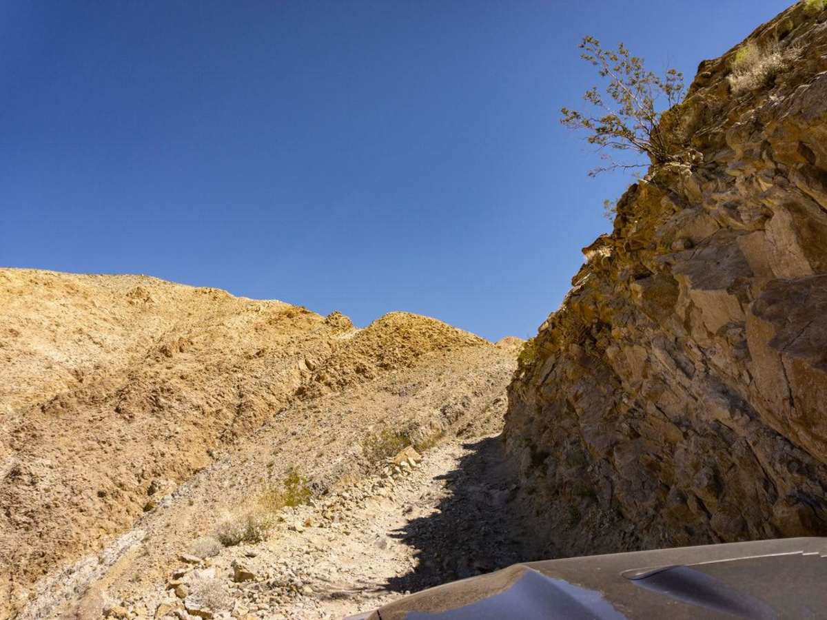
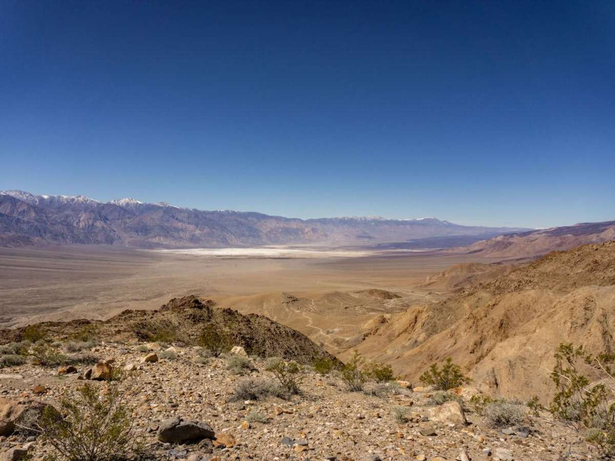
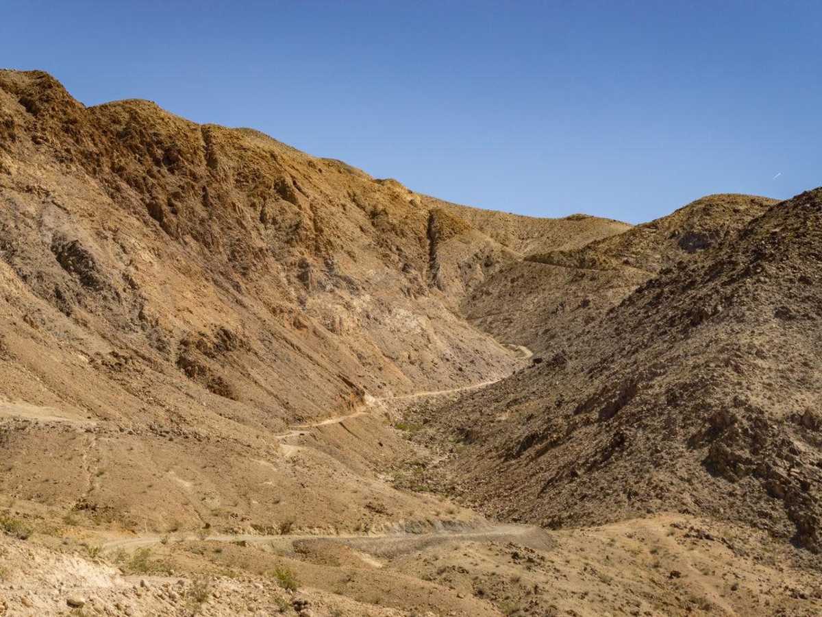
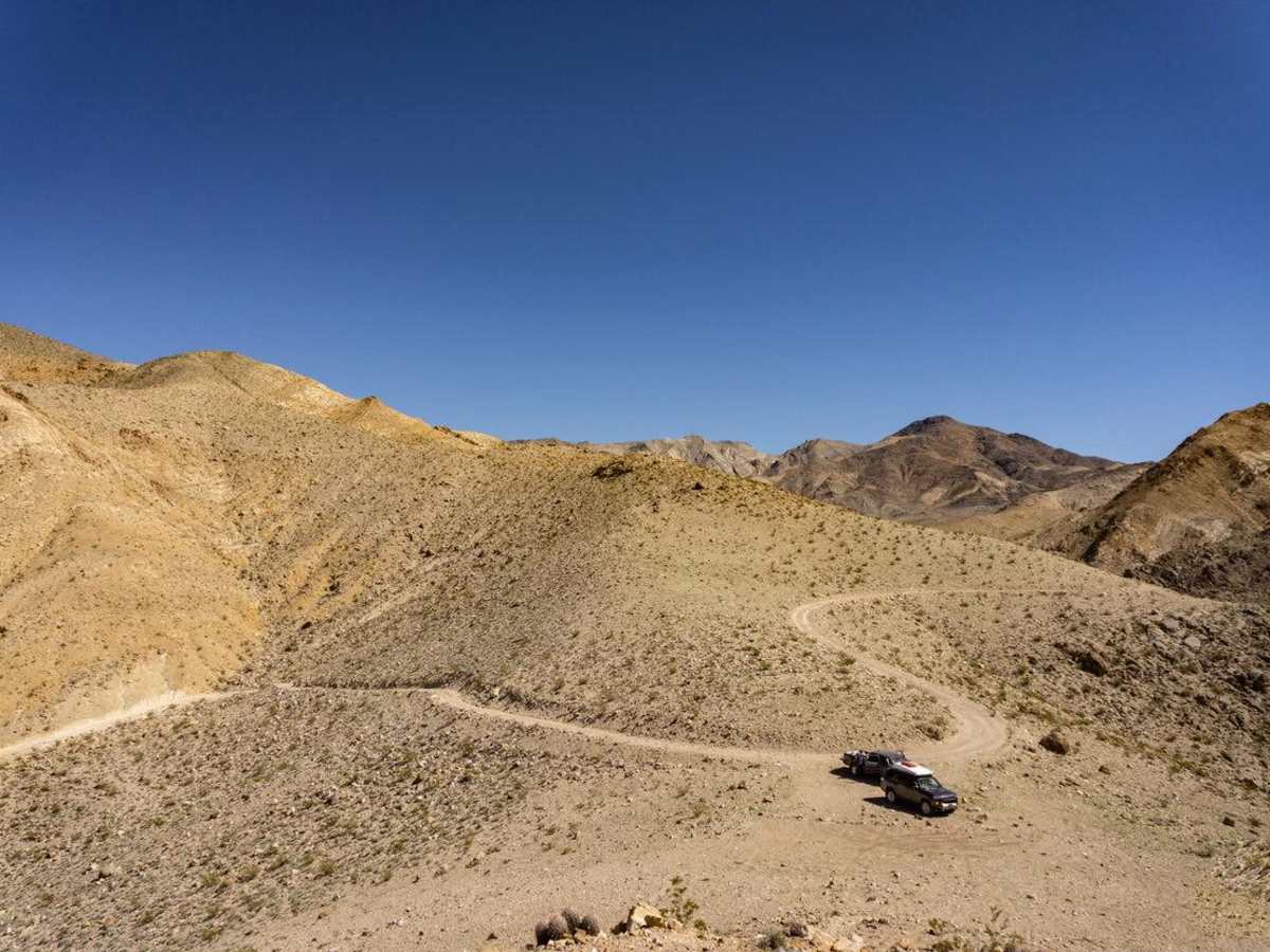
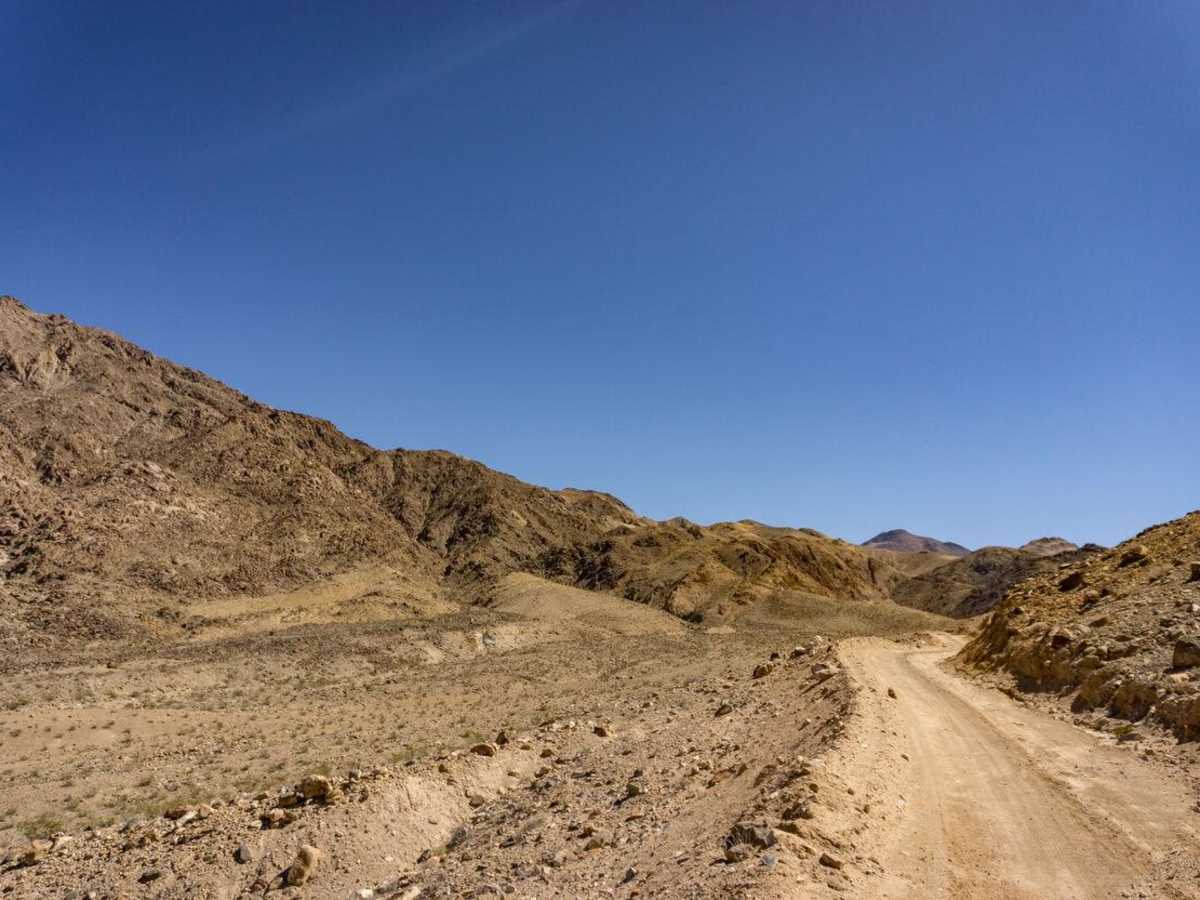
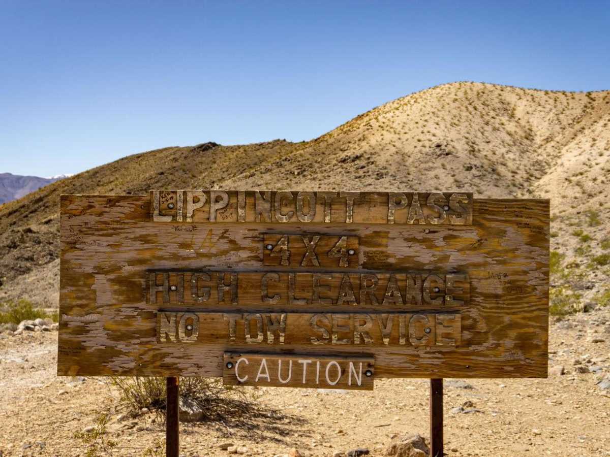
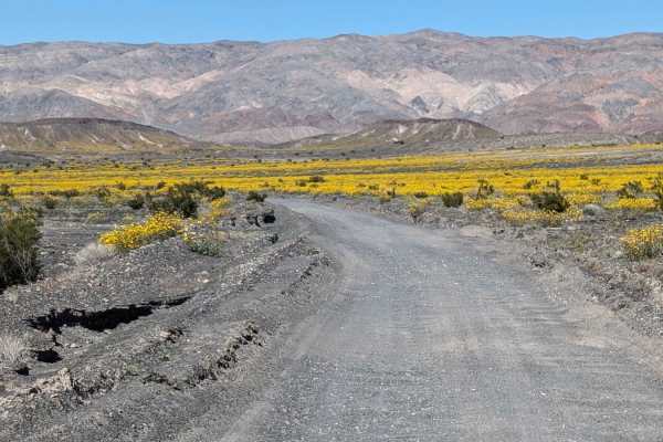
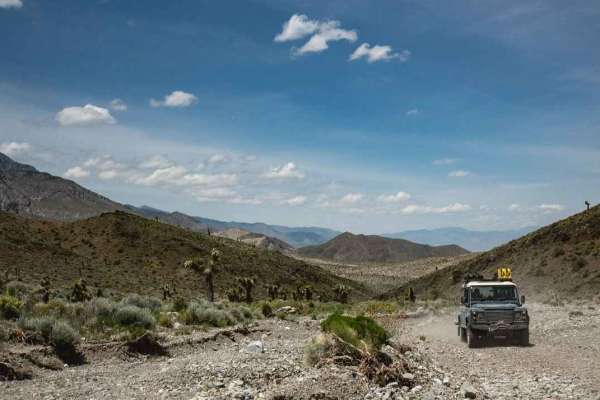
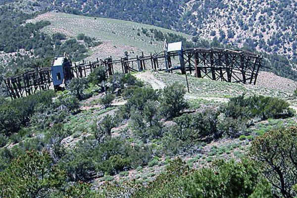
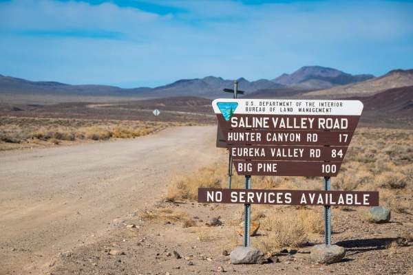
This short but steep trail links Saline Valley and Racetrack Valley. The shelf trail is famously narrow as it winds through Last Chance Range with a number of off-camber sections, rock gardens, and tight turns. 4WD is mandatory and long wheel base or top heavy vehicles are not advised without previous experience. The approach to Lippincott Mine Road from the bottom starts at its intersection with Saline Valley Road near the south end of Saline Valley. The road heads east from the intersection along a downward straight track leading to the base of the Last Chance Range and the bottom of Lippincott Pass. The straight section of road is well worn into the landscape and has a number of sharp rock sections that could create a sidewall puncture. Stick to the defined ruts to best avoid a flat tire, and moderate your speed to allow enough time to maneuver around larger rocks. At the base of the mountains, the trail becomes less rocky as it turns north and heads uphill. About 4 miles in, the trail gets to its narrowest section as you climb along a canyon into a series of sharp switchbacks. An outside spotter is recommended through the rock garden and the switchbacks immediately following. The trail continues to climb with great views of Saline Valley behind you and views of the Lippincott Mine on the right as you approach the top. The trail ends at the Lippincott Pass sign and the intersection of Racetrack Road with a beautiful view of Racetrack Playa below to the north. The trail can be travelled either direction, and use of VHF radios are highly recommended to call out positions for opposing traffic. Most 4x4s will monitor the 146.460Hz frequency in the Death Valley Area. If approaching from below, relay an uphill message before mile 4 as there will be no way for vehicles to pass between miles 4 and 6. Like much of Death Valley, this trail has no cell coverage.

Photos of Lippincott Pass

Difficulty

Numerous off-camber sections, switchbacks and a small rock garden along a shelf road make this trail moderate to difficult depending on vehicle size.

History

Lippincott pass was originally an access point for Lippincott Mine, located on the southwest corner of Racetrack Valley. Originating as far back as 1906, the mine produced lead and silver ore into the 1970's.

Technical Rating

4

Status Reports

Add Status Report
Cody Shaw
Dec 28, 2025
Open
The recent grading has deteriorated in some spots. Otherwise, passable with high clearance.
Jim Nardulli
Oct 29, 2025
Open
Rough washboard to and from. Pass was in good shape. Worthwhile - great views.
CemenTRDgen CemenTRDgen
Apr 18, 2025
Open
Lippincott Pass has been freshly graded and widened. It is now a smoothly graded dirt and gravel road with no rock obstacles. A stock high clearance 4x4 can easily make it without issue. Rating should be revised to a 3 or 2.
Randy Boelkes
Apr 17, 2025
Open
Trail is well graded, with no technical features to negotiate on a narrow high exposure shelf road. There were an adequate number of pullouts to allow several other groups to pass in the other direction, but this was the “busiest” trail we were on in 6 days of wheeling in and around DVNP. Be prepared to back up hill on a narrow shelf road fairly long distances.
Zander R
Apr 11, 2025
Open
The lower approach from the valley had some of the roughest sections. The trail up the hill was very clean. we only had to get out once to move one sharp rock. Three motorcycles were coming down as we just started up. We saw three vehicles up at the racetrack that had come in from the north.
Joshua Ruiz
Jan 18, 2025
Open
Ryan Caceres
Jan 05, 2025
Open
Went down the trail, super chill. Didn’t see a single vehicle going up or down. The hardest part of the trail is building up the courage to go down in hopes no one is coming up, but there are plenty of spots to pull over. I’d recommend pulling off and checking ahead by foot if it’s a blind corner. Did this in my gx470, will be on my YouTube channel Raidan overland.
Jason Baker
Jan 03, 2025
Open
Sky Yang
Dec 29, 2024
Open
Good condition. Some scary spots but safe if you are careful.
Matt p
Dec 28, 2024
Open
Very fun! Easy going down in low range gears
Christian Hansen
May 04, 2024
Open
Freshly graded, very smooth. Still a narrow 4x4 trail but you could still see the dozer tracks.
Daniel Wallace
Apr 27, 2024
Open
Carlos Castellanos
Apr 01, 2024
Open
Trail was in good condition, according to the other two rigs in our group, the trail has been in the best condition they have seen It in a while. still nerve-racking seeing the edge, but trail has been recently leveled and was not an issue.
Ernesto Lopez
Jan 20, 2024
Open
Echoing the last 2 reports: the hardest part of this trail was the first section through the valley. Several washed out areas have very steep ledges which were the biggest obstacle and could pose a big issue for those with a longer wheelbase or lower approach angle. I gave the trail a 5 for this area. The switchbacks up the mountain have been recently graded and are really not technical, maybe a 2/10. Still somewhat nerve wracking due to the amount of exposure though!
Candace Bathurst
Jan 05, 2024
Open
Pass was recently grated not much for washouts on pass. Drove Jeep jk pulling turtleback trailer. Took lots of patience and time with trailer but made it through. Valley below still had a few big wash outs from rains. Jeep and trailer made it though.

Lippincott Pass Trail can be accessed by the following ride types:

  • High Clearance

Lippincott Pass Map

The onX Offroad Difference

onX Offroad combines trail photos, descriptions, difficulty ratings, width restrictions, seasonality, and more in a user-friendly interface. Available on all devices, with offline access and full compatibility with CarPlay and Android Auto. Discover what you're missing today!

Open Trail Map