Moni L
Jul 18, 2026
2023 Toyota 4Runner
Open
NormalDusty
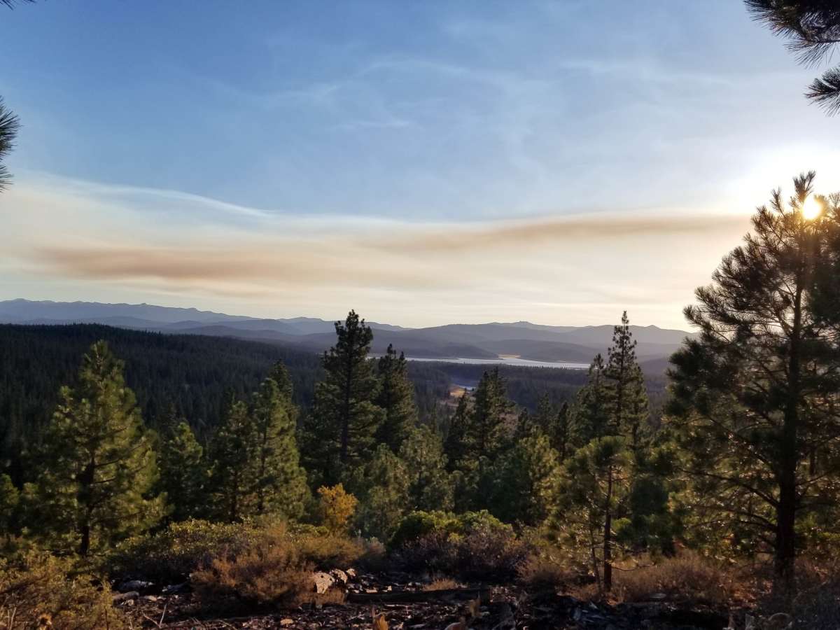
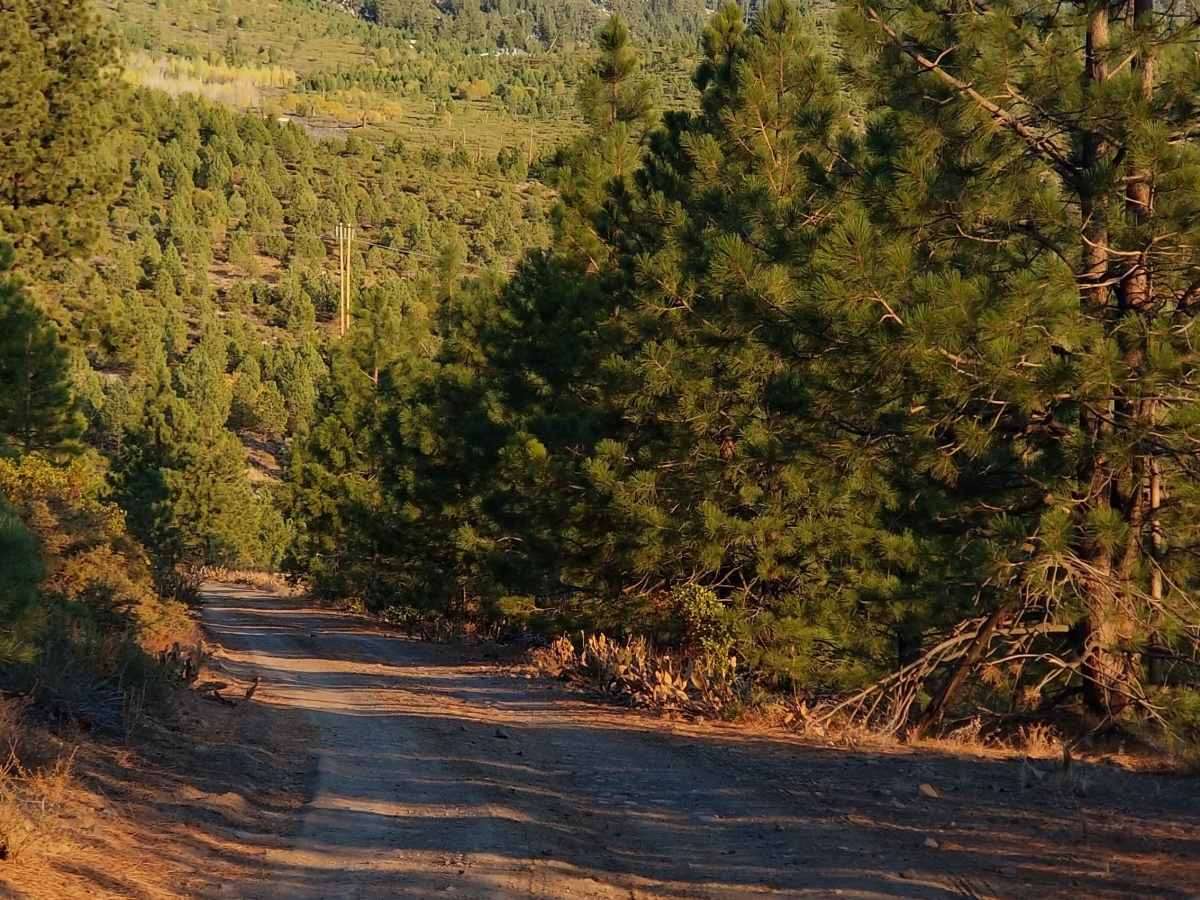
Easy trail with beautiful views of Stampede and Boca Reservoirs. Not very technical but rocky. Some downed trees had already been pulled to the side. Spotted the occasional Mountain biker, dirt bikes and two other vehicles. I only made it 5 miles in then turned around due to it taking a lot longer to drive.
Steve Deal
Jul 17, 2026
2023 RAM ProMaster
Open
Dusty
Dry and dusty with some loose small rocky areas. FWD High clearance van had no issues. Great views at the top. Views are drone shots.
Nichole Paine
May 24, 2026
2025 Ford Bronco
Open
Normal
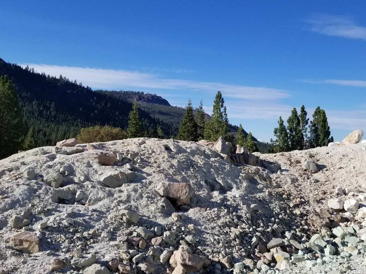
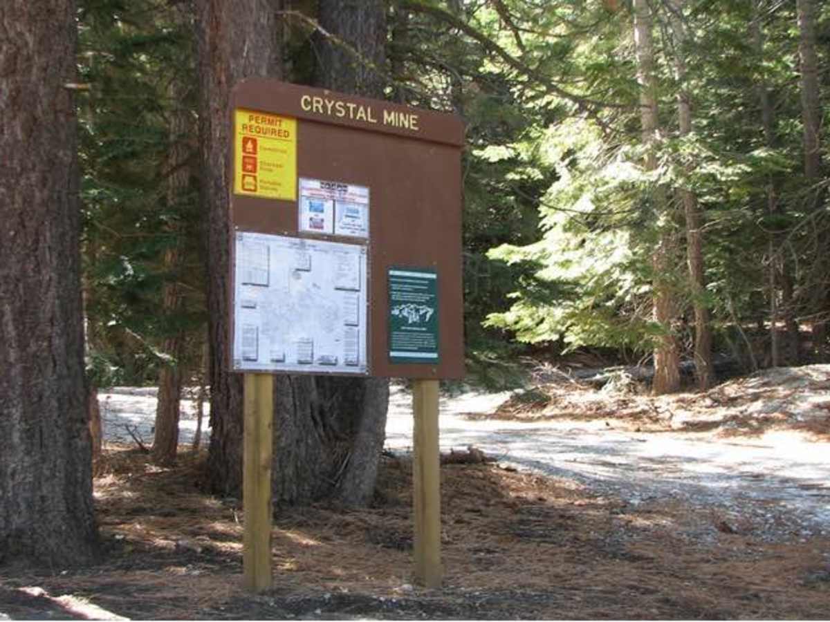
The Crystal Peak Mine Loop is a great, fairly easy trail that leads directly up to an out of use Crystal Mine.
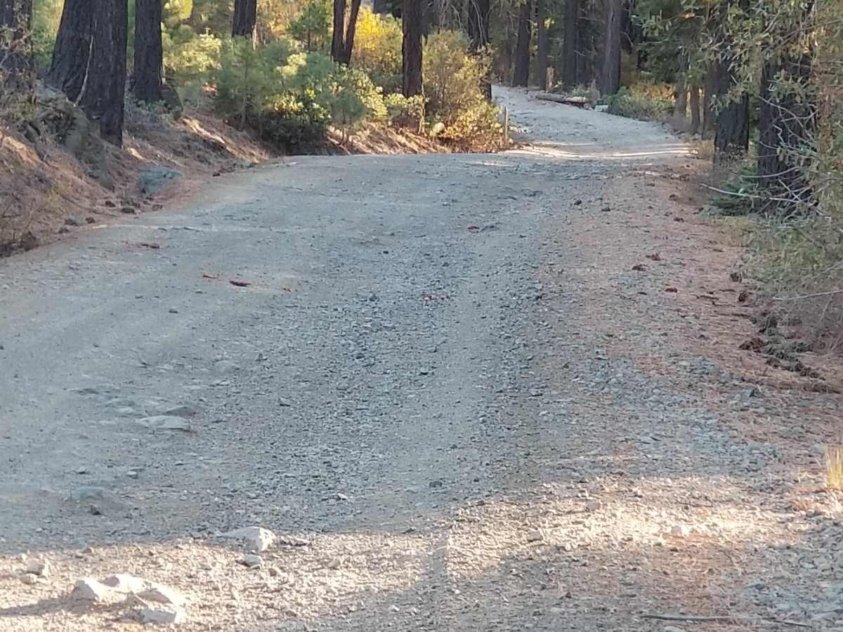
The trail is fairly easy, consisting of well-traveled dirt roads with some rock areas. Until the final climb to the mine itself, there are no major areas of concern.
At the final ascent, there is one obstacle that presents a challenge for lower or long-wheel base vehicles where erosion has created somewhat of a ledge where some vehicles could become high centered.
JACK INGHAM
May 10, 2026
2021 Jeep Gladiator
Open
Dusty
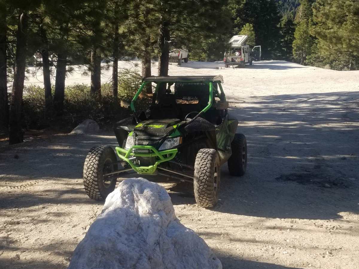
Dirt bikes 3, 1 side by side, 1 jeep. Went to the mine, then out to NV. Full day
Heather Theaderman
Apr 29, 2026
2023 Toyota 4 Runner
Open
NormalRough/Deteriorated
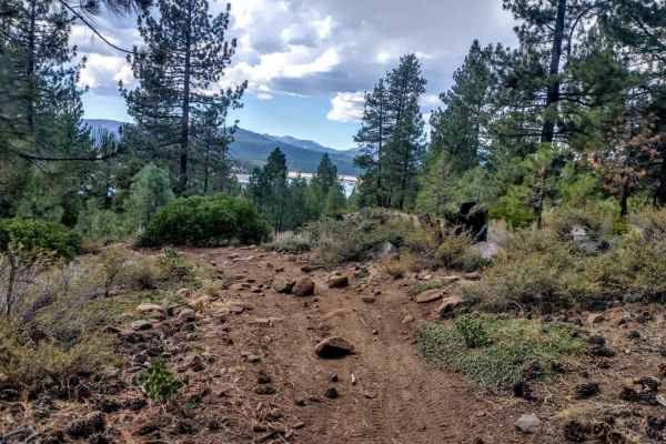
Beautiful trail, open and a couple people camping around. Only section you definitely need high clearance for is climbing up to the mine on the little “hook” of the map after campground. Some deep ruts through it, quite steep. Beautiful view from up on the mine.
Steve Deal
Apr 10, 2026
2023 RAM ProMaster
Temporarily Closed
Seasonal Closure
Another storm coming in tomorrow too.
daniel w
Jan 19, 2026
2010 Toyota Tundra
Temporarily Closed
Probably won’t open until the snow melts completely.
JACK INGHAM
Oct 13, 2025
2021 Jeep Gladiator
Open
Normal
Came out of Truckee east to off of 80. Exit and drive on Hirschdale road, 894 Head north towards Boca dam. Continue North to Boca rest campground FS 73 Crystal Peak mine loop. We continued for 11 miles. Mostly dirt steady elevation changes and easy turn. Some places for passing other wise one lane wide. Two narrow spaces where bushes and limbs would touch. Avoid and drive slow. Amazing fall colors and Aspens galore in many small groves. We turned around due to night fall. Simply incredible views of forest and water. Snow caps on a few mountain ranges in the distance. This trail was fun and simple. Great for beginners and novices.
Steve Baker
Jun 25, 2025
2021 Can-Am Outlander Max 1000R
Open
Normal
Beautiful day on this trail. Did the full loop and the road was in great shape. Stopped in to speak with really nice people at one of the campgrounds. Saw a few other cars and a dirt biker. Overall it was a great day to be in nature!
Eric C
Jun 14, 2025
2007 Toyota 4Runner
Open
Normal
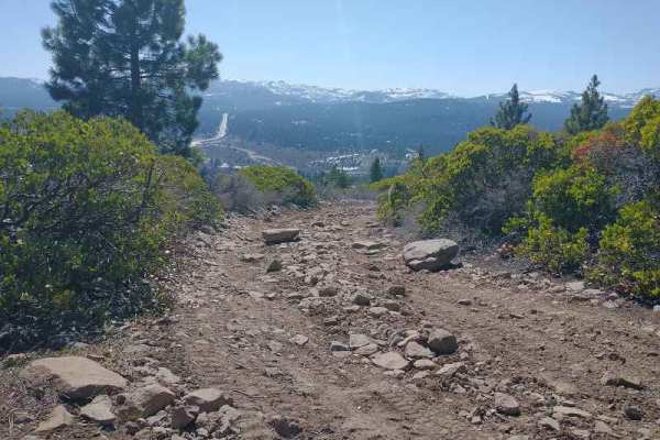
Open, all clear, easy drive. Eastern routes are a cake walk, 1/10, could do comfortably in a 2wd. Western routes are 2/10, a few small obstacles well under 12”; a muddy rut, a dirt ledge, small rocky areas. Crystal hunting at the peak with the kids was a lot of fun. We’ll be back to do this trip again!
Matt B
Apr 19, 2025
Open
NormalDustyMuddy/Wet
Toiyobe Forest parts of the trail are all passable fairly easily. Some snow still in shaded areas.
JC B
Apr 09, 2025
2024 Rivian R1S
Open
Snow/Ice
Easy for the most part. Snow patches here and there but within a mile of the campground there was high snow
Noah gardizi
Feb 14, 2025
Open
DustyMuddy/WetSnow/IceRough/Deteriorated
I started the trail from 385 in sunvalley Reno. The trail had a diversity of challenges from river crossings too inclines with loose rocks. I was traveling towards truckee ended up struggling with the snow higher up the summit. Amazing trail I’d wait until its dryer out to get the full potential that the trail.
John Rivera
Sep 29, 2024
Open
NormalDusty
Rode dirt bikes with the kids from Boca to Crystal Peak. It was around 43 miles round trip. Longer than the map states even though we took the exact trail marked as Crystal Peak Loop. A couple of sections close to the staging area were sandy and not easy for beginner dirt bike riders like ourselves. Most of the trail was gravelly or rocky. Taking the length of the loop in consideration, I’d rate it between 4-6 from a beginners perspective.
Eric C
Aug 11, 2024
2007 Toyota 4Runner
Open
Dusty
Wide open. Boulder that used to partially obstruct the trail has been removed. Dry, dusty conditions with a few soft rutted spots. Overall easy and fun drive.