Ken Ekenseair
Jun 27, 2026
Open
Normal
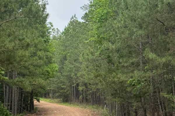
We had a pop-up night ride. We ran this from the North to the south, which makes it a little more technical. Huge washouts. Fun trail, and definitely one of the more technical trails in this area. Fun trail; most 4x4s can do this trail. Just plan you lines and you will be fine.
Big Mike
Jun 09, 2026
Open
Muddy/WetRough/DeterioratedWashboard
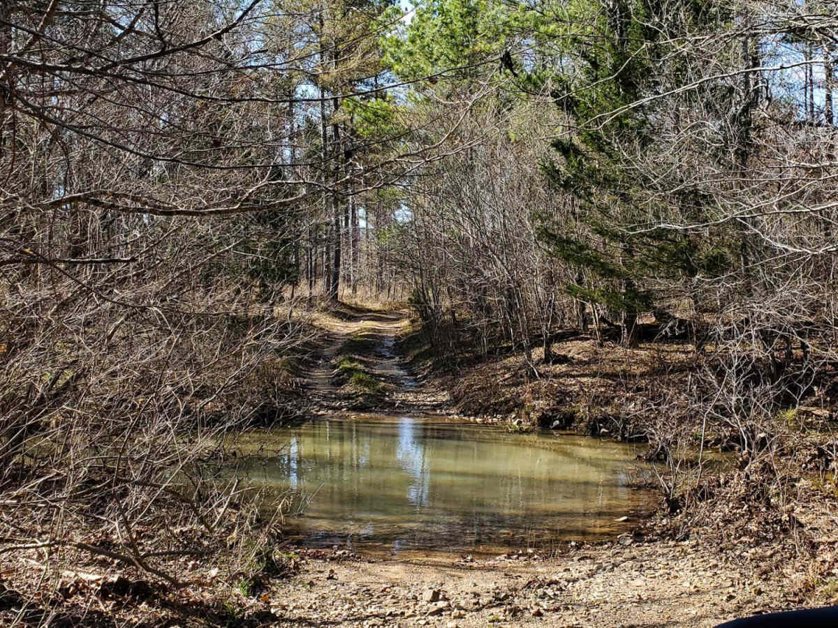
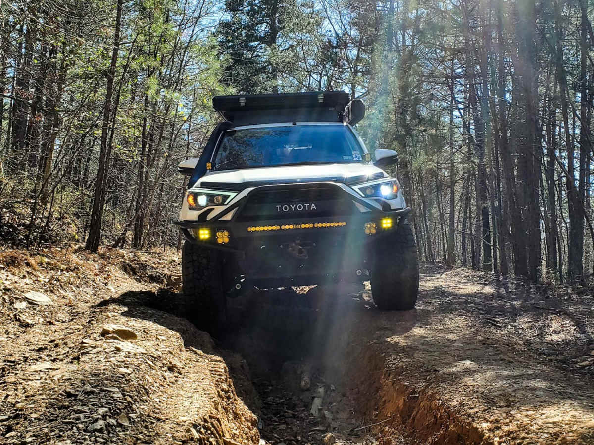
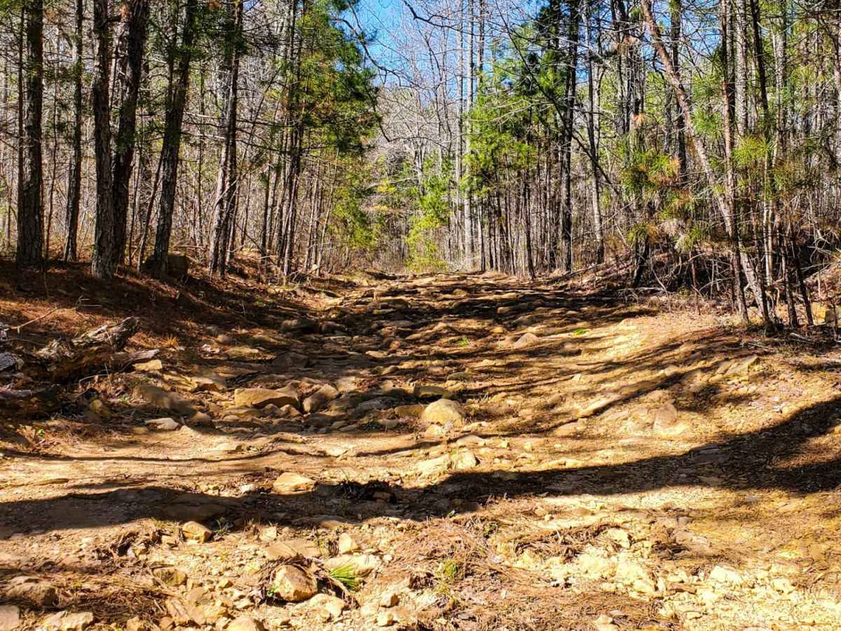
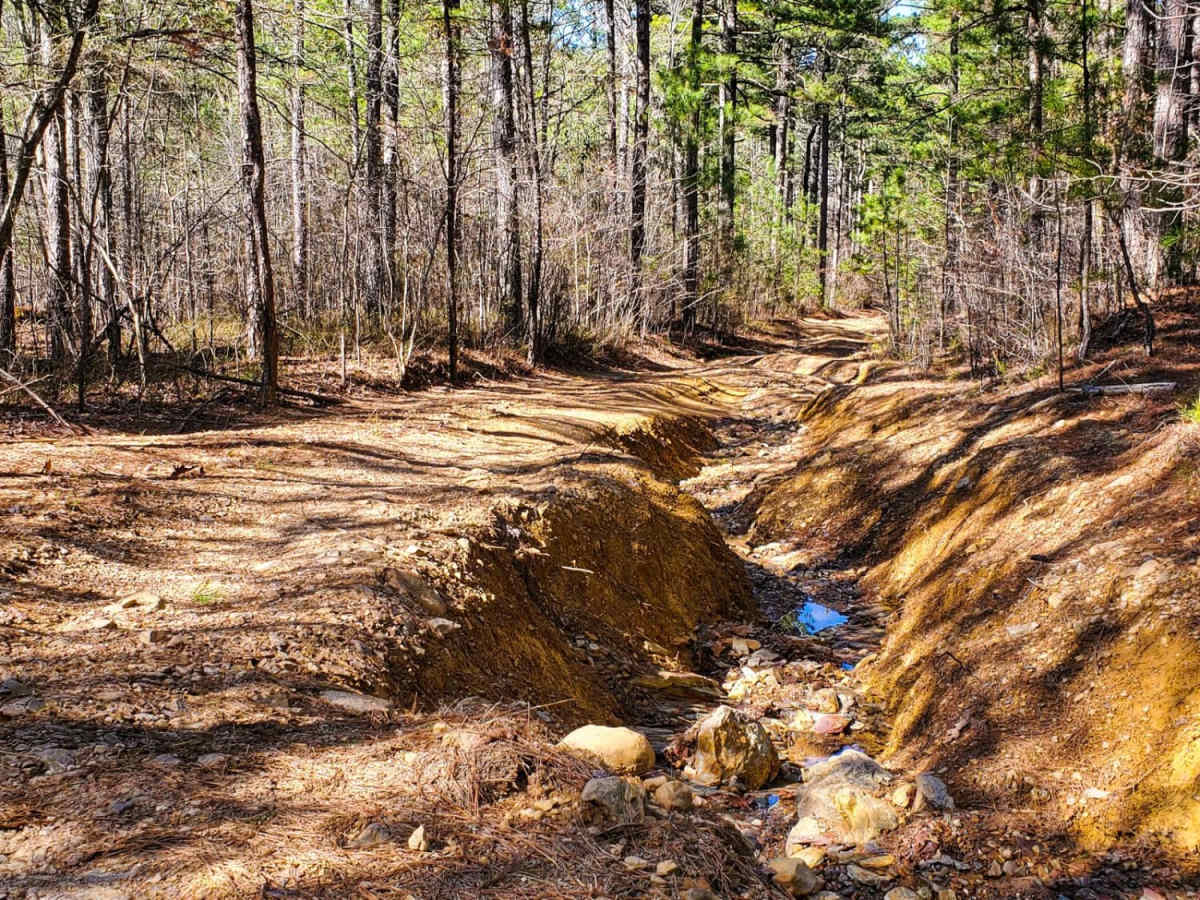
Large 3-4ft washouts throughout several parts of the trail. 2-3 mud holes less than 2 ft deep. 1 creek crossing (less than 1ft deep). Would not recommend to full sized trucks without lockers. Clay and shale, slippery when wet.
Danny Doyle
May 09, 2026
Open
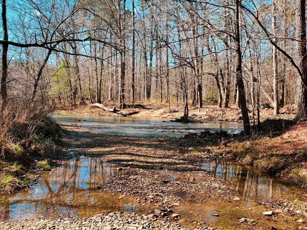
Did this in a 2016 vw touareg on 33s. Didn't plan on doing the trail, was gonna scout it but found myself halfway and said why not. Ran S to N. The most stressful trail I've ever did. Those washouts are 3 ft deep the entire trail. I'll say the trail is as hard as you make it, you can hug the sides and make it. One water crossing, it was low (10 inches).
Aaron Rickel
Mar 29, 2026
2019 RAM 2500
Open
Normal
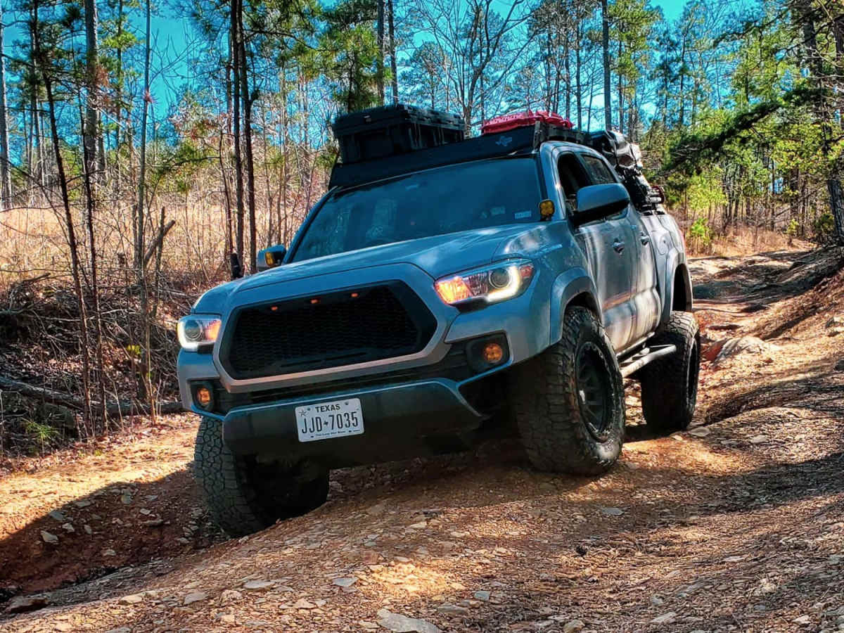
The is a lot of fun. My truck walked through this trail pretty easily. Only took my 2 hours. I had the perfect condition, dry, loads of traction and perfect temps. If this trail was wet then this would be a crazy fun and hard trail. 70% of this trail is really a 1-3 rated even it wet, the remaining 30%max is the harder stuff. I don't think this is a rating of a 6 dry, maybe a 5, but if wet then a 7 or 8. I took all of the hard lines in my full-size truck. Due to my size it made this trail easier, but if you have a shorter wheelbase like a 4runner or Jeep, then you'll had a harder/funner time. IFS guys will definitely be 3 wheeling the entire time. This trail requires wheel travel. I went north to south travel, it may have been the easier route because I was going up on the harder obstacles.
KG Bulldog
Feb 15, 2026
2017 Jeep Wrangler
Open
Muddy/Wet
It had just rained the day before making things slick. Washouts were two and even three feet deep in a few places. The river crossing was fine but moving. If you select the direct route straight across the water was between 2 and 3ft deep, if you went more to the West there is a deep hole just before the North bank. Keep it straight and shoot for the middle of each opening on the bank. My JK's fender went completely under water there, being on 3.5 inch lift and 37s. The trail was easy running North to South. It was much more difficult doing the reverse. All the mud holes were fine with the largest being near the river on the North side. It was about 2ft deep and had a good step getting out going South. Running North to South took 43 minutes. It was about an hour South to North. We were passed by three other Jeeps going South. It was a fun time close to Hot Springs. Starting at the South end was only a 30 minute drive from Hot springs to get on Angling Pinnacle 2 to get to Ritter.
Damon Holasek
Jan 20, 2026
Open
Rough/Deteriorated
Lots of ruts but overall fun. Make sure to be high clearance four wheel drive. Water was low and icy, but manageable.
Troy Hughes
Jan 01, 2026
Open
Normal
Had a blast running Ritter Road with my friends!
Jeremy Ramsey
Oct 11, 2025
2017 Toyota Tacoma
Open
Dusty
Stock square body making it down.
Brandon Bell
Jun 07, 2025
2023 Toyota 4Runner
Open
Muddy/WetRough/Deteriorated
Made trail with some clinching and pinstripes in my factory 23 Toyota orp. Loved the challenge was an absolute blast to see what this could do. While being followed by a nice upgraded wrangler. Sorry no photos of this stretch. But plenty of other areas.
John Knotts
Mar 29, 2025
2020 Jeep Wrangler
Open
Muddy/WetRough/Deteriorated
The washout section was very technical. I’m in a JL Rubicon, 2 inch lift and 35’s and it was definitely flexing the ol’ girl out. I came in the North side so I was tackling the washouts uphill. Maybe going South to North would be better. There is also a decent sized mud hole close to the beginning of the North end that was pretty deep. If going southbound when you get to the at mud hole, stay right and use the tree roots as something to grip.
Neil C
Jan 19, 2025
Open
Made it in a stock Bronco Raptor with 37" tires, but came out with pinstripes, even in the winter. Some of the washouts are legit.
Ivan Olivares
Jan 17, 2025
Open
Rough/Deteriorated
Couldn’t take pictures but got very deep at points I only did half from south to west and went on another trail
Kris Holmes
Nov 30, 2024
Open
pretty washed out. Didn't have any issues with a Stock Rubicon JKU
Alex Messer
Aug 31, 2024
Open
Rough/Deteriorated
Trail was lots of fun, but a bit challenging. We took a A Jeep ZJ and Lexus GX and both needed some careful consideration before lines. Some minor water sections but nothing is more than 2 feet deep. 4WD was needed as both cars 3wheeled in a few spots
Dana Avery
Aug 18, 2024
2019 Jeep Wrangler
Open
DustyRough/Deteriorated
Trail is open. Deep ruts throughout the section from Angling Pinnacle 2 and Alum Experimental Road 962. In wet conditions this trail could get tricky, however I did it in 2WD the entire time. Fun trail. I would have continued to Alum Fork 114 but was running low on time.