Tonto 677

Total Miles5.1
Technical Rating
4Moderate
Best TimeSpring, Fall, Winter
Trail TypeHigh-Clearance 4x4 Trail
Accessible By
Open Trail Map

Trail Overview

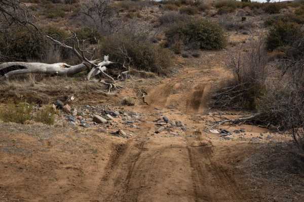
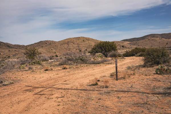
Tonto 677 is a scenic point-to-point trail through the Tonto National Forest and is also part of the Great Western Trail. The route is mostly easy but does have many areas containing deep ruts and erosion that will require proper tire placement. Expect to see wildlife and grazing cows, and in the spring and fall, the wildflowers are in full bloom. There is no shade along this trail, so please plan accordingly. Recent rain or forecasted rain will likely increase the trail difficulty, especially if water is running in the washes. High clearance and 4WD are required. As always, please be a steward of our public lands and National Forests;please observe Tread Lightly principles and have fun.

Photos of Tonto 677

Difficulty

Deep ruts are the primary obstacles along Tonto 677. However, most ruts can be bypassed or straddled. Future erosion will continue to increase the difficulty of this trail. Short, sandy wash crossings and rocky sections containing both loose and buried rock will also be encountered along the trail. High clearance and 4WD required.

History

FR 677 is a portion of the Arizona Section of the Great Western Trail. The Great Western Trail is a 3000+ mile multiple-use trail that travels from Mexico to Canada. The route incorporates some of Arizona's well-known scenic drives, such as Mount Lemon, Pioneer Pass, Four Peaks, Seven Springs Road, Cherry Road, and several others.

Technical Rating

4

Status Reports

Add Status Report
Joel Urena
Nov 07, 2026
2020 Ford F-150
Open
Muddy/WetRough/DeterioratedWashboard
Did this trail today from North to South starting in Dugas down to Bloody Basin Rd. The creek crossing just past the Bar K Bar Ranch private land is very deep and loose and it’s not a straight shot. You will have to travel several yards almost parallel to the creek. My driver side tires sunk pretty far down and it was scary. I do not recommend it be crossed unless you have significant ground clearance and somewhere or someone to winch from. I barely made it out and I will not be trying it again. After that major crossing there is a rock garden of mostly lava rock. 4 low and lockers will get you out with some technical tire placement. After that rock garden there is deep ruts that you can straddle or bypass. Prepare for lots of pin striping and bumpy bouncing around. There are some wonderful river crossings that you can stop and dip your feet into. Our kids had a blast there. In my opinion this trail is best by avoiding the silver creek crossing and the rock garden just to the south of it. Enjoy!
Dick Dufourd
May 07, 2026
Open
Rough/Deteriorated
This is basically a powerline trail that gets little use. We ran it south to north. It was rutted in places so high clearance was required, but not 4wd. Nice trail except for one fairly long rocky section. The reward was at the north end there are three or four nice water crossings. The description says no shade, but that is not correct. The trail passes thru or near about four groves of trees, so there are shade opportunities.
Mark Whitney
Apr 11, 2026
2018 Jeep Wrangler
Open
NormalDusty
This is correctly designated as a 4. It was mostly easy and very scenic. I recommend. It’s bumpy but seldom traveled, so you enjoy the solitude.

Tonto 677 Trail can be accessed by the following ride types:

  • Single Track
  • 50 Inch
  • 60 Inch
  • High Clearance

Tonto 677 Map

The onX Offroad Difference

onX Offroad combines trail photos, descriptions, difficulty ratings, width restrictions, seasonality, and more in a user-friendly interface. Available on all devices, with offline access and full compatibility with CarPlay and Android Auto. Discover what you're missing today!

Open Trail Map