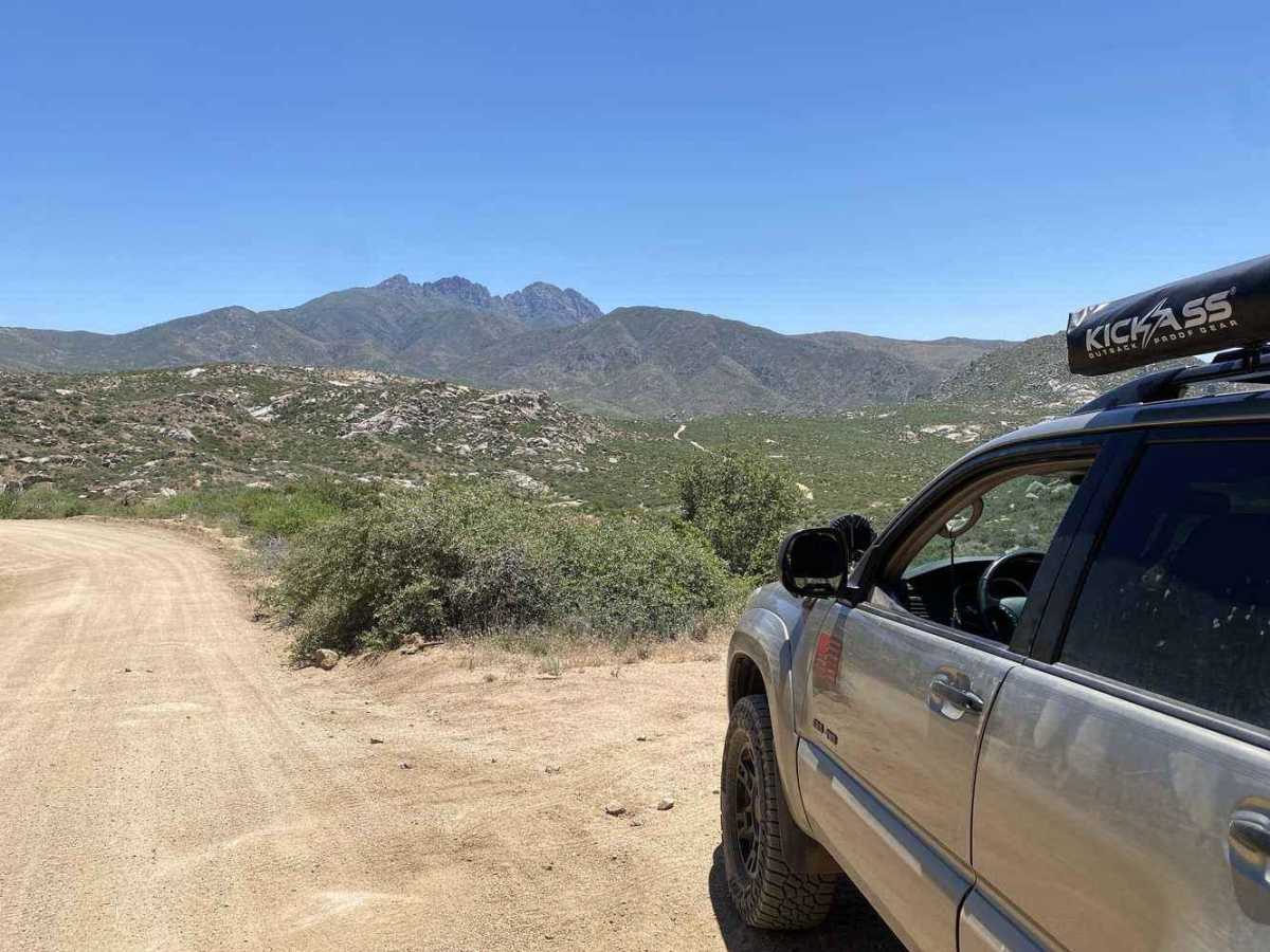
Four Peaks Wilderness Area

Total Miles 25.1
Technical Rating
2 Easy
Best Time Spring, Summer, Fall, Winter
Trail Type Full-Width Road
Accessible By
Open Trail Map

Trail Overview

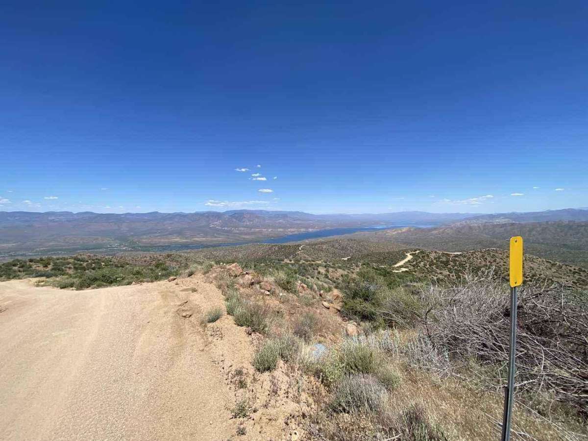
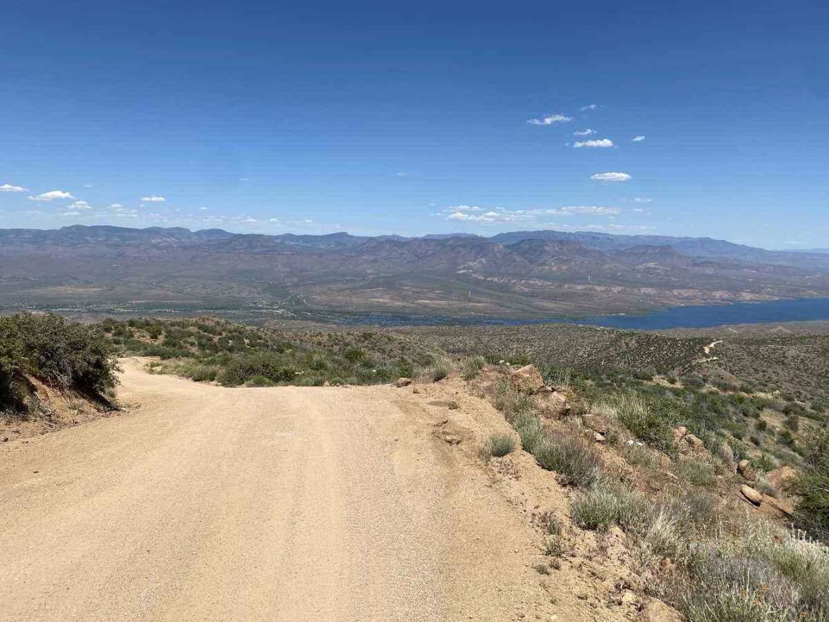
Four Peaks Wilderness Area in Arizona is one of the most recognizable landmarks on the eastern skyline of Phoenix and a popular off-road destination in Tonto National Forest. Located about 40 miles east-northeast of Phoenix, this route follows Forest Road 143 toward the rugged Four Peaks range, offering an approachable dirt-road adventure with big desert views and a front-row look at one of central Arizona’s most iconic mountain backdrops. 
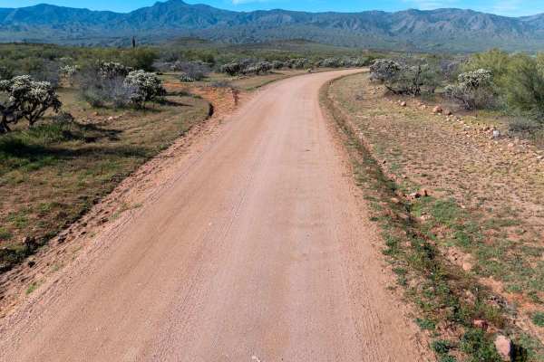
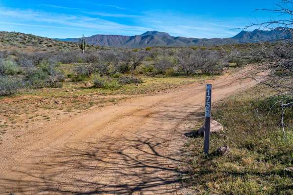
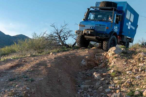
Four Peaks Wilderness Area route is a great option for beginner off-roaders or anyone looking for a scenic day trip from the Phoenix area. The trail is generally well-maintained and not overly technical, with a mix of graded dirt, loose rock, washboard, shallow ruts, and dusty sections during dry weather. Most stock 4x4s and high-clearance SUVs should be comfortable here in good conditions, but storms can change the road quickly. 
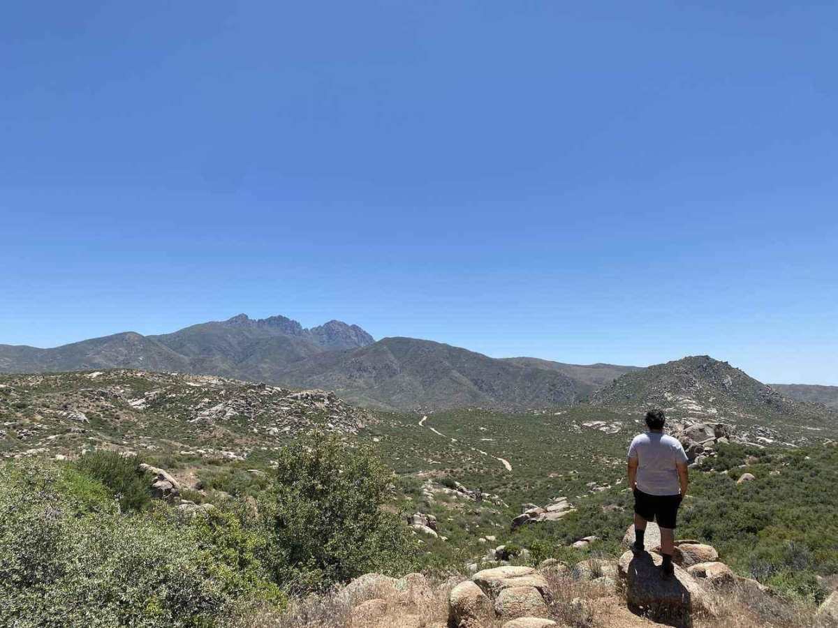
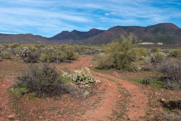
Four Peaks is part of the Mazatzal Mountains, rising above the Sonoran Desert with four distinct summits along a north-south ridge. The highest point, Brown’s Peak, reaches roughly 7,600 feet and is the tallest peak in Maricopa County. In winter, the peaks are sometimes dusted with snow, creating a striking view that can be seen across the Phoenix metro area. 
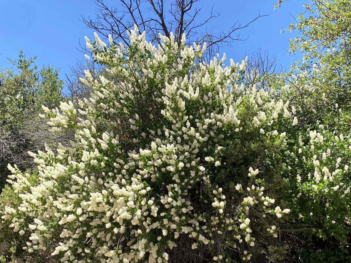
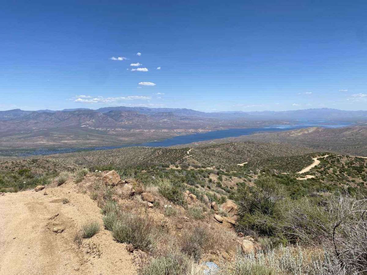
As the road climbs, the scenery shifts from cactus-covered desert and open washes to higher-elevation terrain with sweeping views of the surrounding mountains, Roosevelt Lake, and the desert floor below. The area is also known for hidden geologic treasures, including an amethyst mine that has produced some of Arizona’s well-known gemstones. Four Peaks is typically accessible for much of the year, but conditions can vary with weather, fire restrictions, forest closures, and road maintenance. This is a high-use area, especially on weekends, so expect other vehicles and help keep the route open by staying on designated roads. Download your maps before you go, bring plenty of water, and be prepared for limited cell service once you’re deeper into Tonto National Forest. This route leads to Lone Pine Saddle, where you can enjoy lunch in a spacious open area with options for parking and hiking. Along the way, you will pass notable points of interest, including Pigeon Trailhead, Lone Pine Trailhead, Browns Trailhead, and the Four Peaks Trailhead. Plenty of campsites are along the Four Peaks Trail. All campsites are primitive, offering a rugged outdoor experience amidst the natural beauty of the area.

Photos of Four Peaks Wilderness Area

Difficulty

Please be advised that this trail features narrow shelf roads and can become quite dusty, with blind corners at higher elevations. Exercise caution, take your time, and enjoy the scenic views for a safe and pleasant journey.

Technical Rating

2

Status Reports

Add Status Report
Gerald Sagen
Dec 16, 2025
Open
Some traffic forest service management working Lakeside backhoe and road grader.
Chris Bayle
Dec 09, 2025
Open
Great day to run this trail. The trail was a little dusty with quite a few washboard sections, mostly on the corners. To say the views were amazing would not do it justice, everywhere you looked was another awesome view. The trip took us about 4hrs compared to the 2.5hrs stated in the description but that was our fault as we needed to stop and take a ton of photos..
Amy Bytnar
Nov 01, 2025
Open
I have a stock 2022 wrangler eco diesel. It did this trail with no issues at all. It was washboard and dusty. It was busy with other vehicles and SxS but to be expected on a Saturday. Trail was a mix of rocks, washboard, flat dirt, hills, sharp corners, and some parts were recently washed out but still passable. It took us 4 hours to complete from 87 and rolls OHV to 188 near Tonto Basin. We did stop for a short lunch.
Nick Bruncie
Oct 26, 2025
Open
We came from the Roosevelt Lake area Route 188 and headed west across four peaks with a stop at the viewing area at the top (midway). The half from Roosevelt to the top was smooth and very easy maybe a little dusty. The other half from the top down to catch Highway 88 to head home was extremely beat up from the last rain. It was rutted and the top layer of dirt washed away to reveal buried rocks that made it extremely bumpy.
Conner hicks
Oct 03, 2025
Open
Some areas are worse then other about Half way through the trail you will hit a pretty rough rock garden would highly recommend at least 18-26in clearance
Roger Vanderpool
Sep 24, 2025
Open
Roger Vanderpool
Jun 24, 2025
Open
Very wash boarded, exposed rock areas, some of the curves have deep ruts.
Julian Williams
Jun 22, 2025
Open
Anthony Roy
Jun 18, 2025
Open
Marcin J
May 18, 2025
Open
Great, scenic trail. We saw a few trucks and SxS and were alone most of the time. Plenty of spots to stop and take a break.
Krysta Summers
May 17, 2025
Open
Cabram Allred
May 10, 2025
Open
Mark Burrell
May 04, 2025
Open
We did the trail from the Rolls OHV area to Roosevelt. The first mile or so was washbboaeded before giving way to a relatively flat but minimally maintained road. the road was wide enough for two cars for most of the length, although two full-size trucks might have issues passing abrest in a few places.
Trevor Snedeker
Apr 26, 2025
Open
J m
Mar 08, 2025
Open

Four Peaks Wilderness Area Trail can be accessed by the following ride types:

  • Single Track
  • 50 Inch
  • 60 Inch
  • High Clearance
  • Full Width

Four Peaks Wilderness Area Map

The onX Offroad Difference

onX Offroad combines trail photos, descriptions, difficulty ratings, width restrictions, seasonality, and more in a user-friendly interface. Available on all devices, with offline access and full compatibility with CarPlay and Android Auto. Discover what you're missing today!

Open Trail Map