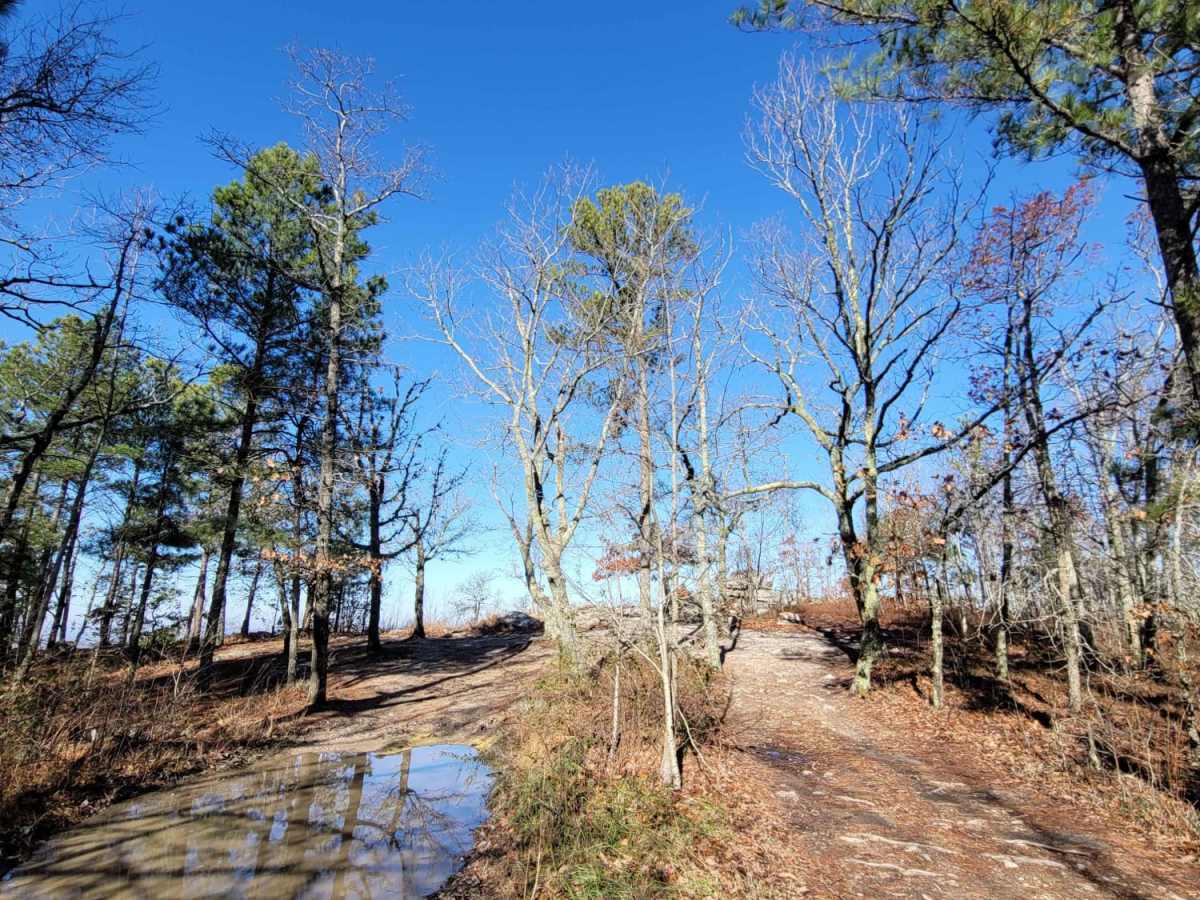
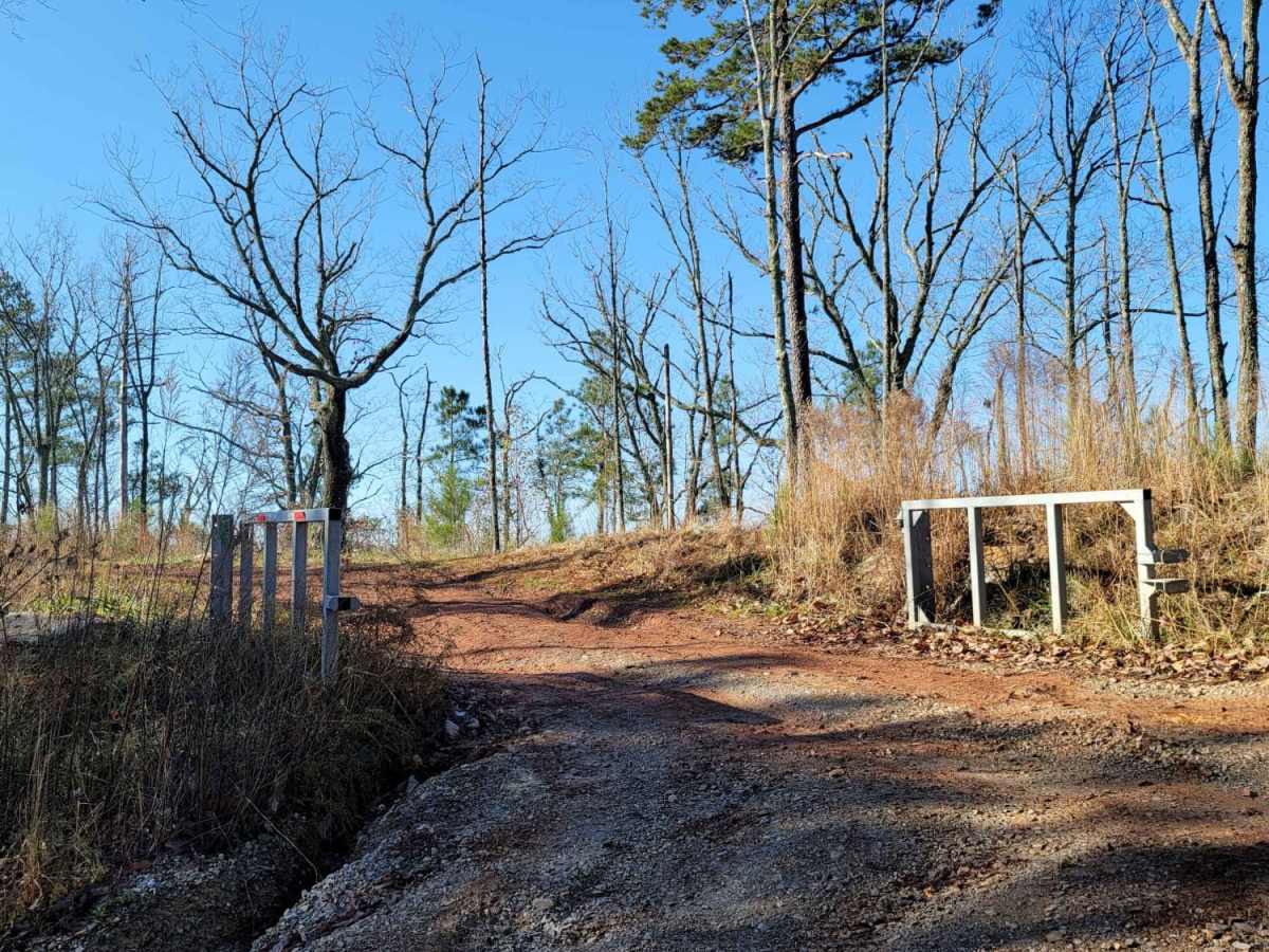
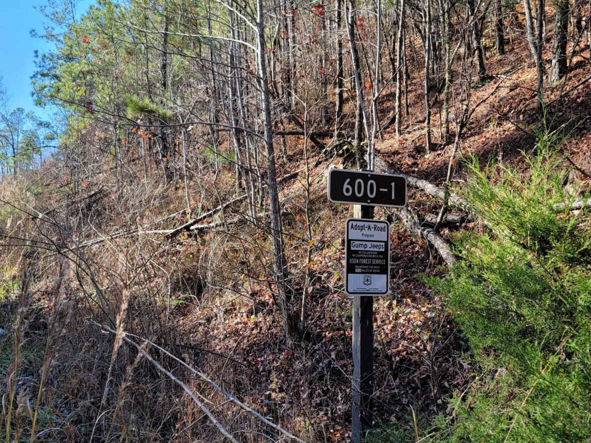
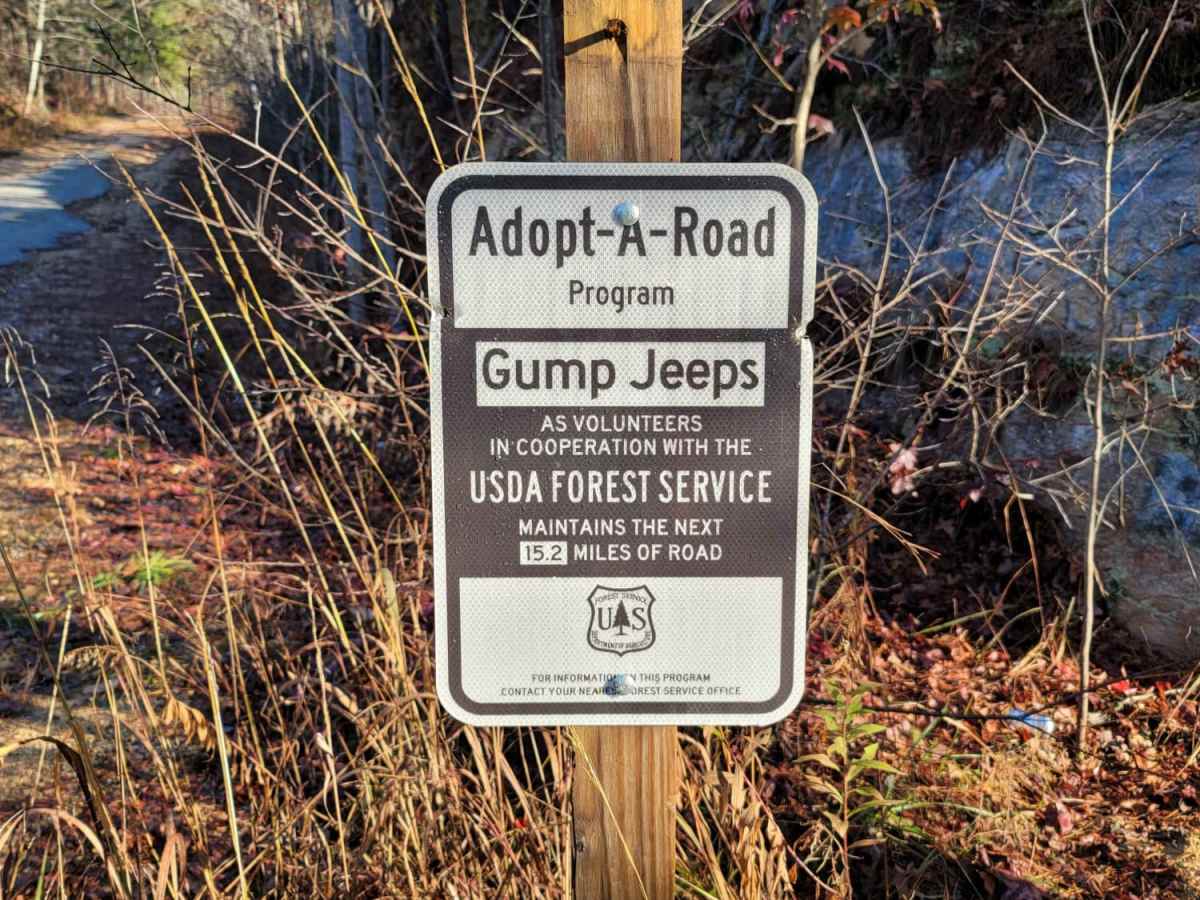
USFSR #600-1

Total Miles 13.9
Technical Rating
4 Moderate
Best Time Spring, Summer, Fall, Winter
Trail Type Full-Width Road
Accessible By
Open Trail Map

Trail Overview

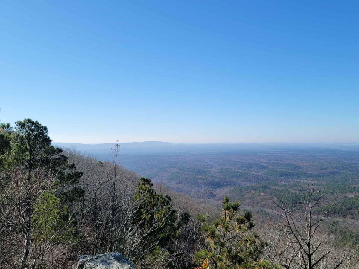
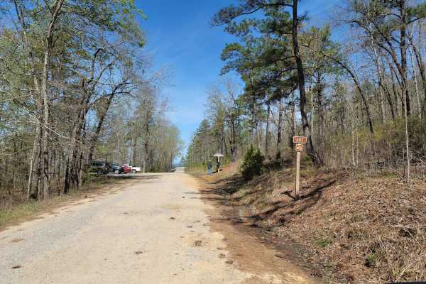
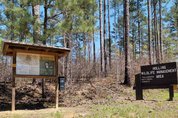
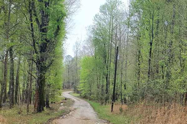
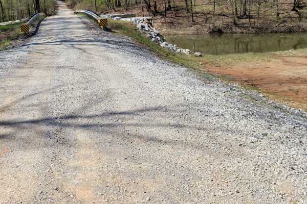
600-1 and its partner trail 600-2 are the most common trails in Alabama that are on public lands. People come from all over to see the scenic views and to see what the trail is all about. The trail begins just outside the small town of Sylacauga, nestled in the hills of the Millerville community. It will end at the north end on AL HWY 77. It rides along the ridgebacks of Horn mountain, with 3 main lookout points with beautiful views. In a dry season, the trail is very basic, yet the mud holes will hold their water; some are unavoidable. The trail is mainly muddy silt, to a light brown hard packing with rock throughout. This trail does have a few ruts and obstacles, but once the rain comes, complacency can put you in an unfortunate situation. The trail is occasionally maintained by the USFS, but is heavily traveled. Remember, all USFS roads are marked with a brown sign with white writing. If the trail isn't marked, you shouldn't be on it. Avoid all side trails as local enforcement has been known to give fines for getting off of designated trails. According to the Motor Vehicle Use Map(MVUM), ATVs are not allowed.

Photos of USFSR #600-1

Difficulty

This trail is very seasonal. It is also "maintained" by the forest service, so sometimes it is graded. It can be easy to moderate at all times. Due to it being along the ridge of Horn mountain, water runoff can create large mud holes or ruts, most of which are avoidable.

History

600-1 and 600-2 are two trails that were originally put in place during President Roosevelt's New Deal. It was apart of a system of fire towers erected by the Civilian Conservation Corps (CCC) that helped preserve the 75 mile system that leads from Sylacauga to Borden Springs just North of Piedmont.

Technical Rating

4

Status Reports

Add Status Report
Donald
Dec 27, 2025
Open
Muddy in spots awesome over looks one spot was a little tricky but fun
Michael Maas
Dec 21, 2025
Open
Lots of mud holes, not many people.
Caleb Johnson
Nov 28, 2025
Open
Chip Cole
Nov 07, 2025
Open
Washouts a bit more prominent than normal. Biggest mud hole about midway through is deepest and muddiest. Whatever you do, take the little side roads to open skies…no chance of being disappointed. Do recommend 4x4 lifted to really enjoy. Could likely be done in a stock jeep with A/Ts on easy lines.
Vincent Hoen
Oct 05, 2025
Open
Dry conditions. Need some clearance for part closer to Sylacauga.
Christian Ceccarelli
Sep 01, 2025
Open
joey Benda
Aug 23, 2025
Open
cam Tanner
Aug 23, 2025
Open
Traveling from south to north. The trail has become very rocky, especially the first 4-5 miles. Even after several afternoons of showers, the mud was pretty minimal.
Jordan Butler
Aug 03, 2025
Open
Truck was able to handle the entire trail but there were some trouble spots - 3 to 4 very technical large rock sections and several mudpits that will require 4 wheel drive and technical knowledge to traverse. Note, I went on a rainy day so it was wet and slippery and mud pits may have been deeper vs. a sunny dry day.
Justin Gee
Jul 12, 2025
Open
Kyle P
Jul 05, 2025
Open
Some very rocky spots that would be difficult for lower clearance vehicles.
Steven Owings
Jun 28, 2025
Open
The one spot was still slick. 35-37s. 1 locker need. Maybe both. But we got the crew of 8 all the way to the end. Including a stock 4 door jk
Toast Norris
May 17, 2025
Open
Downed tree partially blocking. Smaller rigs should be fine. My F250 on 37s with GFC couldn’t fit. Tree is closer to the 148 entrance
bradley clure
May 03, 2025
Open
red Lewis
Apr 11, 2025
Open
Loose rocky road on the southern 1/3 of the road. Some places were pretty washed out from the weather lately.

USFSR #600-1 Trail can be accessed by the following ride types:

  • High Clearance
  • Full Width

USFSR #600-1 Map

The onX Offroad Difference

onX Offroad combines trail photos, descriptions, difficulty ratings, width restrictions, seasonality, and more in a user-friendly interface. Available on all devices, with offline access and full compatibility with CarPlay and Android Auto. Discover what you're missing today!

Open Trail Map