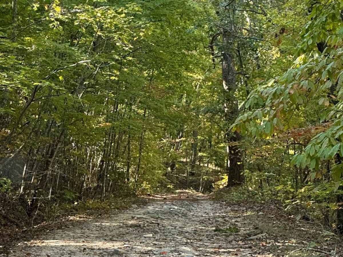
FS600-2

Total Miles 10
Technical Rating
6 Moderate
Best Time Spring, Summer, Fall, Winter
Trail Type Full-Width Road
Accessible By
Open Trail Map

Trail Overview

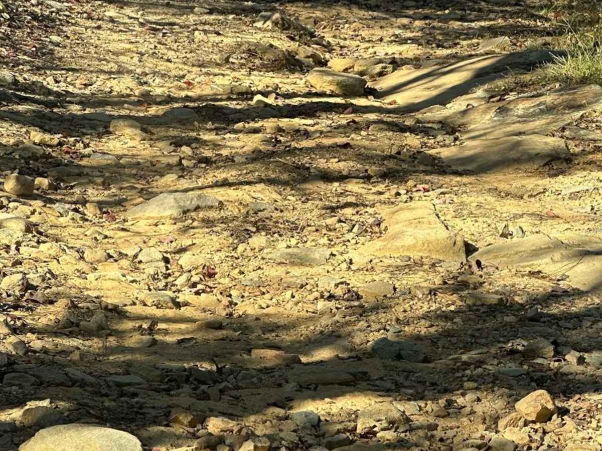
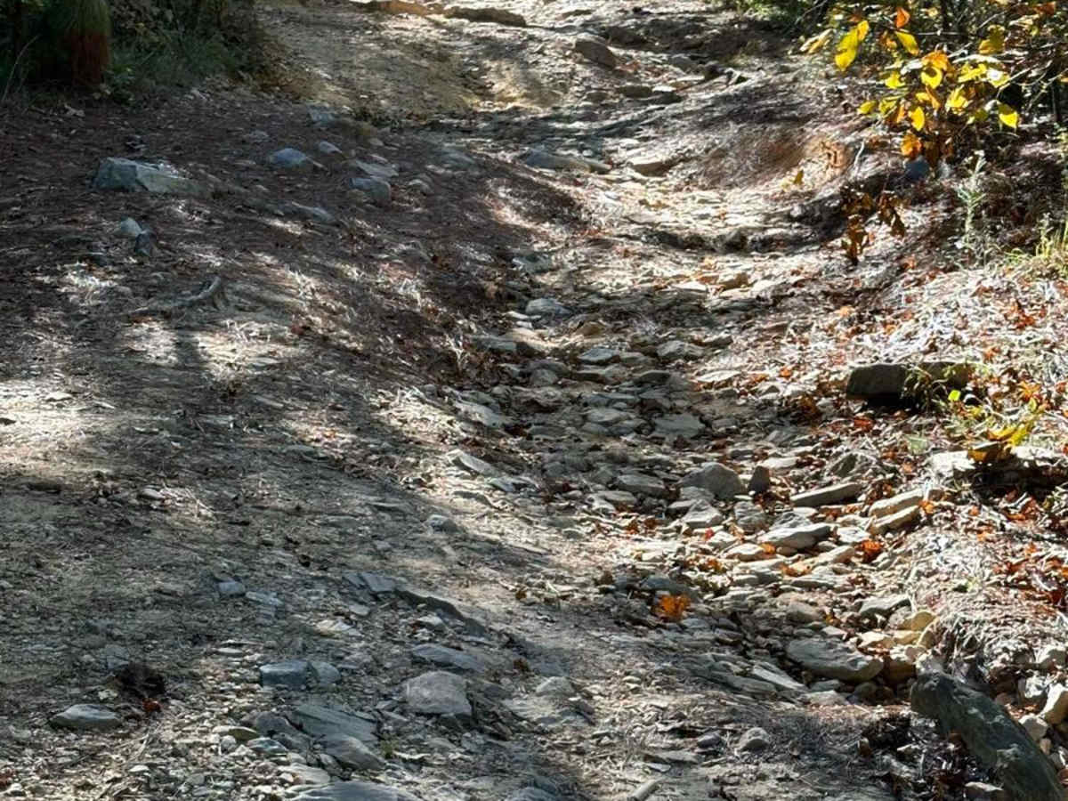
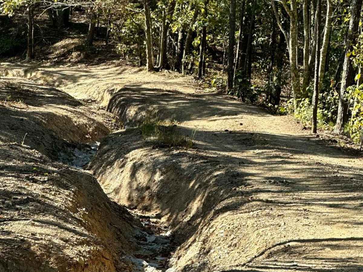
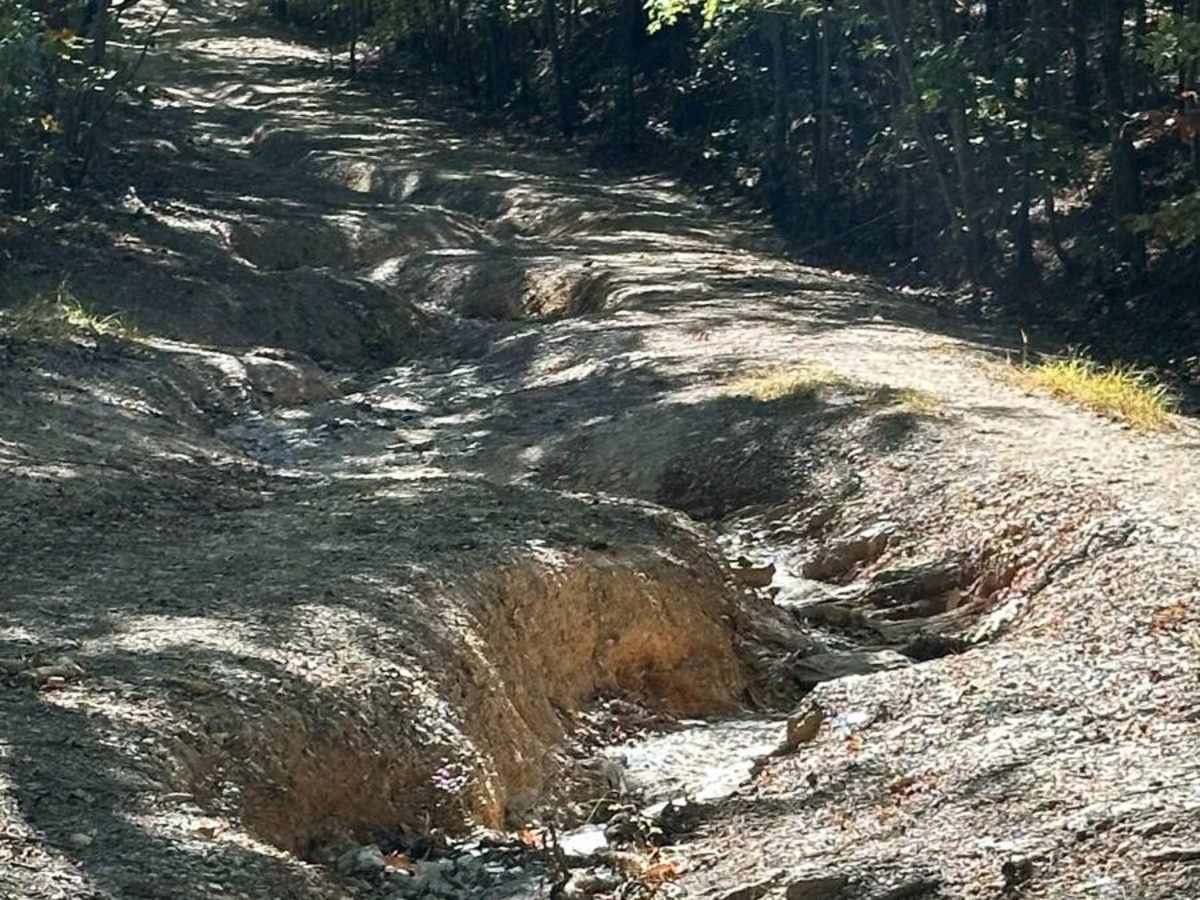
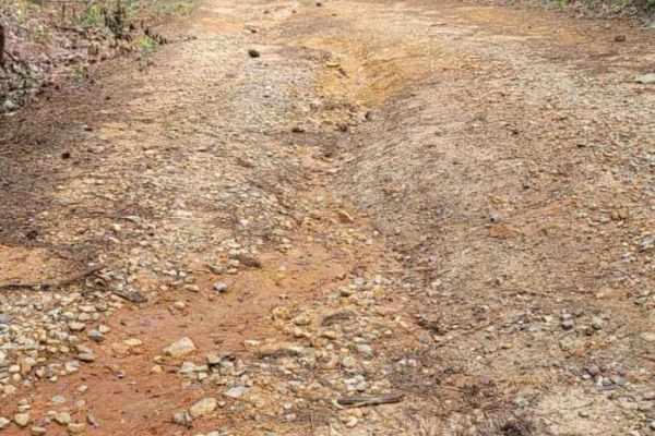
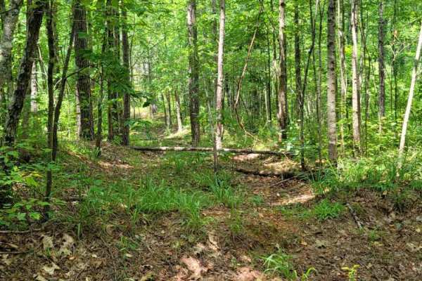
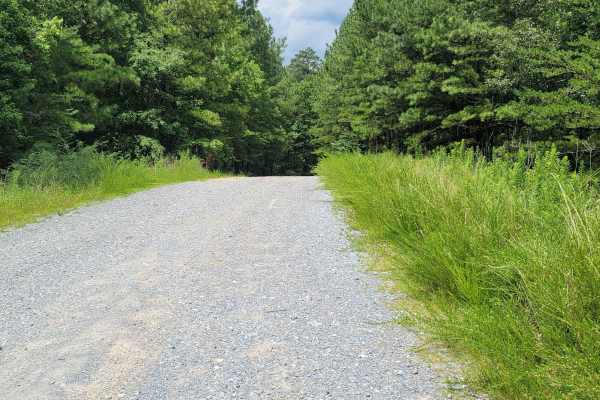
Beginning at the northeast end of FS600-2 and traveling southwest, this service road is packed with dirt filled with irregular rocks, making for a rough ride if not airing down. The first couple of miles are similar before reaching the first of the washouts. Washouts are 1 to 3 feet deep and are avoidable in some places, while unavoidable in others. The midpoint crosses the pavement at Gunter's Rock Road. and continues in the same direction; the lower half has more washouts, which are more challenging, where a spotter will benefit. These washouts have deteriorated significantly in recent years and pose a significant technical challenge. Ruts and washouts may exceed 3 feet deep and require careful attention and a capable vehicle. The area inside Talladega Forest, near Cheaha State Park, is heavily wooded, offering many hiking trails like the very popular Pinhoti Trail, which runs 326 miles northeast into north Georgia. Traffic is light, with the occasional local sometimes gaining access from adjoining private gated roads.

Photos of FS600-2

Difficulty

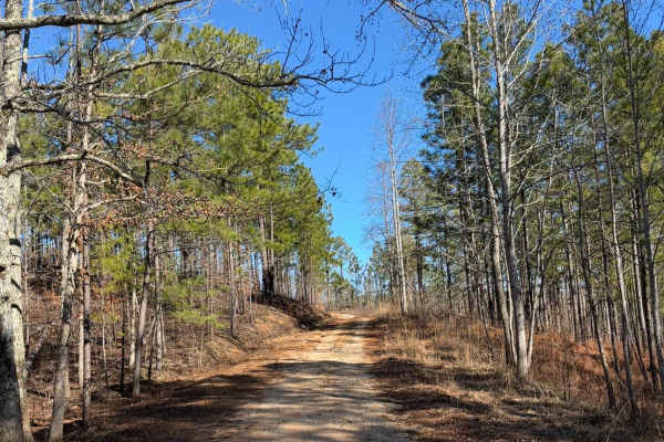
The northern half of the trail is straightforward with only minor rutting and washouts. The southern half of the trail, below Gunter's Rock Road, provides a significantly more challenging experience. Expect large washouts, deep rutting, and steep grades. This stretch of the trail is best suited to experienced drivers in capable offroad vehicles.

Technical Rating

6

Status Reports

Add Status Report
Ryan
Oct 21, 2025
Open
My buddy and I were driving the SE BDR with a DR650 and R1T. Most of the trail is level 4, but the washed-out, rutted section must be more washed out than before and is probably a level 7. Sorry, my pictures aren't great.Attached screenshots where I turned around and the section in the SE BDR to go around. Also, it's difficult to turn around if you do get to that point. It should be doable after that point, but it could also depend on the direction we were going (south to north).).
matt walker
Aug 09, 2025
Open
towards the end of the first 3rd of the trail heading north the wash has become extremely steep and slick.
Justin Gee
Jul 12, 2025
Open
Steven Owings
Jun 28, 2025
Open
Easy nice drive was some muddy spots but over all easy
Sam Isaacs
Jun 08, 2025
Open
We ran this trail south to north immediately after a large storm. we had to turn around at picture 2 and could not complete this trail, a large slick rock washout that our mostly stock jeeps (Wrangler Rubicon, Gladiator Sport & Willy's) could not overcome it.
Sam Isaacs
Jun 08, 2025
Open
ran this trail immediately after a thunderstorm, south to north. 2-3 foot deep mud hole. there is a washed out section of the trail my group could not complete. picture 2 is what stopped us, a slick rock off camber climb out of a washout, we turned around and did not complete the trail.
Rusty cooper
Jun 01, 2025
Open
bradley clure
May 03, 2025
Open
You will definitely need 4wd. Very rutted out. 3 foot or deep ruts
Jasper Thompson
Apr 12, 2025
Open
Extreme washouts worse than usual, be cautious
Josh Bodiford
Feb 22, 2025
Open
Expect heavy flex for modest lifts, definitely possible. Fairly washed out compared to normal on the first 1/4 of the trail. I would recommend at least 35s as it sits but our buddy with a stock TJ on 33s managed it with some very good driving. To be clear he is seasoned and wasn’t scared to get scratched.
Preston -_-
Feb 16, 2025
Open
4R0AMR Williams
Jan 05, 2025
Open
While the majority of this trail has remained the same, the later portion of it has become more eroded and washed out which can add some very fun lines if you’re feeling adventurous. Approaching from the NE as you’re coming off of 281, the first 3/4’s is tame with some small rocks and ruts that aren’t difficult. The final 1/4 of it has some deep ruts measuring 2-3 feet in depth and its difficulty will depend on your vehicle and the lines you take. I’ve seen stock vehicles do it with no issue. There are two larger mud holes at the end as well. The gate is no longer closed and has been ordered to remain open as it is a public road so no more turning around. The wetter/muddier it is, the more challenging it can become. I’d give it a 4-5 depending on a few variables. Overall a very enjoyable ride that can take an hour or two depending on trail traffic and conditions. 600-1 is the other portion of the trail that’s located nearby and I highly recommend it as well. It’s a little easier.
Carter Brown
Jan 04, 2025
Open
I got on 600-2 at hanging rock road and headed south. The first 60% of the trail was very straight forward. The last 40% included a few hard bottom mud holes some of which were rutted out. There is a 500ft long section shown in a picture that has about 2-3ft deep ruts washed out. You will get crossed up and you will lift a tire. I used my rear locker twice.
Phillip McCoy
Dec 22, 2024
Open
I drove the northern section of this trail, starting at Hanging Rock road. This section was pretty easy and any stock vehicle could do it. There were none of the rocks and washouts that are encountered on the southern section. There were a few nice views since the leaves are fallen.
Larry Gardner
Dec 06, 2024
Open
Gates on both ends of trail were open. No obstructions on trail .

FS600-2 Trail can be accessed by the following ride types:

  • Single Track
  • 50 Inch
  • 60 Inch
  • High Clearance
  • Full Width

FS600-2 Map

The onX Offroad Difference

onX Offroad combines trail photos, descriptions, difficulty ratings, width restrictions, seasonality, and more in a user-friendly interface. Available on all devices, with offline access and full compatibility with CarPlay and Android Auto. Discover what you're missing today!

Open Trail Map