
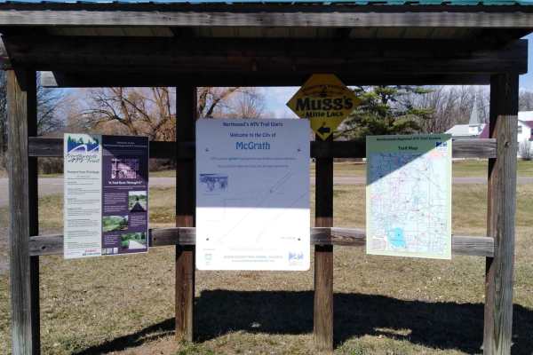
Off-Road Trails
Near McGrath, Minnesota
Off-Road Trails Near McGrath, Minnesota
Discover the best offroad trails near you. Browse trail maps, check difficulty ratings, and find your next adventure — whether you're looking for a quick ride or an all-day expedition.
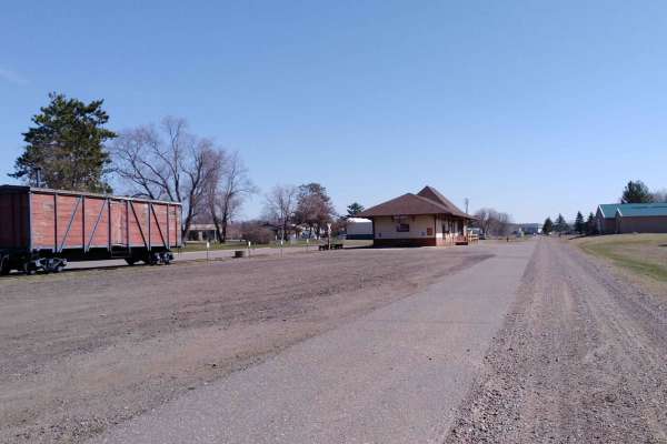
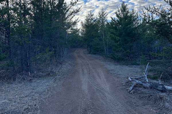
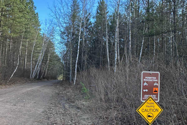
Wahkon to McGrath
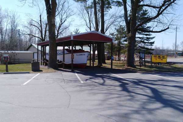
Wahkon to McGrath is a section of converted rail grade. It's 15 miles long and takes about 30 minutes with an average speed of 13.7 MPH. This section starts at the Wahkon City Park. There is an easily-accessed gas station at this city park in Wahkon. (There's no parking for trailers to start your tr...
Learn more about Wahkon to McGrath
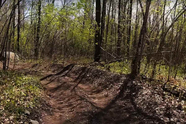
Solana Loop
The Solana Loop has roughly 15 miles of rideable trail with the main loop being about 14 miles. The trail also provides access to the Solana State Forest, which includes an additional 25+ miles of trail. The Solana Loop provides a mostly level ride through the forest with occasional rolling hills. T...
Learn more about Solana Loop
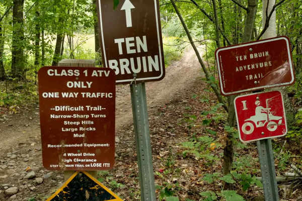
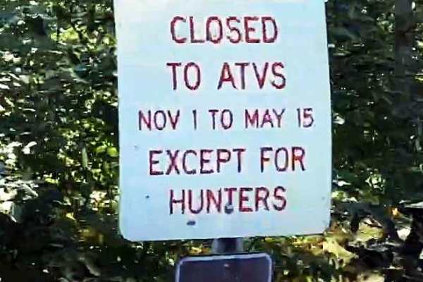
Ten Bruin-Red Top
The Ten Bruin Trail is a more difficult side trail off the Red Top Loop. This trail is very popular with many riders and will challenge the ability to remain on the vehicle. The trail is known for being narrow, winding, and having steep drops or climbs, all while being within a restricted forest env...
Learn more about Ten Bruin-Red Top
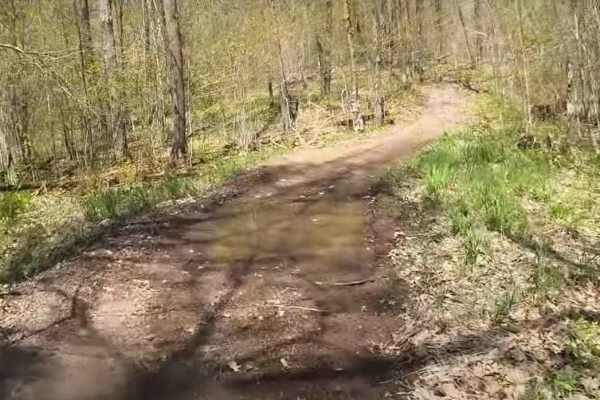
Red Top Loop
The Red Top Loop is located within a wooded area between the communities of Isle and McGrath in Aitkin County. The Red Top Loop trail network is made up of several different trails, all generally looping back to the main Red Top Loop. The entire network consists of more than 25 miles of ATV accessib...
Learn more about Red Top Loop
Foxy Loop Main
The Foxy Loop is the first ATV trail network along the Soo Line Trail just north of Isle, Minnesota. There are about 2.5 miles of trail within the Foxy Loop network. The 1.5-mile main trail runs between the north and south gates of this bidirectional trail. Several side trails can be run as loops of...
Learn more about Foxy Loop Main
Foxy Loop 2
The Foxy Loop 2 is a shorter loop trail within the Foxy Loop network, accessed a short distance in from either entrance on the Soo Line. The trail is a little shorter than the Foxy Loop Main at only 1 mile. Combined with the Foxy Main, the network is roughly 2.5 miles of trail. This network is a gr...
Learn more about Foxy Loop 2
Onamia to Wahkon
Onamia to Wahkon on the Soo Line South is a section of converted rail grade. At 8.2 miles long, it takes about 30 minutes with an average speed of 13.7 MPH. This section of the Soo Line South Trail is provided by Mille Lacs County and maintained by the Mille Lacs Drift Skippers Snowmobile/ATV Club. ...
Learn more about Onamia to Wahkon
McGrath to Denham
McGrath to Denham on the Soo Line South is a section of converted rail grade. It's 19 miles long and takes about 40 minutes with an average speed of 28.5 MPH. This section has a few muddy areas due to spring thaw and could be wet during rainy times later in the season.
Learn more about McGrath to Denham
Lawler to McGregor
Lawler to McGregor on the Soo Line North is a section of converted rail grade that is 8.9 miles long and takes about 45 minutes with an average speed of 11.1 MPH. Take note at the McGregor end that you leave the old rail grade corridor to safely cross an active BNSF Railroad. There are signs on the ...
Learn more about Lawler to McGregor
Freeway West FR
If you’re trying to get onto dirt (or sand) as soon as you’re off the freeway, run this instead of taking Old Hwy 61 into the rest of the state forest. It’s an easy trail overall, but in dry conditions the sand can get pretty loose. Not a problem with 4x4 and decent tires. After rain, there are a fe...
Learn more about Freeway West FR
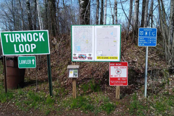
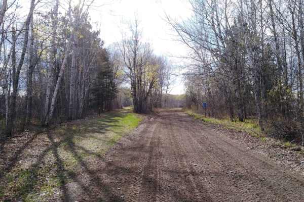
Lawler Loop Trails to Lawler
Lawler Loop Trails to Lawler goes from the far east intersection of Soo Line Trail North and Lawler Loops North and South 4-way intersection. This section of converted rail grade is 5.6 miles long and takes about 20 minutes with an average speed of 15.3 MPH. This converted rail grade is raised enoug...
Learn more about Lawler Loop Trails to Lawler
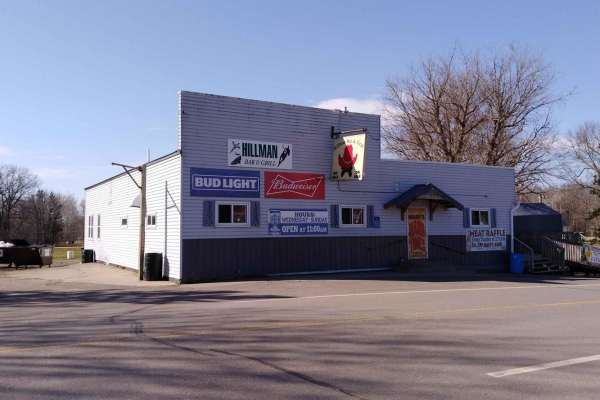
Hillman to Onamia
Hillman to Onamia on the Soo Line South Trail is a section of converted rail grade. At 12 miles long, it takes about 30 minutes with an average speed of 24.1 mph. This section of the Soo Line South Trail is provided by Mille Lacs County and maintained by the Mille Lacs Drift Skippers Snowmobile/ATV ...
Learn more about Hillman to Onamia
Zalesky Lake Trail
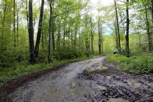
This trail is meant to take you to Zalesky Lake as an out-and-back; however, there is significant deadfall across the southern part of the trail that makes it impassable. In its current state, it is still useful as it provides access to a dispersed campsite. It's not clear whether the end of this tr...
Learn more about Zalesky Lake Trail
Doc's Trail
This trail is a long, mostly straight sand track with some hills, braking bumps, small whoops, and a few areas that collect water after rain, particularly as you get closer to Doc's Sports Bar. This is a great connector if you're tired after a day of riding and want to sit down for a hot meal at Doc...
Learn more about Doc's Trail
Sandy Pines Trail
This is one of the more fun ATV-type trails in this system. On the freeway side, there is a section with some taller whoops before it enters the forest. The rest of the trail is a faster, flowy sand track that weaves through the pines. There are many blind corners on this trail, so be sure to respec...
Learn more about Sandy Pines Trail
Freeway View Trail
This is a fast, straight section with a lot of small sand whoops and braking bumps. Some of the whoops are big enough to double on a dirt bike if you carry speed. The trail runs parallel to the freeway for much of its length, with a fence on that side. The sand can get a little loose in dry conditio...
Learn more about Freeway View Trail
Freeway East FR
This is a basic sandy forest road that connects Dago Lake Road to Willow River N Forest Road. Beware of the intersection with East/West forest road, where it can be hard to see other vehicle traffic, especially in the summer when the trees are filled out. Use this road to access other trails in the ...
Learn more about Freeway East FR
Dago Lake Fork
Take this route to return to the Dago Lake boat ramp/parking area or use it to connect up with other trails and forest roads in the system. This trail is a mix of sections that are multiple vehicles wide down to single vehicle width. There is one section that has had a tree across it for some time. ...
Learn more about Dago Lake Fork
Willow River North
This is a longer perimeter forest road that intersects with many other trails and forest roads along the way. This road is mostly a long sand track, but there are a few spots that can hold decent water after heavy rain or snowmelt. There are some hills that are blind, so be sure to stay on your side...
Learn more about Willow River North
Dago Day Use - 0340D
This forest road connects the north and south ends of the forest and is an easy, sandy road about two vehicles wide in most places. There are a few spots where puddles form after rain, but 4x4 vehicles should have no issues crossing. This is a good road for accessing other trails and a nice drive, e...
Learn more about Dago Day Use - 0340D
ATV trails near McGrath, Minnesota
Explore ATV-friendly trails near you. These trails are accessible for vehicles up to 50 inches wide, perfect for ATVs and smaller off-road machines.
Wahkon to McGrath
Wahkon to McGrath is a section of converted rail grade. It's 15 miles long and takes about 30 minutes with an average speed of 13.7 MPH. This section starts at the Wahkon City Park. There is an easily-accessed gas station at this city park in Wahkon. (There's no parking for trailers to start your tr...
Learn more about Wahkon to McGrath
Solana Loop
The Solana Loop has roughly 15 miles of rideable trail with the main loop being about 14 miles. The trail also provides access to the Solana State Forest, which includes an additional 25+ miles of trail. The Solana Loop provides a mostly level ride through the forest with occasional rolling hills. T...
Learn more about Solana Loop
Ten Bruin-Red Top
The Ten Bruin Trail is a more difficult side trail off the Red Top Loop. This trail is very popular with many riders and will challenge the ability to remain on the vehicle. The trail is known for being narrow, winding, and having steep drops or climbs, all while being within a restricted forest env...
Learn more about Ten Bruin-Red Top
Red Top Loop
The Red Top Loop is located within a wooded area between the communities of Isle and McGrath in Aitkin County. The Red Top Loop trail network is made up of several different trails, all generally looping back to the main Red Top Loop. The entire network consists of more than 25 miles of ATV accessib...
Learn more about Red Top Loop
UTV/side-by-side trails near McGrath, Minnesota
Find UTV and side-by-side trails near you. These trails accommodate vehicles up to 60 inches wide, ideal for UTVs, side-by-sides, and wider off-road rigs.
Wahkon to McGrath
Wahkon to McGrath is a section of converted rail grade. It's 15 miles long and takes about 30 minutes with an average speed of 13.7 MPH. This section starts at the Wahkon City Park. There is an easily-accessed gas station at this city park in Wahkon. (There's no parking for trailers to start your tr...
Learn more about Wahkon to McGrath
Solana Loop
The Solana Loop has roughly 15 miles of rideable trail with the main loop being about 14 miles. The trail also provides access to the Solana State Forest, which includes an additional 25+ miles of trail. The Solana Loop provides a mostly level ride through the forest with occasional rolling hills. T...
Learn more about Solana Loop
Red Top Loop
The Red Top Loop is located within a wooded area between the communities of Isle and McGrath in Aitkin County. The Red Top Loop trail network is made up of several different trails, all generally looping back to the main Red Top Loop. The entire network consists of more than 25 miles of ATV accessib...
Learn more about Red Top Loop
Onamia to Wahkon
Onamia to Wahkon on the Soo Line South is a section of converted rail grade. At 8.2 miles long, it takes about 30 minutes with an average speed of 13.7 MPH. This section of the Soo Line South Trail is provided by Mille Lacs County and maintained by the Mille Lacs Drift Skippers Snowmobile/ATV Club. ...
Learn more about Onamia to Wahkon
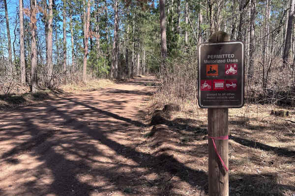
The onX Offroad Difference
onX Offroad combines trail photos, descriptions, difficulty ratings, width restrictions, seasonality, and more in a user-friendly interface. Available on all devices, with offline access and full compatibility with CarPlay and Android Auto. Discover what you're missing today!
Open Trail Map