
Off-Road Trails
Near Devol, Oklahoma
Off-Road Trails Near Devol, Oklahoma
Discover the best offroad trails near you. Browse trail maps, check difficulty ratings, and find your next adventure — whether you're looking for a quick ride or an all-day expedition.
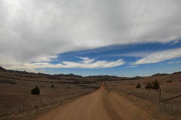
Wichita Mountians OAT Trail
This Leg of the Oklahoma Adventure Trail (OAT) runs the north side of the historic Wichita Mountains between Granite and Medicine Park, Oklahoma. Throughout this trail, you will pass through some of the oldest ranches in the state. There are several low-water crossings along the route and a few catt...
Learn more about Wichita Mountians OAT Trail
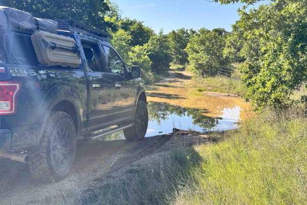
Lake Bryson Road
Lake Bryson Road is a public road giving access to Lake Bryson. The dirt starts as soon as you turn off the pavement in the town of Bryson. Lake Bryson Road is hardly maintained. You will experience small rocks sticking up through the caliche road base. You will quickly run into the gatekeeper obsta...
Learn more about Lake Bryson Road
ATV trails near Devol, Oklahoma
Explore ATV-friendly trails near you. These trails are accessible for vehicles up to 50 inches wide, perfect for ATVs and smaller off-road machines.
Lake Bryson Road
Lake Bryson Road is a public road giving access to Lake Bryson. The dirt starts as soon as you turn off the pavement in the town of Bryson. Lake Bryson Road is hardly maintained. You will experience small rocks sticking up through the caliche road base. You will quickly run into the gatekeeper obsta...
Learn more about Lake Bryson Road
UTV/side-by-side trails near Devol, Oklahoma
Find UTV and side-by-side trails near you. These trails accommodate vehicles up to 60 inches wide, ideal for UTVs, side-by-sides, and wider off-road rigs.
Lake Bryson Road
Lake Bryson Road is a public road giving access to Lake Bryson. The dirt starts as soon as you turn off the pavement in the town of Bryson. Lake Bryson Road is hardly maintained. You will experience small rocks sticking up through the caliche road base. You will quickly run into the gatekeeper obsta...
Learn more about Lake Bryson Road
The onX Offroad Difference
onX Offroad combines trail photos, descriptions, difficulty ratings, width restrictions, seasonality, and more in a user-friendly interface. Available on all devices, with offline access and full compatibility with CarPlay and Android Auto. Discover what you're missing today!
Open Trail Map