
Dirt Bike Trails
Near Wade, North Carolina
Explore All Dirt Bike Trails Near Wade, North Carolina
Dirt Bike Trails Near Wade, North Carolina
Discover the best dirt bike trails near you. Browse trail maps, check difficulty ratings, and find your next adventure — whether you're looking for a quick ride or an all-day expedition.
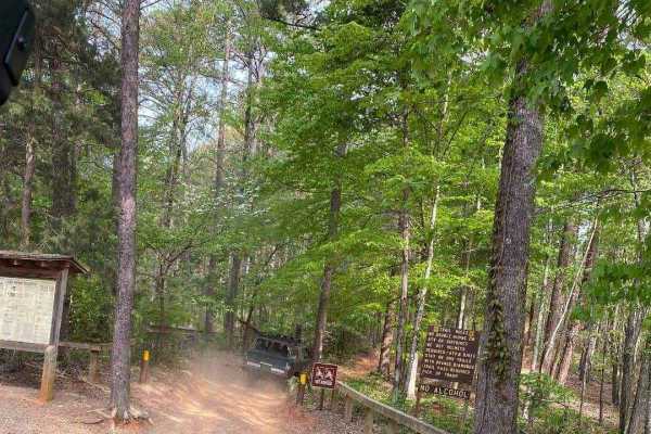
390 - Daniel
Expert riders only! Daniel is one of 3 trails that start with a "D" that the locals know well. This trail sees frequent rollovers and vehicle damage, resulting in its "Black" trail rating. Daniel starts at the Cotton Place trailhead on the east side of the Badin Lake OHV area, within the Uhwarrie Na...
Learn more about 390 - Daniel
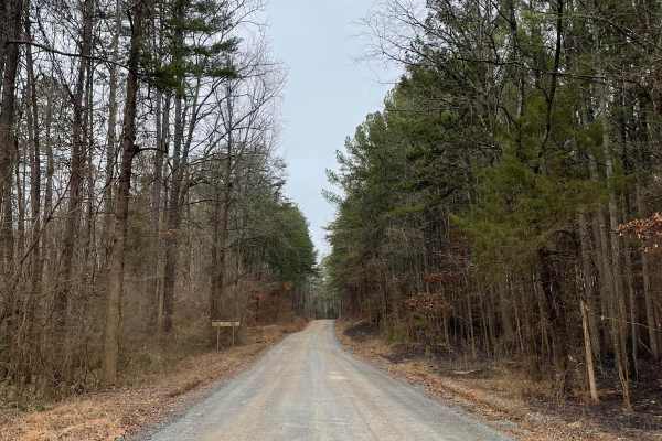
FS-576
FS-576 in Uwharrie National Forest, also known as Moccasin Cir, is a gravel road that splits the National Forest from east to west and dead-ends at the Deep Woods camp area. Along the way, there are several primitive campsites just off the road. Some of them have stunning views of Badin Lake just so...
Learn more about FS-576
ATV trails near Wade, North Carolina
Explore ATV-friendly trails near you. These trails are accessible for vehicles up to 50 inches wide, perfect for ATVs and smaller off-road machines.
390 - Daniel
Expert riders only! Daniel is one of 3 trails that start with a "D" that the locals know well. This trail sees frequent rollovers and vehicle damage, resulting in its "Black" trail rating. Daniel starts at the Cotton Place trailhead on the east side of the Badin Lake OHV area, within the Uhwarrie Na...
Learn more about 390 - Daniel
FS-576
FS-576 in Uwharrie National Forest, also known as Moccasin Cir, is a gravel road that splits the National Forest from east to west and dead-ends at the Deep Woods camp area. Along the way, there are several primitive campsites just off the road. Some of them have stunning views of Badin Lake just so...
Learn more about FS-576
UTV/side-by-side trails near Wade, North Carolina
Find UTV and side-by-side trails near you. These trails accommodate vehicles up to 60 inches wide, ideal for UTVs, side-by-sides, and wider off-road rigs.
390 - Daniel
Expert riders only! Daniel is one of 3 trails that start with a "D" that the locals know well. This trail sees frequent rollovers and vehicle damage, resulting in its "Black" trail rating. Daniel starts at the Cotton Place trailhead on the east side of the Badin Lake OHV area, within the Uhwarrie Na...
Learn more about 390 - Daniel
FS-576
FS-576 in Uwharrie National Forest, also known as Moccasin Cir, is a gravel road that splits the National Forest from east to west and dead-ends at the Deep Woods camp area. Along the way, there are several primitive campsites just off the road. Some of them have stunning views of Badin Lake just so...
Learn more about FS-576
The onX Offroad Difference
onX Offroad combines trail photos, descriptions, difficulty ratings, width restrictions, seasonality, and more in a user-friendly interface. Available on all devices, with offline access and full compatibility with CarPlay and Android Auto. Discover what you're missing today!
Open Trail Map