
Dirt Bike Trails
Near Stewartsville, Missouri
Explore All Dirt Bike Trails Near Stewartsville, Missouri
Dirt Bike Trails Near Stewartsville, Missouri
Discover the best dirt bike trails near you. Browse trail maps, check difficulty ratings, and find your next adventure — whether you're looking for a quick ride or an all-day expedition.
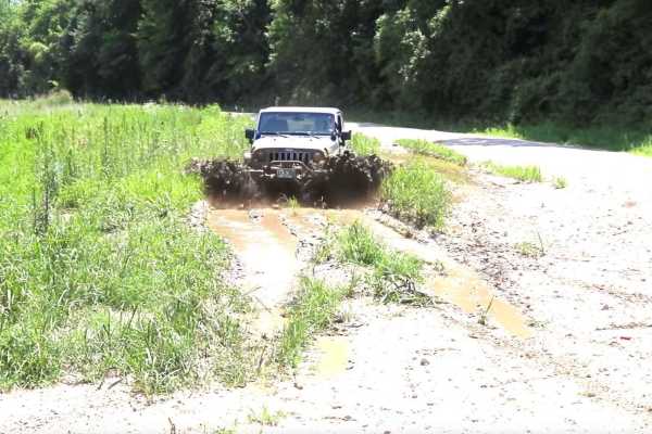
Kickapoo Trail
The Kickapoo Trail offers a relaxing and scenic off-road experience in northeast Kansas, perfect for riders looking to enjoy a leisurely ride through nature without too much difficulty. Located near Kickapoo in Brown County, this trail primarily follows a well-maintained gravel road, making it acces...
Learn more about Kickapoo Trail

Green 52
This trail travels along the southeast corner and loops around to the backside of the abandoned house. While it presents no major obstacles, sections of the trail have significant overgrowth from nearby vegetation. These areas, especially around the curves, can become tight for longer wheelbases or ...
Learn more about Green 52
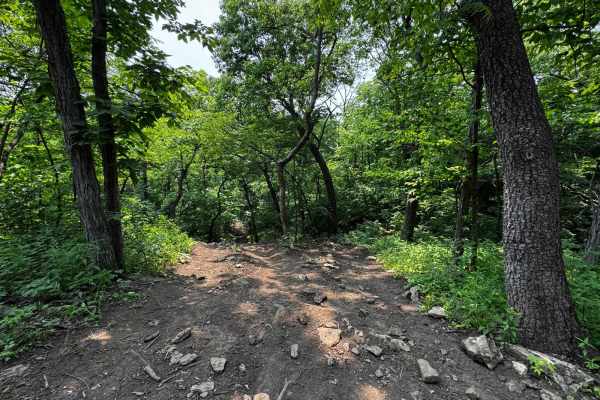
Yellow 121
This trail runs parallel to Garbage Alley 122 and connects Headache 120 at the top with Green 126 at the bottom. It features a steep hill climb with a rock ledge offering step-ups ranging from one to four feet, depending on your line. Traction is generally good, but the trees lining the trail show v...
Learn more about Yellow 121
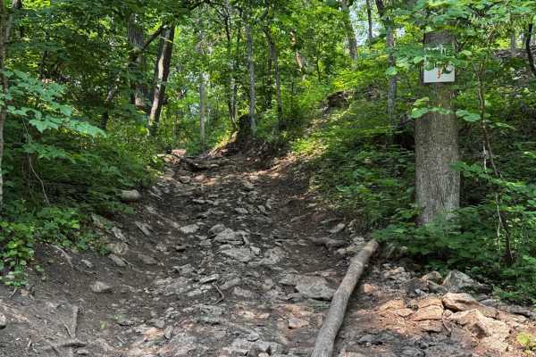
Garbage Alley 122
Garbage Alley 122 is an uphill trail that runs alongside Yellow 121 and connects to Headache 120 at the top and Green 126 at the bottom. This trail is heavily affected by water runoff, which often washes debris such as tree limbs and branches onto the path. Traction can vary depending on conditions,...
Learn more about Garbage Alley 122
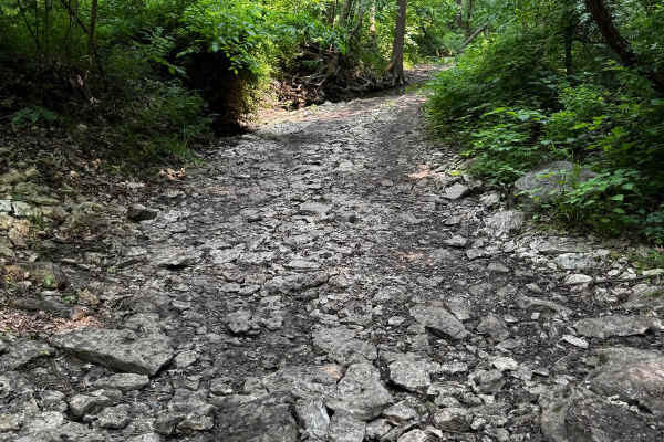
2 Finger 125
This trail runs through a creek bed, so the terrain is primarily rocky. There are several larger rocks to navigate, including one prominent rock about 2 feet tall that you can either drive over or carefully go around, if your vehicle is not too wide. Small fallen trees cross the trail as well. Be aw...
Learn more about 2 Finger 125
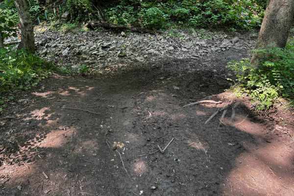
Yellow 124
Yellow 124 features a primarily dirt base with several off-camber sections throughout the trail. When the ground is wet, these tilted areas can make maintaining control difficult, increasing the chance of sliding toward the trees that lie between this trail and 2 Finger 125. Aside from the off-cambe...
Learn more about Yellow 124
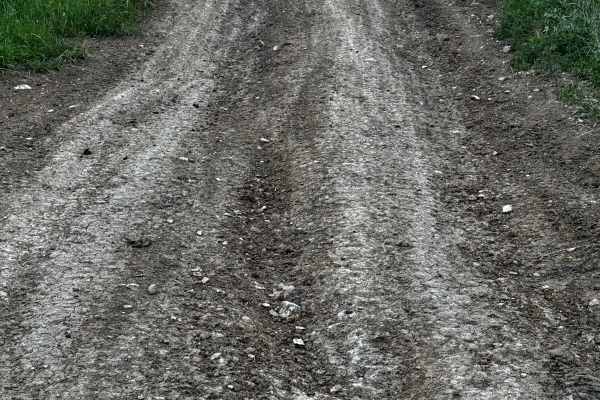
Green 49
This trail consists of a long hill climb on a mostly dirt base, which can become slick and muddy when wet, making traction more difficult. At the top of the hill, there's a dirt mound on the right side that can be driven up for a great photo opportunity. While there are no major obstacles, the combi...
Learn more about Green 49
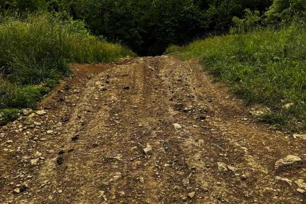
Yellow 54
This trail runs between Red 53 and Green 55 and follows a steady incline for most of its length. The surface is a mix of dirt and rock, which can become slick and difficult when wet. Several off-camber sections add to the challenge. Near the treeline, you'll encounter rock steps with jagged rocks up...
Learn more about Yellow 54
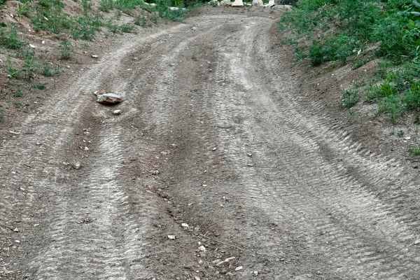
Green 50
This trail parallels Green 49 along a short, gradual uphill route with a dirt and rock surface. It's generally straightforward with no major obstacles to navigate. However, when wet, the terrain can become slick, requiring more attention to traction and vehicle control. This trail follows a short, g...
Learn more about Green 50
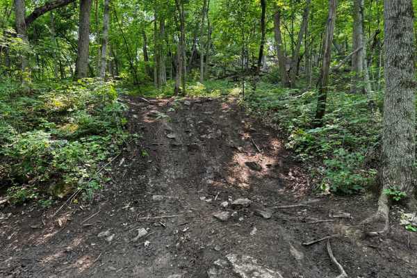
Yellow 127
Yellow 127 is located between Green 126 and Green 128 and features a trail that is quite off-camber, weaving through dense trees, which increases the risk of body damage. The hills are mostly dirt-based, making the trail extremely difficult when wet. Fortunately, there are many trees available for w...
Learn more about Yellow 127
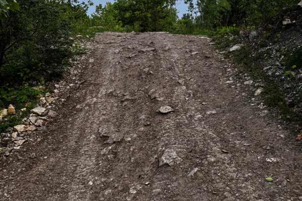
Green 42
This trail runs between Yellow 41 and Yellow 40, featuring a few hills and several washed-out sections that may require careful navigation. Although the terrain is mostly manageable and there are no major obstacles, one section contains a mud hole. Fortunately, the base beneath the water is solid, a...
Learn more about Green 42

Green 51
This trail features several tight sections where pinstriping is likely due to close tree spacing. It leads to an interesting older abandoned house with lots of character, though its deteriorating condition may make it unsafe to enter. The area around the house offers a unique spot that would be perf...
Learn more about Green 51
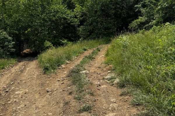
Yellow 97
This trail is a small loop connected to Yellow 54 at the top and Green 55 at the bottom. It features off-camber sections up to 25 degrees, combined with a steep incline reaching 24 degrees. The path squeezes between trees, leaning you toward them and increasing the risk of body damage. At the bottom...
Learn more about Yellow 97
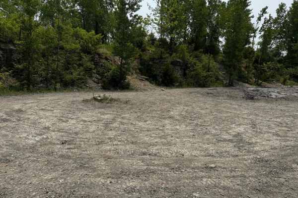
Donut Bowl 115
This large open area serves as the central hub for many of the park's bounty hill climbs. While it provides space to regroup or take a break, it's not without challenges. Deep mud holes are scattered throughout, and traction can be unpredictable. Drivers should proceed with caution when navigating t...
Learn more about Donut Bowl 115
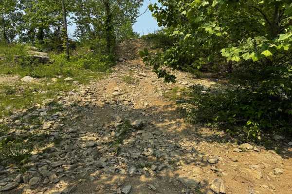
Yellow 98
Yellow 98 is a short but challenging trail that climbs over a loose rock surface. The hill climb features embedded rocks up to a foot tall, and the angle of the trail leans your vehicle toward a nearby tree, increasing the chance of body damage. In wet conditions, traction becomes limited, making th...
Learn more about Yellow 98
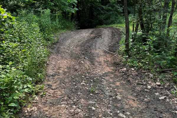
Green 56
This trail winds through the woods and features several mud holes along the way, with some tight sections where pinstriping is likely. While there are no major obstacles, one entrance includes a steep 30-degree downhill slope leading toward trees, requiring extra caution. The trail connects to Green...
Learn more about Green 56
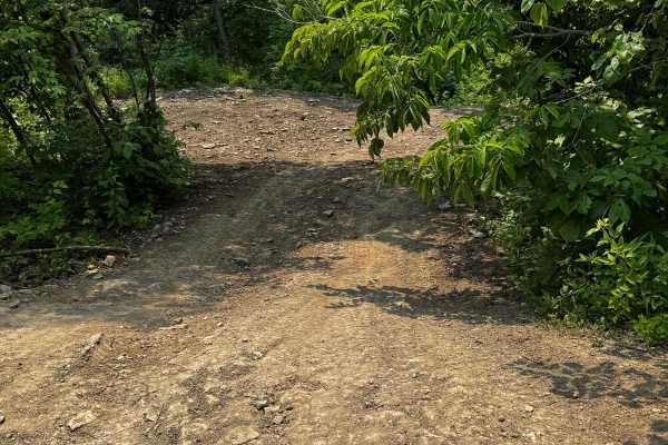
Yellow 119
Yellow 119 is a steep hill climb with a loose dirt and rock base. Scattered throughout the trail are smaller rock ledges, exposed tree roots, and embedded rocks reaching up to 18 inches in height. The combination of incline and uneven terrain requires precise tire placement and good traction to avoi...
Learn more about Yellow 119
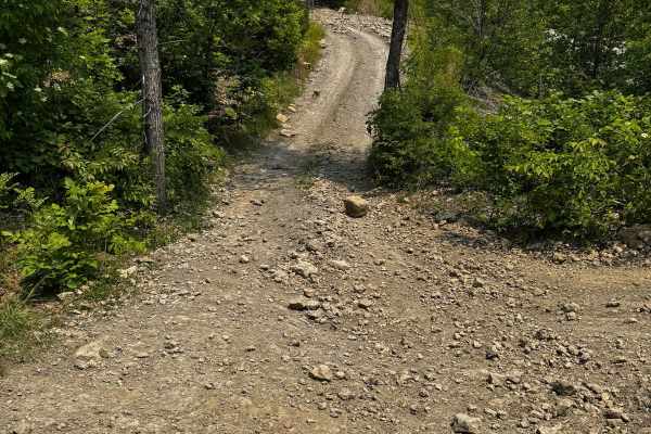
Yee Haw Ledges 100
This trail runs along the top of the Yeehaw Ledges hill climbs and provides a route that goes down into the famous Donut Bowl. It features several ruts along with a few small hill climbs. Some sections are off-camber, making traction tricky, and there is also a steep hill to navigate carefully.
Learn more about Yee Haw Ledges 100
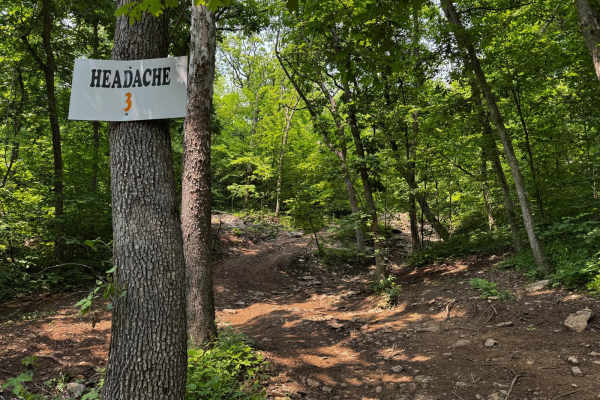
Headache 120
Headache 120 is a short but challenging trail branching off from Yellow 119. It features a mostly dirt and loose rock surface with several steep sections that require careful throttle control. The trail winds through tight trees with limited room for error and includes off-camber spots. An optional ...
Learn more about Headache 120
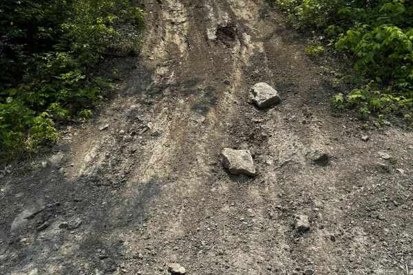
Yee Haw Ledges 114
Yee Haw Ledges 114 is a moderately difficult trail located in the Donut Bowl area of the park. The base of the trail consists of loose dirt and rock, making traction a challenge for some. It includes a steep climb with a few larger rocks sticking out of the ground, some up to a foot tall.
Learn more about Yee Haw Ledges 114
ATV trails near Stewartsville, Missouri
Explore ATV-friendly trails near you. These trails are accessible for vehicles up to 50 inches wide, perfect for ATVs and smaller off-road machines.
Kickapoo Trail
The Kickapoo Trail offers a relaxing and scenic off-road experience in northeast Kansas, perfect for riders looking to enjoy a leisurely ride through nature without too much difficulty. Located near Kickapoo in Brown County, this trail primarily follows a well-maintained gravel road, making it acces...
Learn more about Kickapoo Trail
Green 52
This trail travels along the southeast corner and loops around to the backside of the abandoned house. While it presents no major obstacles, sections of the trail have significant overgrowth from nearby vegetation. These areas, especially around the curves, can become tight for longer wheelbases or ...
Learn more about Green 52
Yellow 121
This trail runs parallel to Garbage Alley 122 and connects Headache 120 at the top with Green 126 at the bottom. It features a steep hill climb with a rock ledge offering step-ups ranging from one to four feet, depending on your line. Traction is generally good, but the trees lining the trail show v...
Learn more about Yellow 121
Garbage Alley 122
Garbage Alley 122 is an uphill trail that runs alongside Yellow 121 and connects to Headache 120 at the top and Green 126 at the bottom. This trail is heavily affected by water runoff, which often washes debris such as tree limbs and branches onto the path. Traction can vary depending on conditions,...
Learn more about Garbage Alley 122
UTV/side-by-side trails near Stewartsville, Missouri
Find UTV and side-by-side trails near you. These trails accommodate vehicles up to 60 inches wide, ideal for UTVs, side-by-sides, and wider off-road rigs.
Kickapoo Trail
The Kickapoo Trail offers a relaxing and scenic off-road experience in northeast Kansas, perfect for riders looking to enjoy a leisurely ride through nature without too much difficulty. Located near Kickapoo in Brown County, this trail primarily follows a well-maintained gravel road, making it acces...
Learn more about Kickapoo Trail
Green 52
This trail travels along the southeast corner and loops around to the backside of the abandoned house. While it presents no major obstacles, sections of the trail have significant overgrowth from nearby vegetation. These areas, especially around the curves, can become tight for longer wheelbases or ...
Learn more about Green 52
Yellow 121
This trail runs parallel to Garbage Alley 122 and connects Headache 120 at the top with Green 126 at the bottom. It features a steep hill climb with a rock ledge offering step-ups ranging from one to four feet, depending on your line. Traction is generally good, but the trees lining the trail show v...
Learn more about Yellow 121
Garbage Alley 122
Garbage Alley 122 is an uphill trail that runs alongside Yellow 121 and connects to Headache 120 at the top and Green 126 at the bottom. This trail is heavily affected by water runoff, which often washes debris such as tree limbs and branches onto the path. Traction can vary depending on conditions,...
Learn more about Garbage Alley 122
The onX Offroad Difference
onX Offroad combines trail photos, descriptions, difficulty ratings, width restrictions, seasonality, and more in a user-friendly interface. Available on all devices, with offline access and full compatibility with CarPlay and Android Auto. Discover what you're missing today!
Open Trail Map