
Dirt Bike Trails
Near Sarepta, Louisiana
Explore All Dirt Bike Trails Near Sarepta, Louisiana
Dirt Bike Trails Near Sarepta, Louisiana
Discover the best dirt bike trails near you. Browse trail maps, check difficulty ratings, and find your next adventure — whether you're looking for a quick ride or an all-day expedition.

Butler Circle
This is a basic fire road within Kisatchie National Forest. It involves rolling hills through the Louisiana landscape. Hidden around the area are lookout towers for fire detection, a relic from past land management in the area. This area of the Kisatchie has a number of private in-holdings as well a...
Learn more about Butler Circle
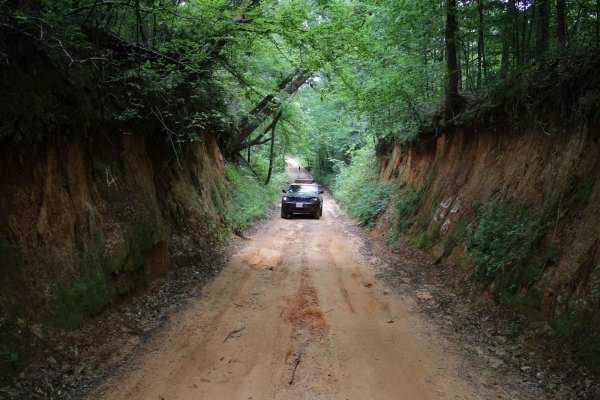
Old Stagecoach Road
Old Stagecoach road is made up of a mix of rock, sand, and dirt. When wet you get a red clay that can be slick as ice. There are some rocks in the road about 8 inches in diameter. Some narrow washouts across the road are 8-plus inches deep. Logging trucks have been traveling sections of the road an...
Learn more about Old Stagecoach Road
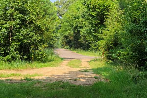
Low Water Bridge on Lake Wright Patman
This route starts off of Hwy 67 just west of Texarkana and goes to the low water bridge that crosses part of Wright Patman Lake. There are plenty of areas to fish. Bring a kayak because there is water access on each side of the bridge and plenty of parking. The low water bridge does close when heav...
Learn more about Low Water Bridge on Lake Wright Patman
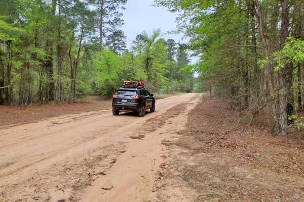
Primitive Camp and Shooting Range in Poison Springs WMA
White Oak State Park is a great place to stay while you explore the Poison Springs WMA. If you want full hookups and restrooms while you camp. While at White Oak State Park, ask the visitor center for a map to "The Little Grand Canyon." A must-see while in the area. You are close to the state park h...
Learn more about Primitive Camp and Shooting Range in Poison Springs WMA

Poison Springs WMA - Campsite C-10 to C-29 and C-54
This dirt and gravel road takes you to dispersed campsites within the Poison Springs WMA area. Camping permits are required and are free at Poison Springs WMA website. Roads can be slick, and water crossing can be found after rains. Watch for wildlife to cross roads. There are creeks in the area.
Learn more about Poison Springs WMA - Campsite C-10 to C-29 and C-54
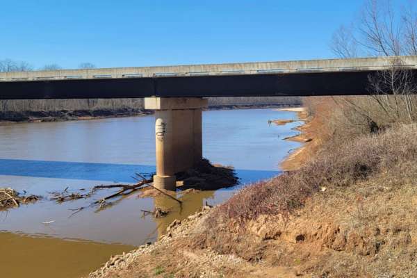
Follow the Red River
This 30-mile route follows along the Northside of the Red River. This East to West route is almost completely gravel roads. The roads are maintained but can be nasty after or during rains. Although you may not see a lot of the river, you will see lots of pasture land with livestock, creeks with brid...
Learn more about Follow the Red River
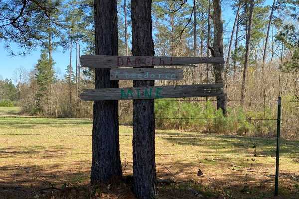
Jackson Parish Line Trail
Jackson Parish Line Trail runs near the Jackson Parish/Lincoln Parish line. This trail is gravel and dirt roads with very shallow ruts. This trail has beautiful views of rolling hills and also the dense forest. It is a great wildlife-spotting trail. Towards the end of the trail, there are a few wood...
Learn more about Jackson Parish Line Trail
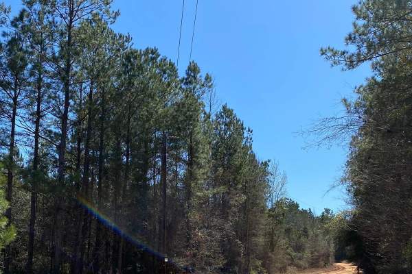
Jake Anding Trail
This route starts on Jake Anding Road and turns left onto Olive Grove Road. This trail contains mud holes and the red dirt roads are very slick when wet. This trail has beautiful views but has private property on both sides of the road so don't go off on any of the side trails. This trail is very fu...
Learn more about Jake Anding Trail
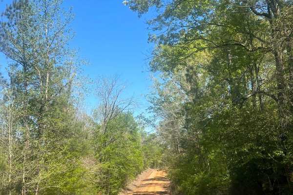
Sugar Creek Road
This trail is very fun to cruise down, soak in the beautiful views, and spot wildlife. Both sides are flooded with pine trees and shrubbery. The area is also very wildlife-abundant, so be cautious when driving and be respectful of wildlife. This road has several turn-offs that are private property. ...
Learn more about Sugar Creek Road
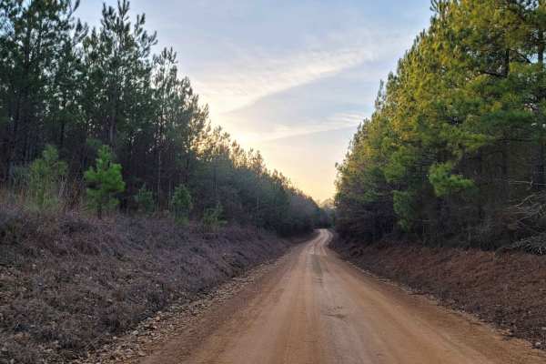
Country Route to White Oak Lake Group Campsite
This is a gravel and dirt road that leads to an awesome group campsite on White Oak Lake. A permit can be found online to camp in this free Poison Springs Forest. There are several campsites in this area. This particular campsite is on a hill right beside White Oak Lake. The later part of this route...
Learn more about Country Route to White Oak Lake Group Campsite
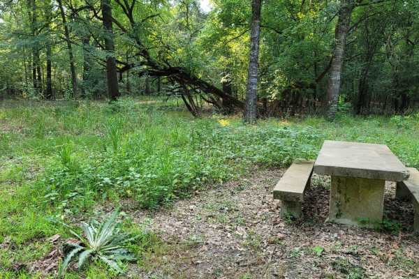
Trail to the Sulphur River
This easy scenic drive is ideal for beginners, families, and outdoor enthusiasts looking for convenient access to primitive camping and a boat launch on the Sulphur River. Starting at the intersection of Highway 67 and Highway 8 near Maud, Texas, this 4.4-mile route crosses railroad tracks and follo...
Learn more about Trail to the Sulphur River
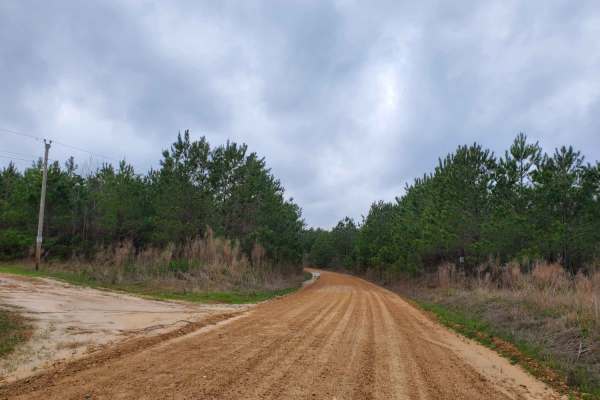
Highway 24 to Poison Springs WMA
This is a dirt and gravel road south of Highway 24. This road goes into the Poison Spring WMA. A camping permit is required and is free at the Poison Springs WMA website. This road can be slippery when wet. Some mild water crossings can be present during and after rains. Watch for wildlife crossing ...
Learn more about Highway 24 to Poison Springs WMA
Winnfield Road
This trail is very fun to cruise down, soak in the beautiful views, and spot wildlife. Both sides are flooded with pine trees and shrubbery. The area is also very wildlife-abundant, so be cautious when driving and be respectful of wildlife. This road has several turn-offs that are private property. ...
Learn more about Winnfield Road
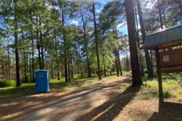
Champagnolle Creek Loop
The Champagnolle Creek Loop is a well-maintained dirt road with some uneven and rutted sections. While the road is easily passable during normal weather, the high river level makes the road impassable at times. Along this route, expect mild traffic, especially during prime fishing and hunting season...
Learn more about Champagnolle Creek Loop
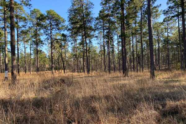
5338-W022B
This trail is in Kisatchie National Forest and is an intermediate trail. It has very deep mud holes, deep water, and steep ascents/descents. There are several side trails that you can explore and there are many nice, beautiful spots to stop and have a picnic. While this trail has very nice views, yo...
Learn more about 5338-W022B
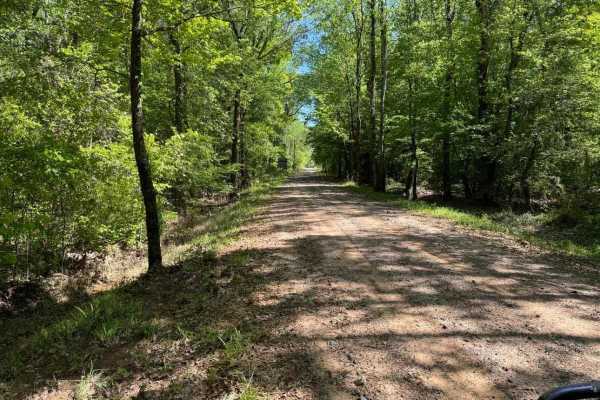
Fox Camp Road
These maintained dirt and gravel parish roads will take you through pine thickets, swamps, and a forestry runway. Take your time enjoying the historic Olive Grove Cemetery before traveling Fox Trot Road. Halfway through the adventure, you'll find a forestry dirt runway. You'll see the Eros water tow...
Learn more about Fox Camp Road
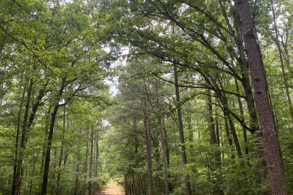
Potlach Road
This is a well-maintained dirt road with a few campsites along the way. This road leads through the Moro Big Pine WMA and there are several horseshoe lakes in the surrounding areas. It is very common to see wildlife such as hogs, turkeys, deer, and occasionally bears. This road can be very dusty dur...
Learn more about Potlach Road
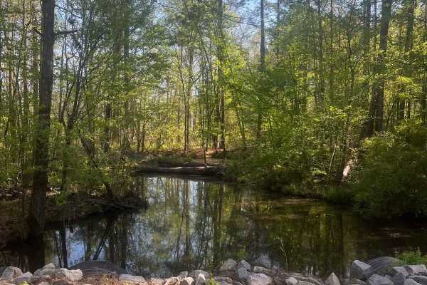
Vernon Eros Road
This trail is very fun to cruise down, soak in the beautiful views, and spot wildlife. Both sides are flooded with pine trees and shrubbery. The area is also very wildlife-abundant, so be cautious when driving and be respectful of wildlife. This road has several turn-offs that are private property. ...
Learn more about Vernon Eros Road
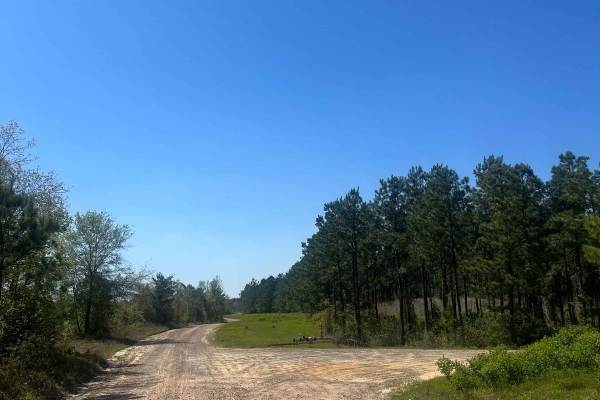
Ramsey Hill Road
This trail is very fun to cruise down, soak in the beautiful views, and spot wildlife. Both sides are flooded with pine trees and shrubbery. The area is also very wildlife-abundant, so be cautious when driving and be respectful of wildlife. This road has several turn-offs that are private property. ...
Learn more about Ramsey Hill Road
ATV trails near Sarepta, Louisiana
Explore ATV-friendly trails near you. These trails are accessible for vehicles up to 50 inches wide, perfect for ATVs and smaller off-road machines.
Butler Circle
This is a basic fire road within Kisatchie National Forest. It involves rolling hills through the Louisiana landscape. Hidden around the area are lookout towers for fire detection, a relic from past land management in the area. This area of the Kisatchie has a number of private in-holdings as well a...
Learn more about Butler Circle
Jackson Parish Line Trail
Jackson Parish Line Trail runs near the Jackson Parish/Lincoln Parish line. This trail is gravel and dirt roads with very shallow ruts. This trail has beautiful views of rolling hills and also the dense forest. It is a great wildlife-spotting trail. Towards the end of the trail, there are a few wood...
Learn more about Jackson Parish Line Trail
Jake Anding Trail
This route starts on Jake Anding Road and turns left onto Olive Grove Road. This trail contains mud holes and the red dirt roads are very slick when wet. This trail has beautiful views but has private property on both sides of the road so don't go off on any of the side trails. This trail is very fu...
Learn more about Jake Anding Trail
Sugar Creek Road
This trail is very fun to cruise down, soak in the beautiful views, and spot wildlife. Both sides are flooded with pine trees and shrubbery. The area is also very wildlife-abundant, so be cautious when driving and be respectful of wildlife. This road has several turn-offs that are private property. ...
Learn more about Sugar Creek Road
UTV/side-by-side trails near Sarepta, Louisiana
Find UTV and side-by-side trails near you. These trails accommodate vehicles up to 60 inches wide, ideal for UTVs, side-by-sides, and wider off-road rigs.
Butler Circle
This is a basic fire road within Kisatchie National Forest. It involves rolling hills through the Louisiana landscape. Hidden around the area are lookout towers for fire detection, a relic from past land management in the area. This area of the Kisatchie has a number of private in-holdings as well a...
Learn more about Butler Circle
Jackson Parish Line Trail
Jackson Parish Line Trail runs near the Jackson Parish/Lincoln Parish line. This trail is gravel and dirt roads with very shallow ruts. This trail has beautiful views of rolling hills and also the dense forest. It is a great wildlife-spotting trail. Towards the end of the trail, there are a few wood...
Learn more about Jackson Parish Line Trail
Jake Anding Trail
This route starts on Jake Anding Road and turns left onto Olive Grove Road. This trail contains mud holes and the red dirt roads are very slick when wet. This trail has beautiful views but has private property on both sides of the road so don't go off on any of the side trails. This trail is very fu...
Learn more about Jake Anding Trail
Sugar Creek Road
This trail is very fun to cruise down, soak in the beautiful views, and spot wildlife. Both sides are flooded with pine trees and shrubbery. The area is also very wildlife-abundant, so be cautious when driving and be respectful of wildlife. This road has several turn-offs that are private property. ...
Learn more about Sugar Creek Road
The onX Offroad Difference
onX Offroad combines trail photos, descriptions, difficulty ratings, width restrictions, seasonality, and more in a user-friendly interface. Available on all devices, with offline access and full compatibility with CarPlay and Android Auto. Discover what you're missing today!
Open Trail Map