
Dirt Bike Trails
Near Republic, Ohio
Explore All Dirt Bike Trails Near Republic, Ohio
Dirt Bike Trails Near Republic, Ohio
Discover the best dirt bike trails near you. Browse trail maps, check difficulty ratings, and find your next adventure — whether you're looking for a quick ride or an all-day expedition.
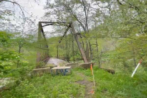
Bridge of Dreams to Hunter Steel Bridge
This is a narrow, graded winding gravel dirt mix that runs along the Kokosing River. Just after the roadside Springs, it changes Elevation to go up through a small patch of woods, and it drops down into a sweeping farmland Vista with sandstone ruins travels down a single track dead-end road to Hunte...
Learn more about Bridge of Dreams to Hunter Steel Bridge
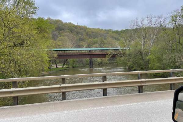
Bridge of Dreams to Mohican River
Fantastic rolling gravel along Kokosing River. There are multiple springs for filling water along the southern edge of the route. Some sections to this can be very high speed if graded well. New canoe access and Campground are adjacent to the Bridge of Dreams Park which is a 300+ foot-long pedestria...
Learn more about Bridge of Dreams to Mohican River
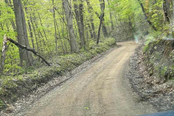
Walhonding Hills Steel Bridge to Bridge of Dreams
This trail is a tertiary gravel road that winds through the Amish Community with significant changes in elevation and sharp terms. Be aware of oncoming vehicle horse and foot traffic in the area as it is heavily Amish residential. Some of the sections at the end of this road get very steep with blin...
Learn more about Walhonding Hills Steel Bridge to Bridge of Dreams
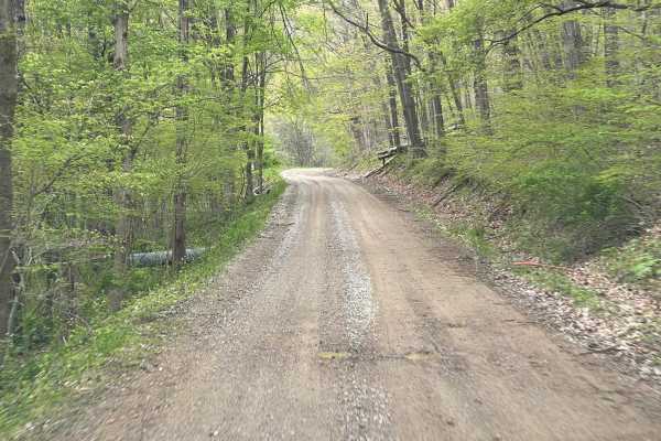
Batnest Loop
This is the eastern loop of Batnest Road back to Main Road 715. The nice twisty well-graded gravel road gets fairly steep in places. Hunting and fishing in the area with proper licensing, known for foraging of ginseng and mushrooms. Part of the Batnest and Stone Quarry Loop near Walhonding, Ohio, an...
Learn more about Batnest Loop
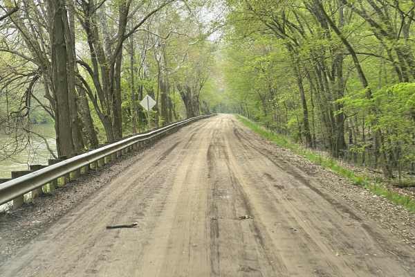
Walhonding Hills Steel Bridge to 715 Batnest Loop
This is a high-speed, secondary gravel road running along the Kokosing River. Expect to encounter significant changes in elevation, and some blind turns on the cliff edge. This area is public hunting so foraging for ginseng and mushrooms are allowed with proper permits. Use caution in the fall, bein...
Learn more about Walhonding Hills Steel Bridge to 715 Batnest Loop
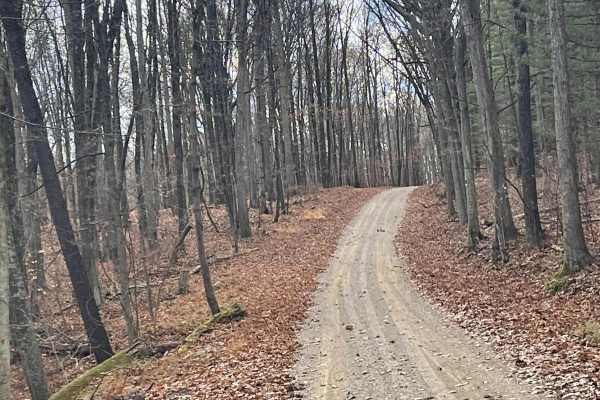
Jug Run to Girl Scout Camp
This is a rural country backroad track that becomes a narrow hill climb and can be severely washed out after even a mild rain. There are multiple creek crossings without bridges up to 2 feet deep. Find a beautiful covered bridge with pull-offs and fishing on either side. If traveling south to north ...
Learn more about Jug Run to Girl Scout Camp
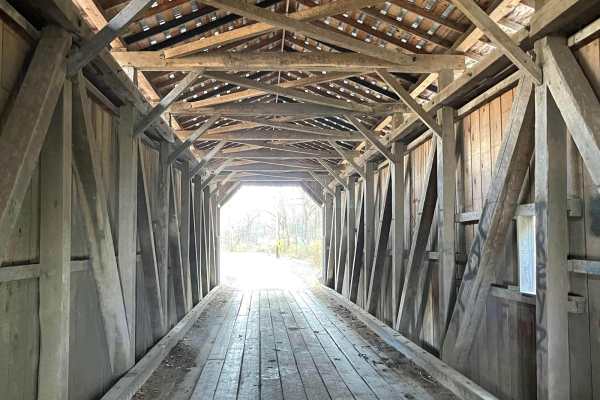
Amish Lumber Mills
These are some great winding country back roads going through Amish Country seeing several Amish lumber mills and roadside markets to purchase Amish produce and craft. With beautiful changes in elevation, some of these roads can get narrow and technical. Many places to pull over and have other traff...
Learn more about Amish Lumber Mills

Valley and Cows
Lots of scenic wooded gravel roads. Quite a bit of up and down on the side loops as you come in and out of the valley. We were rewarded at the end of this trip with an amazing road and a beautiful cow farm. Recommend running this backward in the winter as the first western Hillclimb is very steep.
Learn more about Valley and Cows

Full Tilt
This trail is directional and opens up with a fun rock crawl. There is a bypass for the rock crawl, but don't bother with this trail if you have no interest in rock crawling. There are two more rock crawls later on in the trail. There are a couple of small hills and a couple of areas to bail out if ...
Learn more about Full Tilt

G Spot
G Spot is an intermediate trail that weaves in and out of the foliage and trees. It has a couple of mild hill climbs and a few water holes. Some of the water holes are deep and some of them are not. There is also a water hole that has been filled in with a mild rock crawl.
Learn more about G Spot

Border Trail Part 2
The trail runs along the edge of the park and into the Whispering Woods. The trail is for SXS, ATVS, and motorcycles only. There are some mud holes and areas with tight trees. The trail intertwines with a couple of other trails back in the woods. It seems that some have taken it upon themselves to m...
Learn more about Border Trail Part 2

Devil's Hole
Devil's Hole is an open scramble area that has a set trail running through it. There are many entrances and exits to the area. There are also many areas that are labeled "Drop Off". If you are not familiar with the park, use caution and get out to look at what you are about to drive.
Learn more about Devil's Hole

Peastone Hill
There are many pathways (5) up this hill. It is very steep and has a loose gravel base. This trail is one-way, and that's going up. The top of all 5 climbs come together in the Peastone Pit at the top. Be sure to look for traffic from all directions at the top and bottom of the hill.
Learn more about Peastone Hill

Devil's Tower
This is a very short trail that goes up and immediately comes back down the hill. The landing in the middle overlooks Devil's Hole and has an immediate, dangerous drop-off. The view from the landing is pretty and it's fun to watch all the craziness in Devil's Hole, but note there's only enough room ...
Learn more about Devil's Tower

Baby Nut Check
This trail is a washout that runs along the main road at the top of Devil's Hole. It is a great intermediate obstacle for a new driver looking for experience as long as they have a spotter. The vehicle will need to ride the walls of the washout and there is one spot where the vehicle gets off-camber...
Learn more about Baby Nut Check

Whispering Woods
The signage for this trail was very hard to follow. Many people have just created their own route through the woods making this a tangled mess. The mud holes were deep although it was in August when we ran it. Just make sure to check them for depth before proceeding.
Learn more about Whispering Woods

Chicken Hill
Chicken Hill starts and finishes on the main haul road in the park. It is a short trail that winds through the woods, with mild hill climbs and one steep descent/climb in the loop. There are other no-name trails of similar difficulty weaving in and out of the area.
Learn more about Chicken Hill

Bare Back
The entrance to this trail can be picked up from the Lower Parking Lot and runs along the picnic area. This trail is mild with a couple of spots of articulation and a couple of spots that can be muddy if it's been raining. This trail also runs under the two-track style bridge that can be found in th...
Learn more about Bare Back

Little Willy
Little Willy is a mild trail that has few elevation changes. There is also an area that tends to get washed out when it's been raining. It's not very long and is a great trail for beginners. This trail has access to the Lower Parking Lot and access to the two-track style bridge in the park.
Learn more about Little Willy

Welcome Trail
This trail begins at the Lower Level Parking Lot and is a connector trail between one of the main roads that runs through the park and the parking lots. There are very few elevation changes. There are some mud holes, some deep and some not so deep. Use caution when traversing the mud holes. The two-...
Learn more about Welcome Trail
ATV trails near Republic, Ohio
Explore ATV-friendly trails near you. These trails are accessible for vehicles up to 50 inches wide, perfect for ATVs and smaller off-road machines.

Jug Run to Girl Scout Camp
This is a rural country backroad track that becomes a narrow hill climb and can be severely washed out after even a mild rain. There are multiple creek crossings without bridges up to 2 feet deep. Find a beautiful covered bridge with pull-offs and fishing on either side. If traveling south to north ...
Learn more about Jug Run to Girl Scout Camp

Full Tilt
This trail is directional and opens up with a fun rock crawl. There is a bypass for the rock crawl, but don't bother with this trail if you have no interest in rock crawling. There are two more rock crawls later on in the trail. There are a couple of small hills and a couple of areas to bail out if ...
Learn more about Full Tilt

G Spot
G Spot is an intermediate trail that weaves in and out of the foliage and trees. It has a couple of mild hill climbs and a few water holes. Some of the water holes are deep and some of them are not. There is also a water hole that has been filled in with a mild rock crawl.
Learn more about G Spot

Border Trail Part 2
The trail runs along the edge of the park and into the Whispering Woods. The trail is for SXS, ATVS, and motorcycles only. There are some mud holes and areas with tight trees. The trail intertwines with a couple of other trails back in the woods. It seems that some have taken it upon themselves to m...
Learn more about Border Trail Part 2
UTV/side-by-side trails near Republic, Ohio
Find UTV and side-by-side trails near you. These trails accommodate vehicles up to 60 inches wide, ideal for UTVs, side-by-sides, and wider off-road rigs.

Jug Run to Girl Scout Camp
This is a rural country backroad track that becomes a narrow hill climb and can be severely washed out after even a mild rain. There are multiple creek crossings without bridges up to 2 feet deep. Find a beautiful covered bridge with pull-offs and fishing on either side. If traveling south to north ...
Learn more about Jug Run to Girl Scout Camp

Full Tilt
This trail is directional and opens up with a fun rock crawl. There is a bypass for the rock crawl, but don't bother with this trail if you have no interest in rock crawling. There are two more rock crawls later on in the trail. There are a couple of small hills and a couple of areas to bail out if ...
Learn more about Full Tilt

G Spot
G Spot is an intermediate trail that weaves in and out of the foliage and trees. It has a couple of mild hill climbs and a few water holes. Some of the water holes are deep and some of them are not. There is also a water hole that has been filled in with a mild rock crawl.
Learn more about G Spot

Border Trail Part 2
The trail runs along the edge of the park and into the Whispering Woods. The trail is for SXS, ATVS, and motorcycles only. There are some mud holes and areas with tight trees. The trail intertwines with a couple of other trails back in the woods. It seems that some have taken it upon themselves to m...
Learn more about Border Trail Part 2
The onX Offroad Difference
onX Offroad combines trail photos, descriptions, difficulty ratings, width restrictions, seasonality, and more in a user-friendly interface. Available on all devices, with offline access and full compatibility with CarPlay and Android Auto. Discover what you're missing today!
Open Trail Map