
Dirt Bike Trails
Near Raymondville, Missouri
Explore All Dirt Bike Trails Near Raymondville, Missouri
Dirt Bike Trails Near Raymondville, Missouri
Discover the best dirt bike trails near you. Browse trail maps, check difficulty ratings, and find your next adventure — whether you're looking for a quick ride or an all-day expedition.
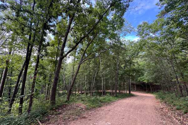
Devil's Well Road
This short, well-maintained dirt road has a compacted surface that is easy to drive on. The road is narrow and feels more like a trail, so watch carefully for oncoming traffic. Avoid pulling into the grass because hidden tree stumps may cause vehicle damage. Under the conditions we encountered, the ...
Learn more about Devil's Well Road
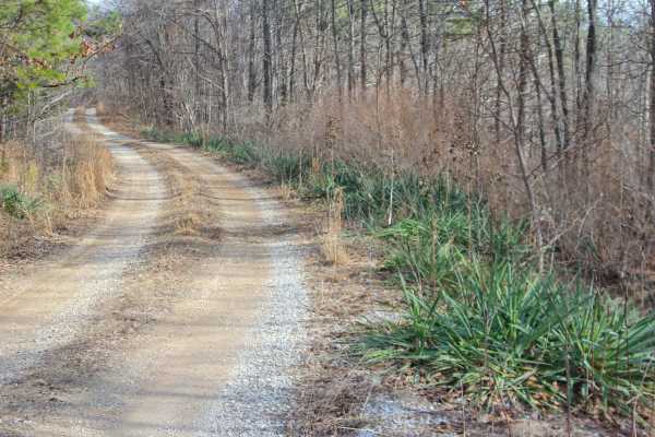
Perkins Ridge - FS 423
Perkins Ridge (FS 423) is a semi-maintained gravel forest service road within the Willow Springs Unit of Mark Twain National Forest. The Perkins Ridge begins at Missouri Route AM, heading west along the raised ridge top spines, first dropping downhill as it overlooks deep valleys on both sides of th...
Learn more about Perkins Ridge - FS 423
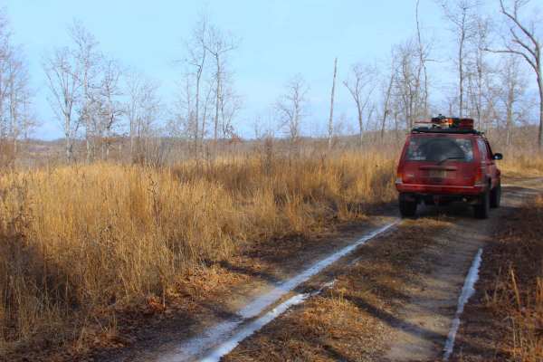
Tick Hollow - FS 423A
Tick Hollow (FS 423A), also known as Perkins Ridge Spur, is a semi-maintained gravel forest service road within the Willow Springs Unit of Mark Twain National Forest. The Tick Hollow road begins as the northern offshoot from the Perkins Ridge FS 423, turning northward, going down a short hill, up to...
Learn more about Tick Hollow - FS 423A
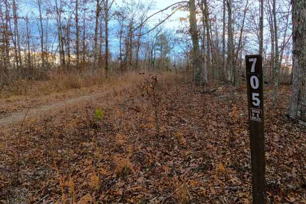
Section 8 - FS 705
Section 8 (FS 705) is a fading gravel dirt forest service road within the Willow Springs Unit of Mark Twain National Forest. Section 8 logistically connects between the Middle Ridge FS 424 on the east, and the Howell County Road 5830 on the west. The road features a thinning gravel, and natural dirt...
Learn more about Section 8 - FS 705
Middle Ridge - FS 424
Middle Ridge (FS 424) is a semi-maintained gravel forest service road within the Willow Springs Unit of Mark Twain National Forest. The road begins at Missouri Route AM, heading north along the elevated ridge. When at the half-mile mark from the entry of the track, there is a small peak of a ridge s...
Learn more about Middle Ridge - FS 424
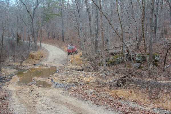
Indian Narrows - FS 426
Indian Narrows (FS 426) is a semi-maintained gravel Forest Service road within the Willow Springs Unit of Mark Twain National Forest. Indian Narrows begins at the Missouri Route AM along the ridge top, heading south, slowly losing elevation at first, then gradually getting steeper in grade to the po...
Learn more about Indian Narrows - FS 426
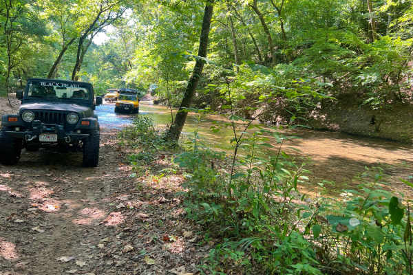
Horse Hollow - SCR 319A
Horse Hollow Road, also known as Angeline Road, or Shannon County Road 319 and 319A, is a natural dirt and creek gravel road through the Missouri Department of Conservation's Angeline Conservation Area, and a small portion of the Ozark National Scenic Riverways. The Shannon 319A is a historic road t...
Learn more about Horse Hollow - SCR 319A
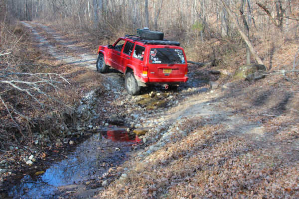
Big Gulch - FS 497
Big Gulch (FS 497) is a semi-maintained gravel, transitioning to natural coarse gravel and dirt, forest service road within Mark Twain National Forest, Willow Springs Unit. The road begins at the Douglas County Road 160, heading north into a large logging area along the hilltop, where views are plen...
Learn more about Big Gulch - FS 497
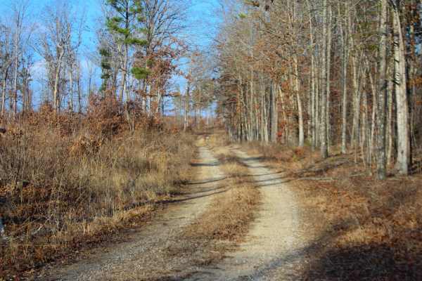
Upper Greasy Creek - FS 129
Upper Greasy Creek (FS 129) is a gravel Forest Service road within the Mark Twain National Forest Willow Springs Unit. Upper Greasy Creek begins by turning northwest off Missouri Route 181, first turning hard north on clean gravel, to quickly realign hard west, to climb the main grade of the track, ...
Learn more about Upper Greasy Creek - FS 129
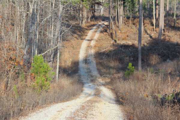
Greasy Creek - FS 427
Greasy Creek (FS 427) is a gravel Forest Service road within the Mark Twain National Forest Willow Springs Unit. Greasy Creek begins by turning west off Missouri Route 181, quickly dropping grade down and back up into a small valley, with a rainwater runoff channel featuring exposed small cobbles an...
Learn more about Greasy Creek - FS 427
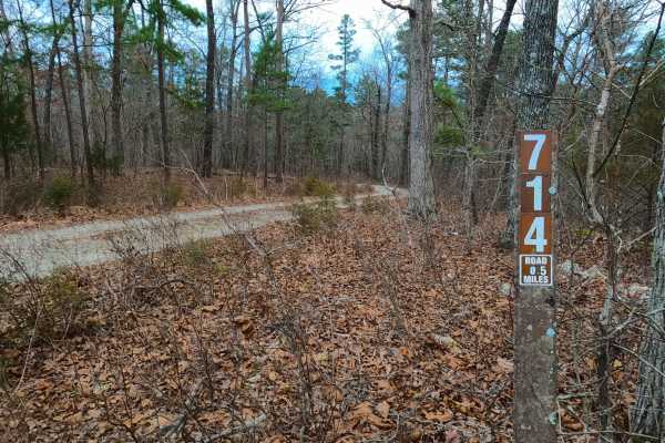
Robin Hood - FS 714
Robin Hood (FS 714) is a semi-maintained gravel Forest Service road within the Willow Springs Unit of Mark Twain National Forest. Robin Hood begins at the Howell County Road 5710 heading south into the forest, first descending a curvy hill overlooking a small water collection area to the southwest, ...
Learn more about Robin Hood - FS 714
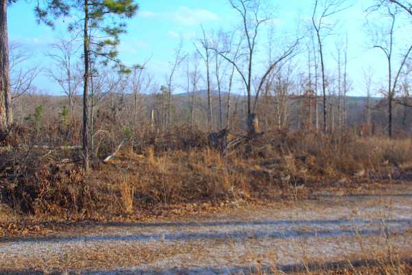
Bull Knot - FS 139
Bull Knot (FS 139) is a gravel Forest Service road within the Mark Twain National Forest Willow Springs Unit. Bull Knot heads southeast off Missouri Route 181, riding along the ridge, having scenic views of the surrounding knobs and tree lines, with a few small valleys, featuring mild grades, with f...
Learn more about Bull Knot - FS 139
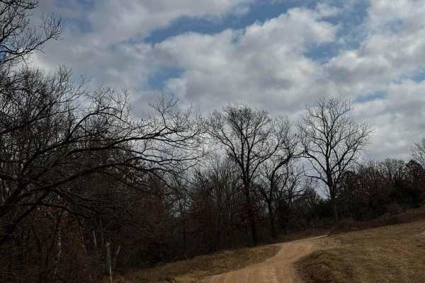
Main Park Entrance Trail
This trail is your main road for accessing different areas within the park. Please follow the signs designating areas where you can camp and also speed limits while some areas may have young riders terrain varies on the trail with some sections being washed out and a bit more difficult to navigate.
Learn more about Main Park Entrance Trail
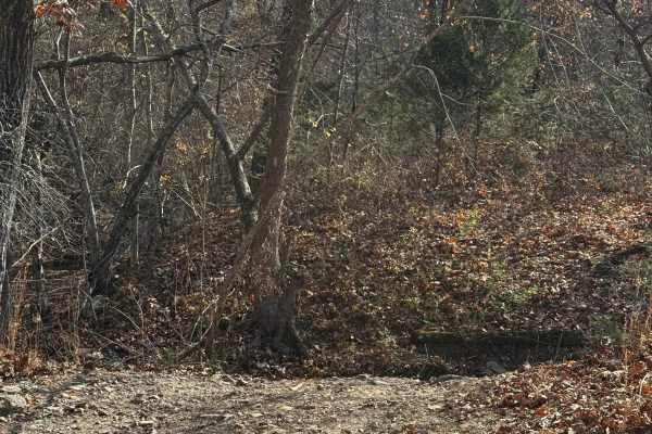
Maze Extra Credit
This part of the "Maze" requires some real dedication while you are navigating large rocks crazy angles and steep climbs. Working your way out of this trail will demand a lot out of your rig so come prepared and take your time enjoying this challenge and remember to please keep the trails clean!
Learn more about Maze Extra Credit
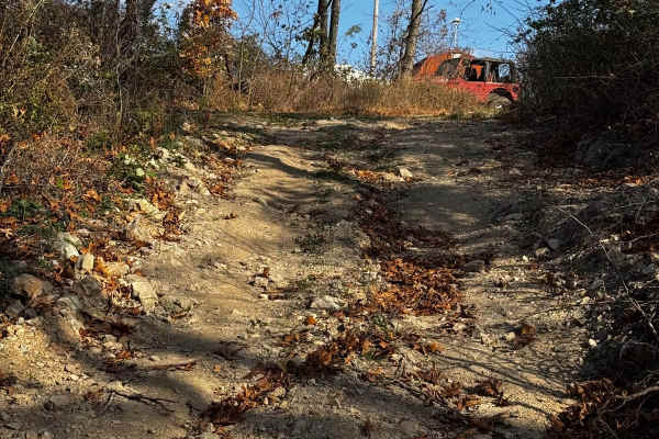
X3 Hill
As the name states this SXS hill climb is an adrenaline-filled experience as you make your way up a loose and rock-filled incline taking you to the top of the trail where you'll have lots of options for fun challenges! Remember to be safe and keep the trails clean.
Learn more about X3 Hill
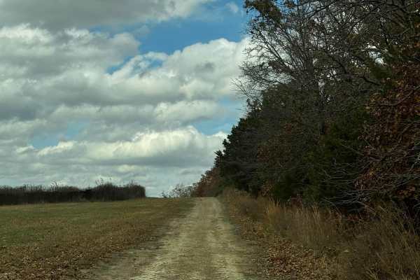
Turkey
This is an absolutely beautiful trail featuring loose rocks and some mild obstacles. Although it's a bit longer of a trail it's truly an enjoyable relaxing experience taking you deep into the trees and surrounding you with nature. Please be mindful of others and do your part with keeping the trail c...
Learn more about Turkey
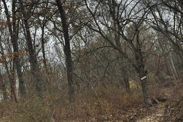
AXC Kids Loop
This loop is very fun for the kids to run laps on. The trail is easy and mellow with a few little "challenges" along the way. Located centrally in the park gives you a chance to relax and let them wear themselves out. With rain and other weather it can change the track so make sure to check it out b...
Learn more about AXC Kids Loop
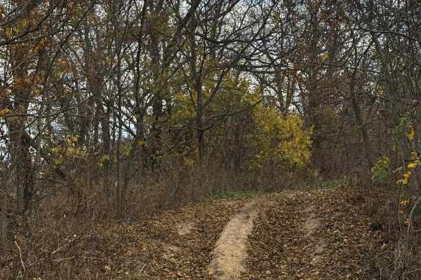
AXC Crossing
This crossing is a medium-lengthed trail that features some ruts and rock. The trail still provides beautiful scenery and a good way to get access to other challenges located close by, Be mindful of trail traffic and make sure to do your part in keeping the park clean and friendly for everyone.
Learn more about AXC Crossing
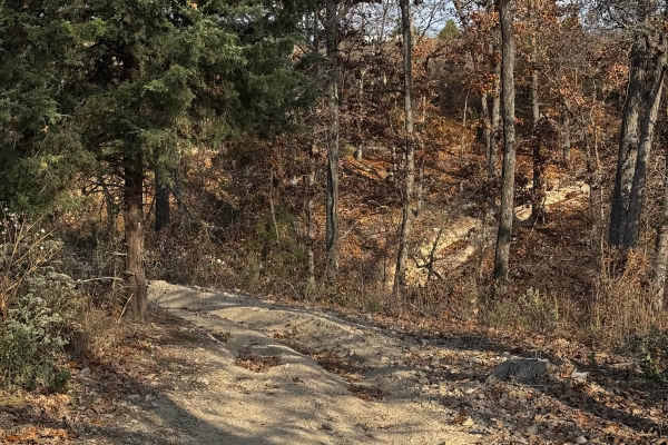
Deer Lick
This is one of the longer trails in the park. This trail takes you into a beautiful deep scenery of trees and nature while also pushing you into some challenges featuring rock ledges, ruts, a nice climb, and descent into some different elevations! Please remember to be safe and keep the trail clean.
Learn more about Deer Lick
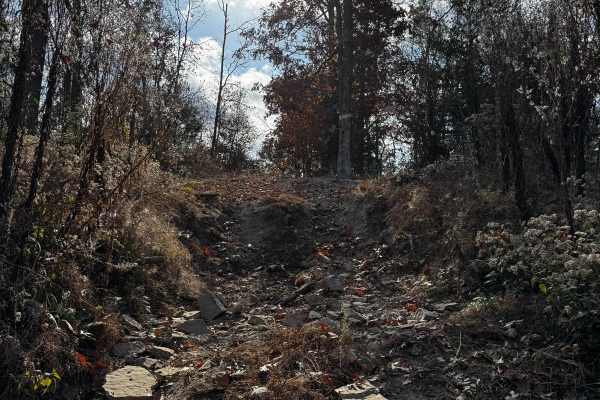
Dog Leg
This short trail is anything but sweet featuring a nice climb with some good-sized rocks and deep ruts putting you up for a nice ride! Make sure to be mindful of others on the trail that may be coming down and please remember to keep the trails clean!
Learn more about Dog Leg
ATV trails near Raymondville, Missouri
Explore ATV-friendly trails near you. These trails are accessible for vehicles up to 50 inches wide, perfect for ATVs and smaller off-road machines.
Perkins Ridge - FS 423
Perkins Ridge (FS 423) is a semi-maintained gravel forest service road within the Willow Springs Unit of Mark Twain National Forest. The Perkins Ridge begins at Missouri Route AM, heading west along the raised ridge top spines, first dropping downhill as it overlooks deep valleys on both sides of th...
Learn more about Perkins Ridge - FS 423
Tick Hollow - FS 423A
Tick Hollow (FS 423A), also known as Perkins Ridge Spur, is a semi-maintained gravel forest service road within the Willow Springs Unit of Mark Twain National Forest. The Tick Hollow road begins as the northern offshoot from the Perkins Ridge FS 423, turning northward, going down a short hill, up to...
Learn more about Tick Hollow - FS 423A
Section 8 - FS 705
Section 8 (FS 705) is a fading gravel dirt forest service road within the Willow Springs Unit of Mark Twain National Forest. Section 8 logistically connects between the Middle Ridge FS 424 on the east, and the Howell County Road 5830 on the west. The road features a thinning gravel, and natural dirt...
Learn more about Section 8 - FS 705
Middle Ridge - FS 424
Middle Ridge (FS 424) is a semi-maintained gravel forest service road within the Willow Springs Unit of Mark Twain National Forest. The road begins at Missouri Route AM, heading north along the elevated ridge. When at the half-mile mark from the entry of the track, there is a small peak of a ridge s...
Learn more about Middle Ridge - FS 424
UTV/side-by-side trails near Raymondville, Missouri
Find UTV and side-by-side trails near you. These trails accommodate vehicles up to 60 inches wide, ideal for UTVs, side-by-sides, and wider off-road rigs.
Perkins Ridge - FS 423
Perkins Ridge (FS 423) is a semi-maintained gravel forest service road within the Willow Springs Unit of Mark Twain National Forest. The Perkins Ridge begins at Missouri Route AM, heading west along the raised ridge top spines, first dropping downhill as it overlooks deep valleys on both sides of th...
Learn more about Perkins Ridge - FS 423
Tick Hollow - FS 423A
Tick Hollow (FS 423A), also known as Perkins Ridge Spur, is a semi-maintained gravel forest service road within the Willow Springs Unit of Mark Twain National Forest. The Tick Hollow road begins as the northern offshoot from the Perkins Ridge FS 423, turning northward, going down a short hill, up to...
Learn more about Tick Hollow - FS 423A
Section 8 - FS 705
Section 8 (FS 705) is a fading gravel dirt forest service road within the Willow Springs Unit of Mark Twain National Forest. Section 8 logistically connects between the Middle Ridge FS 424 on the east, and the Howell County Road 5830 on the west. The road features a thinning gravel, and natural dirt...
Learn more about Section 8 - FS 705
Middle Ridge - FS 424
Middle Ridge (FS 424) is a semi-maintained gravel forest service road within the Willow Springs Unit of Mark Twain National Forest. The road begins at Missouri Route AM, heading north along the elevated ridge. When at the half-mile mark from the entry of the track, there is a small peak of a ridge s...
Learn more about Middle Ridge - FS 424
The onX Offroad Difference
onX Offroad combines trail photos, descriptions, difficulty ratings, width restrictions, seasonality, and more in a user-friendly interface. Available on all devices, with offline access and full compatibility with CarPlay and Android Auto. Discover what you're missing today!
Open Trail Map