
Dirt Bike Trails
Near Pueblo, Colorado
Explore All Dirt Bike Trails Near Pueblo, Colorado
Dirt Bike Trails Near Pueblo, Colorado
Discover the best dirt bike trails near you. Browse trail maps, check difficulty ratings, and find your next adventure — whether you're looking for a quick ride or an all-day expedition.
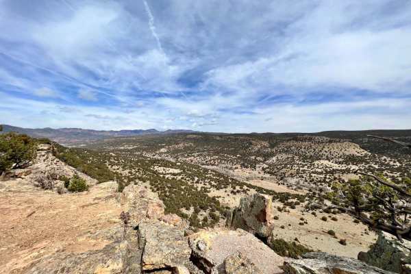
Shaeffer Dam Loop - BLM#6102K
Penrose Commons OHV Trail# 6102K is the easternmost trail of the Penrose Commons OHV recreational site. Majority of the trail traverses along the top edge of a valley overlooking the scenic cliffs of Patton Canyon and Beaver Creek. This is a site of the historic Schaeffer Dam collapse in June 1921 w...
Learn more about Shaeffer Dam Loop - BLM#6102K
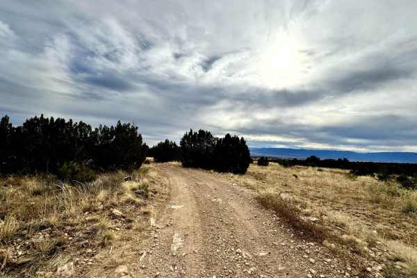
Penrose Commons BLM 6102E
Penrose Commons OHV Trail 6102E is a trail that runs north/south through the middle of the Penrose Commons OHV recreational site. The majority of the trail traverses along the top edge of a valley overlooking the scenic cliffs of Patton Canyon and Beaver Creek. Enjoy panoramic views, including the S...
Learn more about Penrose Commons BLM 6102E
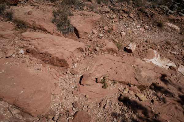
6102i
6102i departs from 6201F and goes over a bunch of slick rock layers, with a couple of 6" tall rock ledges right away. The rest of the short trail has small loose rocks, more flat slickrock layers, and a small steeper downhill descent with layers of embedded rock that make it a bit more challenging. ...
Learn more about 6102i
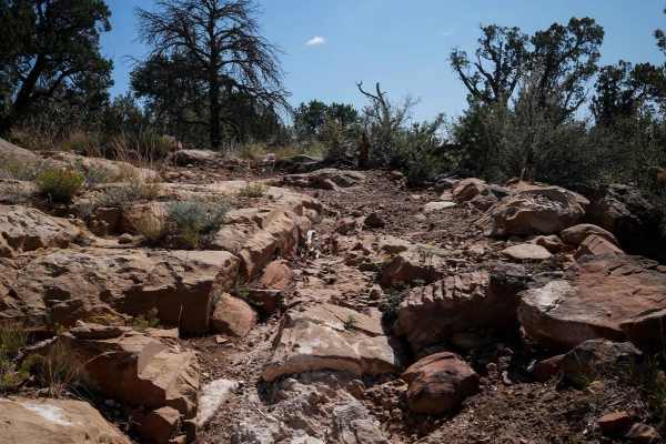
6102F
The 6102F ATV trail meanders through the Penrose Commons trail system for 1.6 miles, with many easy sections, but also several intermediate rock obstacles that make this trail more interesting and a moderate challenge. From the intersection with 6102B, it descends down, and starts dropping down some...
Learn more about 6102F
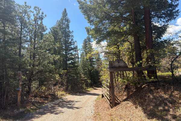
Meade Road
Easy-to-moderate, out-and-back dirt road located outside the town of Beulah, Colorado. The trail is off Colorado Route 78 and winds through scenic forest terrain within the San Isabel National Forest. The route is generally suitable for most offroad vehicles and provides access to dispersed recreati...
Learn more about Meade Road
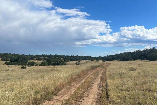
6102G
This trail is a short finger that runs down off the main loop (6102) in the Penrose Commons. Uneventful and flat. After a good rain, mud will be present. The end of the trail turns into a <50-inch wide trail (6102D). There is one spot to camp at the turnaround at the end.
Learn more about 6102G
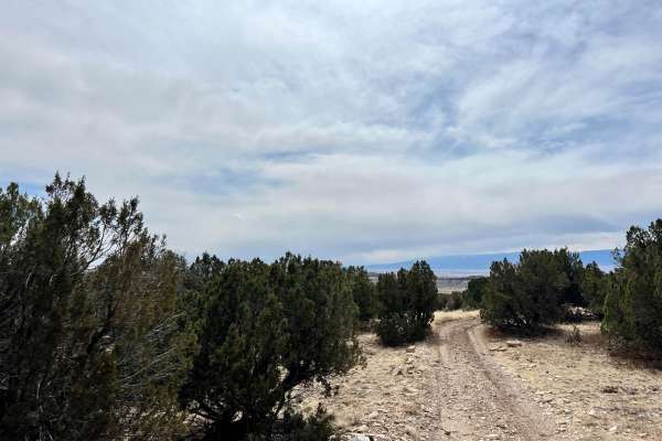
Beaver Creek Lookout - BLM#6102J
Trail#6102J is one of two sites drivable by a full-size 4x4 towards a scenic site where you can see Patton Canyon and Beaver Creek in the valley below as well as ruins of an old damn that collapse in 1921. Take a short walk toward the end of the cliff to see the panoramic view of the valley below. T...
Learn more about Beaver Creek Lookout - BLM#6102J
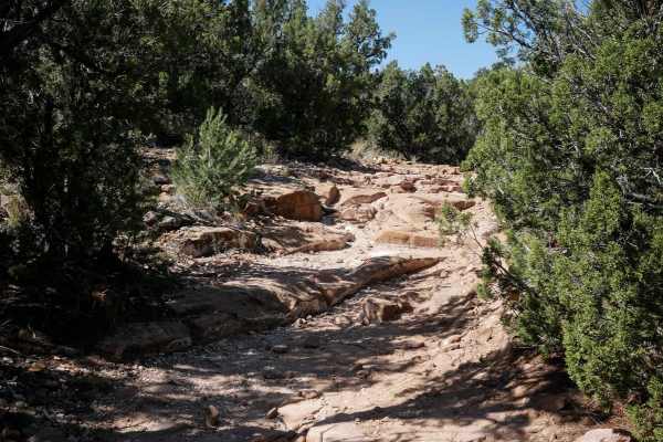
6102E
The south end of 6102E starts out as a wide dirt two-track tight between the pinyon pine and comes up to several small 6" rock ledges right away. The rock ledges are like a series of step-ups with a bunch of small ledges in a row. It continues to ride over long layers of slab rock and has several bi...
Learn more about 6102E

Penrose Commons (BLM #1602)
Penrose Commons OHV Trail# 6102 is the main trail that connects other trails in the area. Enjoy panoramic views including the Sangre De Cristo Mountain Range. The trail traverses through Pinon and Juniper Trees as well as the occasional deer sighting. There are a couple of steep ledges up to 12"-18"...
Learn more about Penrose Commons (BLM #1602)
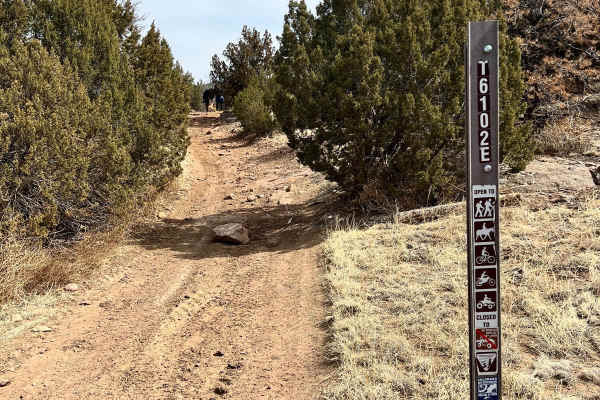
Patton Canyon Lookout - BLM#6102H
Trail#6102H is one of two sites drivable by a full-size 4x4 towards a scenic site where you can see Patton Canyon and Beaver Creek in the valley below as well as ruins of an old damn that collapse in 1921. Take a short walk toward the end of the cliff to see the panoramic view of the valley below. T...
Learn more about Patton Canyon Lookout - BLM#6102H

Penrose Commons BLM#6102A
Penrose Commons OHV Trail# 6102A is the trail that overlooks a narrow valley where the famous Patriot trails traverse (Independence Trail, Patriot Trail, and Liberty Trail). Although this trail connects the well-known extreme 4x4 trail, 6102A is a moderate trail consisting of mostly rocks and surrou...
Learn more about Penrose Commons BLM#6102A
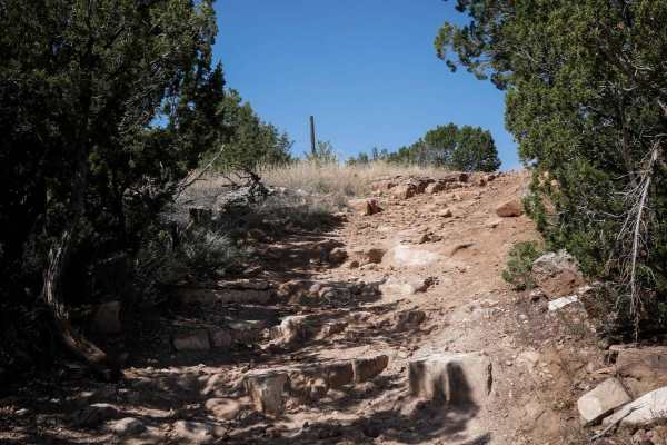
6102A
This ATV trail starts off of BLM Route 6102, just north of the Penrose Commons parking lot. It starts as a flat two-track with small loose rocks, going through wide open grassy terrain with pinyon pine bushes. After 0.2 miles, it splits. Left is an easy direct route north for 0.4 miles to the road (...
Learn more about 6102A
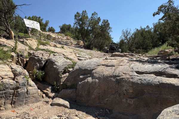
Independece
The trail that started it all, Independence, is a short but brutal crawl through rocky washes and canyon terrain. Its steep drop-ins, vertical ledges, and tight exits make it every bit as difficult as Patriot, despite its shorter length. Independence serves as a gateway to the full trail system, del...
Learn more about Independece
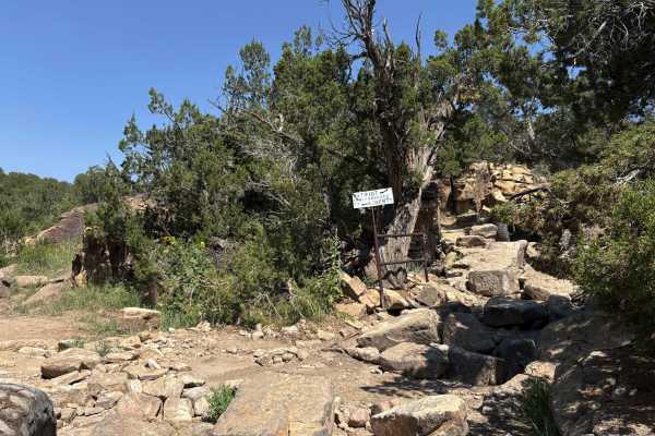
Liberty
Part of the legendary Independence Off-Road Trail System, Liberty Trail is the longest and also the easiest, but it still provides a technical rock-crawling challenge. Expect scattered rock gardens leading to larger and more challenging obstacles littered throughout the canyon floor. Similar to the ...
Learn more about Liberty
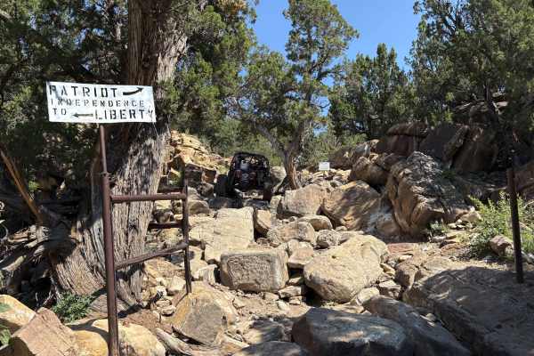
Patriot
Patriot Trail is the heart-pounding centerpiece of the Independence Off-Road Trail System, widely regarded as one of Colorado’s most challenging rock-crawling trails. Tucked into rugged canyon country, Patriot delivers a relentless gauntlet of vertical waterfalls, deep cracks, and tight boulder-stre...
Learn more about Patriot

6102C
6102C is another rocky ATV trail through Penrose Commons that is similar to the many high desert trails in the area. It has fast and straight sections atop the grassy mesa, with pinyon pine lining the trail. The trail has views out towards the mesas and horizon. It has rocky curves with rock ledges ...
Learn more about 6102C
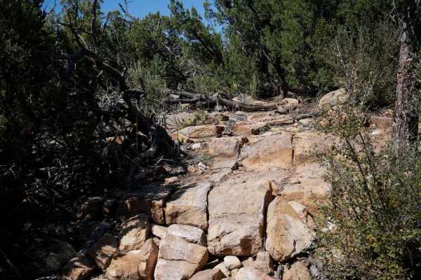
The Ridge - Penrose Commons Recreation Area
This is a new singletrack within the Penrose Commons Recreation Area. The south end starts out on top of a mesa, on a rocky trail that rides over a bunch of rock slab and rock ledges. It goes up some two-foot tall blunt rock ledges, similarly tall drop-offs, and curves around through the pinyon pine...
Learn more about The Ridge - Penrose Commons Recreation Area
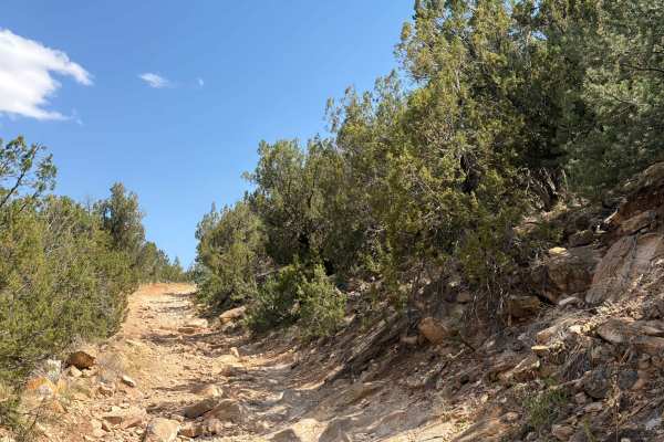
BLM 6101
BLM Route 6101 is located within the Penrose Commons Recreation Area outside the town of Penrose, Colorado. As one of the many interconnected trails in the recreation area, it provides access to a network of routes suitable for off-highway vehicle enthusiasts. The trail is open to all classes of OHV...
Learn more about BLM 6101
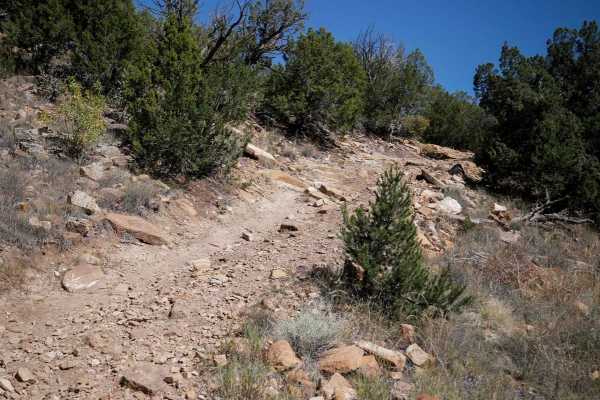
6101B
This is an intermediate ATV trail through Penrose Commons that curves through the pinyon pine on a wide dirt track with lots of loose rock on the surface. There are embedded rock layers in the trail that make small ledges, and some steep hill climbs that are full of loose rock. The trail has some sh...
Learn more about 6101B
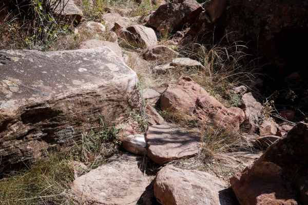
Warmup Trail
This is a new singletrack in the Penrose Commons Recreation Area. The south end starts as a narrow single track off of the ATV Trail 6102C, going through pinyon pine, very tightly between the bushes. You'll be ducking for branches the whole ride. It snakes through this high desert forest, weaving be...
Learn more about Warmup Trail
ATV trails near Pueblo, Colorado
Explore ATV-friendly trails near you. These trails are accessible for vehicles up to 50 inches wide, perfect for ATVs and smaller off-road machines.
Shaeffer Dam Loop - BLM#6102K
Penrose Commons OHV Trail# 6102K is the easternmost trail of the Penrose Commons OHV recreational site. Majority of the trail traverses along the top edge of a valley overlooking the scenic cliffs of Patton Canyon and Beaver Creek. This is a site of the historic Schaeffer Dam collapse in June 1921 w...
Learn more about Shaeffer Dam Loop - BLM#6102K
Penrose Commons BLM 6102E
Penrose Commons OHV Trail 6102E is a trail that runs north/south through the middle of the Penrose Commons OHV recreational site. The majority of the trail traverses along the top edge of a valley overlooking the scenic cliffs of Patton Canyon and Beaver Creek. Enjoy panoramic views, including the S...
Learn more about Penrose Commons BLM 6102E
6102i
6102i departs from 6201F and goes over a bunch of slick rock layers, with a couple of 6" tall rock ledges right away. The rest of the short trail has small loose rocks, more flat slickrock layers, and a small steeper downhill descent with layers of embedded rock that make it a bit more challenging. ...
Learn more about 6102i
6102F
The 6102F ATV trail meanders through the Penrose Commons trail system for 1.6 miles, with many easy sections, but also several intermediate rock obstacles that make this trail more interesting and a moderate challenge. From the intersection with 6102B, it descends down, and starts dropping down some...
Learn more about 6102F
UTV/side-by-side trails near Pueblo, Colorado
Find UTV and side-by-side trails near you. These trails accommodate vehicles up to 60 inches wide, ideal for UTVs, side-by-sides, and wider off-road rigs.
Shaeffer Dam Loop - BLM#6102K
Penrose Commons OHV Trail# 6102K is the easternmost trail of the Penrose Commons OHV recreational site. Majority of the trail traverses along the top edge of a valley overlooking the scenic cliffs of Patton Canyon and Beaver Creek. This is a site of the historic Schaeffer Dam collapse in June 1921 w...
Learn more about Shaeffer Dam Loop - BLM#6102K
Penrose Commons BLM 6102E
Penrose Commons OHV Trail 6102E is a trail that runs north/south through the middle of the Penrose Commons OHV recreational site. The majority of the trail traverses along the top edge of a valley overlooking the scenic cliffs of Patton Canyon and Beaver Creek. Enjoy panoramic views, including the S...
Learn more about Penrose Commons BLM 6102E
Meade Road
Easy-to-moderate, out-and-back dirt road located outside the town of Beulah, Colorado. The trail is off Colorado Route 78 and winds through scenic forest terrain within the San Isabel National Forest. The route is generally suitable for most offroad vehicles and provides access to dispersed recreati...
Learn more about Meade Road
6102G
This trail is a short finger that runs down off the main loop (6102) in the Penrose Commons. Uneventful and flat. After a good rain, mud will be present. The end of the trail turns into a <50-inch wide trail (6102D). There is one spot to camp at the turnaround at the end.
Learn more about 6102G
The onX Offroad Difference
onX Offroad combines trail photos, descriptions, difficulty ratings, width restrictions, seasonality, and more in a user-friendly interface. Available on all devices, with offline access and full compatibility with CarPlay and Android Auto. Discover what you're missing today!
Open Trail Map