
Dirt Bike Trails
Near Pinckard, Alabama
Explore All Dirt Bike Trails Near Pinckard, Alabama
Dirt Bike Trails Near Pinckard, Alabama
Discover the best dirt bike trails near you. Browse trail maps, check difficulty ratings, and find your next adventure — whether you're looking for a quick ride or an all-day expedition.
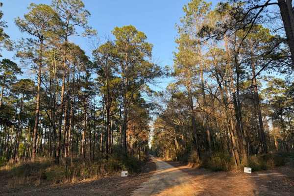
Hogfoot Road - FS 332
This scenic route winds through towering pines on a smooth, well-maintained road, making for a relaxing drive through Conecuh National Forest. Along the way, you'll cross two picturesque bridges, adding to the charm of this peaceful forest trail. Ideal for all vehicle types, this road provides easy ...
Learn more about Hogfoot Road - FS 332
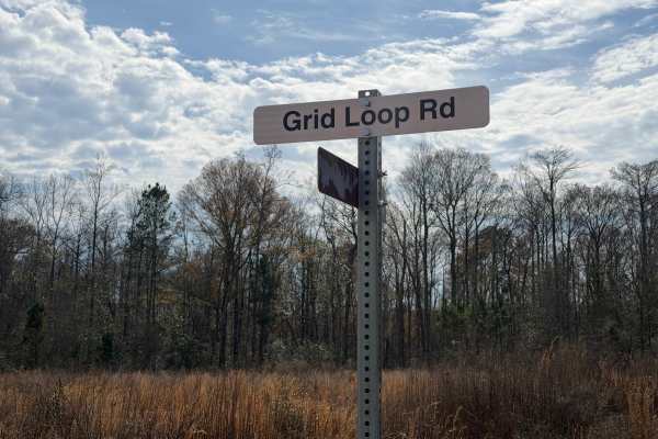
Grid Loop Road
Grid Loop Road runs through the southeastern quadrant of the Chickasawhatchee Wildlife Management Area (WMA). Only street-legal, registered, and licensed vehicles are permitted. Additionally, the Georgia Department of Natural Resources (GADNR) requires individuals to be in possession of the Georgia ...
Learn more about Grid Loop Road
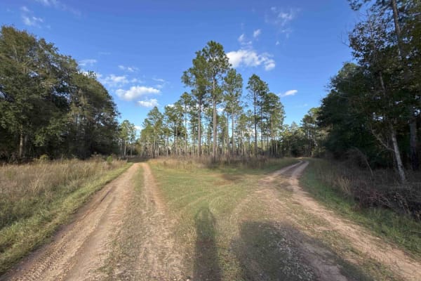
Seven Bridge Road
The Seven Bridge Road connects the Chickasawhatchee Road at the west end and the Mud Creek Road at the east end. The trail takes you through the Chickasawhatchee Wildlife Management Area and crosses the waterways several times. The road conditions are a mixture of packed sand, loose sand, and some d...
Learn more about Seven Bridge Road
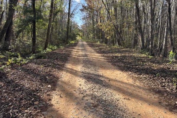
Chickasawhatchee Road
The Chickasawhatchee Road connects the north entrance at GA-62 and the west entrance at GA-37. The trail gives you access to the Campground and several other trails in the Chickasawhatchee Wildlife Management Area. The road conditions are a mixture of packed sand, loose sand and some deep holes that...
Learn more about Chickasawhatchee Road
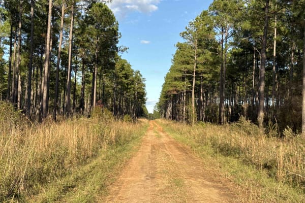
Pine Island Road
The Pine Island Road connects GA-62 at the north end and the Seven Bridge Road at the south end. The trail gives you access to the Mike Commander Shooting Range at the Chickasawhatchee Wildlife Management Area. The road conditions are a mixture of packed sand, loose sand, and some deep holes that ca...
Learn more about Pine Island Road
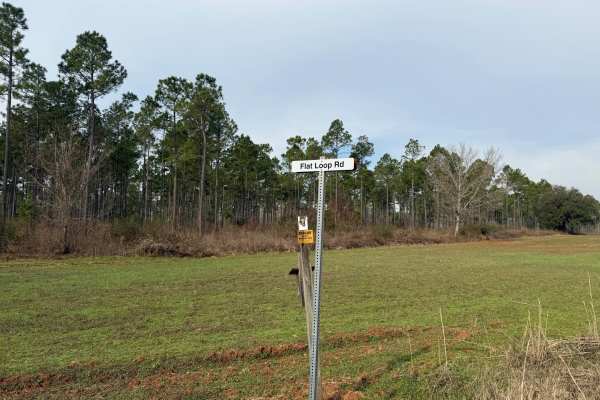
Flat Hole Loop
Flat Hole Loop runs through the southeastern quadrant of the Chickasawhatchee Wildlife Management Area (WMA). Only street-legal, registered, and licensed vehicles are permitted. Additionally, the Georgia Department of Natural Resources (GADNR) requires individuals to be in possession of the Georgia ...
Learn more about Flat Hole Loop
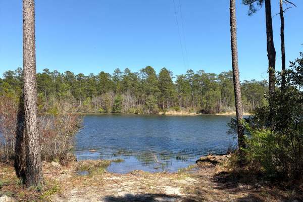
H 32
Forest Road H 32 is a dead-end road that takes you from the Upper Karick Lake Road to the public boat ramp and picnic area on the west side of Karick Lake. It is a short trail in the north-east part of the Blackwater River State Forest. The road conditions are a mixture of packed sand, loose sand, a...
Learn more about H 32
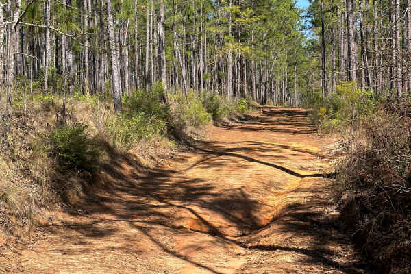
R 123
Forest Road R 123 connects High Bridge Road at the west end and SR 189 at the east end. It is a 2-mile-long trail that takes you through the north east part of the Blackwater River State Forest and gives you access to several trails along the Barrel Branch District, and has an appendix that ends at ...
Learn more about R 123
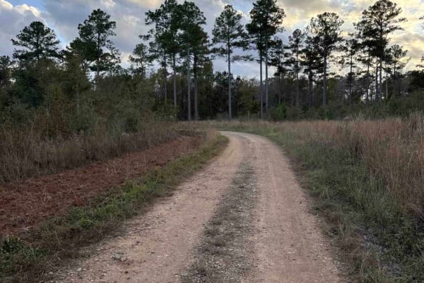
Mud Creek Road
The Mud Creek Road connects GA-62 at the north entrance and the Seven Bridge Road at the south end. The trail gives you access to the Gut Pit and several other trails in the Chickasawhatchee Wildlife Management Area. The road conditions are a mixture of packed sand, loose sand, and some deep holes t...
Learn more about Mud Creek Road
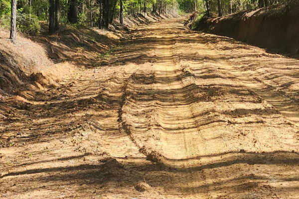
Tatum Road Trail
This 6.3‑mile through‑trail winds through timberland, hunting areas, and to hunting camps bordering the Hannahatchee Creek WMA. Packed red clay and sandy silt create ever‑changing terrain, easily rutted after rain. Scenic vistas near the Georgia foothills offer stunning views, while use, seasonal, a...
Learn more about Tatum Road Trail
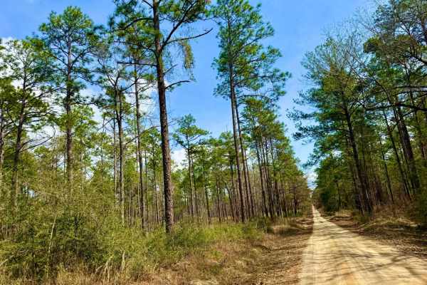
Grab mill Rd/ XC Rd FS 305
This main thoroughfare is the longest continual road in Conecuh National Forest, offering easy access to the rest of the forest. The route features scenic views of pine stands, occasional burned scars, and five water crossings. The road is generally well-maintained but can be slick and muddy in spot...
Learn more about Grab mill Rd/ XC Rd FS 305
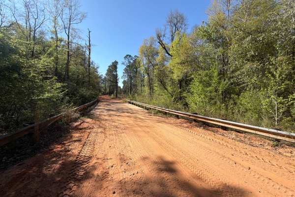
Mattie Kennedy Road
Mattie Kennedy Road connects Sherman Kennedy Road at the east end and Kennedy Bridge Road at the west end. It is a 2-mile trail that takes you through the northeast part of the Blackwater River State Forest along More Creek and gives you access to several OHV and off-road trails in the area. The roa...
Learn more about Mattie Kennedy Road
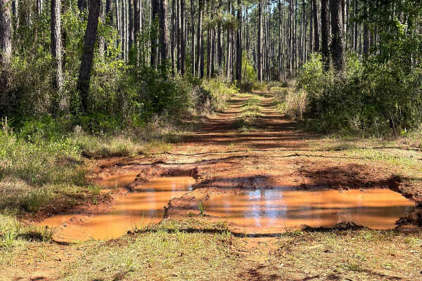
R 137
Forest Road R 137 connects Sherman Kennedy Road at the west end and Finkel Road at the east end. It is a 2-mile-long trail that takes you through the north-east part of the Blackwater River State Forest and gives you access to several trails along the Panther Creek District. The road conditions are ...
Learn more about R 137

High Bridge
High Bridge Road connects Sherman Kennedy Road at the west end and County Road 189 at the east end. It is a 3-mile-long trail that takes you through the northeast part of the Blackwater River State Forest and gives you access to several trails along the Panther Creek District. The road conditions ar...
Learn more about High Bridge
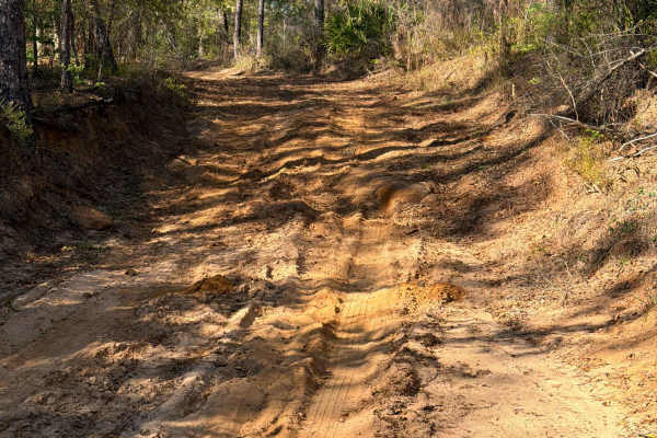
R 155
Blackwater River Forest Road R 155 connects FR R 159 at the north end and Kennedy Bridge Road at the south end. It is a short trail that takes you through the north east part of the Blackwater River State Forest along the east side of the Blackwater River and gives you access to a beautiful camping ...
Learn more about R 155
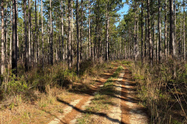
R 159
Blackwater River Forest Road R 159 connects FR R 155 at the west end and Kennedy Bridge Road at the east end. It is a short trail that takes you through the north east part of the Blackwater River State Forest along the east side of the Blackwater River and gives you access to a beautiful camping an...
Learn more about R 159
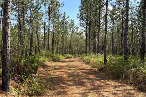
R 17
Blackwater River Forest Road R 17 is a loop that starts and ends at the Mashourn Forks Road. It is a short trail that takes you through the north east part of the Blackwater River State Forest along the west side of the Blackwater River and gives you access to a few hiking trails to the river. The r...
Learn more about R 17

Miller Creek Road - FS 311
This main thoroughfare through Conecuh National Forest is a typical forest service road, mostly smooth with a few slick and muddy spots after rain. It features five water crossings, passing through tall pine stands and offering scenic views along the way. The route is generally straightforward, maki...
Learn more about Miller Creek Road - FS 311
ATV trails near Pinckard, Alabama
Explore ATV-friendly trails near you. These trails are accessible for vehicles up to 50 inches wide, perfect for ATVs and smaller off-road machines.
Hogfoot Road - FS 332
This scenic route winds through towering pines on a smooth, well-maintained road, making for a relaxing drive through Conecuh National Forest. Along the way, you'll cross two picturesque bridges, adding to the charm of this peaceful forest trail. Ideal for all vehicle types, this road provides easy ...
Learn more about Hogfoot Road - FS 332
Seven Bridge Road
The Seven Bridge Road connects the Chickasawhatchee Road at the west end and the Mud Creek Road at the east end. The trail takes you through the Chickasawhatchee Wildlife Management Area and crosses the waterways several times. The road conditions are a mixture of packed sand, loose sand, and some d...
Learn more about Seven Bridge Road
Chickasawhatchee Road
The Chickasawhatchee Road connects the north entrance at GA-62 and the west entrance at GA-37. The trail gives you access to the Campground and several other trails in the Chickasawhatchee Wildlife Management Area. The road conditions are a mixture of packed sand, loose sand and some deep holes that...
Learn more about Chickasawhatchee Road
Pine Island Road
The Pine Island Road connects GA-62 at the north end and the Seven Bridge Road at the south end. The trail gives you access to the Mike Commander Shooting Range at the Chickasawhatchee Wildlife Management Area. The road conditions are a mixture of packed sand, loose sand, and some deep holes that ca...
Learn more about Pine Island Road
UTV/side-by-side trails near Pinckard, Alabama
Find UTV and side-by-side trails near you. These trails accommodate vehicles up to 60 inches wide, ideal for UTVs, side-by-sides, and wider off-road rigs.
Hogfoot Road - FS 332
This scenic route winds through towering pines on a smooth, well-maintained road, making for a relaxing drive through Conecuh National Forest. Along the way, you'll cross two picturesque bridges, adding to the charm of this peaceful forest trail. Ideal for all vehicle types, this road provides easy ...
Learn more about Hogfoot Road - FS 332
Seven Bridge Road
The Seven Bridge Road connects the Chickasawhatchee Road at the west end and the Mud Creek Road at the east end. The trail takes you through the Chickasawhatchee Wildlife Management Area and crosses the waterways several times. The road conditions are a mixture of packed sand, loose sand, and some d...
Learn more about Seven Bridge Road
Chickasawhatchee Road
The Chickasawhatchee Road connects the north entrance at GA-62 and the west entrance at GA-37. The trail gives you access to the Campground and several other trails in the Chickasawhatchee Wildlife Management Area. The road conditions are a mixture of packed sand, loose sand and some deep holes that...
Learn more about Chickasawhatchee Road
Pine Island Road
The Pine Island Road connects GA-62 at the north end and the Seven Bridge Road at the south end. The trail gives you access to the Mike Commander Shooting Range at the Chickasawhatchee Wildlife Management Area. The road conditions are a mixture of packed sand, loose sand, and some deep holes that ca...
Learn more about Pine Island Road
The onX Offroad Difference
onX Offroad combines trail photos, descriptions, difficulty ratings, width restrictions, seasonality, and more in a user-friendly interface. Available on all devices, with offline access and full compatibility with CarPlay and Android Auto. Discover what you're missing today!
Open Trail Map