
Dirt Bike Trails
Near Ozawkie, Kansas
Explore All Dirt Bike Trails Near Ozawkie, Kansas
Dirt Bike Trails Near Ozawkie, Kansas
Discover the best dirt bike trails near you. Browse trail maps, check difficulty ratings, and find your next adventure — whether you're looking for a quick ride or an all-day expedition.
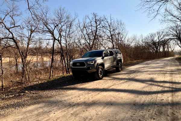
Scenic River Road
The Scenic River Road, County Road N. 2000 Road to N. 2050 Road, travels along the Kansas River Northwest of Lawrence, Kansas, heading west toward historic Lecompton, Kansas, the first state capital. The trail is hard-packed dirt and gravel suitable for any vehicle except in winter conditions with h...
Learn more about Scenic River Road
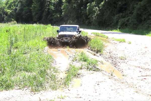
Kickapoo Trail
The Kickapoo Trail offers a relaxing and scenic off-road experience in northeast Kansas, perfect for riders looking to enjoy a leisurely ride through nature without too much difficulty. Located near Kickapoo in Brown County, this trail primarily follows a well-maintained gravel road, making it acces...
Learn more about Kickapoo Trail
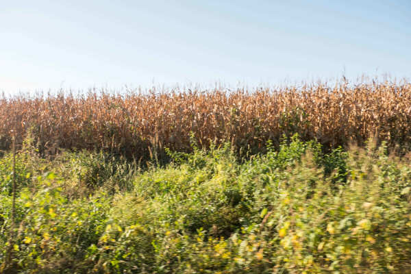
Brown State Fishing Lake Road
Easy gravel road around Brown State Fishing Lake with small spurs around the lake to camp and fish. Camping and fishing are free. A couple of pit toilets around the lake and campfire rings at campsites. The lake is surrounded by cornfields. The grade is gentle and can be driven in a 2-wheel drive ve...
Learn more about Brown State Fishing Lake Road
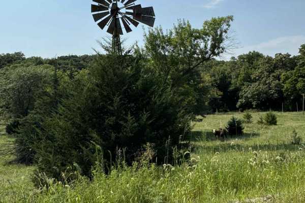
River Run Spur
River Run Spur is mostly gravel roads that are less maintained and that follows along the edge of Tuttle Creek Lake, This trail will take you through the beautiful flint hills area where you see plenty of wildlife and have access points to Tuttle creek lake. Enjoy exploring the area and take time to...
Learn more about River Run Spur
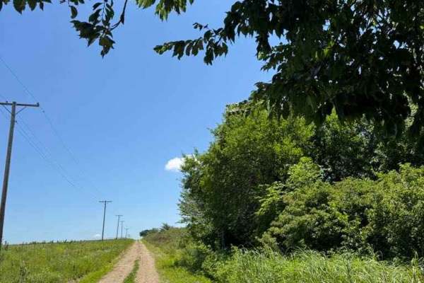
River Run
This trail follows the east bank of the Big Blue River along mostly gravel roads with easy access. It offers scenic views of the Flint Hills, abundant wildlife, and vibrant wildflowers. Several access points along the route provide opportunities to reach the river and Tuttle Creek Lake for hiking an...
Learn more about River Run
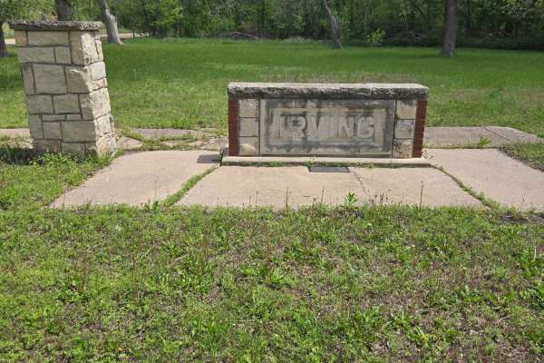
Big Blue River Route
This trail follows along the historic Big Blue River to where it will meet with Tuttle Creek Lake. Along this route, you will find old ghost towns of Irving and Cleburne, a natural spring (which, yes, is safe to drink from), great views, and, of course, some wildlife. There are plenty of stopping po...
Learn more about Big Blue River Route
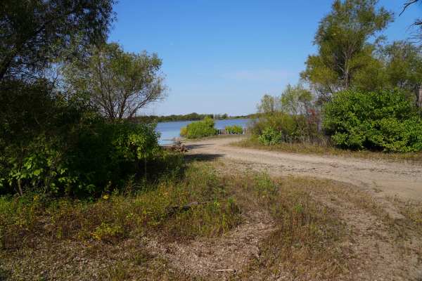
Lake Road West Fork
Lake Rd (west fork) is a graded rock road that forks off to the west for lake access. This was another a great spot for fishing or a picnic. There is a lot of native tallgrass prairie, and is on a flight path for migratory ducks and geese. There is no camping or fires allowed in this area, however t...
Learn more about Lake Road West Fork
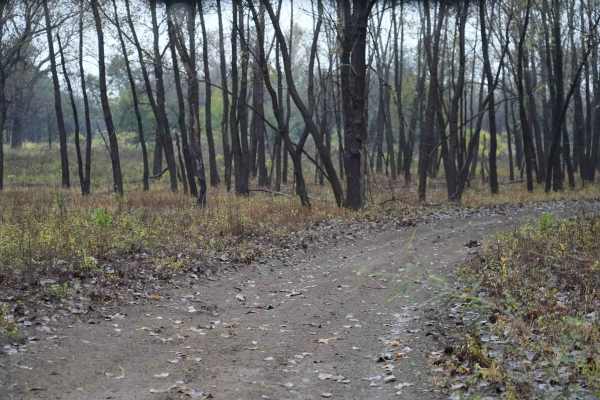
Otter Creek Inner Trail
The Inner trail connects with the main trail throughout the area. This trail is dirt with relatively shallow mud holes, rutted out tracks. This trail gets extremely muddy and slick with the rain. Most of the mud holes are near trees. Take caution with the ones that are not, as you may not have a way...
Learn more about Otter Creek Inner Trail
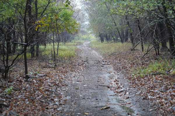
Otter Creek Main Trail
This 2 1/2 mile Trail takes you through the Otter Creek ORV area. The trail is mostly flat, with a few slight elevation changes, and some mud holes that can get deep; however, they are relatively easy to either split or go around entirely. Everything from a small ATV up should have no problem. If th...
Learn more about Otter Creek Main Trail
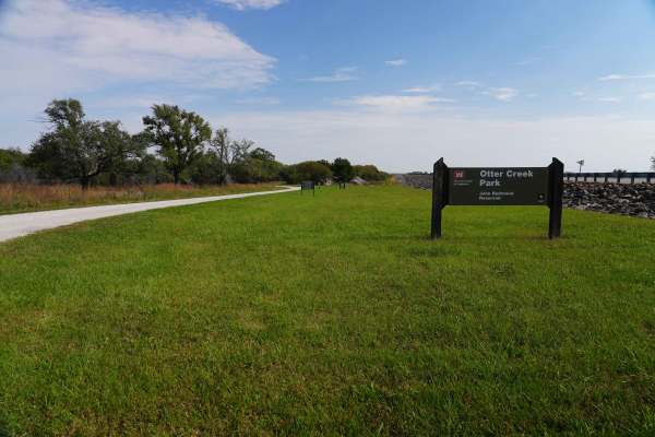
Lake Road
Lake Road is a graded rock road that is a quiet and peaceful drive to the lake at John Redmond Reservoir. This looked like a great spot for fishing or a picnic. There is no camping or fires allowed in this area; however, there is plenty of primitive or RV camping, with 110 hookups just on the other ...
Learn more about Lake Road
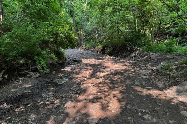
Yellow 130
This trail runs primarily through a rocky creek bed, making for a rough and technical ride nearly the entire way. You will have access to several other trails along the way. Some sections feature boulders reaching up to three feet in diameter and 18 inches tall, requiring careful line selection to a...
Learn more about Yellow 130
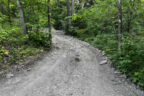
Yellow 148
This hill leads all the way to the top of the Punch Bowl, offering a great vantage point to watch your friends. The trail is steep and features some rocks to climb over, making it moderately challenging. When wet, it becomes much more difficult. There are no other major obstacles on this route.
Learn more about Yellow 148
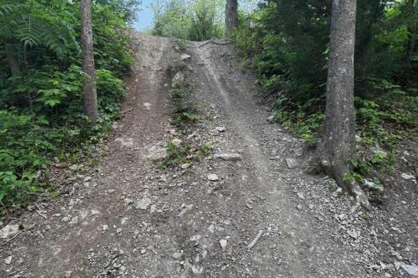
Yellow 157
This trail includes two distinct hill climbs. The first is short but features an aggressive break-over angle that can easily high-center longer wheelbase vehicles. At the crest, drivers must veer slightly right to avoid unintentionally dropping down an adjacent trail. The second hill is a long, stea...
Learn more about Yellow 157
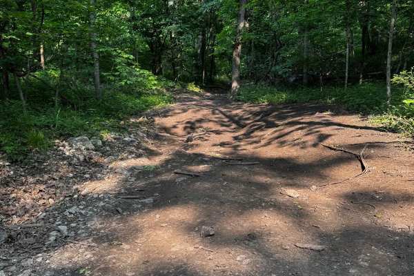
Green 133
Green 133 runs between Over The Hill 135 and Yellow 130, with access to Yellow 134. This trail features several muddy sections that can become very slick, especially during or after rain. There are also off-camber areas where a loss of traction could slide you toward nearby trees. Mud-terrain tires ...
Learn more about Green 133

1 Finger 129
This trail follows a creek bed, which makes for a consistently rocky path with occasional standing water. Some sections are off-camber, requiring careful tire placement to stay balanced. While there aren't any major rock ledges or large obstacles, changing water levels can affect traction and visibi...
Learn more about 1 Finger 129

Over The Hill 135
The side of Over The Hill 135 that connects to Yellow 130 offers two very steep lines to choose from at the bottom, both featuring rock ledges ranging from 1 to 4 feet tall with near-vertical grades. The base is dirt, which becomes slippery and muddy in wet conditions. The side of this trail that co...
Learn more about Over The Hill 135
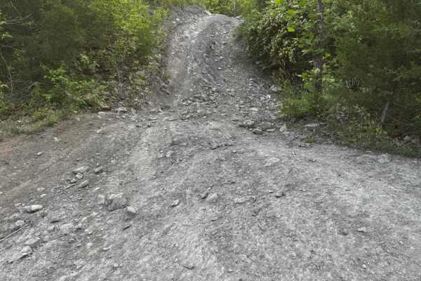
Yellow 155
This trail features a steep incline with loose rock, making traction challenging. It will lean your vehicle off camber, pushing it towards a tree stump on one side, requiring precise control to avoid contact. Near the top, drivers can choose to turn left, right, or continue straight, offering multip...
Learn more about Yellow 155
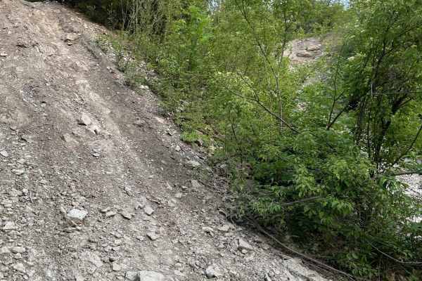
Yellow 158
This trail features a steep incline with a loose rock base that can make traction challenging, especially in wet conditions. One section includes a hill with a turn at the top, requiring precise control. On the dirt side of the Punchbowl, you'll encounter rock ledges up to 12 inches tall. Use cautio...
Learn more about Yellow 158

Green 139
Green 139 connects Hillside Drive 142 to Green 147 and leads into the punch bowl area. This trail includes a mud hole that typically has a solid bottom, so traction is manageable. A unique feature of the trail is a section with hills on both sides of your vehicle, requiring good suspension flex. Whi...
Learn more about Green 139
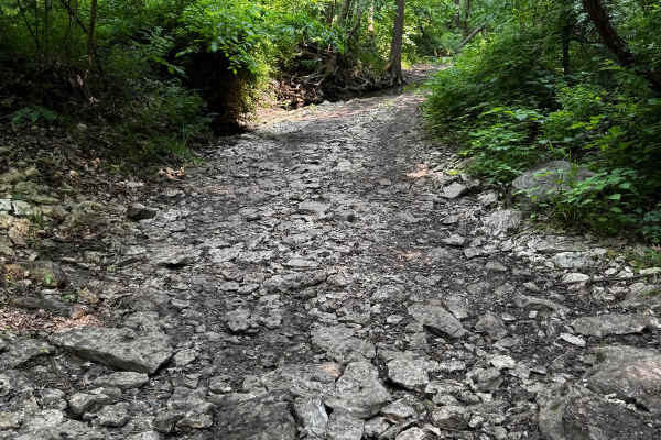
2 Finger 125
This trail runs through a creek bed, so the terrain is primarily rocky. There are several larger rocks to navigate, including one prominent rock about 2 feet tall that you can either drive over or carefully go around, if your vehicle is not too wide. Small fallen trees cross the trail as well. Be aw...
Learn more about 2 Finger 125
ATV trails near Ozawkie, Kansas
Explore ATV-friendly trails near you. These trails are accessible for vehicles up to 50 inches wide, perfect for ATVs and smaller off-road machines.
Scenic River Road
The Scenic River Road, County Road N. 2000 Road to N. 2050 Road, travels along the Kansas River Northwest of Lawrence, Kansas, heading west toward historic Lecompton, Kansas, the first state capital. The trail is hard-packed dirt and gravel suitable for any vehicle except in winter conditions with h...
Learn more about Scenic River Road
Kickapoo Trail
The Kickapoo Trail offers a relaxing and scenic off-road experience in northeast Kansas, perfect for riders looking to enjoy a leisurely ride through nature without too much difficulty. Located near Kickapoo in Brown County, this trail primarily follows a well-maintained gravel road, making it acces...
Learn more about Kickapoo Trail
Brown State Fishing Lake Road
Easy gravel road around Brown State Fishing Lake with small spurs around the lake to camp and fish. Camping and fishing are free. A couple of pit toilets around the lake and campfire rings at campsites. The lake is surrounded by cornfields. The grade is gentle and can be driven in a 2-wheel drive ve...
Learn more about Brown State Fishing Lake Road
River Run Spur
River Run Spur is mostly gravel roads that are less maintained and that follows along the edge of Tuttle Creek Lake, This trail will take you through the beautiful flint hills area where you see plenty of wildlife and have access points to Tuttle creek lake. Enjoy exploring the area and take time to...
Learn more about River Run Spur
UTV/side-by-side trails near Ozawkie, Kansas
Find UTV and side-by-side trails near you. These trails accommodate vehicles up to 60 inches wide, ideal for UTVs, side-by-sides, and wider off-road rigs.
Scenic River Road
The Scenic River Road, County Road N. 2000 Road to N. 2050 Road, travels along the Kansas River Northwest of Lawrence, Kansas, heading west toward historic Lecompton, Kansas, the first state capital. The trail is hard-packed dirt and gravel suitable for any vehicle except in winter conditions with h...
Learn more about Scenic River Road
Kickapoo Trail
The Kickapoo Trail offers a relaxing and scenic off-road experience in northeast Kansas, perfect for riders looking to enjoy a leisurely ride through nature without too much difficulty. Located near Kickapoo in Brown County, this trail primarily follows a well-maintained gravel road, making it acces...
Learn more about Kickapoo Trail
Brown State Fishing Lake Road
Easy gravel road around Brown State Fishing Lake with small spurs around the lake to camp and fish. Camping and fishing are free. A couple of pit toilets around the lake and campfire rings at campsites. The lake is surrounded by cornfields. The grade is gentle and can be driven in a 2-wheel drive ve...
Learn more about Brown State Fishing Lake Road
River Run Spur
River Run Spur is mostly gravel roads that are less maintained and that follows along the edge of Tuttle Creek Lake, This trail will take you through the beautiful flint hills area where you see plenty of wildlife and have access points to Tuttle creek lake. Enjoy exploring the area and take time to...
Learn more about River Run Spur
The onX Offroad Difference
onX Offroad combines trail photos, descriptions, difficulty ratings, width restrictions, seasonality, and more in a user-friendly interface. Available on all devices, with offline access and full compatibility with CarPlay and Android Auto. Discover what you're missing today!
Open Trail Map