Off-road trails in undefined

Dirt Bike TrailsUnited States of AmericaOne Loudoun, Virginia

Dirt Bike Trails
Near One Loudoun, Virginia

Explore All Dirt Bike Trails Near One Loudoun, Virginia

Trail Length
Technical Rating
Best Time of Year
Sort By

Dirt Bike Trails Near One Loudoun, Virginia

Discover the best dirt bike trails near you. Browse trail maps, check difficulty ratings, and find your next adventure — whether you're looking for a quick ride or an all-day expedition.
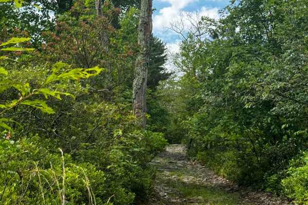
Learn more about Walters Gap
Walters Gap

Walters Gap

This is one of the 4 trails that is accessible by full-sized rigs within the Peters Mill OHV area. The trail is about a mile long and consists of a few hill climbs and a few very long rock gardens ranging in size from a few inches to no taller than a foot. One offshoot/optional obstacle does occur o...
Learn more about Walters Gap
Total Miles
0.9
Tech Rating
4Moderate
Best Time
Spring, Summer, Fall
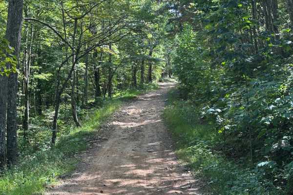
Learn more about Moss Road - T-318
Moss Road - T-318

Moss Road - T-318

Moss road or T-318 cuts through the southern Game lands. Reaching elevations of 1166 Ft traversing the forest and meadows. There is no public camping allowed on this route. Several parking locations are along the trail. If coming from the south look for a sharp turn heading up a gravel road.
Learn more about Moss Road - T-318
Total Miles
2.8
Tech Rating
1Easy
Best Time
Spring, Summer, Fall, Winter
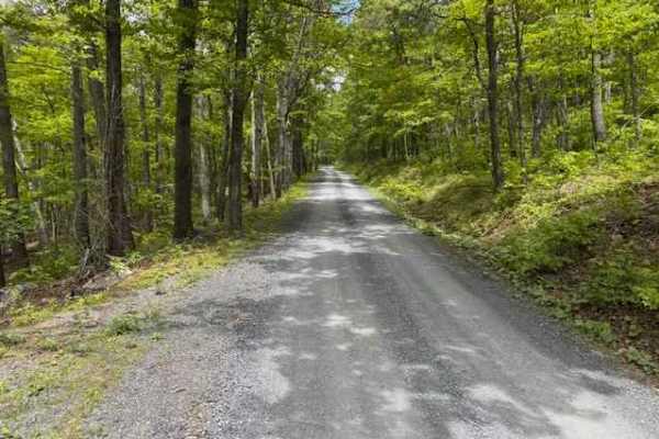
Learn more about Devils Hole Road
Devils Hole Road

Devils Hole Road

Devils Hole Road, or RT 691 Gravel Road, is an adventure weaving through the heart of the George Washington National Forest. Rocky in sections, with winding forest roads, leads to breathtaking mountain overlooks. Surrounded by towering hardwoods and remote wilderness, the trail delivers a perfect mi...
Learn more about Devils Hole Road
Total Miles
6.3
Tech Rating
1Easy
Best Time
Spring, Summer, Fall, Winter
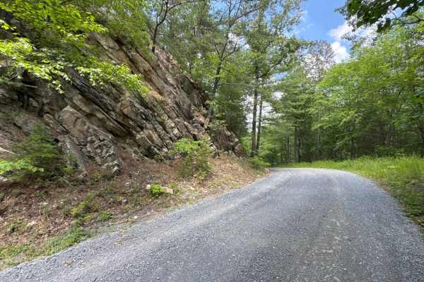
Learn more about Chrisman Hollow - FS 274
Chrisman Hollow - FS 274

Chrisman Hollow - FS 274

The Chrisman Hollow Trail, also known as FS 274, connects US 211 at the south end and State Road 674 at the north end of the trail. It takes you to several trailheads, including the Lion's Tale Trail, which offers an ADA-accessible, half-mile trail along the Passage Creek. There are several primitiv...
Learn more about Chrisman Hollow - FS 274

Total Miles
9.1
Tech Rating
2Easy
Best Time
Spring, Summer, Fall
Learn more about Browns Gap Turnpike
Browns Gap Turnpike

Browns Gap Turnpike

Browns Gap Turnpike, also known as Route 629, is a dead‑end route that terminates at Shenandoah National Park. The route begins as a maintained gravel driveway for roughly the first 10 percent of the trail, with difficulty increasing to about 2/10 due to washouts and channels approximately 6 inches ...
Learn more about Browns Gap Turnpike

Total Miles
2.2
Tech Rating
3Easy
Best Time
Spring, Summer, Winter, Fall
Learn more about FSR #85-2 Hall Spring Road
FSR #85-2 Hall Spring Road

FSR #85-2 Hall Spring Road

This route will take you along the side of the mountain with beautiful views of Appalachia. This trail feels like an East Coast shelf road since it is mainly single track with only a few places to pass oncoming vehicles. This road follows the WV-VA border and is only accessible 10/01-01/15.
Learn more about FSR #85-2 Hall Spring Road

Total Miles
9.2
Tech Rating
3Easy
Best Time
Winter, Fall
Learn more about 2101 Blue
2101 Blue

2101 Blue

Trail 2101 is a blue trail located within the Potomac River Riding Area of Wolf Den Run State Park. The Potomac River is the southernmost of the three riding areas at Wolf Den Run. Potomac River has a good mix of green and blue, and black trails. It also has a slag pile playground. There are also a ...
Learn more about 2101 Blue

Total Miles
1.4
Tech Rating
4Moderate
Best Time
Spring, Summer, Fall
Learn more about Parking Road
Parking Road

Parking Road

The Parking lot road is a green trail located within the Potomac River Riding Area of Wolf Den Run State Park. This is the main trail into the primary parking area for the Potomac River Riding Area. Potomac River is the southernmost of the three riding areas at Wolf Den Run. Potomac River has a goo...
Learn more about Parking Road

Total Miles
0.2
Tech Rating
1Easy
Best Time
Spring, Summer, Fall
Learn more about 2103 Blue
2103 Blue

2103 Blue

Trail 2103 is a blue trail located within the Potomac River Riding Area of Wolf Den Run State Park. The Potomac River is the southernmost of the three riding areas at Wolf Den Run. Potomac River has a good mix of green and blue, and black trails. It also has a slag pile playground. There are also a ...
Learn more about 2103 Blue

Total Miles
1.1
Tech Rating
5Moderate
Best Time
Spring, Summer, Fall
Learn more about 2101 Connector
2101 Connector

2101 Connector

Trail 2101 Connector is a blue trail located within the Potomac River Riding Area of Wolf Den Run State Park. The Potomac River is the southernmost of the three riding areas at Wolf Den Run. Potomac River has a good mix of green and blue, and black trails. It also has a slag pile playground. There a...
Learn more about 2101 Connector

Total Miles
0.1
Tech Rating
4Moderate
Best Time
Spring, Summer, Fall
Learn more about 2104 Green
2104 Green

2104 Green

Trail 2104 is a green trail located within the Potomac River Riding Area of Wolf Den Run State Park. The Potomac River is the southernmost of the three riding areas at Wolf Den Run. Potomac River has a good mix of green and blue, and black trails. It also has a slag pile playground. There are also a...
Learn more about 2104 Green

Total Miles
0.8
Tech Rating
3Easy
Best Time
Spring, Summer, Fall
Learn more about 2105 Blue
2105 Blue

2105 Blue

Trail 2105 is a blue trail located within the Potomac River Riding Area of Wolf Den Run State Park. The Potomac River is the southernmost of the three riding areas at Wolf Den Run. Potomac River has a good mix of green and blue, and black trails. It also has a slag pile playground. There are also a ...
Learn more about 2105 Blue

Total Miles
0.6
Tech Rating
5Moderate
Best Time
Spring, Summer, Fall
Learn more about 2305 Black
2305 Black

2305 Black

Trail 2305 is a black trail located within the Potomac River Riding Area of Wolf Den Run State Park. Trail 2305 has a very steep ledge at the eastern end that is caused by washouts and rutting on Trail 2301. Potomac River is the southernmost of the three riding areas at Wolf Den Run. Potomac River h...
Learn more about 2305 Black

Total Miles
0.2
Tech Rating
8Difficult
Best Time
Spring, Summer, Fall
Learn more about 2301 Black
2301 Black

2301 Black

Trail 2301 is a black trail located within the Potomac River Riding Area of Wolf Den Run State Park. Trail 2301 is a black loop trail that connects all the other black trails within this section of the Potomac River riding area. Potomac River is the southernmost of the three riding areas at Wolf Den...
Learn more about 2301 Black

Total Miles
1.6
Tech Rating
7Difficult
Best Time
Spring, Summer, Fall
Learn more about 2302 Black One Way
2302 Black One Way

2302 Black One Way

Trail 2302 is a black trail located within the Potomac River Riding Area of Wolf Den Run State Park. Trail 2302 is a one-way trail that must be ridden from south to north. Potomac River is the southernmost of the three riding areas at Wolf Den Run. Potomac River has a good mix of green and blue, and...
Learn more about 2302 Black One Way

Total Miles
0.1
Tech Rating
7Difficult
Best Time
Spring, Summer, Fall
Learn more about 2304 Black
2304 Black

2304 Black

Trail 2304 is a black trail located within the Potomac River Riding Area of Wolf Den Run State Park. Trail 2304 has very deep ruts and washouts at the eastern end, where it connects to trail 2301. Potomac River is the southernmost of the three riding areas at Wolf Den Run. Potomac River has a good m...
Learn more about 2304 Black

Total Miles
0.5
Tech Rating
8Difficult
Best Time
Spring, Summer, Fall
Learn more about Coal Haul Road
Coal Haul Road

Coal Haul Road

The Coal Haul Road is a green trail that connects the Potomac River and North Hill Riding Areas of Wolf Den Run State Park. Wolf Den Run State Park has a good mix of green and blue, and black trails. It also has a slag pile playground. There are also a few narrow-width trails specifically just for S...
Learn more about Coal Haul Road

Total Miles
1.8
Tech Rating
2Easy
Best Time
Spring, Summer, Fall
Learn more about 1101 Blue
1101 Blue

1101 Blue

Trail 1101 is a blue trail located within the North Hills Riding Area of Wolf Den Run State Park. North Hill is the northernmost of the three riding areas at Wolf Den Run. North Hill has a good mix of green and blue trails. It has one black trail as well. There are also a few narrow-width trails spe...
Learn more about 1101 Blue

Total Miles
1.2
Tech Rating
4Moderate
Best Time
Spring, Summer, Fall
Learn more about 2202 Green
2202 Green

2202 Green

Trail 2202 is a green trail located within the Potomac River Riding Area of Wolf Den Run State Park. The Potomac River is the southernmost of the three riding areas at Wolf Den Run. Potomac River has a good mix of green and blue, and black trails. It also has a slag pile playground. There are also a...
Learn more about 2202 Green

Total Miles
0.5
Tech Rating
3Easy
Best Time
Spring, Summer, Fall
Learn more about 1102 Blue
1102 Blue

1102 Blue

Trail 1102 is a blue trail located within the North Hills Riding Area of Wolf Den Run State Park. North Hill is the northernmost of the three riding areas at Wolf Den Run. North Hill has a good mix of green and blue trails. It has one black trail as well. There are also a few narrow-width trails spe...
Learn more about 1102 Blue

Total Miles
0.8
Tech Rating
4Moderate
Best Time
Spring, Summer, Fall

ATV trails near One Loudoun, Virginia

Explore ATV-friendly trails near you. These trails are accessible for vehicles up to 50 inches wide, perfect for ATVs and smaller off-road machines.

Learn more about Walters Gap
Walters Gap

Walters Gap

This is one of the 4 trails that is accessible by full-sized rigs within the Peters Mill OHV area. The trail is about a mile long and consists of a few hill climbs and a few very long rock gardens ranging in size from a few inches to no taller than a foot. One offshoot/optional obstacle does occur o...
Learn more about Walters Gap

Total Miles
0.9
Tech Rating
4Moderate
Best Time
Spring, Summer, Fall
Learn more about Moss Road - T-318
Moss Road - T-318

Moss Road - T-318

Moss road or T-318 cuts through the southern Game lands. Reaching elevations of 1166 Ft traversing the forest and meadows. There is no public camping allowed on this route. Several parking locations are along the trail. If coming from the south look for a sharp turn heading up a gravel road.
Learn more about Moss Road - T-318

Total Miles
2.8
Tech Rating
1Easy
Best Time
Spring, Summer, Fall, Winter
Learn more about Devils Hole Road
Devils Hole Road

Devils Hole Road

Devils Hole Road, or RT 691 Gravel Road, is an adventure weaving through the heart of the George Washington National Forest. Rocky in sections, with winding forest roads, leads to breathtaking mountain overlooks. Surrounded by towering hardwoods and remote wilderness, the trail delivers a perfect mi...
Learn more about Devils Hole Road

Total Miles
6.3
Tech Rating
1Easy
Best Time
Spring, Summer, Fall, Winter
Learn more about 2101 Blue
2101 Blue

2101 Blue

Trail 2101 is a blue trail located within the Potomac River Riding Area of Wolf Den Run State Park. The Potomac River is the southernmost of the three riding areas at Wolf Den Run. Potomac River has a good mix of green and blue, and black trails. It also has a slag pile playground. There are also a ...
Learn more about 2101 Blue

Total Miles
1.4
Tech Rating
4Moderate
Best Time
Spring, Summer, Fall

UTV/side-by-side trails near One Loudoun, Virginia

Find UTV and side-by-side trails near you. These trails accommodate vehicles up to 60 inches wide, ideal for UTVs, side-by-sides, and wider off-road rigs.

Learn more about Walters Gap
Walters Gap

Walters Gap

This is one of the 4 trails that is accessible by full-sized rigs within the Peters Mill OHV area. The trail is about a mile long and consists of a few hill climbs and a few very long rock gardens ranging in size from a few inches to no taller than a foot. One offshoot/optional obstacle does occur o...
Learn more about Walters Gap

Total Miles
0.9
Tech Rating
4Moderate
Best Time
Spring, Summer, Fall
Learn more about Moss Road - T-318
Moss Road - T-318

Moss Road - T-318

Moss road or T-318 cuts through the southern Game lands. Reaching elevations of 1166 Ft traversing the forest and meadows. There is no public camping allowed on this route. Several parking locations are along the trail. If coming from the south look for a sharp turn heading up a gravel road.
Learn more about Moss Road - T-318

Total Miles
2.8
Tech Rating
1Easy
Best Time
Spring, Summer, Fall, Winter
Learn more about Devils Hole Road
Devils Hole Road

Devils Hole Road

Devils Hole Road, or RT 691 Gravel Road, is an adventure weaving through the heart of the George Washington National Forest. Rocky in sections, with winding forest roads, leads to breathtaking mountain overlooks. Surrounded by towering hardwoods and remote wilderness, the trail delivers a perfect mi...
Learn more about Devils Hole Road

Total Miles
6.3
Tech Rating
1Easy
Best Time
Spring, Summer, Fall, Winter
Learn more about FSR #85-2 Hall Spring Road
FSR #85-2 Hall Spring Road

FSR #85-2 Hall Spring Road

This route will take you along the side of the mountain with beautiful views of Appalachia. This trail feels like an East Coast shelf road since it is mainly single track with only a few places to pass oncoming vehicles. This road follows the WV-VA border and is only accessible 10/01-01/15.
Learn more about FSR #85-2 Hall Spring Road

Total Miles
9.2
Tech Rating
3Easy
Best Time
Winter, Fall

The onX Offroad Difference

onX Offroad combines trail photos, descriptions, difficulty ratings, width restrictions, seasonality, and more in a user-friendly interface. Available on all devices, with offline access and full compatibility with CarPlay and Android Auto. Discover what you're missing today!

Open Trail Map