
Dirt Bike Trails
Near Monticello, Arkansas
Explore All Dirt Bike Trails Near Monticello, Arkansas
Dirt Bike Trails Near Monticello, Arkansas
Discover the best dirt bike trails near you. Browse trail maps, check difficulty ratings, and find your next adventure — whether you're looking for a quick ride or an all-day expedition.
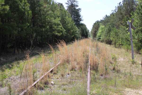
The Arkansas Overland Route - TrailHawk Loop - Section 15
Gravel and dirt roads that can be muddy and slick with possible ruts when wet. This is Section 15 of the Arkansas Overland Route. This section makes up the Hawks' beak when looking at this loop on the map. There are some nice straight sections on this trail. Watch for wildlife. This road goes to the...
Learn more about The Arkansas Overland Route - TrailHawk Loop - Section 15
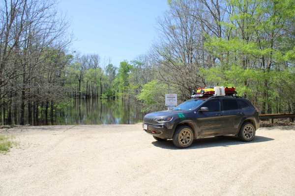
The Arkansas Overland Route - TrailHawk Loop - Section 16
Gravel and pavement roads that go to Eagle Landing Lake and boat ramp. Portions of roads can be muddy and slick when wet. These roads are well maintained but can be a bit rough in areas. There is dispersed camping and picnicking at the Eagle Landing Lake area.
Learn more about The Arkansas Overland Route - TrailHawk Loop - Section 16
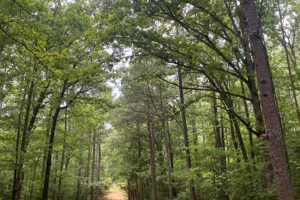
Potlach Road
This is a well-maintained dirt road with a few campsites along the way. This road leads through the Moro Big Pine WMA and there are several horseshoe lakes in the surrounding areas. It is very common to see wildlife such as hogs, turkeys, deer, and occasionally bears. This road can be very dusty dur...
Learn more about Potlach Road
Champagnolle Creek Loop
The Champagnolle Creek Loop is a well-maintained dirt road with some uneven and rutted sections. While the road is easily passable during normal weather, the high river level makes the road impassable at times. Along this route, expect mild traffic, especially during prime fishing and hunting season...
Learn more about Champagnolle Creek Loop
ATV trails near Monticello, Arkansas
Explore ATV-friendly trails near you. These trails are accessible for vehicles up to 50 inches wide, perfect for ATVs and smaller off-road machines.
Potlach Road
This is a well-maintained dirt road with a few campsites along the way. This road leads through the Moro Big Pine WMA and there are several horseshoe lakes in the surrounding areas. It is very common to see wildlife such as hogs, turkeys, deer, and occasionally bears. This road can be very dusty dur...
Learn more about Potlach Road
Champagnolle Creek Loop
The Champagnolle Creek Loop is a well-maintained dirt road with some uneven and rutted sections. While the road is easily passable during normal weather, the high river level makes the road impassable at times. Along this route, expect mild traffic, especially during prime fishing and hunting season...
Learn more about Champagnolle Creek Loop
UTV/side-by-side trails near Monticello, Arkansas
Find UTV and side-by-side trails near you. These trails accommodate vehicles up to 60 inches wide, ideal for UTVs, side-by-sides, and wider off-road rigs.
Potlach Road
This is a well-maintained dirt road with a few campsites along the way. This road leads through the Moro Big Pine WMA and there are several horseshoe lakes in the surrounding areas. It is very common to see wildlife such as hogs, turkeys, deer, and occasionally bears. This road can be very dusty dur...
Learn more about Potlach Road
Champagnolle Creek Loop
The Champagnolle Creek Loop is a well-maintained dirt road with some uneven and rutted sections. While the road is easily passable during normal weather, the high river level makes the road impassable at times. Along this route, expect mild traffic, especially during prime fishing and hunting season...
Learn more about Champagnolle Creek Loop
The onX Offroad Difference
onX Offroad combines trail photos, descriptions, difficulty ratings, width restrictions, seasonality, and more in a user-friendly interface. Available on all devices, with offline access and full compatibility with CarPlay and Android Auto. Discover what you're missing today!
Open Trail Map