
Dirt Bike Trails
Near Machias, Maine
Explore All Dirt Bike Trails Near Machias, Maine
Dirt Bike Trails Near Machias, Maine
Discover the best dirt bike trails near you. Browse trail maps, check difficulty ratings, and find your next adventure — whether you're looking for a quick ride or an all-day expedition.

West to Oxhead Connector
This trail is a connector between the West Lake Southern Tip and Oxhead Lakes Trail. The trail is primarily a dirt road, with some sections that are more water saturated and could be evaluated during the spring or other wet times of the year. The trail is less developed than some of the other larger...
Learn more about West to Oxhead Connector

Buffalo Stream East
This trail provides access to the eastern side of Buffalo Stream. The trail is primarily dirt/grass and is very narrow due to the soft white pine needles. Use caution as the narrowness of this trail may result in scratches on the vehicle. This trail dead ends at Buffalo Stream, where there used to b...
Learn more about Buffalo Stream East
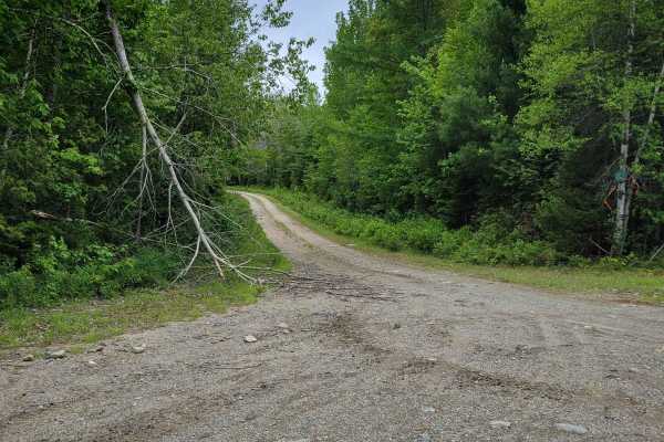
Brandy Pond West
This trail provides access to the western side of Brandy Pond. The trail is primarily dirt road, with some sections that are more water-saturated and could be evaluated during the spring or other wet times of the year. The trail is less developed than some of the other larger trails and is more acce...
Learn more about Brandy Pond West
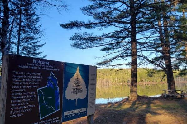
Oxhead Lakes Trail
This trail provides access to the Oxhead Ponds and a variety of other trails to be explored. The trail is dirt and wide enough for 2 vehicles to pass with ease. As a primary access road, it can be considered busy at times, but as a connector, it is a crucial part of other trails to be explored. Ther...
Learn more about Oxhead Lakes Trail
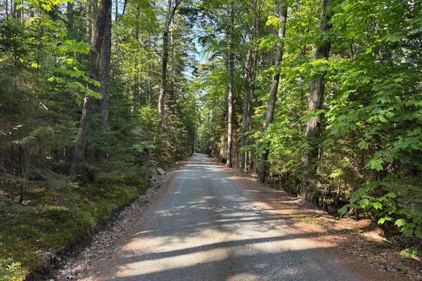
Western Mountain Road
The Western Mountain Road Trail is one of the few dirt roads in the Acadia National Park where you can escape the crowds. The trail starts at the Seal Cove Road and takes you to several trailheads and the Seal Cove Pond. The trail is a gravel forestry road with some soft sand spots that can turn int...
Learn more about Western Mountain Road
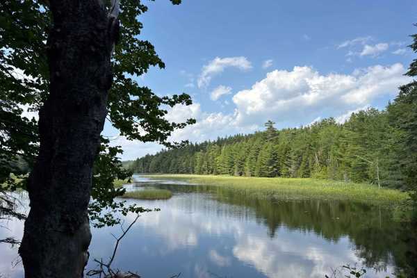
Long Pond Fire Road
The Long Pond Fire Road Trail is one of the few dirt roads in the Acadia National Park where you can escape the crowds. The trail starts at the Tremont Road and takes you to several trailheads, a beautiful swimming area at the Long Pond, Hodgdon Pond, and the Seal Cove Pond. The trail is a gravel fo...
Learn more about Long Pond Fire Road
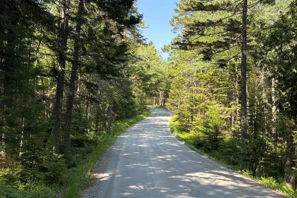
Seal Cove Road
Seal Cove Road is one of the few dirt roads in Acadia National Park where you can escape the crowds. The trail starts at Tremont Road at the West end, and Main Street at the east end of the trail. It takes you to several trailheads and allows you to access the Western Mountain Road and White Birches...
Learn more about Seal Cove Road
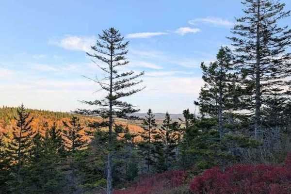
Turtle Mountain
This trail is a breeze for hikers and up to ATVs. For full-size rigs, this is the Rubicon trail in New Brunswick. The trail begins near Highway 7, just south of Welsford. You can enter on the hydro line or through the main gate. It's a well-kept gravel road for the first few kilometers past a couple...
Learn more about Turtle Mountain
ATV trails near Machias, Maine
Explore ATV-friendly trails near you. These trails are accessible for vehicles up to 50 inches wide, perfect for ATVs and smaller off-road machines.
West to Oxhead Connector
This trail is a connector between the West Lake Southern Tip and Oxhead Lakes Trail. The trail is primarily a dirt road, with some sections that are more water saturated and could be evaluated during the spring or other wet times of the year. The trail is less developed than some of the other larger...
Learn more about West to Oxhead Connector
Buffalo Stream East
This trail provides access to the eastern side of Buffalo Stream. The trail is primarily dirt/grass and is very narrow due to the soft white pine needles. Use caution as the narrowness of this trail may result in scratches on the vehicle. This trail dead ends at Buffalo Stream, where there used to b...
Learn more about Buffalo Stream East
Brandy Pond West
This trail provides access to the western side of Brandy Pond. The trail is primarily dirt road, with some sections that are more water-saturated and could be evaluated during the spring or other wet times of the year. The trail is less developed than some of the other larger trails and is more acce...
Learn more about Brandy Pond West
Oxhead Lakes Trail
This trail provides access to the Oxhead Ponds and a variety of other trails to be explored. The trail is dirt and wide enough for 2 vehicles to pass with ease. As a primary access road, it can be considered busy at times, but as a connector, it is a crucial part of other trails to be explored. Ther...
Learn more about Oxhead Lakes Trail
UTV/side-by-side trails near Machias, Maine
Find UTV and side-by-side trails near you. These trails accommodate vehicles up to 60 inches wide, ideal for UTVs, side-by-sides, and wider off-road rigs.
West to Oxhead Connector
This trail is a connector between the West Lake Southern Tip and Oxhead Lakes Trail. The trail is primarily a dirt road, with some sections that are more water saturated and could be evaluated during the spring or other wet times of the year. The trail is less developed than some of the other larger...
Learn more about West to Oxhead Connector
Buffalo Stream East
This trail provides access to the eastern side of Buffalo Stream. The trail is primarily dirt/grass and is very narrow due to the soft white pine needles. Use caution as the narrowness of this trail may result in scratches on the vehicle. This trail dead ends at Buffalo Stream, where there used to b...
Learn more about Buffalo Stream East
Brandy Pond West
This trail provides access to the western side of Brandy Pond. The trail is primarily dirt road, with some sections that are more water-saturated and could be evaluated during the spring or other wet times of the year. The trail is less developed than some of the other larger trails and is more acce...
Learn more about Brandy Pond West
Oxhead Lakes Trail
This trail provides access to the Oxhead Ponds and a variety of other trails to be explored. The trail is dirt and wide enough for 2 vehicles to pass with ease. As a primary access road, it can be considered busy at times, but as a connector, it is a crucial part of other trails to be explored. Ther...
Learn more about Oxhead Lakes Trail
The onX Offroad Difference
onX Offroad combines trail photos, descriptions, difficulty ratings, width restrictions, seasonality, and more in a user-friendly interface. Available on all devices, with offline access and full compatibility with CarPlay and Android Auto. Discover what you're missing today!
Open Trail Map