
Dirt Bike Trails
Near Lake Stickney, Washington
Explore All Dirt Bike Trails Near Lake Stickney, Washington
Dirt Bike Trails Near Lake Stickney, Washington
Discover the best dirt bike trails near you. Browse trail maps, check difficulty ratings, and find your next adventure — whether you're looking for a quick ride or an all-day expedition.
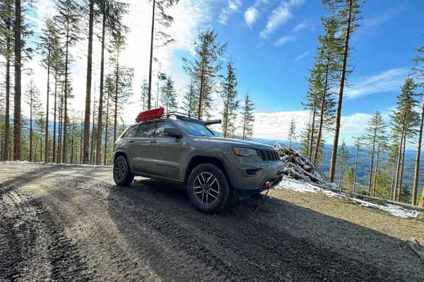
Green Mountain Road/NF-011
Green Mountain Road starts as a well-groomed dirt/ gravel track with a spectacular forest surround. This is a popular location for people to come shooting, with many small pullouts along the first half of the trail. Please be responsible and pick up your casings afterward! It climbs in elevation rat...
Learn more about Green Mountain Road/NF-011
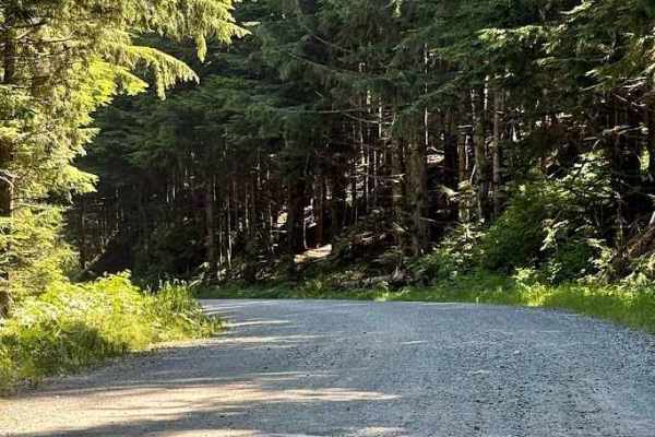
Mount Pilchuck - FS 4200
Forest Service Road 4200 to the Mount Pilchuck Trailhead is a scenic and enjoyable mountain drive in the Mount Baker-Snoqualmie National Forest. The road is primarily well-maintained gravel with some paved sections near the upper trailhead, making it accessible for most high-clearance vehicles and S...
Learn more about Mount Pilchuck - FS 4200

Bear Lake Trail
This is the 2nd more intense trail off Schweitzer Creek Road, the other is Boardman Lake Trail. This trail is a bit more technical than Boardman Lake and a bit longer in distance. Similarly, there are large loose rocks and deep ruts to navigate but offers much more stunning scenery including a bridg...
Learn more about Bear Lake Trail
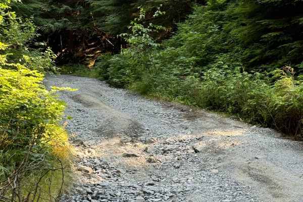
Boardman Lake Trail
Boardman Lake Trail starts out as a standard gravel FS road but is laden with relatively large potholes and the elevation climbs quickly. There are many turnouts for dispersed camping but none offer privacy. After about 2 miles, you will reach a "Y" in the road where you can go to the Boardman Lake ...
Learn more about Boardman Lake Trail

Overlook of Seattle Campsite
This trail is hardly a trail but more of some backwoods exploring through an old logging and quarry site. The best part of this loop is the campsite; it is well worth the short trek. Due note the trail is a skinny one-lane road up, so say goodbye to that scratch-less paint job you are rocking, and h...
Learn more about Overlook of Seattle Campsite
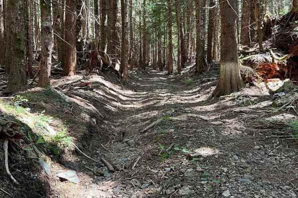
Walt Bailey
This is a great day trip or weekend getaway as there are multiple camp spots along this trail and even a small waterfall at the bridge crossing. The main trail is all gravel with some moderate elevation gain, but accessible by all vehicles; there are a few side trails that require high clearance veh...
Learn more about Walt Bailey
Mallardy Cr - NFSR 4030
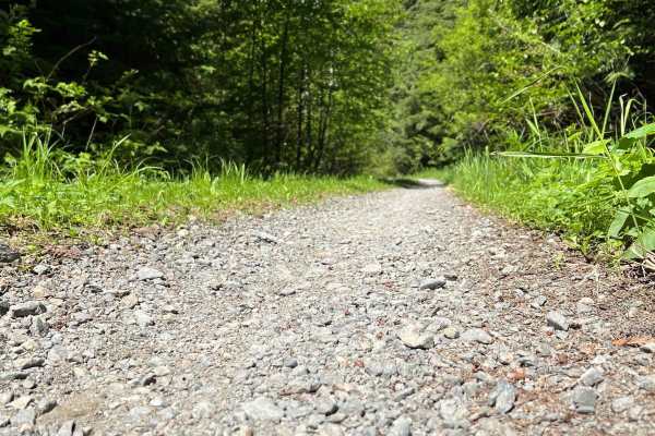
This is a perfect trail for beginners and low-clearance vehicles alike, or simply to escape the city. The terrain is all gravel with small potholes scattered throughout the trail. The roadway is one vehicle wide with moderate brush overgrowth, so be ready for some pinstripes. There is a camping spot...
Learn more about Mallardy Cr - NFSR 4030
BonJon Pass
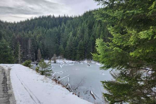
A smooth, well maintained grade skirting the edge of the Olympic Mountains, BonJon Pass climbs up from Lord's Lake to just below the peak of Mt. Zion, offering peek-a-boo views through the trees of distant peaks and steep valleys. Accessible to most vehicles in summer, winter offers a patchwork of m...
Learn more about BonJon Pass

NF 2581 - Puddlejumper
This is a fun, casual trail through serene forests. The route starts on well-graded forest roads off Snow Creek Road before quickly narrowing after leaving the main track. An out-and-back trail to a secluded alder grove, you'll encounter tight squeezes through underbrush and large flooded washouts, ...
Learn more about NF 2581 - Puddlejumper
Lake Cavanaugh Road
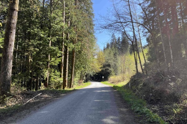
Lake Cavanaugh Road is a point-to-point wide gravel road that connects Lake Cavanaugh and SR530. This trail is well-maintained and open to all vehicle traffic, however, some larger vehicles will find some of the switchbacks on the southern side of the trail to be tight. There are several short steep...
Learn more about Lake Cavanaugh Road
I-5
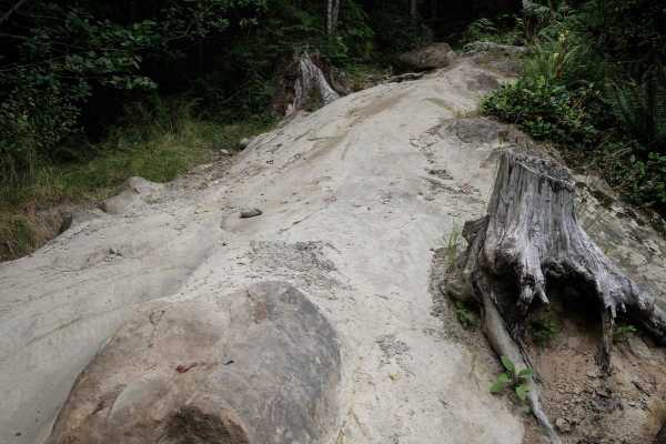
I-5 is a mile-long single track in the Walker Valley ORV Area, that is easy the whole way, with one additional rock slab obstacle that makes it slightly more difficult. The south end starts with lots of leafy ferns and bushes, in a thick jungle-like forest. It's very similar to many of the other tra...
Learn more about I-5
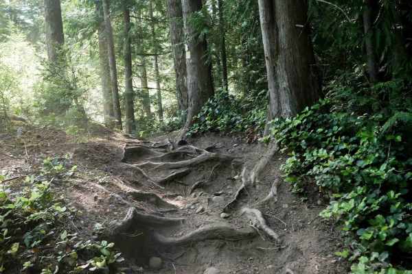
Beaver Pond
Beaver Pond Trail is a 2.5-mile dirt bike route that serves as an alternate path to Wildcat Trail, allowing dirt bikers to create a loop between the two. The trail alternates between narrow and wider sections as it winds through dense forest and a logged area with young tree growth. Terrain includes...
Learn more about Beaver Pond
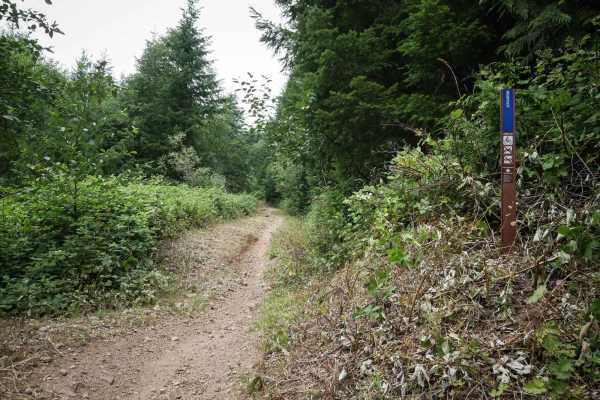
Webfoot
Webfoot is a short and easy single track through the southwest end of the Walker Valley ORV Area. It's .7 miles long, and very easy the whole way. It's accessed from the staging area through all easy trails as well, making it part of a great ride for beginner riders. If riding south to north, there'...
Learn more about Webfoot
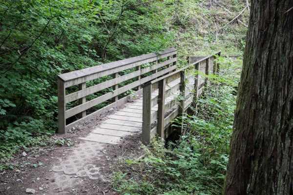
SMC
SMC is a 1.3-mile-long dirt bike trail through the Walker Valley ORV Area. It is an easy single track, with small features like roots, low embedded rocks, and somewhat steep sections, but is overall still very easy for the average rider. It's a mix of really wide sections traversing across hillsides...
Learn more about SMC
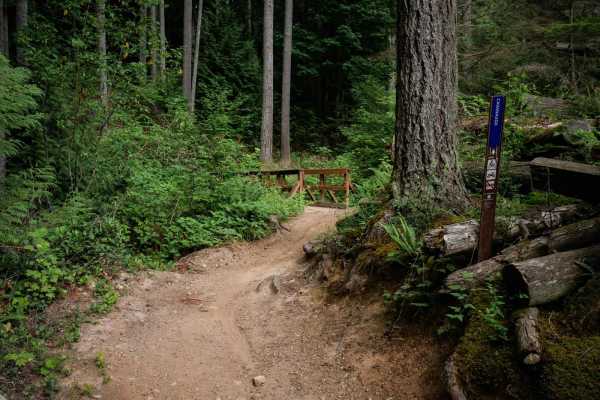
Cavanaugh
Cavanaugh is a 1.3-mile long ATV trail that has some fun features like harder rocky sections, and big mud puddles. It climbs up from the end of the Webfoot single track, up to a wooden bridge over a creek crossing. Throughout the trail there are several more wooden bridges, and many sections that ha...
Learn more about Cavanaugh
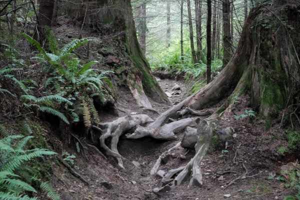
Curt's Conundrum
Curt's Conundrum is a short single track just over a mile long, in the Walker Valley ORV Area, that has a few trickier root obstacles. It starts out from the north end on a wide dirt single track underneath a forest of red cedars, with lots of roots in the trail. The trail is a bit blown out and pre...
Learn more about Curt's Conundrum
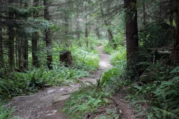
Doug's Loop
Doug's Loop is a short and easy ATV trail in the Walker Valley ORV Area. The north end starts out in a logging area with lots of fallen trees. Most of the trees that have fallen over the trail have been cut, except for a few that are elevated above the trail several feet high that you have to duck f...
Learn more about Doug's Loop
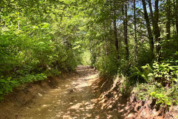
EZ Valley Connector
This is a curvy, eroded trail that is fairly easy to navigate. The trail is very muddy during the wetter times of the year and dusty during the dry months. There are a few rock obstacles, but the trail is full of rocky areas that can make it more difficult for smaller 4x4s and lower clearance vehicl...
Learn more about EZ Valley Connector
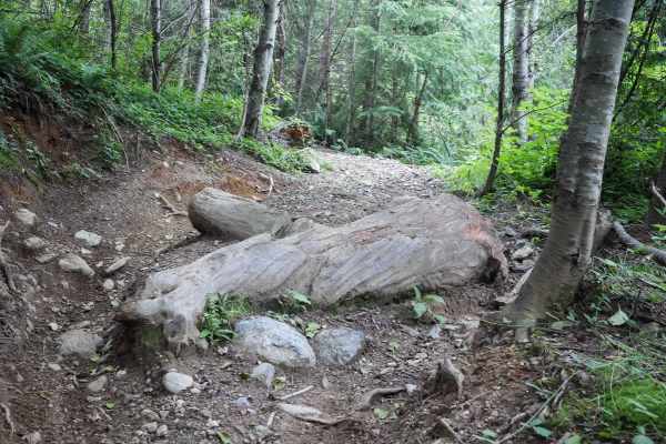
Ben's Revenge
Ben's Revenge is a short single track that makes a loop off of the Coyote ATV Trail. This one is moderate difficulty for the trail system. It is a bit narrow, starting from the south end with a rutted hill climb with lots of small rocks and roots. There are bigger embedded boulders in the trail, and...
Learn more about Ben's Revenge
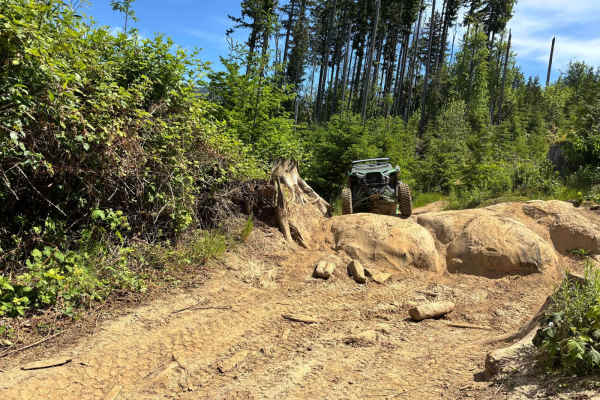
Timber Tamer
This trail tends to be muddy year-round. It travels through a low area of the system and is a very rocky and muddy mess, which makes it a lot of fun and challenging. This trail changes to some extent every time you ride it because the rock obstacles are almost all loose rock fields except the larger...
Learn more about Timber Tamer
ATV trails near Lake Stickney, Washington
Explore ATV-friendly trails near you. These trails are accessible for vehicles up to 50 inches wide, perfect for ATVs and smaller off-road machines.
Green Mountain Road/NF-011
Green Mountain Road starts as a well-groomed dirt/ gravel track with a spectacular forest surround. This is a popular location for people to come shooting, with many small pullouts along the first half of the trail. Please be responsible and pick up your casings afterward! It climbs in elevation rat...
Learn more about Green Mountain Road/NF-011
Mount Pilchuck - FS 4200
Forest Service Road 4200 to the Mount Pilchuck Trailhead is a scenic and enjoyable mountain drive in the Mount Baker-Snoqualmie National Forest. The road is primarily well-maintained gravel with some paved sections near the upper trailhead, making it accessible for most high-clearance vehicles and S...
Learn more about Mount Pilchuck - FS 4200
Bear Lake Trail
This is the 2nd more intense trail off Schweitzer Creek Road, the other is Boardman Lake Trail. This trail is a bit more technical than Boardman Lake and a bit longer in distance. Similarly, there are large loose rocks and deep ruts to navigate but offers much more stunning scenery including a bridg...
Learn more about Bear Lake Trail
Boardman Lake Trail
Boardman Lake Trail starts out as a standard gravel FS road but is laden with relatively large potholes and the elevation climbs quickly. There are many turnouts for dispersed camping but none offer privacy. After about 2 miles, you will reach a "Y" in the road where you can go to the Boardman Lake ...
Learn more about Boardman Lake Trail
UTV/side-by-side trails near Lake Stickney, Washington
Find UTV and side-by-side trails near you. These trails accommodate vehicles up to 60 inches wide, ideal for UTVs, side-by-sides, and wider off-road rigs.
Green Mountain Road/NF-011
Green Mountain Road starts as a well-groomed dirt/ gravel track with a spectacular forest surround. This is a popular location for people to come shooting, with many small pullouts along the first half of the trail. Please be responsible and pick up your casings afterward! It climbs in elevation rat...
Learn more about Green Mountain Road/NF-011
Mount Pilchuck - FS 4200
Forest Service Road 4200 to the Mount Pilchuck Trailhead is a scenic and enjoyable mountain drive in the Mount Baker-Snoqualmie National Forest. The road is primarily well-maintained gravel with some paved sections near the upper trailhead, making it accessible for most high-clearance vehicles and S...
Learn more about Mount Pilchuck - FS 4200
Bear Lake Trail
This is the 2nd more intense trail off Schweitzer Creek Road, the other is Boardman Lake Trail. This trail is a bit more technical than Boardman Lake and a bit longer in distance. Similarly, there are large loose rocks and deep ruts to navigate but offers much more stunning scenery including a bridg...
Learn more about Bear Lake Trail
Boardman Lake Trail
Boardman Lake Trail starts out as a standard gravel FS road but is laden with relatively large potholes and the elevation climbs quickly. There are many turnouts for dispersed camping but none offer privacy. After about 2 miles, you will reach a "Y" in the road where you can go to the Boardman Lake ...
Learn more about Boardman Lake Trail
The onX Offroad Difference
onX Offroad combines trail photos, descriptions, difficulty ratings, width restrictions, seasonality, and more in a user-friendly interface. Available on all devices, with offline access and full compatibility with CarPlay and Android Auto. Discover what you're missing today!
Open Trail Map