
Dirt Bike Trails
Near Jackson, Alabama
Explore All Dirt Bike Trails Near Jackson, Alabama
Dirt Bike Trails Near Jackson, Alabama
Discover the best dirt bike trails near you. Browse trail maps, check difficulty ratings, and find your next adventure — whether you're looking for a quick ride or an all-day expedition.
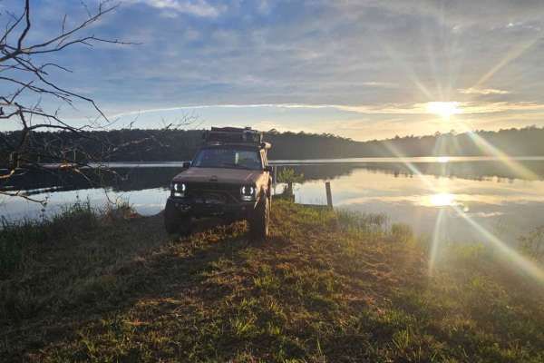
Peninsula Grove
Entering the trail will be a gate that should be unlocked depending on seasonal closures. Be sure to close the gate upon entering and leaving. The trail is mostly grassy with a few small ruts and a mixture of dirt and sand. Vehicles the size of a Jeep Cherokee or Toyota Rav 4 can fit down the trail ...
Learn more about Peninsula Grove
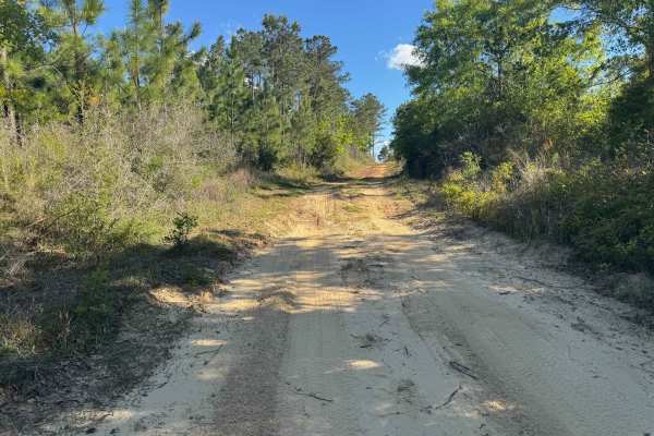
Duck Road Bypass
Bypass the Rocky Duck Road with an easy and scenic route through the coastal pine forests of South Alabama. Starts a little sandy, then moves to packed dirt. Most SUVs will have no issue on the trail. Has a nice overlook at the end. This trail will connect to Blue Lake Loop.
Learn more about Duck Road Bypass
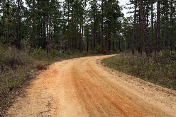
McDaniel Road
McDaniel Road connects Simmons Road at the north end and County Road 4 at the south end. It is a 2.5-mile-long road that takes you through the north-west part of the Blackwater River State Forest and gives you access to several trails and swimming spots along the Coldwater Creek District. The road c...
Learn more about McDaniel Road
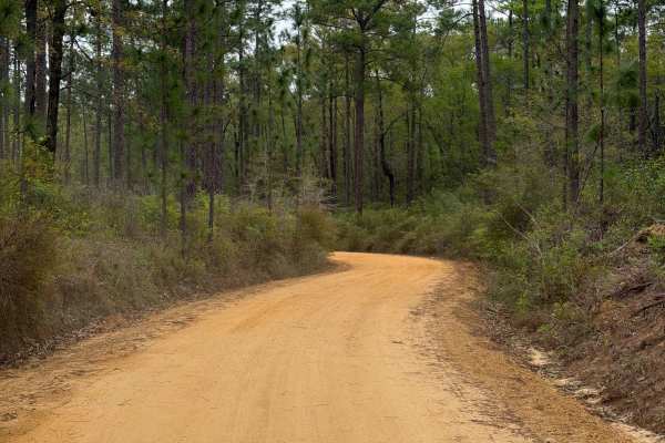
Simmons Road
Simmons Road connects Three Notch Trail at the east end and Mason West Road at the west end. It is a 6-mile-long road that takes you through the north-west part of the Blackwater River State Forest and gives you access to several trails along the Coldwater Creek District. The road conditions are a m...
Learn more about Simmons Road
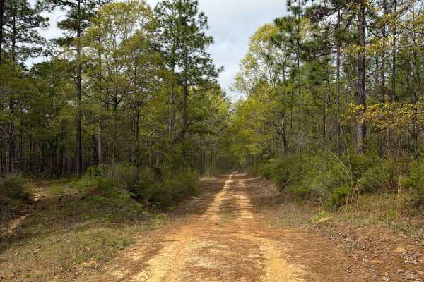
Jeff Capp Road - C133
Jeff Capp Road, also known as Forest Road C133 in the Blackwater River State Forest, connects Three Notch Trail at the west end and County Road 191 at the east end. It is a 2-mile-long road that takes you through the north-west part of the Blackwater River State Forest and gives you access to severa...
Learn more about Jeff Capp Road - C133
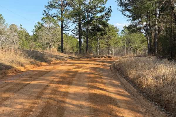
South Tank Trail - FS 35000
FS 35000 is a well-maintained 14-mile gravel road that runs east-west through the DeSoto National Forest. The road is well-traveled, with the western two-thirds running near/through the Mississippi National Guard's Camp Shelby Military Reservation. The eastern third offers a few easily accessible di...
Learn more about South Tank Trail - FS 35000
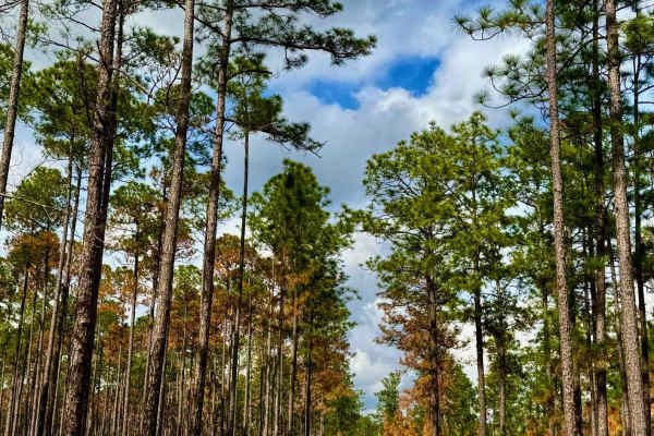
Alafora Road
This well-traveled, two-lane forest service road serves as the main thoroughfare through Conecuh National Forest. Cutting through towering pine stands and diverse woodland terrain, it provides a scenic and accessible route with five water crossings along the way. The road is generally well-maintaine...
Learn more about Alafora Road
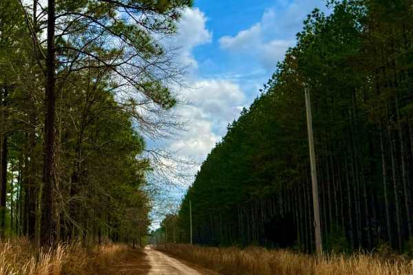
Run for the Border
This forest service road winds through the towering pines of Conecuh National Forest, offering a scenic and adventurous route to the Alabama-Florida border. Along the way, travelers will cross five water crossings, ranging from shallow creek fords to wider spans with scenic reflections of the forest...
Learn more about Run for the Border
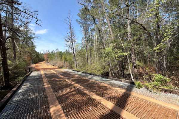
Overstreet Road
Overstreet Road connects County Road 191 at the west end and Belandville Road at the east end. It is a 2.5-mile trail that takes you through the northeast part of the Blackwater River State Forest and gives you access to several OHV and off-road trails. The road conditions are a mixture of packed sa...
Learn more about Overstreet Road
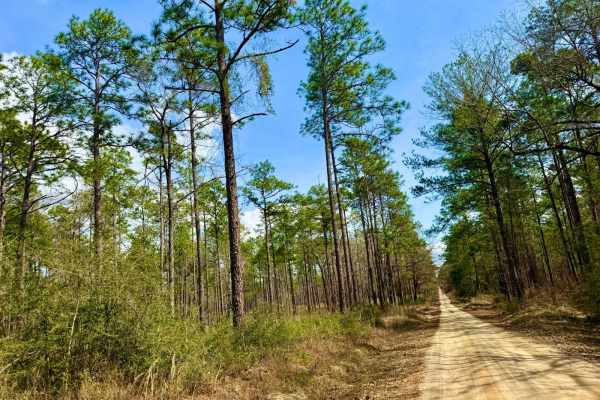
Grab mill Rd/ XC Rd FS 305
This main thoroughfare is the longest continual road in Conecuh National Forest, offering easy access to the rest of the forest. The route features scenic views of pine stands, occasional burned scars, and five water crossings. The road is generally well-maintained but can be slick and muddy in spot...
Learn more about Grab mill Rd/ XC Rd FS 305
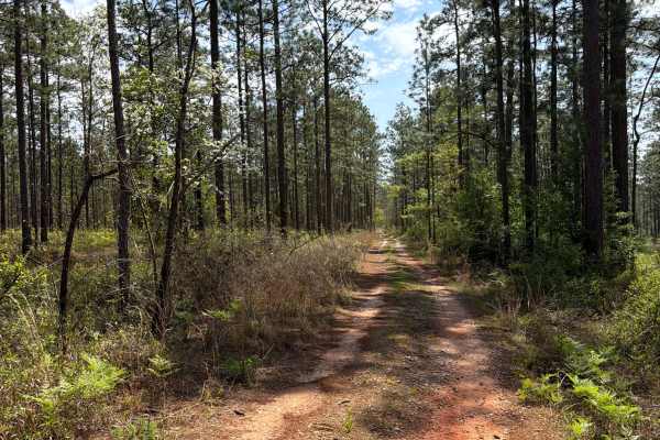
S 17
Forest Road S 17 connects County Road 191 at the west end and Belandville Road at the east end. It is a 3-mile trail that takes you through the northern part of the Blackwater River State Forest and gives you access to several OHV and off-road trails. The road conditions are a mixture of packed sand...
Learn more about S 17
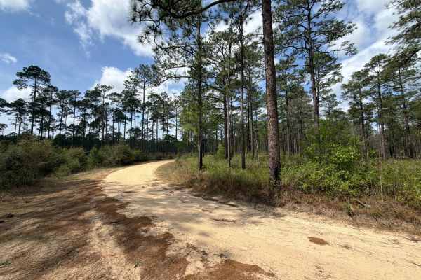
Bracken Road
Bracken Road connects Run for the Border at the west end and Beaver Creek Road at the east end. It is a 3-mile trail that takes you through the northeast part of the Blackwater River State Forest and gives you access to several OHV and off-road trails. The road conditions are a mixture of packed san...
Learn more about Bracken Road
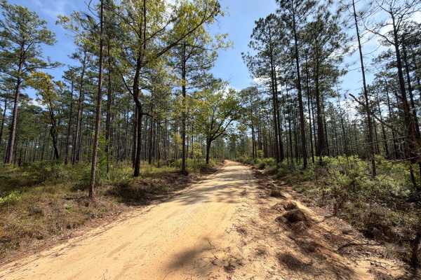
Carpenter Road
Carpenter Road connects County Road 191 at the west end and Belandville Road at the east end. It is a 2.5-mile trail that takes you through the northern part of the Blackwater River State Forest and gives you access to several OHV and off-road trails. The road conditions are a mixture of packed sand...
Learn more about Carpenter Road
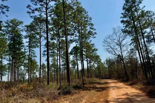
Blackwater Cut 2
This trail offers a great mix of terrain, making it an exciting and well-rounded route for any adventure. Expect a blend of sandy sections and gravel stretches, keeping the ride varied and interesting. Conditions shift between dry and wet areas, adding a dynamic element to the journey. The highlight...
Learn more about Blackwater Cut 2
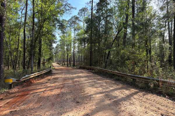
Three Notch Trail
The Three Notch Trail connects CR 191 at the north end and Buddy Hardy Road at the south end. It is a 14-mile-long road that takes you through the north-west part of the Blackwater River State Forest and gives you access to countless trails along the Coldwater Creek District and a natural spring. Th...
Learn more about Three Notch Trail
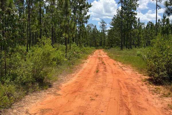
FS F10
Forest Road F10 connects FS F12 at the east end and CR-191 at the west end. The trail takes you through the southwest part of the Blackwater River State Forest and gives you access to several trails in the area. The road conditions are a mixture of packed sand, loose sand, some deep holes that can t...
Learn more about FS F10
FS F7
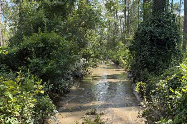
Forest Road F7 is a dead-end road that starts at CR 191. The trail takes you through the southwest part of the Blackwater River State Forest along Pittman Creek. It gives you access to several trails in the area, a primitive campsite, and a few hiking trails to the Blackwater River. The road conditi...
Learn more about FS F7
Coldwater Horse Trail
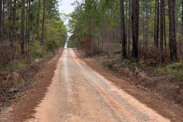
Coldwater Horse Trail connects Buddy Hardy Road at the west end and County Road 191 at the east end. It is a 4-mile-long road that takes you through the north-west part of the Blackwater River State Forest and gives you access to several trails along the Mason Branch District. The road conditions ar...
Learn more about Coldwater Horse Trail

Miller Creek Road - FS 311
This main thoroughfare through Conecuh National Forest is a typical forest service road, mostly smooth with a few slick and muddy spots after rain. It features five water crossings, passing through tall pine stands and offering scenic views along the way. The route is generally straightforward, maki...
Learn more about Miller Creek Road - FS 311
ATV trails near Jackson, Alabama
Explore ATV-friendly trails near you. These trails are accessible for vehicles up to 50 inches wide, perfect for ATVs and smaller off-road machines.
Peninsula Grove
Entering the trail will be a gate that should be unlocked depending on seasonal closures. Be sure to close the gate upon entering and leaving. The trail is mostly grassy with a few small ruts and a mixture of dirt and sand. Vehicles the size of a Jeep Cherokee or Toyota Rav 4 can fit down the trail ...
Learn more about Peninsula Grove
Duck Road Bypass
Bypass the Rocky Duck Road with an easy and scenic route through the coastal pine forests of South Alabama. Starts a little sandy, then moves to packed dirt. Most SUVs will have no issue on the trail. Has a nice overlook at the end. This trail will connect to Blue Lake Loop.
Learn more about Duck Road Bypass
McDaniel Road
McDaniel Road connects Simmons Road at the north end and County Road 4 at the south end. It is a 2.5-mile-long road that takes you through the north-west part of the Blackwater River State Forest and gives you access to several trails and swimming spots along the Coldwater Creek District. The road c...
Learn more about McDaniel Road
Simmons Road
Simmons Road connects Three Notch Trail at the east end and Mason West Road at the west end. It is a 6-mile-long road that takes you through the north-west part of the Blackwater River State Forest and gives you access to several trails along the Coldwater Creek District. The road conditions are a m...
Learn more about Simmons Road
UTV/side-by-side trails near Jackson, Alabama
Find UTV and side-by-side trails near you. These trails accommodate vehicles up to 60 inches wide, ideal for UTVs, side-by-sides, and wider off-road rigs.
Peninsula Grove
Entering the trail will be a gate that should be unlocked depending on seasonal closures. Be sure to close the gate upon entering and leaving. The trail is mostly grassy with a few small ruts and a mixture of dirt and sand. Vehicles the size of a Jeep Cherokee or Toyota Rav 4 can fit down the trail ...
Learn more about Peninsula Grove
Duck Road Bypass
Bypass the Rocky Duck Road with an easy and scenic route through the coastal pine forests of South Alabama. Starts a little sandy, then moves to packed dirt. Most SUVs will have no issue on the trail. Has a nice overlook at the end. This trail will connect to Blue Lake Loop.
Learn more about Duck Road Bypass
McDaniel Road
McDaniel Road connects Simmons Road at the north end and County Road 4 at the south end. It is a 2.5-mile-long road that takes you through the north-west part of the Blackwater River State Forest and gives you access to several trails and swimming spots along the Coldwater Creek District. The road c...
Learn more about McDaniel Road
Simmons Road
Simmons Road connects Three Notch Trail at the east end and Mason West Road at the west end. It is a 6-mile-long road that takes you through the north-west part of the Blackwater River State Forest and gives you access to several trails along the Coldwater Creek District. The road conditions are a m...
Learn more about Simmons Road
The onX Offroad Difference
onX Offroad combines trail photos, descriptions, difficulty ratings, width restrictions, seasonality, and more in a user-friendly interface. Available on all devices, with offline access and full compatibility with CarPlay and Android Auto. Discover what you're missing today!
Open Trail Map