
Off-road trails in undefined

Dirt Bike TrailsUnited States of AmericaHunter, Ohio

Dirt Bike Trails
Near Hunter, Ohio

Explore All Dirt Bike Trails Near Hunter, Ohio

Trail Length
Technical Rating
Best Time of Year
Sort By

Dirt Bike Trails Near Hunter, Ohio

Discover the best dirt bike trails near you. Browse trail maps, check difficulty ratings, and find your next adventure — whether you're looking for a quick ride or an all-day expedition.
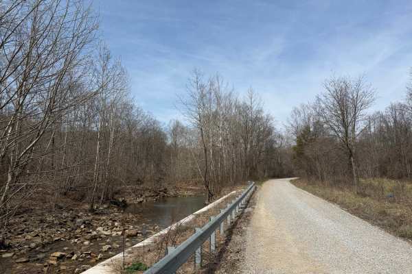
Learn more about Turkey Run Road
Turkey Run Road

Turkey Run Road

Turkey Run Road is a leisurely gravel road that provides beautiful views of Pee Pee Creek and the Hawe Fork of Pee Pee Creek. (Yes, that is the actual name of the creek.) The road turns and puts you into mature forest along Turkey Run. The road is generally single-lane wide. Excellent route for gett...
Learn more about Turkey Run Road
Total Miles
2.7
Tech Rating
1Easy
Best Time
Spring, Summer, Fall, Winter
Learn more about Morrell Hollow
Morrell Hollow

Morrell Hollow

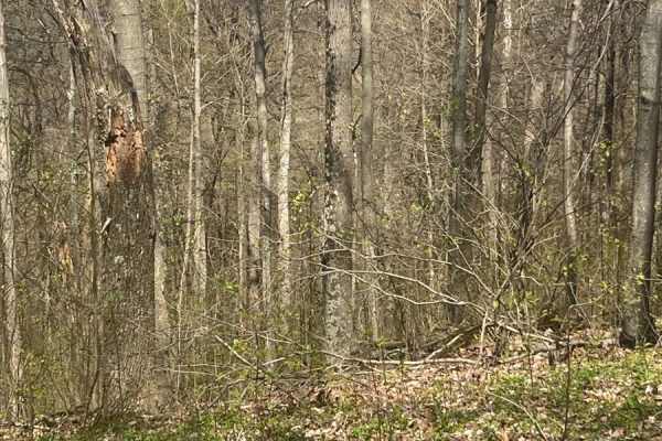
A mixture of mud and off-camber areas with some steep rocky climbs, this trail will test the typical factory-built rig. It starts near an old hunting cabin and continues into the forest past an old cemetery. It is a great trail, however, about halfway down, it is blocked due to tornado damage. There...
Learn more about Morrell Hollow
Total Miles
0.7
Tech Rating
3Easy
Best Time
Spring, Summer, Fall
Learn more about Potter's Hollow
Potter's Hollow

Potter's Hollow

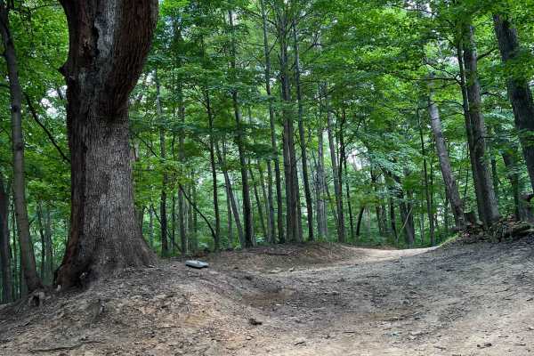
First and foremost, I recommend downloading offline maps prior to any excursion however especially for this area. There is no cell service for about 5 miles out in any direction near this assortment of trails. Overall its a fairly easy trail, some narrow parts that will give you some pin-striping an...
Learn more about Potter's Hollow
Total Miles
1.9
Tech Rating
6Moderate
Best Time
Summer
Learn more about Tobe Lewis Road
Tobe Lewis Road

Tobe Lewis Road

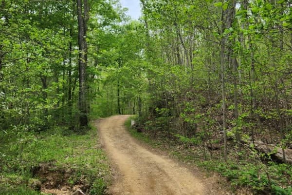
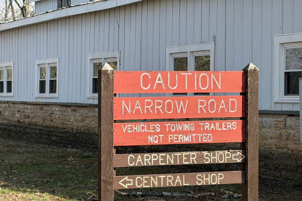
This is an offroad paradise for people who want to enjoy nature but don't have built rigs. The trail will give you off-camber ruts through mudholes as well as rocky hill climbs with great views of the outskirts of the Shawnee State Forest. Do not attempt this in a 2WD vehicle or a truck that does no...
Learn more about Tobe Lewis Road
Total Miles
1.1
Tech Rating
4Moderate
Best Time
Spring, Summer, Fall
Learn more about North Ridge Road
North Ridge Road

North Ridge Road

Scioto Trail State Park North Ridge Road is a single-lane gravel road that takes the high north ridge through the park. There are several sidings and pull-offs to let other traffic by. This road offers incredible views of the southern Ohio hills. There are several turnouts that offer a nice place to...
Learn more about North Ridge Road

Total Miles
5.1
Tech Rating
2Easy
Best Time
Spring, Summer, Fall, Winter
Learn more about Sunshine Ridge Road
Sunshine Ridge Road

Sunshine Ridge Road

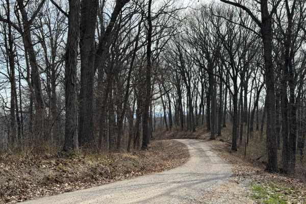
The trail starts easy, however, once you cross over Blue Creek Road, the trail climbs up a hill and can be slick during and or after some rain. Once on the top, it levels out for a bit until you come to some mud holes. These are about 2 feet deep but have solid bottoms. Continue on the trail until y...
Learn more about Sunshine Ridge Road
Total Miles
3.7
Tech Rating
2Easy
Best Time
Spring, Summer, Fall
Learn more about ODNR #4
ODNR #4

ODNR #4

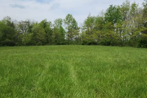
ODNR #4 Road is a high ridge road that goes through the southernmost portion of Scioto Trail State Forest. The road provides exceptional views of the surrounding hills. There are some road is gravel and generally single lane width. There are a few blind switchbacks, and the road can be muddy and sli...
Learn more about ODNR #4
Total Miles
2.6
Tech Rating
2Easy
Best Time
Spring, Summer, Fall, Winter
Learn more about Mouth Hollow Road
Mouth Hollow Road

Mouth Hollow Road

This is an easy scenic trail that passes through a meadow on the outskirts of the Shawnee State Forest. This trail is easily passable by any high-clearance vehicle; there are few ruts/obstacles to get through or around. It is just a mellow, slow-paced trail to enjoy nature.
Learn more about Mouth Hollow Road

Total Miles
1.1
Tech Rating
1Easy
Best Time
Spring, Summer, Fall
Learn more about South Ridge Road
South Ridge Road

South Ridge Road

In Scioto Trail State Park, South Ridge Road snakes its way along the high south ridge of the park. The road is gravel and generally single-lane. There are multiple sidings and turnouts to let vehicles pass or just stop and enjoy the scenery. The road is not maintained in the winter months. The road...
Learn more about South Ridge Road

Total Miles
5.8
Tech Rating
1Easy
Best Time
Spring, Summer, Fall, Winter
Learn more about Park Road 39
Park Road 39

Park Road 39

This route is for anyone that wants to rip a rally-like road, and experience the great scenery and wildlife Ohio can offer! This gravel route is very loose and has a few washouts. It also has two hairpin turns that may require some two-point turns for big or full-sized rigs. This trail is accessible...
Learn more about Park Road 39

Total Miles
4.8
Tech Rating
2Easy
Best Time
Spring, Summer, Fall
Learn more about Trail 85
Trail 85

Trail 85

This is a rocky and technical Trail. The lower entrance is Close to Briery Creek. The Top entrance is connected to Green Trail 5. Trail 85 offers a challenge without a lot of risk, Slick Rocks and washouts are the obstacles you will encounter along the way. Only one steep hill climb out of the valle...
Learn more about Trail 85

Total Miles
1.2
Tech Rating
8Difficult
Best Time
Spring, Summer, Fall
Learn more about Trail 88
Trail 88

Trail 88

Trail 88 offers a slight challenge with a couple of tight turns and steep climbs. The lower entrance to Trail 88 begins close the Briery Creek. At this entrance, you find a large open area which in previous years was a hunting campsite. Do not enter any structures on site.
Learn more about Trail 88

Total Miles
1.3
Tech Rating
7Difficult
Best Time
Spring, Summer, Fall
Learn more about Trail 1 - Tower Ride
Trail 1 - Tower Ride

Trail 1 - Tower Ride

Trail 1 will start at the Straight Fork Parking area and ends in "Deep Hole Hollow." This Trail is well maintained and once on the ridge top, it is smooth and easy riding. Be sure to make the hard right at the 201 Trail intersection if you wish to continue on Trail 1. The Trail offers towering views...
Learn more about Trail 1 - Tower Ride

Total Miles
4.1
Tech Rating
2Easy
Best Time
Spring, Summer, Fall, Winter
Learn more about Trail 201 - Straight Fork Long Loop
Trail 201 - Straight Fork Long Loop

Trail 201 - Straight Fork Long Loop

The trail starts near 1806 Adventures Parking Area off Straight Fork Road. The trail begins with a short but fairly steep climb to the ridge line. The trail surface consists of mainly hard pack with some loose rock, great views of the surrounding land from the top of the RidgesEnds with the Connecti...
Learn more about Trail 201 - Straight Fork Long Loop

Total Miles
3.9
Tech Rating
5Moderate
Best Time
Summer, Fall, Spring
Learn more about Trail 34
Trail 34

Trail 34

Trail 34 is otherwise known as Old Tar Fork Road. This was a log truck route at one time. This route will take you to the hill named "Larry's Lip" which will connect you back to the Briery Creek Road Area. Close to Trail 88 and the Briery Creek Mudholes.
Learn more about Trail 34

Total Miles
1.4
Tech Rating
4Moderate
Best Time
Spring, Summer, Fall
Learn more about Trail 27
Trail 27

Trail 27

This Route is the "wetter" alternative ride to and from the abandoned tower. You will find that most of this trail consists of low-lying ground. The trail consists of solid ground for the most part and a few slightly technical sections. This is the cool (Temperature) ride during the hotter summer mo...
Learn more about Trail 27

Total Miles
2.4
Tech Rating
6Moderate
Best Time
Spring, Summer, Fall
Learn more about Trail 2 - High Ground
Trail 2 - High Ground

Trail 2 - High Ground

Start or end at the Abandon Communication Tower. The trail follows ridge tops the entire trail. There are tight sections, but they are passable in full-size vehicles. The trail stays dry 90% of the year and is suitable for all ages. The trail has some spur ridge lines off it for future trail expansi...
Learn more about Trail 2 - High Ground

Total Miles
1.9
Tech Rating
2Easy
Best Time
Winter, Fall, Summer, Spring
Learn more about Trail 202
Trail 202

Trail 202

Trail 202 is a spur off of Trail 201. The trail follows a ridge line and then gradually drops to a bottom. Traveling the bottom you may encounter a few wetter spots during the spring and winter months. A short climb out of the bottom brings you to an intersecting trail that continues straight throug...
Learn more about Trail 202

Total Miles
1.5
Tech Rating
4Moderate
Best Time
Fall, Summer, Spring
Learn more about Lyra Trail
Lyra Trail

Lyra Trail

Lyra Trail is a solid pick for ATV and dirtbike riders looking for a moderate challenge deep in the Ironton Ranger District of Wayne National Forest. Twisting through southeastern Ohio’s wooded hills, this narrow forest route delivers a mix of rutted dirt, rocky patches, and the occasional muddy was...
Learn more about Lyra Trail

Total Miles
4.2
Tech Rating
4Moderate
Best Time
Spring, Summer, Fall
Learn more about Telegraph Trail
Telegraph Trail

Telegraph Trail

Telegraph Trail (FS 15) is a solid choice for ATV and dirtbike riders looking for a moderately challenging OHV trail in southeastern Ohio. Winding through the Ironton Ranger District of Wayne National Forest, this route delivers classic Appalachian terrain with just enough technical features to keep...
Learn more about Telegraph Trail

Total Miles
2.8
Tech Rating
6Moderate
Best Time
Spring, Summer, Fall

ATV trails near Hunter, Ohio

Explore ATV-friendly trails near you. These trails are accessible for vehicles up to 50 inches wide, perfect for ATVs and smaller off-road machines.

Learn more about Morrell Hollow
Morrell Hollow

Morrell Hollow

A mixture of mud and off-camber areas with some steep rocky climbs, this trail will test the typical factory-built rig. It starts near an old hunting cabin and continues into the forest past an old cemetery. It is a great trail, however, about halfway down, it is blocked due to tornado damage. There...
Learn more about Morrell Hollow

Total Miles
0.7
Tech Rating
3Easy
Best Time
Spring, Summer, Fall
Learn more about Potter's Hollow
Potter's Hollow

Potter's Hollow

First and foremost, I recommend downloading offline maps prior to any excursion however especially for this area. There is no cell service for about 5 miles out in any direction near this assortment of trails. Overall its a fairly easy trail, some narrow parts that will give you some pin-striping an...
Learn more about Potter's Hollow

Total Miles
1.9
Tech Rating
6Moderate
Best Time
Summer
Learn more about Tobe Lewis Road
Tobe Lewis Road

Tobe Lewis Road

This is an offroad paradise for people who want to enjoy nature but don't have built rigs. The trail will give you off-camber ruts through mudholes as well as rocky hill climbs with great views of the outskirts of the Shawnee State Forest. Do not attempt this in a 2WD vehicle or a truck that does no...
Learn more about Tobe Lewis Road

Total Miles
1.1
Tech Rating
4Moderate
Best Time
Spring, Summer, Fall
Learn more about Sunshine Ridge Road
Sunshine Ridge Road

Sunshine Ridge Road

The trail starts easy, however, once you cross over Blue Creek Road, the trail climbs up a hill and can be slick during and or after some rain. Once on the top, it levels out for a bit until you come to some mud holes. These are about 2 feet deep but have solid bottoms. Continue on the trail until y...
Learn more about Sunshine Ridge Road

Total Miles
3.7
Tech Rating
2Easy
Best Time
Spring, Summer, Fall

UTV/side-by-side trails near Hunter, Ohio

Find UTV and side-by-side trails near you. These trails accommodate vehicles up to 60 inches wide, ideal for UTVs, side-by-sides, and wider off-road rigs.

Learn more about Morrell Hollow
Morrell Hollow

Morrell Hollow

A mixture of mud and off-camber areas with some steep rocky climbs, this trail will test the typical factory-built rig. It starts near an old hunting cabin and continues into the forest past an old cemetery. It is a great trail, however, about halfway down, it is blocked due to tornado damage. There...
Learn more about Morrell Hollow

Total Miles
0.7
Tech Rating
3Easy
Best Time
Spring, Summer, Fall
Learn more about Potter's Hollow
Potter's Hollow

Potter's Hollow

First and foremost, I recommend downloading offline maps prior to any excursion however especially for this area. There is no cell service for about 5 miles out in any direction near this assortment of trails. Overall its a fairly easy trail, some narrow parts that will give you some pin-striping an...
Learn more about Potter's Hollow

Total Miles
1.9
Tech Rating
6Moderate
Best Time
Summer
Learn more about Tobe Lewis Road
Tobe Lewis Road

Tobe Lewis Road

This is an offroad paradise for people who want to enjoy nature but don't have built rigs. The trail will give you off-camber ruts through mudholes as well as rocky hill climbs with great views of the outskirts of the Shawnee State Forest. Do not attempt this in a 2WD vehicle or a truck that does no...
Learn more about Tobe Lewis Road

Total Miles
1.1
Tech Rating
4Moderate
Best Time
Spring, Summer, Fall
Learn more about Sunshine Ridge Road
Sunshine Ridge Road

Sunshine Ridge Road

The trail starts easy, however, once you cross over Blue Creek Road, the trail climbs up a hill and can be slick during and or after some rain. Once on the top, it levels out for a bit until you come to some mud holes. These are about 2 feet deep but have solid bottoms. Continue on the trail until y...
Learn more about Sunshine Ridge Road

Total Miles
3.7
Tech Rating
2Easy
Best Time
Spring, Summer, Fall

The onX Offroad Difference

onX Offroad combines trail photos, descriptions, difficulty ratings, width restrictions, seasonality, and more in a user-friendly interface. Available on all devices, with offline access and full compatibility with CarPlay and Android Auto. Discover what you're missing today!

Open Trail Map