
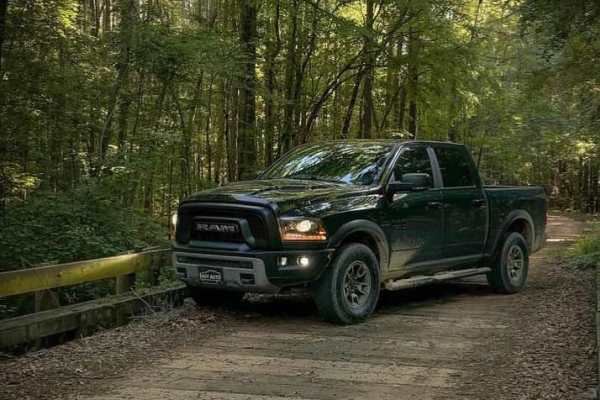
Dirt Bike Trails
Near Hosston, Louisiana
Explore All Dirt Bike Trails Near Hosston, Louisiana
Dirt Bike Trails Near Hosston, Louisiana
Discover the best dirt bike trails near you. Browse trail maps, check difficulty ratings, and find your next adventure — whether you're looking for a quick ride or an all-day expedition.
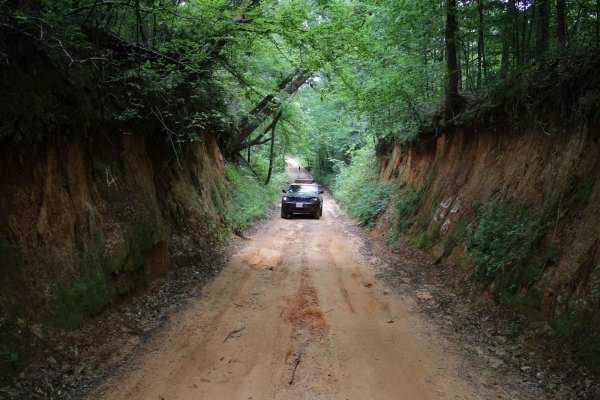
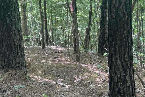
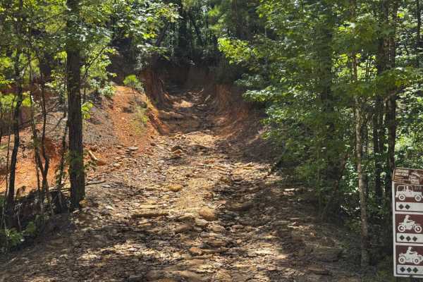
Old Stagecoach Road
Old Stagecoach road is made up of a mix of rock, sand, and dirt. When wet you get a red clay that can be slick as ice. There are some rocks in the road about 8 inches in diameter. Some narrow washouts across the road are 8-plus inches deep. Logging trucks have been traveling sections of the road an...
Learn more about Old Stagecoach Road
Butler Circle
This is a basic fire road within Kisatchie National Forest. It involves rolling hills through the Louisiana landscape. Hidden around the area are lookout towers for fire detection, a relic from past land management in the area. This area of the Kisatchie has a number of private in-holdings as well a...
Learn more about Butler Circle
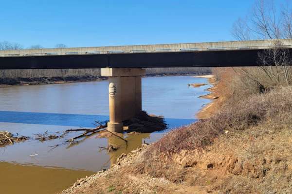
Low Water Bridge on Lake Wright Patman
This route starts off of Hwy 67 just west of Texarkana and goes to the low water bridge that crosses part of Wright Patman Lake. There are plenty of areas to fish. Bring a kayak because there is water access on each side of the bridge and plenty of parking. The low water bridge does close when heav...
Learn more about Low Water Bridge on Lake Wright Patman
Trail to the Sulphur River
This gravel road starts at the Highway 67 and Highway 8 intersection. It is just past the Highway 8 turn if you're coming from Maud, Texas. You will cross the railroad tracks and follow the maintained gravel road to the Sulphur River. There is a boat launch (dirt ramp) at the end of this road. Along...
Learn more about Trail to the Sulphur River
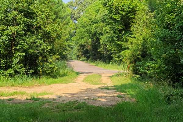
Follow the Red River
This 30-mile route follows along the Northside of the Red River. This East to West route is almost completely gravel roads. The roads are maintained but can be nasty after or during rains. Although you may not see a lot of the river, you will see lots of pasture land with livestock, creeks with brid...
Learn more about Follow the Red River
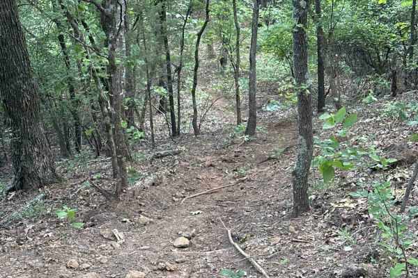
A-Line
This singletrack runs through a classic East Texas forest with a mix of dirt, roots, and scattered rock. Compared to easier nearby routes, riders will find more technical obstacles, including tight root sections and a few challenging hill climbs that require momentum and line choice. Elevation chang...
Learn more about A-Line
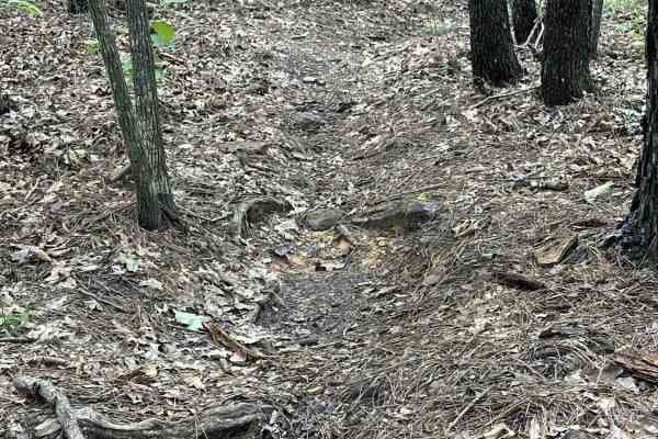
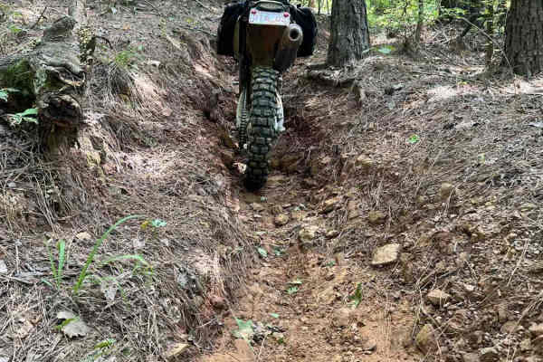
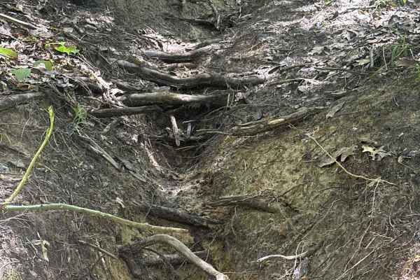
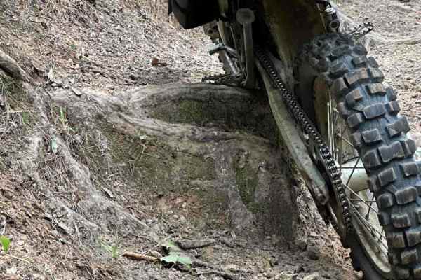
Deep Rut
There is a short section including an alternate line up a steep, off-camber, rutted hill with exposed roots.
Learn more about Deep Rut

Rocket
A quick trip up the hill and back down. Steep, rutted, and loose.
Learn more about Rocket

Jungle Trail
This singletrack runs through a classic East Texas forest with a mix of dirt, roots, and scattered rock. Compared to easier nearby routes, riders will find more technical obstacles, including tight root sections and a few challenging hill climbs that require momentum and line choice. Elevation chang...
Learn more about Jungle Trail
Race Track
This fun, fast loop includes two foot drops to get those wheels off the ground and some challenging elevation change.
Learn more about Race Track
Too Cool
This singletrack runs through a classic East Texas forest with a mix of dirt, roots, and scattered rock. Compared to easier nearby routes, riders will find more technical obstacles, including tight root sections and a few challenging hill climbs that require momentum and line choice. Elevation chang...
Learn more about Too Cool
Cool Whip
This singletrack runs through a classic East Texas forest with a mix of dirt, roots, and scattered rock. Compared to easier nearby routes, riders will find more technical obstacles, including tight root sections and a few challenging hill climbs that require momentum and line choice. Elevation chang...
Learn more about Cool Whip
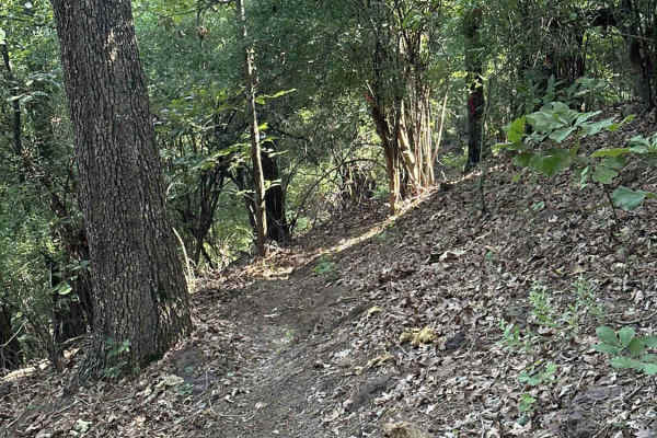
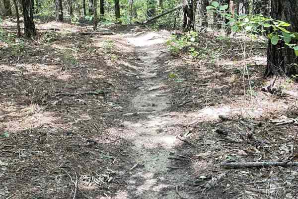
Creek Trail
This singletrack runs alongside the creek and through a dense forest of pines and hardwoods on a primarily dirt surface. Riders will encounter frequent exposed roots and occasional patches of rock that add technical character without raising the difficulty too high. The trail features rolling elevat...
Learn more about Creek Trail
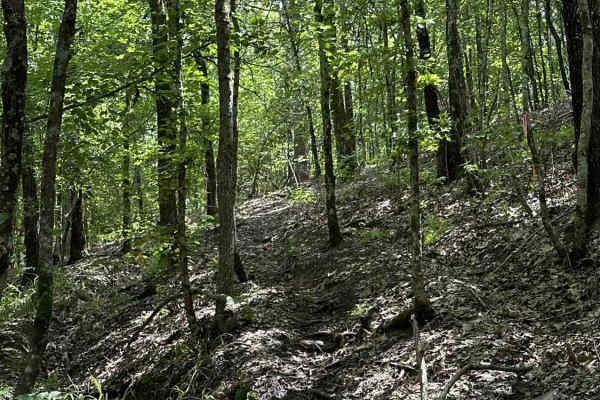
The Drop
This singletrack winds through the East Texas woods with a dirt surface mixed with roots and scattered rock. While the forest setting is similar to other nearby routes, this trail stands out for its steep grades and demanding climbs. Riders should expect sharp elevation changes, including extended ...
Learn more about The Drop
Soli Hull Street
Soli Hull Street ** Park Rating: 3/5 ** Technical Rating: 7/10 ** Vehicle Recommendations ** Lift with 37" tires minimum, lockers (rear at minimum), aggressive tires highly recommended, spotter helpful especially for tight entry, and skid plates and armor suggested due to risk of undercarriage damag...
Learn more about Soli Hull Street
Hippie Hollow
This short alternate line offers an off-camber path through hardwoods and pines to keep your heart pumping and mix up the variety.
Learn more about Hippie Hollow
Karma
This singletrack runs through a classic forest with a mix of dirt, roots, and scattered rock. Compared to easier nearby routes, riders will find more technical obstacles, including tight root sections and a few challenging hill climbs that require momentum and line choice. Elevation changes are more...
Learn more about Karma
Sawmill Loop
This singletrack cuts through a dense forest of pines and hardwoods on a primarily dirt surface. Riders will encounter frequent exposed roots and occasional patches of rock that add technical character without raising the difficulty too high. The trail features rolling elevation with a few short cli...
Learn more about Sawmill Loop
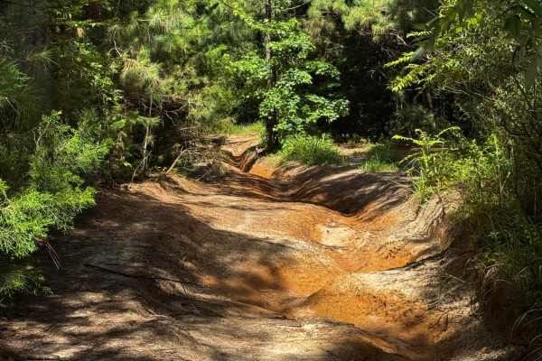
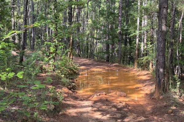
Pipeline Road
Pipeline Road ** Park Rating: 2/5 ** Technical Rating: 7/10 ** Detailed Notes ** One-directional trail with flexi washouts and loose dirt. Scenic creek crossings and hill climbs, including a technical final climb rated at 7/10. Beginners can exit early before the hardest section. The final climb has...
Learn more about Pipeline Road
Louisiana Backroads (AKA Angry Jeep)
Louisiana Backroads (AKA Angry Jeep) ** Park Rating: 2/5 ** Technical Rating: 5/10 ** Detailed Notes ** Mostly easy trail with a rocky, off-camber section on the far west side that is tight and lined with roots and rocks. Final ledge obstacle without a bypass. The rest of the trail is beginner-frien...
Learn more about Louisiana Backroads (AKA Angry Jeep)
ATV trails near Hosston, Louisiana
Explore ATV-friendly trails near you. These trails are accessible for vehicles up to 50 inches wide, perfect for ATVs and smaller off-road machines.
Butler Circle
This is a basic fire road within Kisatchie National Forest. It involves rolling hills through the Louisiana landscape. Hidden around the area are lookout towers for fire detection, a relic from past land management in the area. This area of the Kisatchie has a number of private in-holdings as well a...
Learn more about Butler Circle
Soli Hull Street
Soli Hull Street ** Park Rating: 3/5 ** Technical Rating: 7/10 ** Vehicle Recommendations ** Lift with 37" tires minimum, lockers (rear at minimum), aggressive tires highly recommended, spotter helpful especially for tight entry, and skid plates and armor suggested due to risk of undercarriage damag...
Learn more about Soli Hull Street
Pipeline Road
Pipeline Road ** Park Rating: 2/5 ** Technical Rating: 7/10 ** Detailed Notes ** One-directional trail with flexi washouts and loose dirt. Scenic creek crossings and hill climbs, including a technical final climb rated at 7/10. Beginners can exit early before the hardest section. The final climb has...
Learn more about Pipeline Road
Louisiana Backroads (AKA Angry Jeep)
Louisiana Backroads (AKA Angry Jeep) ** Park Rating: 2/5 ** Technical Rating: 5/10 ** Detailed Notes ** Mostly easy trail with a rocky, off-camber section on the far west side that is tight and lined with roots and rocks. Final ledge obstacle without a bypass. The rest of the trail is beginner-frien...
Learn more about Louisiana Backroads (AKA Angry Jeep)
UTV/side-by-side trails near Hosston, Louisiana
Find UTV and side-by-side trails near you. These trails accommodate vehicles up to 60 inches wide, ideal for UTVs, side-by-sides, and wider off-road rigs.
Butler Circle
This is a basic fire road within Kisatchie National Forest. It involves rolling hills through the Louisiana landscape. Hidden around the area are lookout towers for fire detection, a relic from past land management in the area. This area of the Kisatchie has a number of private in-holdings as well a...
Learn more about Butler Circle
Soli Hull Street
Soli Hull Street ** Park Rating: 3/5 ** Technical Rating: 7/10 ** Vehicle Recommendations ** Lift with 37" tires minimum, lockers (rear at minimum), aggressive tires highly recommended, spotter helpful especially for tight entry, and skid plates and armor suggested due to risk of undercarriage damag...
Learn more about Soli Hull Street
Pipeline Road
Pipeline Road ** Park Rating: 2/5 ** Technical Rating: 7/10 ** Detailed Notes ** One-directional trail with flexi washouts and loose dirt. Scenic creek crossings and hill climbs, including a technical final climb rated at 7/10. Beginners can exit early before the hardest section. The final climb has...
Learn more about Pipeline Road
Louisiana Backroads (AKA Angry Jeep)
Louisiana Backroads (AKA Angry Jeep) ** Park Rating: 2/5 ** Technical Rating: 5/10 ** Detailed Notes ** Mostly easy trail with a rocky, off-camber section on the far west side that is tight and lined with roots and rocks. Final ledge obstacle without a bypass. The rest of the trail is beginner-frien...
Learn more about Louisiana Backroads (AKA Angry Jeep)
The onX Offroad Difference
onX Offroad combines trail photos, descriptions, difficulty ratings, width restrictions, seasonality, and more in a user-friendly interface. Available on all devices, with offline access and full compatibility with CarPlay and Android Auto. Discover what you're missing today!
Open Trail Map