
Dirt Bike Trails
Near Halfway, Oregon
Explore All Dirt Bike Trails Near Halfway, Oregon
Dirt Bike Trails Near Halfway, Oregon
Discover the best dirt bike trails near you. Browse trail maps, check difficulty ratings, and find your next adventure — whether you're looking for a quick ride or an all-day expedition.
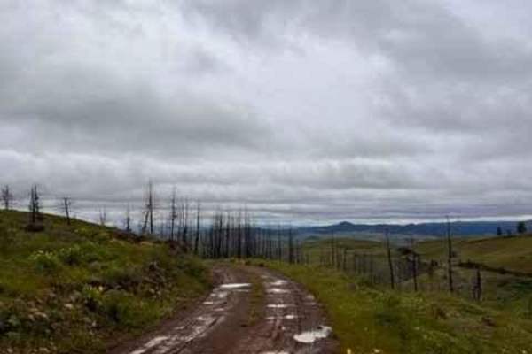
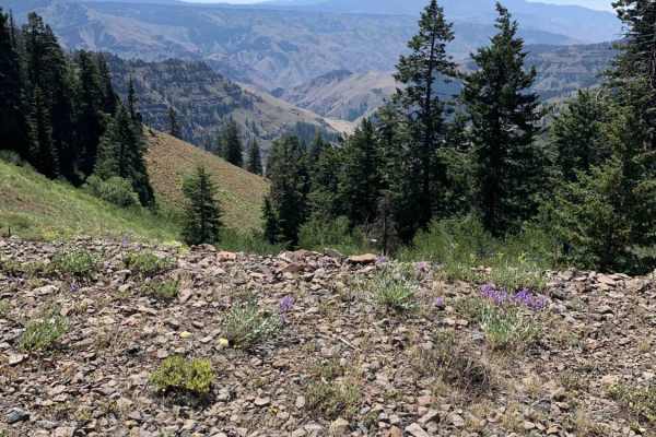
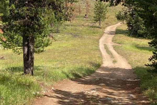
Eagle Creek Vista
The majority of this trail climbs up a gravel road from Highway 86. There is only a small section when turning off of Eagle Creek Road where the road gets rougher and would most likely not be suitable for lower passenger vehicles. Once you're around the bend at the top, you a welcomed by amazing 360...
Learn more about Eagle Creek Vista
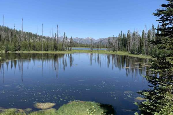
Fish Lake - Twin Lakes
This route takes you to a couple of beautiful small lakes while providing incredible views of the Whitman National Forest. Overall the route is very easy and straight forward, but there is a section that can be a little tight to navigate in larger vehicles. If the brush is too tight or the road is b...
Learn more about Fish Lake - Twin Lakes
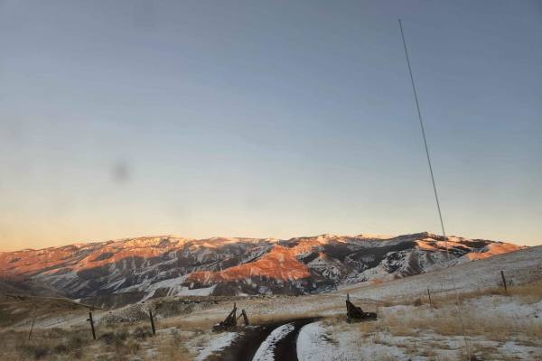
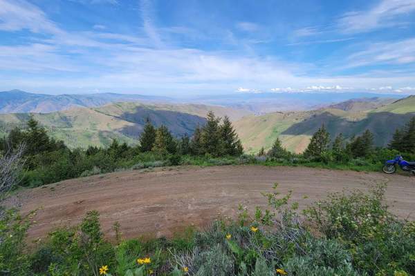
Oregan Eagle Mountain View
Have a good set of mud tires during the cold and wet seasons on this trail. 4x4 is recommended. You will find awesome views of the Eagle Cap Mountains Public Access Road with a little climb to the best view. This is a great place to take the family and watch the sunset or sunrise. There is lots of l...
Learn more about Oregan Eagle Mountain View
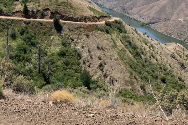
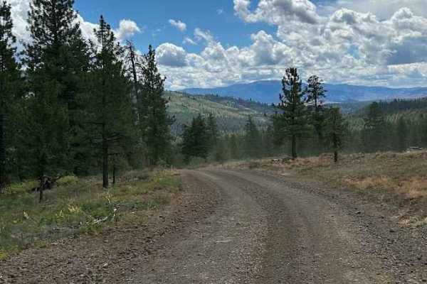
Kleinschmidt Grade - NFD 105
Starting from Hells Canyon/Snake River, this route will take you up a winding single-lane track with great views and significant exposures. As you get higher, the terrain and flora will transform from rock to grass and brush-covered to forested. People do live along this remote route so please ravel...
Learn more about Kleinschmidt Grade - NFD 105
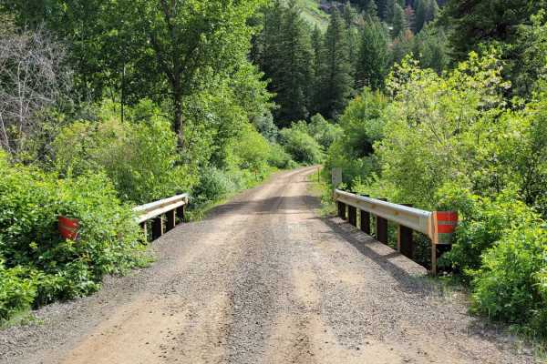
Hells Canyon Overlook - Dirt Road Approach
The Hells Canyon overlook has both a paved and un paved approach. Both are very scenic, but we highly recommend the dirt route as it offers a number of camp sites and incredible views. Signs displayed at both ends of the trail warn that the road is rough and not recommended for passenger vehicles.
Learn more about Hells Canyon Overlook - Dirt Road Approach
FR 306 - Iron Mountain Trail
This trail briefly parallels FR 025 before climbing up onto the mountain ridgeline. There are a handful of short steep climbs to navigate. The trail is narrow and full-size vehicles would undoubtedly brush vegetation. Erosion damage is present throughout, with an active section happening at the time...
Learn more about FR 306 - Iron Mountain Trail
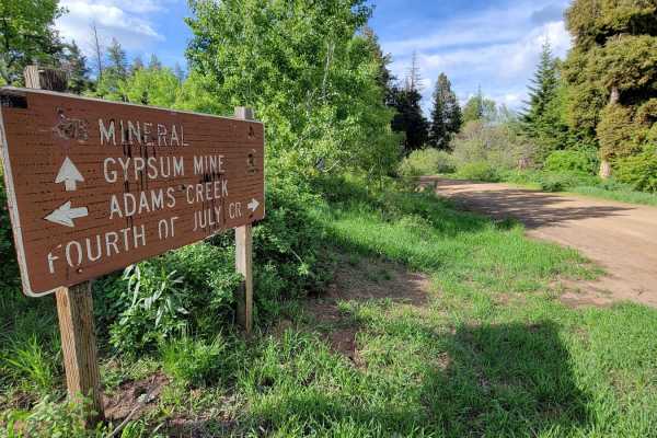
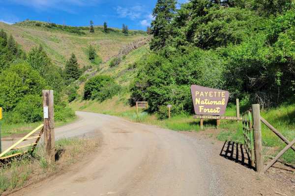
FR 024 - Fourth of July Creek
Fourth of July Creek Trail is the other half of a scenic mountain loop through the Payette National Forest. Plenty of off-shoot trails to explore and primitive camping spots throughout. This trail has more shelf sections (cut into the side of the hill) and offers beautiful views across the forest an...
Learn more about FR 024 - Fourth of July Creek
Sturgil Dennett
This loop connects the top of Bear Creek Saddleback to the main road (FR 025, Adams Creek). It involves three trails: FR 51651, 283, and 010. When this trial was mapped (early June) there were still snowdrifts across the trail, at the top towards Bear Saddle. They proved to be a challenge to cross. ...
Learn more about Sturgil Dennett
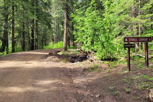
Sturgill Peak - Fire Lookout Tower
This is the second half of FR 09 (Mann Creek). The next six miles beyond the Spring Creek Campground are less maintained and progressively become less and less smooth. Erosion ruts and small rocks make for a bumpy ride. Most of this trail would actually rate 2 - 3, but it's the very last section to ...
Learn more about Sturgill Peak - Fire Lookout Tower
Lick Creek - FS 50143
Lick Creek Road, Forest Service Road 50143 in Idaho, is a classic mountain drive that offers a mix of rugged adventure and scenic beauty. The road begins with well-graded gravel, making for a fairly smooth approach, but quickly transitions into narrower stretches with loose rock, washboards, and occ...
Learn more about Lick Creek - FS 50143
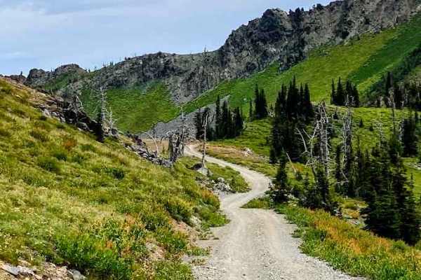
NR 019 - Bear Creek Saddle
From off of NF-24, this beautiful trail takes you North, weaving and winding its way along the side of the mountain, climbing over 1,000' in elevation. At the top is Bear Saddle, where the trail splits. From the top, you can catch some amazing views Northwest and spot neighboring peaks in the distan...
Learn more about NR 019 - Bear Creek Saddle
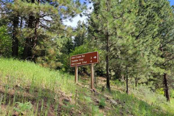
FR 573 - Hitt Creek
This offshoot trail from FR 09 leads to a couple of trailheads - Hitt Creek Trailhead and Keithy Saddle Trailhead. Hitt Creek Trailhead (Trail No. 276) is accessible to bikes and ATVs and is an alternative route to the Sturgil Lookout Tower. If continuing up the trail, unfortunately, there isn't a g...
Learn more about FR 573 - Hitt Creek
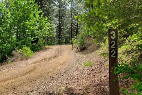
FR 322 - Wolf/Monroe Creek
Passing through a (seasonal) gate at the entrance, this trail begins as a progressive climb up the hill. The puddles are certainly present after wet conditions. There are erosion ruts to navigate as well. There are plenty of offshoot trails to explore, especially towards the top. The trail eventuall...
Learn more about FR 322 - Wolf/Monroe Creek
Horse Mountain Fire Lookout
Horse Mountain Road offers a rewarding drive through classic Idaho backcountry, leading to the scenic Horse Mountain Fire Lookout. The road surface is primarily packed dirt and gravel, with sections of loose rock and ruts. While 4WD isn’t always required in dry conditions, the route can become muddy...
Learn more about Horse Mountain Fire Lookout
Black Lake
Black Lake Road is a scenic off-road route that winds through Idaho’s lush backcountry, offering a mix of adventure and views. The road surface is mostly dirt and gravel, with sections that can be rutted or muddy after rain, making high-clearance 4x4s recommended. As you climb, you’ll pass through t...
Learn more about Black Lake
Moonlight Creek
Moonlight Creek Road (NF 119) is a mellow-to-moderate backcountry drive that climbs a narrow forested valley with frequent creek crossings and views into tight granite draws. The surface is mostly packed dirt and decomposed granite with stretches of embedded rock, occasional baby-head rubble, and sh...
Learn more about Moonlight Creek
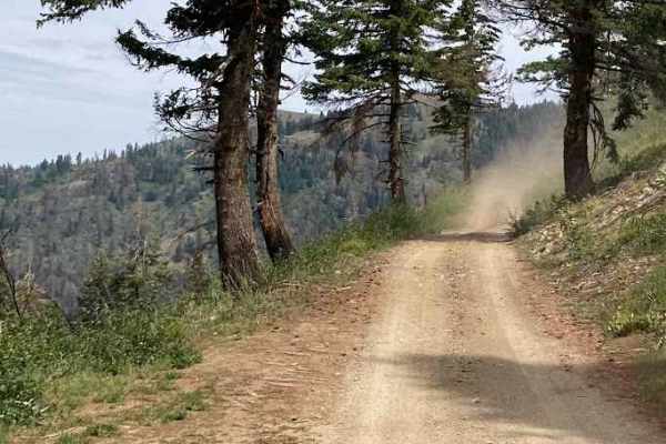
Kinney Point
Embark on a thrilling off-road adventure to Kinney Point Lookout via Forest Road 106 in Idaho's Payette National Forest. This trail offers a rugged journey through diverse terrains, culminating in panoramic views of Hells Canyon. The surface varies from packed dirt to loose gravel and occasional ro...
Learn more about Kinney Point
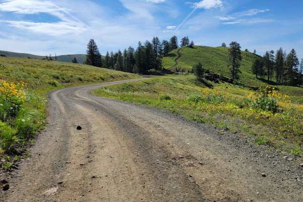
FR 025 - Adams Creek
Adams Creek Trail in the Payette National Forest is a picturesque mountain trail that is half of a scenic loop. It's an easy gradual ascent/descent dirt road with scattered primitive campsites along the way. Easy enough for observed large fifth-wheel camper trailers to reach the summit. At the top, ...
Learn more about FR 025 - Adams Creek
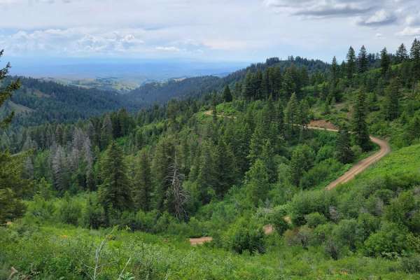
FR 09 - Mann Creek
This is the first section of FR 09. It's an easy and maintained dirt road as it leads to several established campgrounds. There are a handful of offshoot trails to take, as well as a hiking trailhead or two. If looking for primitive campsites, continue up the trail and you'll find quite a few. The M...
Learn more about FR 09 - Mann Creek
Sheep Rock
This trail is a mostly dirt and gravel, with sections that narrow quickly. Expect some washboard texture and occasional loose scree patches. The road isn’t deeply technical, but its tightness and erosion-prone features demand attentive driving. Not ideal for low-clearance vehicles, this route is bes...
Learn more about Sheep Rock
ATV trails near Halfway, Oregon
Explore ATV-friendly trails near you. These trails are accessible for vehicles up to 50 inches wide, perfect for ATVs and smaller off-road machines.
Eagle Creek Vista
The majority of this trail climbs up a gravel road from Highway 86. There is only a small section when turning off of Eagle Creek Road where the road gets rougher and would most likely not be suitable for lower passenger vehicles. Once you're around the bend at the top, you a welcomed by amazing 360...
Learn more about Eagle Creek Vista
Fish Lake - Twin Lakes
This route takes you to a couple of beautiful small lakes while providing incredible views of the Whitman National Forest. Overall the route is very easy and straight forward, but there is a section that can be a little tight to navigate in larger vehicles. If the brush is too tight or the road is b...
Learn more about Fish Lake - Twin Lakes
Oregan Eagle Mountain View
Have a good set of mud tires during the cold and wet seasons on this trail. 4x4 is recommended. You will find awesome views of the Eagle Cap Mountains Public Access Road with a little climb to the best view. This is a great place to take the family and watch the sunset or sunrise. There is lots of l...
Learn more about Oregan Eagle Mountain View
Kleinschmidt Grade - NFD 105
Starting from Hells Canyon/Snake River, this route will take you up a winding single-lane track with great views and significant exposures. As you get higher, the terrain and flora will transform from rock to grass and brush-covered to forested. People do live along this remote route so please ravel...
Learn more about Kleinschmidt Grade - NFD 105
UTV/side-by-side trails near Halfway, Oregon
Find UTV and side-by-side trails near you. These trails accommodate vehicles up to 60 inches wide, ideal for UTVs, side-by-sides, and wider off-road rigs.
Eagle Creek Vista
The majority of this trail climbs up a gravel road from Highway 86. There is only a small section when turning off of Eagle Creek Road where the road gets rougher and would most likely not be suitable for lower passenger vehicles. Once you're around the bend at the top, you a welcomed by amazing 360...
Learn more about Eagle Creek Vista
Fish Lake - Twin Lakes
This route takes you to a couple of beautiful small lakes while providing incredible views of the Whitman National Forest. Overall the route is very easy and straight forward, but there is a section that can be a little tight to navigate in larger vehicles. If the brush is too tight or the road is b...
Learn more about Fish Lake - Twin Lakes
Oregan Eagle Mountain View
Have a good set of mud tires during the cold and wet seasons on this trail. 4x4 is recommended. You will find awesome views of the Eagle Cap Mountains Public Access Road with a little climb to the best view. This is a great place to take the family and watch the sunset or sunrise. There is lots of l...
Learn more about Oregan Eagle Mountain View
Kleinschmidt Grade - NFD 105
Starting from Hells Canyon/Snake River, this route will take you up a winding single-lane track with great views and significant exposures. As you get higher, the terrain and flora will transform from rock to grass and brush-covered to forested. People do live along this remote route so please ravel...
Learn more about Kleinschmidt Grade - NFD 105
The onX Offroad Difference
onX Offroad combines trail photos, descriptions, difficulty ratings, width restrictions, seasonality, and more in a user-friendly interface. Available on all devices, with offline access and full compatibility with CarPlay and Android Auto. Discover what you're missing today!
Open Trail Map