
Dirt Bike Trails
Near Flournoy, California
Explore All Dirt Bike Trails Near Flournoy, California
Dirt Bike Trails Near Flournoy, California
Discover the best dirt bike trails near you. Browse trail maps, check difficulty ratings, and find your next adventure — whether you're looking for a quick ride or an all-day expedition.
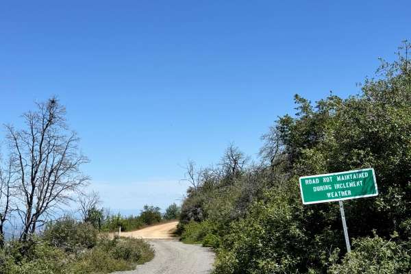
Road 307
This trail is a combination of dirt and gravel. The trail is fairly flat with the occasional rutted wash from water flow. Not far down the trail is the Rattlesnake Firefighter Memorial and the trailhead leading to their gravesites. This road states that it is not maintained in inclement weather. The...
Learn more about Road 307
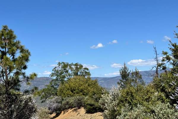
Alder Springs W.C. - FS 21N30
This trail starts off looking like it was freshly graded and then turns into a rutted-out trail. Nothing too difficult, just some sections where water was flowing down and created a rut in the road. This trail does have a few spots where you can pull off to camp as well, with some beautiful views.
Learn more about Alder Springs W.C. - FS 21N30
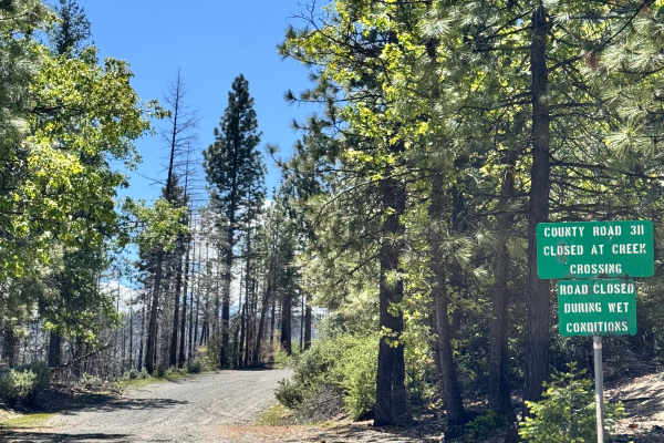
Road 311
At the beginning of the trail, there is a sign that states "closed at creek crossing". However, we did not encounter a creek crossing or any closures along this trail before it meets at M3. Where the road continues after M3 states that it's closed. This trail is a gravel trail with some rutted out s...
Learn more about Road 311
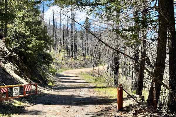
Lower Middle Ridge - FS 21N07
This trail has a gate, so it is likely closed for the winter. The trail is a hard-pack gravel road with some potholes and rutted-out sections. There are a couple of spots that get a little narrow. but does have beautiful trails. The trail looks like it was recently cleared, as there are trees along ...
Learn more about Lower Middle Ridge - FS 21N07
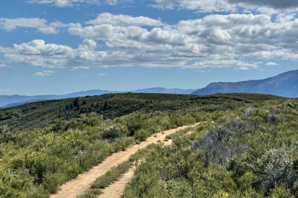
Brushy Ridge - 19N29
This slightly over 2-mile trail definitely lives up to its name. While it remains a two-track route, thick brush crowds the trail in several sections, making for a tight squeeze at times. There are also a few small washes along the edges of the trail, so some caution is recommended.
The route offer...
Learn more about Brushy Ridge - 19N29
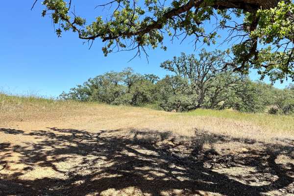
Triplet Butte - 18N02A
This is a short spur road that looks like it used to take you to the top of Triplet Butte however the trail becomes impassable a little less than half way down the road. Has a couple tight sections of trees to pass through and it is clear where the trail ends as the track is not visible, there is ov...
Learn more about Triplet Butte - 18N02A
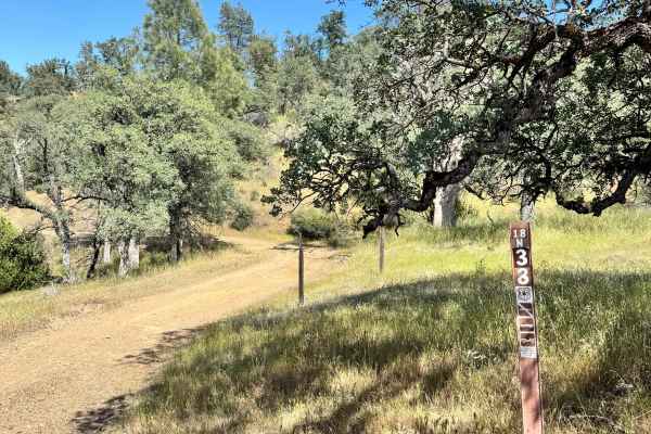
Salt Spring Valley - 18N38
This trail is a combination of dirt and gravel. There are a few small washes along the edges of the trail, but nothing too big, and they can easily be driven around. This trail does end at a gate with "State of California" land on the other side. This trail has some really great views.
Learn more about Salt Spring Valley - 18N38
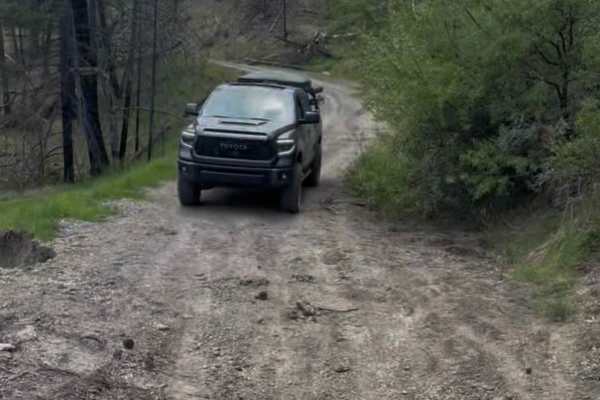
Pillsbury-Indian Dick Road
Pillsberry to Black Butte Trail is a calm, scenic gravel road with some campsites along the river. It's an easy driving, wide road, not normally passable in the wintertime because of snow. There is one small landslide that you can fit a large 4 x 4 through; besides that, the trail is well maintained...
Learn more about Pillsbury-Indian Dick Road
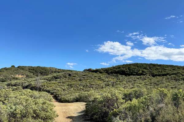
Black Diamond - FS 18N30
This trail has a spot to camp shortly after getting on the trail with a great view. There is a steep hill that a hitch will drag on, not far from the entrance, and some ruts and washes along the trail. Where the trail ends, there is only a very steep hill, nothing else indicating the end of the trai...
Learn more about Black Diamond - FS 18N30
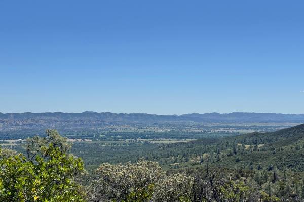
Open Ridge Black Diamond East - FS 18N02
This trail can be accessed by Main Road 306. It goes through private property for a short bit and a water crossing before reaching national forest land. There are many ruts throughout the trail due to water flow and some dips. The trail is nice and easy otherwise. There are beautiful views along the...
Learn more about Open Ridge Black Diamond East - FS 18N02
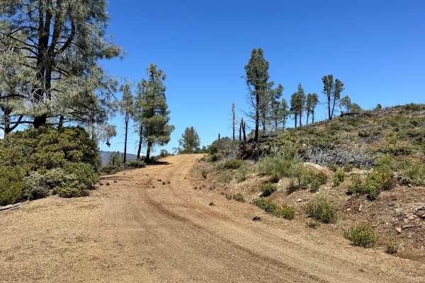
Open Ridge Black Diamond West - FS 18N02
This trail consists of dirt and gravel. It is an out-and-back trail as there is a major washout about 1 mile from the west end, where it's supposed to connect with M3. The trail has some ruts, washes, and a few shelf roads along the way. There are some beautiful views and a few spots to pull off and...
Learn more about Open Ridge Black Diamond West - FS 18N02
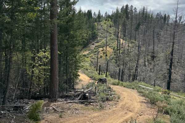
Rattlesnake 4x4 85467
Single wide trail that navigates up and across a ridge. It can get really tight with overgrown vegetation. A good amount of washes, ditches, and water drainage humps, and a few hill climbs and descents. The trail is mixed-use, so watch out for anything from trucks to dirt bikes. There are areas for ...
Learn more about Rattlesnake 4x4 85467
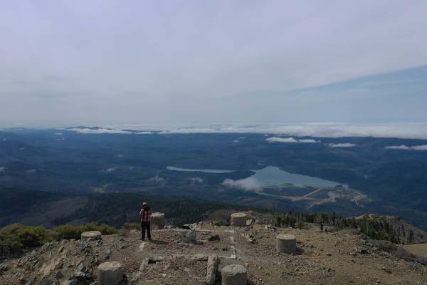
Hull Mountain Trail
Hull Mountain is a dominant peak and rises over 5,000 feet above Lake Pillsbury in the southwest part of the Mendocino National Forest. This is a beautiful area for camping and other recreational activities. Relatively easy mountain roads take you on a journey deep into the wilds of the back countr...
Learn more about Hull Mountain Trail
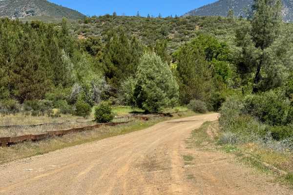
North Fork - FS 18N03
This is a semi maintained fire road. From the South end starts out groomed and starts to get narrow on the shelf road. Some overgrown brush to get some pin stripes. There are multiple smaller washouts and one that you need to navigate carefully since the outside is sliding a bit.
Learn more about North Fork - FS 18N03
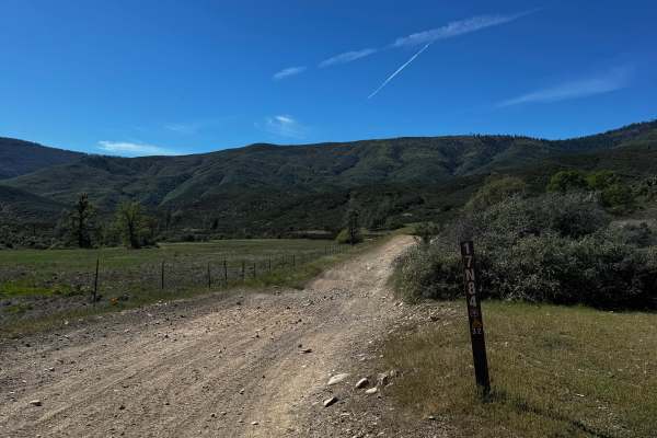
Letts Ridge Trailhead Entrance
This is the beginning of the Letts Ridge trail. Past this is only for dirtbikes and other smaller OHV machines. This trail will also take you to the Champagne trail wh8ch also connects to Potato Hill. At the end is a big area to unload to do the rest of the Letts Ridge trail. A lot of whoops-style b...
Learn more about Letts Ridge Trailhead Entrance
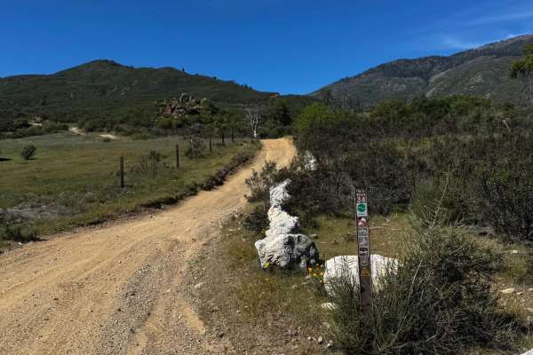
Champagne - FS 17N79
This trail immediately starts climbing. Has many rolling water drainages and rocky sections. Start to get good views of the canyon as well. Crossing a road and continuing on the other side, it's easy to see and is marked. Good warm-up before going on the Potato Hill trail that gets pretty steep.
Learn more about Champagne - FS 17N79
Potato Hill - FS 17N12
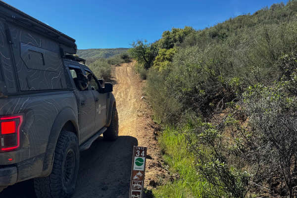
The trail immediately starts to climb the ridge. It gets very steep in some sections and requires high clearance to break over drainages, or you'll slide over them. Good views of the canyon and valley once you get high enough. Lots of off-camber areas and washes. The trail is tight and overgrown; yo...
Learn more about Potato Hill - FS 17N12
Sanborn - FS 17N63
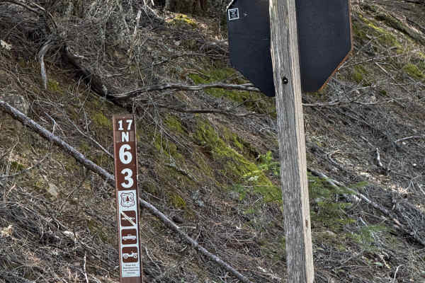
Mostly a wide fire road connecting the road to Potato Hill Trail. There are some small washes, and it narrows at a few sections to one vehicle wide. Good views from the top of the trail. Seasonal close and will close for wet weather. Had a few low-hanging trees and a tree down across the top of the...
Learn more about Sanborn - FS 17N63
Old Letts - FS 17N12
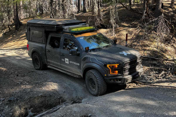
This trail has many steep sections, including one big hill climb. Depending on the direction traveled, you can bypass that hill climb (bypass not included on guided trail). Single vehicle wide, and some areas are overgrown, causing pinstripes. Lots of off camber and many washes, some deep and some e...
Learn more about Old Letts - FS 17N12
East Letts - FS 17N02k
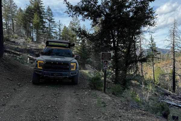
This trail used to be longer, but erosion turned it into half just a dirt bike trail. This trial ends at a bit of a turn around that you could unload your bikes and hit the other trails from that point. It's also a connector to the Old Letts Trail. This trail is single vehicle wide, and there are a ...
Learn more about East Letts - FS 17N02k
ATV trails near Flournoy, California
Explore ATV-friendly trails near you. These trails are accessible for vehicles up to 50 inches wide, perfect for ATVs and smaller off-road machines.
Road 307
This trail is a combination of dirt and gravel. The trail is fairly flat with the occasional rutted wash from water flow. Not far down the trail is the Rattlesnake Firefighter Memorial and the trailhead leading to their gravesites. This road states that it is not maintained in inclement weather. The...
Learn more about Road 307
Alder Springs W.C. - FS 21N30
This trail starts off looking like it was freshly graded and then turns into a rutted-out trail. Nothing too difficult, just some sections where water was flowing down and created a rut in the road. This trail does have a few spots where you can pull off to camp as well, with some beautiful views.
Learn more about Alder Springs W.C. - FS 21N30
Road 311
At the beginning of the trail, there is a sign that states "closed at creek crossing". However, we did not encounter a creek crossing or any closures along this trail before it meets at M3. Where the road continues after M3 states that it's closed. This trail is a gravel trail with some rutted out s...
Learn more about Road 311
Lower Middle Ridge - FS 21N07
This trail has a gate, so it is likely closed for the winter. The trail is a hard-pack gravel road with some potholes and rutted-out sections. There are a couple of spots that get a little narrow. but does have beautiful trails. The trail looks like it was recently cleared, as there are trees along ...
Learn more about Lower Middle Ridge - FS 21N07
UTV/side-by-side trails near Flournoy, California
Find UTV and side-by-side trails near you. These trails accommodate vehicles up to 60 inches wide, ideal for UTVs, side-by-sides, and wider off-road rigs.
Road 307
This trail is a combination of dirt and gravel. The trail is fairly flat with the occasional rutted wash from water flow. Not far down the trail is the Rattlesnake Firefighter Memorial and the trailhead leading to their gravesites. This road states that it is not maintained in inclement weather. The...
Learn more about Road 307
Alder Springs W.C. - FS 21N30
This trail starts off looking like it was freshly graded and then turns into a rutted-out trail. Nothing too difficult, just some sections where water was flowing down and created a rut in the road. This trail does have a few spots where you can pull off to camp as well, with some beautiful views.
Learn more about Alder Springs W.C. - FS 21N30
Road 311
At the beginning of the trail, there is a sign that states "closed at creek crossing". However, we did not encounter a creek crossing or any closures along this trail before it meets at M3. Where the road continues after M3 states that it's closed. This trail is a gravel trail with some rutted out s...
Learn more about Road 311
Lower Middle Ridge - FS 21N07
This trail has a gate, so it is likely closed for the winter. The trail is a hard-pack gravel road with some potholes and rutted-out sections. There are a couple of spots that get a little narrow. but does have beautiful trails. The trail looks like it was recently cleared, as there are trees along ...
Learn more about Lower Middle Ridge - FS 21N07
The onX Offroad Difference
onX Offroad combines trail photos, descriptions, difficulty ratings, width restrictions, seasonality, and more in a user-friendly interface. Available on all devices, with offline access and full compatibility with CarPlay and Android Auto. Discover what you're missing today!
Open Trail Map