
Dirt Bike Trails
Near Dubois, Idaho
Explore All Dirt Bike Trails Near Dubois, Idaho
Dirt Bike Trails Near Dubois, Idaho
Discover the best dirt bike trails near you. Browse trail maps, check difficulty ratings, and find your next adventure — whether you're looking for a quick ride or an all-day expedition.
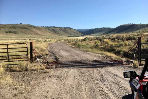
Corral Creek Road - FS 177
This road is a well-maintained dirt road up to the Forest Service boundary. Beyond that, the road is heavily rutted and presents some moderate challenges to travel. The road follows the creek and passes through a nice stand of fir trees. This road is signed as FS 177.
Learn more about Corral Creek Road - FS 177
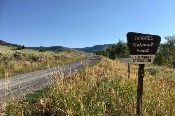
Threemile Road
This road, signed as FS 021 on the ground, is a well-maintained gravel road up to its intersection with the Middle Threemile Road (FS 477). Beyond that intersection, the road narrows, deteriorates, and becomes more suitable for high-clearance 4x4 vehicles. There are several very nice dispersed camp...
Learn more about Threemile Road
Van Noy-Stoddard Road
This is a short Forest Service Road that leads to a trailhead. There are a few dispersed campsites along this road. But the road itself is pretty rough and narrow, so those campsites are not suitable for bigger camp trailers or RVs. The road surface is rocky.
Learn more about Van Noy-Stoddard Road
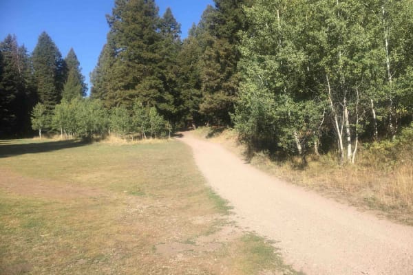
Stoddard Creek Loop Trail
This is a lovely little 3.6-mile loop trail that is convenient to the Stoddard Creek campground and the dispersed campsites along Stoddard Creek Road. It twists and turns through impressive stands of large fir trees with aspen occasionally intermixed with the conifers. It is a very scenic trip with ...
Learn more about Stoddard Creek Loop Trail
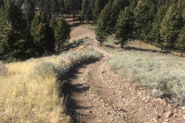
Stoddard Creek Ridge Trail
This trail is a ridgeline trail along its entire 3.5-mile length. Most of that ridgeline is free from timber, so there are abundant opportunities for sweeping panoramic views. The trail tops out at about 7,500 feet in elevation. The high point of the trail is substantially elevated above the surroun...
Learn more about Stoddard Creek Ridge Trail
Van Noy-Stoddard Trail
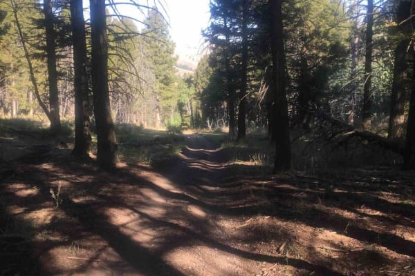
From the end of the Van Noy-Stoddard Road, the trail climbs to a ridgeline for about 1.6 miles, topping out at about 7,800 feet. This section of the trail includes some challenging rocky ascents. The remainder of the trail winds through a beautiful forest of fir trees and some huge aspen groves. The...
Learn more about Van Noy-Stoddard Trail
Spring Creek Road - FS 889
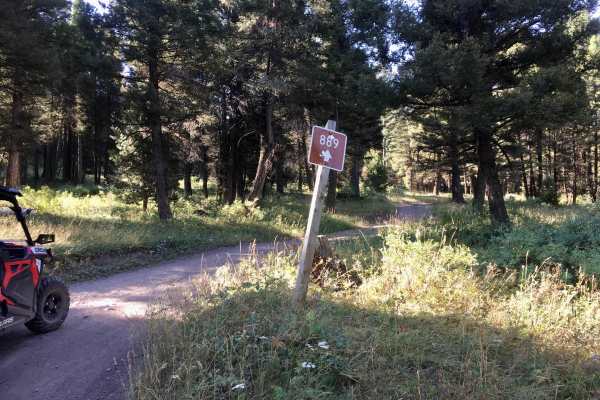
This road provides a delightful trip through a beautiful mixture of dense stands of fir, huge patches of aspen, and open meadows. The road is a one-lane dirt track with several sections badly rutted with rocks and ledges to negotiate. This road is signed as FS 889. At the intersection with the Corra...
Learn more about Spring Creek Road - FS 889
Picnic Ridge Trail
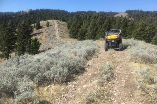
This is a ridgeline trail for its entire 2.8-mile length. The trail traverses a nice mixture of open grassy ridgeline terrain and tread that twists and turns through stands of mixed conifers. This trail tops out at about 7,500 feet of elevation, so there are abundant opportunities for panoramic view...
Learn more about Picnic Ridge Trail
Modoc-Coral Creek Trail
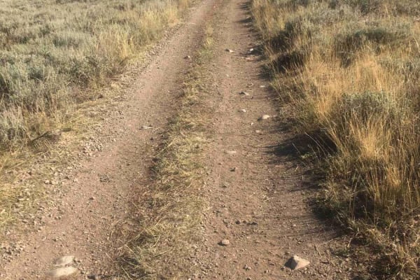
This trail's elevation is above 8,000 feet for its entire length and tops out at 8,900 feet. The trail crawls along grassy alpine ridges with steep rocky ups and downs that seem to go on forever. This is a good place for the full alpine experience. There are whole new varieties and species of plants...
Learn more about Modoc-Coral Creek Trail
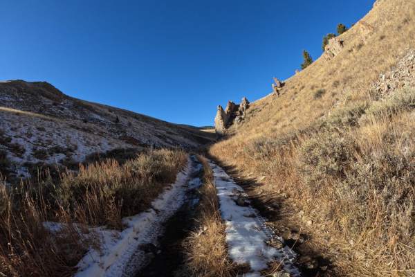
Mahogany Peak
Mahogany Peak is an out-and-back trail, or you can return on another route if so chosen. You start at the air-down spot right off of the highway and work your way up into Chandler Canyon. It is fairly easy-going, with some minor obstacles and a rougher road that will require airing down. You will tu...
Learn more about Mahogany Peak
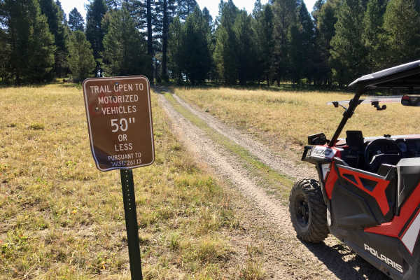
Lookout Point South ATV Trail
This ATV trail is virtually one long ascent (or descent, depending on which way you are travelling) up a broad rocky ridgeline. There are several very steep and very rocky grades. It’s a short, fun trail, but it may not be appropriate for novice riders. This trail is signed as TR 1180.
Learn more about Lookout Point South ATV Trail
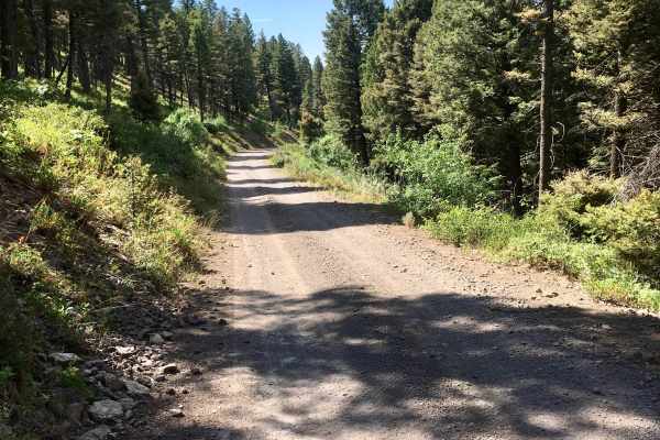
Middle Threemile Road
This is a nice, wide logging road that is suitable for high clearance vehicles. There are a few rocky ruts that need to be navigated carefully, but in general, it is an easy and relaxed trip. It is likely to see wildlife from this road, and there are several dispersed campsites available along this ...
Learn more about Middle Threemile Road
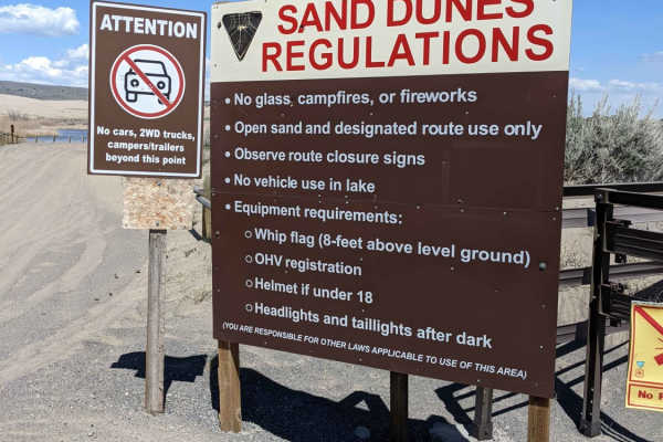
St. Anthony Sand Dunes-Egin Lake to Devils Dune
This is a free ride route over the St. Anthony Dunes. The route will take you along the southern route of the Sand Dunes and cuts up over the top to Devil's Dune. The return route travels along the north route of the dunes to Choke Cherry Hill (a popular hill climb destination). Make a return to Egi...
Learn more about St. Anthony Sand Dunes-Egin Lake to Devils Dune
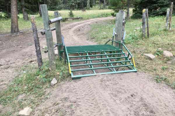
Lone Pine Pass ATV Trail
In addition to being a really fun trail, this trail, signed as ATV TR 175 on the ground, indirectly connects TR 005 to Spencer Kilgore Road. This is a pretty rough trail with lots of ruts and rocks. In several places, the tread width is narrowed by encroaching vegetation. There are several water cro...
Learn more about Lone Pine Pass ATV Trail
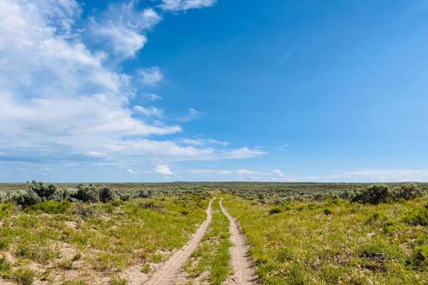
West Y
This lightly traveled two-track trail cuts through fields of sagebrush. In the Springtime and even into early summer, wildflowers dot the sides of the trial. The route is sandy, with little cactus scattered here and there. Occasionally there's a firm rocky section, but they don't last for long. The ...
Learn more about West Y
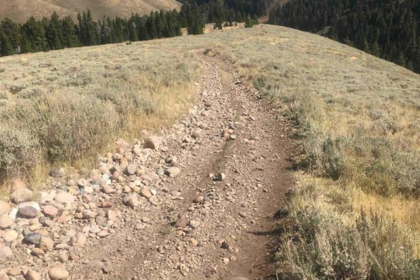
West Modoc Creek Trail
This trail is the seamless extension of Trail 1013. It follows a ridgeline that begins the descent into the Modoc Valley and eventually to the access road to Interstate 15. The trail starts out in an open grassland environment and gradually leads into a forested area. The tread is quite rocky and ro...
Learn more about West Modoc Creek Trail
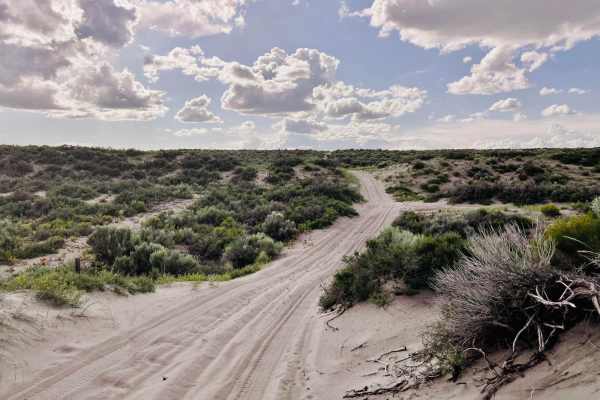
St. Anthony Sand Dunes Western Access
This trail is sandy and offers access to the western side of the St. Anthony Sand Dunes Open Riding area. The western side has really big sand dunes. The route is heavily whooped and bumpy from cattle traffic. There are quite a few cattle out here grazing in this area, so use caution when traveling....
Learn more about St. Anthony Sand Dunes Western Access
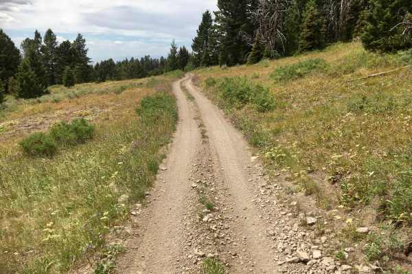
Alex Draw to McGary Canyon ATV Trail
This nearly 11-mile ATV trail is amazing!! The trail itself is designed to accommodate vehicles less than or equal to 50 inches in width, with lots of tight, narrow obstacles, climbing (and descending) rocky hairpin turns, and a few flat stretches where riders can catch their breath. The nature of ...
Learn more about Alex Draw to McGary Canyon ATV Trail
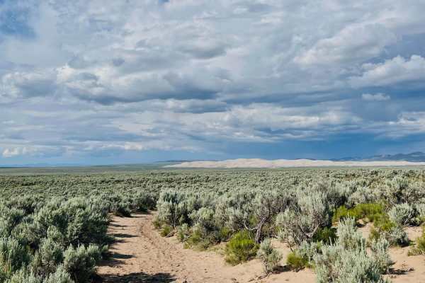
A Mile and a Half Road
First of all, it's closer to three miles, but maybe they first ran it on foot, and it seemed shorter. This is a fun trail that is mostly traveled by cattle. It is a sandy route back up to the main road. The sand gets quite deep at times. There is also the occasional boulder field to watch for. The t...
Learn more about A Mile and a Half Road
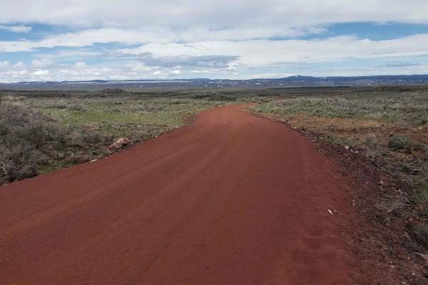
Civil Defense Cave
The Civil Defense Cave trail is a well-maintained, grated road for the first 4 miles until the turn off of Crooked Road onto Civil Defense Cave Road. The last mile is not grated but still well traveled. I would recommend a higher clearance vehicle as there is potential for lower vehicles to bottom o...
Learn more about Civil Defense Cave
ATV trails near Dubois, Idaho
Explore ATV-friendly trails near you. These trails are accessible for vehicles up to 50 inches wide, perfect for ATVs and smaller off-road machines.
Corral Creek Road - FS 177
This road is a well-maintained dirt road up to the Forest Service boundary. Beyond that, the road is heavily rutted and presents some moderate challenges to travel. The road follows the creek and passes through a nice stand of fir trees. This road is signed as FS 177.
Learn more about Corral Creek Road - FS 177
Threemile Road
This road, signed as FS 021 on the ground, is a well-maintained gravel road up to its intersection with the Middle Threemile Road (FS 477). Beyond that intersection, the road narrows, deteriorates, and becomes more suitable for high-clearance 4x4 vehicles. There are several very nice dispersed camp...
Learn more about Threemile Road
Van Noy-Stoddard Road
This is a short Forest Service Road that leads to a trailhead. There are a few dispersed campsites along this road. But the road itself is pretty rough and narrow, so those campsites are not suitable for bigger camp trailers or RVs. The road surface is rocky.
Learn more about Van Noy-Stoddard Road
Stoddard Creek Loop Trail
This is a lovely little 3.6-mile loop trail that is convenient to the Stoddard Creek campground and the dispersed campsites along Stoddard Creek Road. It twists and turns through impressive stands of large fir trees with aspen occasionally intermixed with the conifers. It is a very scenic trip with ...
Learn more about Stoddard Creek Loop Trail
UTV/side-by-side trails near Dubois, Idaho
Find UTV and side-by-side trails near you. These trails accommodate vehicles up to 60 inches wide, ideal for UTVs, side-by-sides, and wider off-road rigs.
Corral Creek Road - FS 177
This road is a well-maintained dirt road up to the Forest Service boundary. Beyond that, the road is heavily rutted and presents some moderate challenges to travel. The road follows the creek and passes through a nice stand of fir trees. This road is signed as FS 177.
Learn more about Corral Creek Road - FS 177
Threemile Road
This road, signed as FS 021 on the ground, is a well-maintained gravel road up to its intersection with the Middle Threemile Road (FS 477). Beyond that intersection, the road narrows, deteriorates, and becomes more suitable for high-clearance 4x4 vehicles. There are several very nice dispersed camp...
Learn more about Threemile Road
Van Noy-Stoddard Road
This is a short Forest Service Road that leads to a trailhead. There are a few dispersed campsites along this road. But the road itself is pretty rough and narrow, so those campsites are not suitable for bigger camp trailers or RVs. The road surface is rocky.
Learn more about Van Noy-Stoddard Road
Spring Creek Road - FS 889
This road provides a delightful trip through a beautiful mixture of dense stands of fir, huge patches of aspen, and open meadows. The road is a one-lane dirt track with several sections badly rutted with rocks and ledges to negotiate. This road is signed as FS 889. At the intersection with the Corra...
Learn more about Spring Creek Road - FS 889
The onX Offroad Difference
onX Offroad combines trail photos, descriptions, difficulty ratings, width restrictions, seasonality, and more in a user-friendly interface. Available on all devices, with offline access and full compatibility with CarPlay and Android Auto. Discover what you're missing today!
Open Trail Map