
Dirt Bike Trails
Near Danville, Arkansas
Explore All Dirt Bike Trails Near Danville, Arkansas
Dirt Bike Trails Near Danville, Arkansas
Discover the best dirt bike trails near you. Browse trail maps, check difficulty ratings, and find your next adventure — whether you're looking for a quick ride or an all-day expedition.
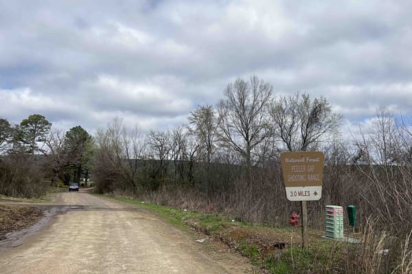
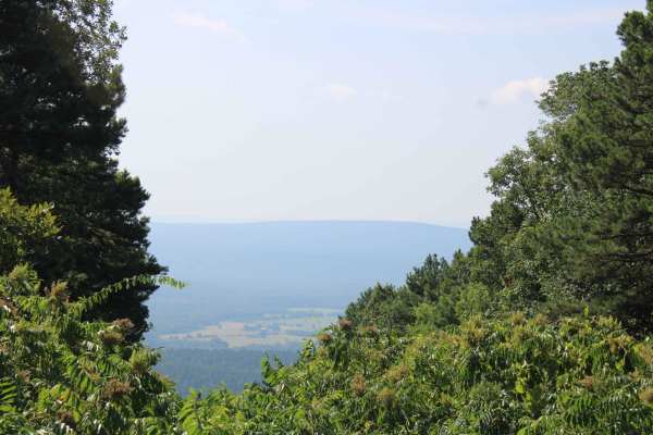
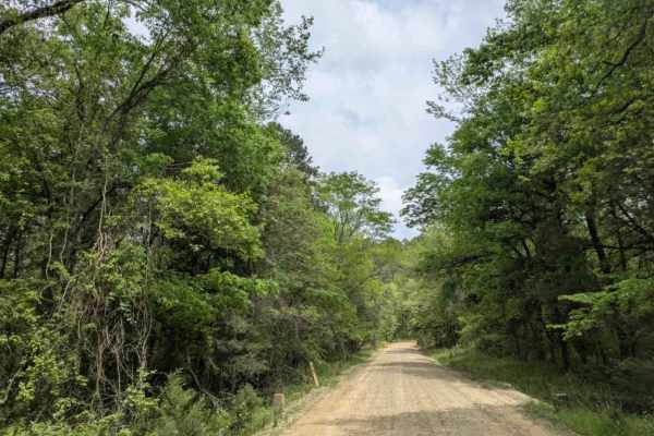
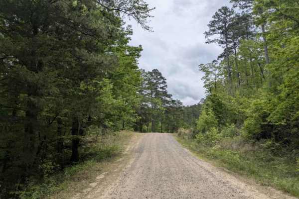
Peeler Gap Shooting Range
This road leads to a really nice shooting range with cell phone service, restrooms, and a nice-sized parking lot. Gravel road with larger-sized rocks in several areas. Low-clearance vehicles (cars) are not recommended. There are no camping areas along this road but there is a beautiful view at the n...
Learn more about Peeler Gap Shooting Range
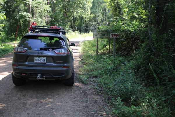
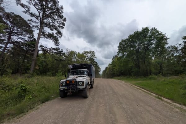
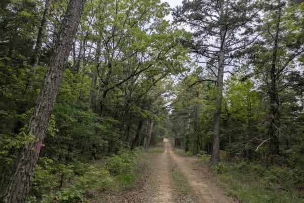
Kingston Road (156C)
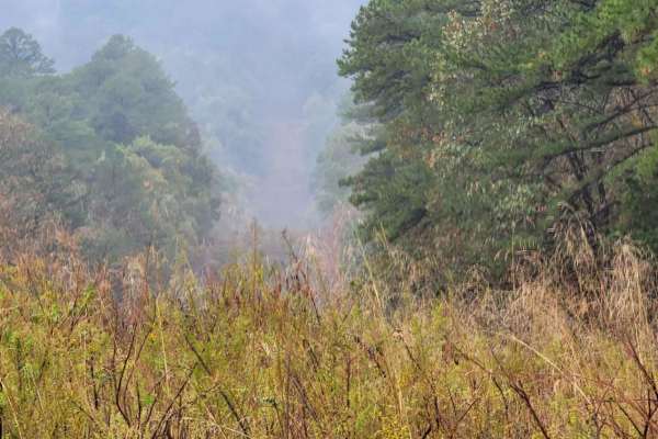
East off Highway 27, starts Kingston Road (156c) that travels east to Peeler Gap Road (YE15). This gravel road winds through the beautiful Ouachita National Forest. During dry weather, the road can be dusty and it can be messy when wet. There can be water crossings during and after rain. Dispersed c...
Learn more about Kingston Road (156C)
Power Line BUZZ
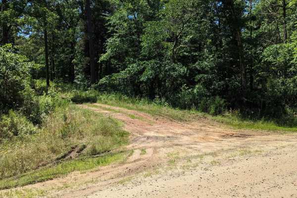
These short gravel roads lead to a power line right of way. This power line area has an open area that could be used for dispersed camping if you can deal with the BUZZ from the electric lines above. This road used to continue on to some camping spots, but after going under the power lines, it is bl...
Learn more about Power Line BUZZ
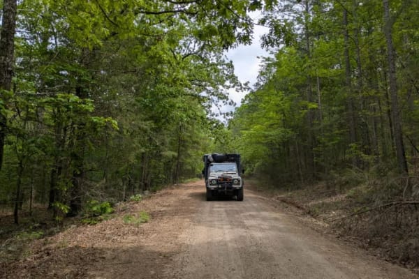
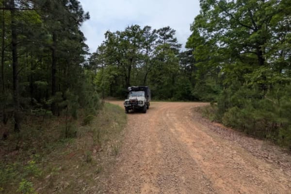
Danville Mountain
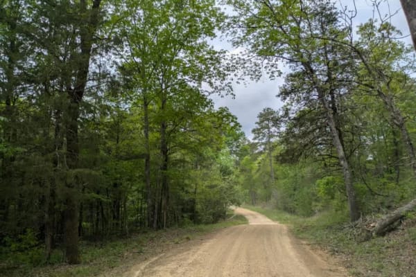
These forest roads consist of F63D, F64E, 658D, and 658 and exits at Growly Road. Some of these roads are narrow and overgrown. A few places will require a bit of ground clearance. Depending on vehicle width scratches are possible. Washouts and ruts will require choosing a line if ground clearance i...
Learn more about Danville Mountain
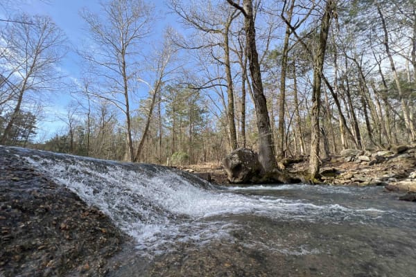
Dutch Creek Mountian to Towers
Dutch Creek Mountain Road (67) is a natural surface forest road that runs along Dutch Creek Mountain in the Ouachita National Forest. This road's natural surface has some larger rocks embedded in the surface, that make for a rough ride in areas. Some dirt areas can be muddy after rain. There can be...
Learn more about Dutch Creek Mountian to Towers
Talley Mountain
This Trail is a gravel road that can be messy when wet. There can be water crossings along this trail depending on precipitation. Not far up this trail as you travel west, you will see a single track on the left side. This single track can be muddy and very steep. The original trail will end at a ni...
Learn more about Talley Mountain
Chickalah Mountain East Trail
This is an easy trail through the pine forests on Chickalah Mountain. The trails are gravel roads with a few mud puddles and creek crossings. Most puddles have a hard bottom and all roads are passable in any vehicle you are willing to take off-road. One creek crossing could be deep if it has rained ...
Learn more about Chickalah Mountain East Trail
White Creek
White Creek is a maintained but rugged trail characterized by its bumpy, rocky terrain as it gently winds through scenic forest areas. Travelers will encounter a few dry creek crossings, particularly noticeable in April, and several smaller side trails branching off the main path. The route offers a...
Learn more about White Creek
Spring Lake Access Road
Spring Lake is a maintained gravel road that offers an easy and pleasant drive through picturesque farmland and open pastures. The surrounding area is largely composed of private land and farmsteads, and there is a steady amount of local traffic, so drivers should exercise caution. While the trail p...
Learn more about Spring Lake Access Road
Harker Valley Road
Harker Valley is a wide gravel trail that offers a scenic drive through dense forest, but it is heavily rutted with deep potholes, often hidden in the shade. Drivers are advised to proceed slowly to protect their tires and suspension. Along the route are at least two established dispersed campsites ...
Learn more about Harker Valley Road
Carter Mountain
Carter Mountain trail is a maintained gravel route that becomes rough and rocky, featuring winding segments and areas overgrown with vegetation. Logging activity is evident along the trail, with blue-painted trees marking those selected for harvest, orange paint indicating protected trees, and purpl...
Learn more about Carter Mountain
Hickory Grove
The Hickory Grove trail begins as a maintained gravel two-track, offering a pleasant drive through forested landscapes past private property and rural homesteads. The latter half transitions into a dusty, uneven, and winding route that, while not particularly challenging, requires careful navigation...
Learn more about Hickory Grove
FS 1601
Spring Lake Road Access is a maintained gravel route frequently traveled by visitors heading to the lake, resulting in noticeable corrugations and potholes that make moderate driving speeds advisable. The trail eventually leads to a campground open seasonally from Memorial Day to Labor Day. Alongsid...
Learn more about FS 1601
Barber Ridge Road
Barber Ridge Trail begins as a narrow, winding route that traverses a scenic forest, bordered by private properties. The initial stretch is rugged, characterized by bumpy terrain, loose rocks, and tight turns. As the trail progresses, it opens up into a broader, well-maintained gravel road, providin...
Learn more about Barber Ridge Road
Barnhart Road 796
Most of the trails in the ONF are easy gravel roads, this one included. There isn't much elevation gain or descent on this trail. Even when it rains, the roads don't really get muddy, however, you may find mud puddles or potholes along this road. There are two water crossings, so a car isn't recomme...
Learn more about Barnhart Road 796
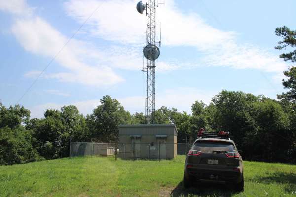
Dutch Creek Mountain Road - Nature Takes Over
This section of Dutch Creek Mountain Road starts from a cell tower clearing and ends where trees and brush close in on the road. This road does continue, but one must be willing to take scratches on the vehicle or clear the trail. There is an open area close to the end for dispersed camping and a fe...
Learn more about Dutch Creek Mountain Road - Nature Takes Over
Smoluck - Trail 1653
The trail is oriented north/south and is better run going north (uphill). This is a multi-vehicle seasonally open trail that connects to 2611, which is an OHV (ATV, UTV, MX) -only trail. This trail is seasonally closed in the months of April & May each year. Do not attempt to connect to trailer 2611...
Learn more about Smoluck - Trail 1653
Walnut Grove
This gravel road has beautiful views and some nice curves. Watch for wildlife as you travel through the tall trees. There are steep drop-offs on the side of the road where you will hear and see streams. The moss-covered rocks are a sight to see. This road can be slippery when wet and dusty when dry....
Learn more about Walnut Grove
Eickleberry Road
Eickleberry Road is a maintained gravel road alternating between wide and narrow sections, featuring several relatively steep ascents and descents. Numerous smaller trails branch off the main route, and a few dispersed campsites with fire rings can be found along the way. The trail climbs to the top...
Learn more about Eickleberry Road
96027A
This is a north/south trail accessible by OHVs (ATV, UTV, MX) and horseback ONLY. There are width restriction gates on both ends, limiting vehicles to approximately 72" max width. The trail has several shallow mud holes with firm bottoms. There is a 370-foot elevation difference between the ends of ...
Learn more about 96027A
ATV trails near Danville, Arkansas
Explore ATV-friendly trails near you. These trails are accessible for vehicles up to 50 inches wide, perfect for ATVs and smaller off-road machines.
Peeler Gap Shooting Range
This road leads to a really nice shooting range with cell phone service, restrooms, and a nice-sized parking lot. Gravel road with larger-sized rocks in several areas. Low-clearance vehicles (cars) are not recommended. There are no camping areas along this road but there is a beautiful view at the n...
Learn more about Peeler Gap Shooting Range
Kingston Road (156C)
East off Highway 27, starts Kingston Road (156c) that travels east to Peeler Gap Road (YE15). This gravel road winds through the beautiful Ouachita National Forest. During dry weather, the road can be dusty and it can be messy when wet. There can be water crossings during and after rain. Dispersed c...
Learn more about Kingston Road (156C)
Power Line BUZZ
These short gravel roads lead to a power line right of way. This power line area has an open area that could be used for dispersed camping if you can deal with the BUZZ from the electric lines above. This road used to continue on to some camping spots, but after going under the power lines, it is bl...
Learn more about Power Line BUZZ
Danville Mountain
These forest roads consist of F63D, F64E, 658D, and 658 and exits at Growly Road. Some of these roads are narrow and overgrown. A few places will require a bit of ground clearance. Depending on vehicle width scratches are possible. Washouts and ruts will require choosing a line if ground clearance i...
Learn more about Danville Mountain
UTV/side-by-side trails near Danville, Arkansas
Find UTV and side-by-side trails near you. These trails accommodate vehicles up to 60 inches wide, ideal for UTVs, side-by-sides, and wider off-road rigs.
Peeler Gap Shooting Range
This road leads to a really nice shooting range with cell phone service, restrooms, and a nice-sized parking lot. Gravel road with larger-sized rocks in several areas. Low-clearance vehicles (cars) are not recommended. There are no camping areas along this road but there is a beautiful view at the n...
Learn more about Peeler Gap Shooting Range
Kingston Road (156C)
East off Highway 27, starts Kingston Road (156c) that travels east to Peeler Gap Road (YE15). This gravel road winds through the beautiful Ouachita National Forest. During dry weather, the road can be dusty and it can be messy when wet. There can be water crossings during and after rain. Dispersed c...
Learn more about Kingston Road (156C)
Power Line BUZZ
These short gravel roads lead to a power line right of way. This power line area has an open area that could be used for dispersed camping if you can deal with the BUZZ from the electric lines above. This road used to continue on to some camping spots, but after going under the power lines, it is bl...
Learn more about Power Line BUZZ
Danville Mountain
These forest roads consist of F63D, F64E, 658D, and 658 and exits at Growly Road. Some of these roads are narrow and overgrown. A few places will require a bit of ground clearance. Depending on vehicle width scratches are possible. Washouts and ruts will require choosing a line if ground clearance i...
Learn more about Danville Mountain
The onX Offroad Difference
onX Offroad combines trail photos, descriptions, difficulty ratings, width restrictions, seasonality, and more in a user-friendly interface. Available on all devices, with offline access and full compatibility with CarPlay and Android Auto. Discover what you're missing today!
Open Trail Map