Dirt Bike Trails
Near Danforth, Maine
Explore All Dirt Bike Trails Near Danforth, Maine
Dirt Bike Trails Near Danforth, Maine
Discover the best dirt bike trails near you. Browse trail maps, check difficulty ratings, and find your next adventure — whether you're looking for a quick ride or an all-day expedition.
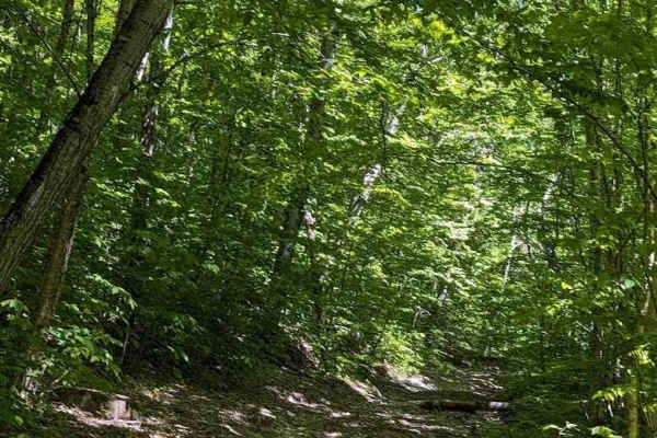
Flat Top Hard Line
This is an alternative route to the ascent to Flat Top Mountain. It features some 20-inch-deep mud holes and a lot of off-camber washouts. While it will challenge your skill, it's not nearly as hard as the actual ascent. Be prepared and bring a chainsaw. The trail rejoins the main drag before the tu...
Learn more about Flat Top Hard Line
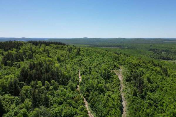
Flat Top Mountain
This winding path takes you from Holt Road southwest of Lake George through logging roads, and eventually a winding passage up the side of the Flat Top mountain. The path narrows as you climb up many boulders and very tight turns leading to the summit. Expect large ledges and boulders as well as mud...
Learn more about Flat Top Mountain
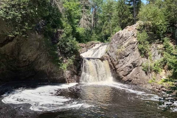
Gibson Falls Run
Entering from Hickey Road in West Waterville, you will find yourself on a snowmobile trail that's mostly rocky bottom. Passing many beaver ponds, the trail is fairly well maintained save for a dam right on the trail. The water is usually about 18 inches deep but with a rock bottom. When you get to t...
Learn more about Gibson Falls Run
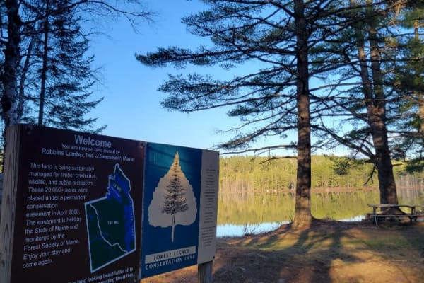
Oxhead Lakes Trail
This trail provides access to the Oxhead Ponds and a variety of other trails to be explored. The trail is dirt and wide enough for 2 vehicles to pass with ease. As a primary access road, it can be considered busy at times, but as a connector, it is a crucial part of other trails to be explored. Ther...
Learn more about Oxhead Lakes Trail

West to Oxhead Connector
This trail is a connector between the West Lake Southern Tip and Oxhead Lakes Trail. The trail is primarily a dirt road, with some sections that are more water saturated and could be evaluated during the spring or other wet times of the year. The trail is less developed than some of the other larger...
Learn more about West to Oxhead Connector
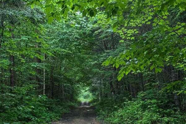
Coac Shortcut
This shortcut promises sooner relief from the climb back up from Coac Falls. Although there are a few bridges keep in mind that they are prone to having the trail washed out on either side of them and that they are designed to be level with compacted layers of snow on either end so there can be a 2....
Learn more about Coac Shortcut
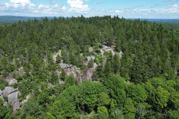
Green Hill Lookout
Visit the lookout above Green Hill Lake on this scenic ascent. Starting on Wiggins Mills Road you come up the backside of the mountain. This mountain trail has some steep inclines, narrow turns, and boulders jutting out of the trail along with narrowly cut deadfall. The cliff edge at the top is wort...
Learn more about Green Hill Lookout
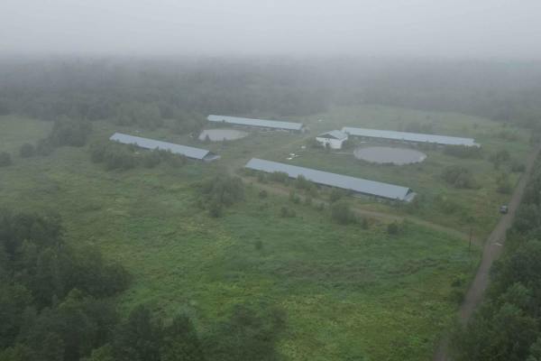
Deserted Pork Corridor
This is a quick way in or out of the forests south of Springfield, New Brunswick. Exiting Highway 615, you will find yourself passing some very large pork facilities that have been vacant for some time. The road is still groomed and graded, and a popular bypass to the more water-logged entrances nea...
Learn more about Deserted Pork Corridor
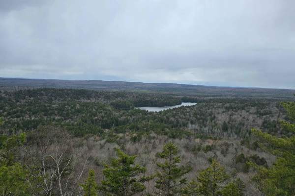
Ayers Lake Lookout
Drive up Route 104 near Millville, enter a logging road, and go straight at the intersection in the road. The road starts to get a little rough, then gets to a climb that is simple in a 4x4, to the lookout parking area. Once there must walk down a path to access the lookout
Learn more about Ayers Lake Lookout
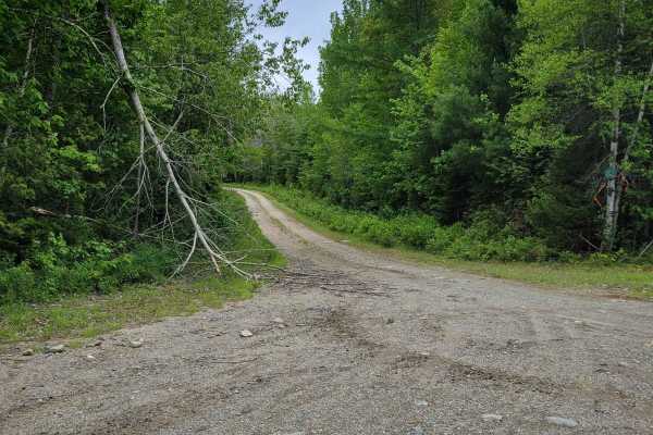
Brandy Pond West
This trail provides access to the western side of Brandy Pond. The trail is primarily dirt road, with some sections that are more water-saturated and could be evaluated during the spring or other wet times of the year. The trail is less developed than some of the other larger trails and is more acce...
Learn more about Brandy Pond West
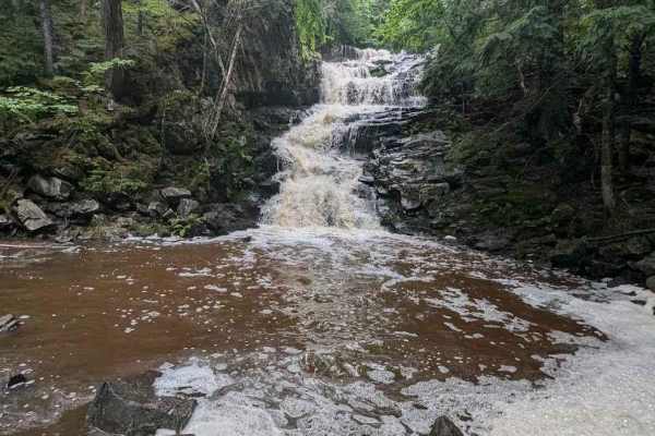
Old Springfield Pass
Beginning on the Old Springfield Road, this trail branches off through the wilderness, while mastering high centered echoes of a busy road turned into a goat path through thick forest. The wildlife is really active in this area, countless beaver dams line the track, as well as wandering deer and bla...
Learn more about Old Springfield Pass

Buffalo Stream East
This trail provides access to the eastern side of Buffalo Stream. The trail is primarily dirt/grass and is very narrow due to the soft white pine needles. Use caution as the narrowness of this trail may result in scratches on the vehicle. This trail dead ends at Buffalo Stream, where there used to b...
Learn more about Buffalo Stream East
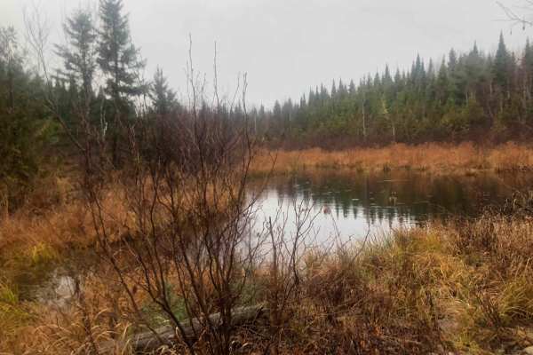
Old Zealand Road
This old logging road connects Zealand, New Brunswick with Greenhill Lake, New Brunswick, and can be traversed by any 4x4 truck or Jeep. The trail leads through the stunning forests of New Brunswick and features a winding dirt road with several hard-bottom water holes ranging from 5 to 10 inches in ...
Learn more about Old Zealand Road
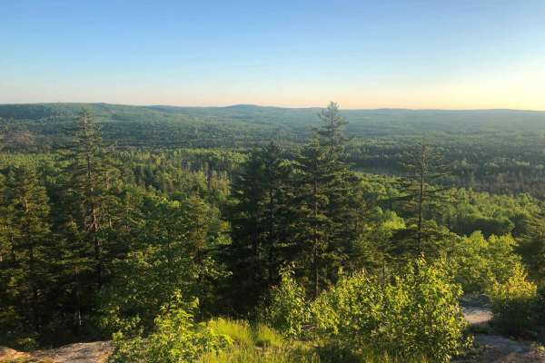
Greenhill Lookout - Hard Line
This is a very difficult trail up the backside of Greenhill Lake Mountain. This is the "Hard line" to take to the Greenhill Lake scenic overlook. It is primarily used as an ATV/OHV trail, however, it is open to all vehicles if you have the right skills and rig to do it. Although the trail is only ha...
Learn more about Greenhill Lookout - Hard Line

Millville Plane Crash
Heading west from Millville on the 104, you enter this trail through Becaguimac South Branch Road. It quickly turns into a track through Crowne woodlands. It is well maintained and very easy to traverse. This will eventually lead you to a plane crash from June 12, 1958. A plaque with information as ...
Learn more about Millville Plane Crash
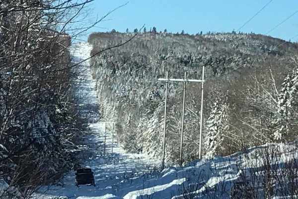
Hillbilly Hydro Line
This trail is open year-round to wheeled vehicles, although, in the winter, it can prove quite challenging due to the potential for deep snow. In the spring, summer, and fall, any 4x4 vehicle can make it through this trail; however, in winter, a winch and lockers may be necessary depending on how mu...
Learn more about Hillbilly Hydro Line
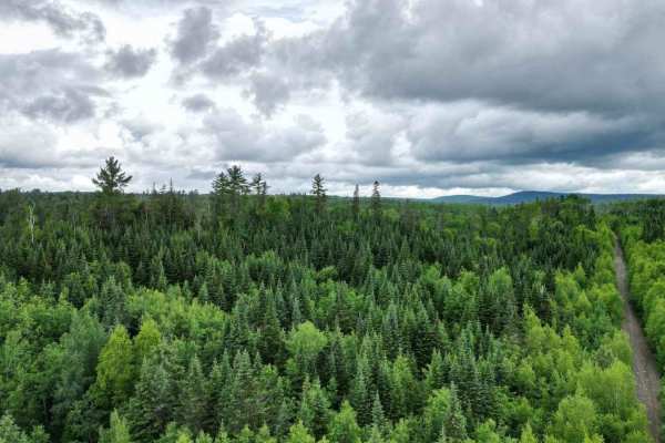
Upper Stone Ridge Winter Run
After Upper Stone Ridge Road dissolves into a dead end, this dirt road looks more like an ATV trail when you start. It leads into the managed snowmobile trail heading north in winter. Once you get through the first sandy hurtle, you can enjoy a solid and dry trail through deep woods. The Keswick Riv...
Learn more about Upper Stone Ridge Winter Run
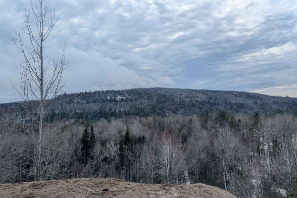
Upper Stone Ridge Easy Sand Pit
This pit trail is accessed towards the end of Upper Stone Ridge Road. The beginning of the trail has a small metal box on a stake in the ground, which is all that remains of the once active pit area. Heading north from here is a simple winding trail that ascends alongside the sandy material piles on...
Learn more about Upper Stone Ridge Easy Sand Pit
Zealand Sand Pits
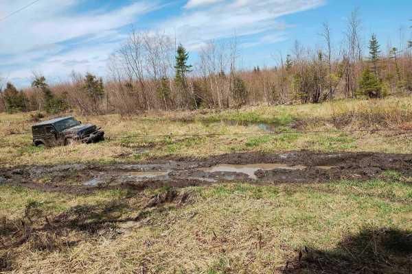
Starting across from the local Irving, you will find yourself on narrow passages mostly traveled by ATVs. The trail winds along the rim of an active pit after passing through some very sandy terrain. The end features a hydro line climb and some very deep mud. A winch is recommended.
Learn more about Zealand Sand Pits
Upper Stone Ridge Backend Pit
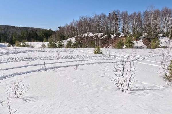
This pit is an access trail that continues past the Upper Stone Ridge Easy Sand Pit. After heading up the hill after a bend in the trail, there is an intersection of trails. Sticking to the left, you will enter an overgrown track going through an old logging area. The alders are quite young and have...
Learn more about Upper Stone Ridge Backend Pit
ATV trails near Danforth, Maine
Explore ATV-friendly trails near you. These trails are accessible for vehicles up to 50 inches wide, perfect for ATVs and smaller off-road machines.
Flat Top Hard Line
This is an alternative route to the ascent to Flat Top Mountain. It features some 20-inch-deep mud holes and a lot of off-camber washouts. While it will challenge your skill, it's not nearly as hard as the actual ascent. Be prepared and bring a chainsaw. The trail rejoins the main drag before the tu...
Learn more about Flat Top Hard Line
Flat Top Mountain
This winding path takes you from Holt Road southwest of Lake George through logging roads, and eventually a winding passage up the side of the Flat Top mountain. The path narrows as you climb up many boulders and very tight turns leading to the summit. Expect large ledges and boulders as well as mud...
Learn more about Flat Top Mountain
Gibson Falls Run
Entering from Hickey Road in West Waterville, you will find yourself on a snowmobile trail that's mostly rocky bottom. Passing many beaver ponds, the trail is fairly well maintained save for a dam right on the trail. The water is usually about 18 inches deep but with a rock bottom. When you get to t...
Learn more about Gibson Falls Run
Oxhead Lakes Trail
This trail provides access to the Oxhead Ponds and a variety of other trails to be explored. The trail is dirt and wide enough for 2 vehicles to pass with ease. As a primary access road, it can be considered busy at times, but as a connector, it is a crucial part of other trails to be explored. Ther...
Learn more about Oxhead Lakes Trail
UTV/side-by-side trails near Danforth, Maine
Find UTV and side-by-side trails near you. These trails accommodate vehicles up to 60 inches wide, ideal for UTVs, side-by-sides, and wider off-road rigs.
Flat Top Hard Line
This is an alternative route to the ascent to Flat Top Mountain. It features some 20-inch-deep mud holes and a lot of off-camber washouts. While it will challenge your skill, it's not nearly as hard as the actual ascent. Be prepared and bring a chainsaw. The trail rejoins the main drag before the tu...
Learn more about Flat Top Hard Line
Flat Top Mountain
This winding path takes you from Holt Road southwest of Lake George through logging roads, and eventually a winding passage up the side of the Flat Top mountain. The path narrows as you climb up many boulders and very tight turns leading to the summit. Expect large ledges and boulders as well as mud...
Learn more about Flat Top Mountain
Gibson Falls Run
Entering from Hickey Road in West Waterville, you will find yourself on a snowmobile trail that's mostly rocky bottom. Passing many beaver ponds, the trail is fairly well maintained save for a dam right on the trail. The water is usually about 18 inches deep but with a rock bottom. When you get to t...
Learn more about Gibson Falls Run
Oxhead Lakes Trail
This trail provides access to the Oxhead Ponds and a variety of other trails to be explored. The trail is dirt and wide enough for 2 vehicles to pass with ease. As a primary access road, it can be considered busy at times, but as a connector, it is a crucial part of other trails to be explored. Ther...
Learn more about Oxhead Lakes Trail
The onX Offroad Difference
onX Offroad combines trail photos, descriptions, difficulty ratings, width restrictions, seasonality, and more in a user-friendly interface. Available on all devices, with offline access and full compatibility with CarPlay and Android Auto. Discover what you're missing today!
Open Trail Map