
Dirt Bike Trails
Near Creola, Alabama
Explore All Dirt Bike Trails Near Creola, Alabama
Dirt Bike Trails Near Creola, Alabama
Discover the best dirt bike trails near you. Browse trail maps, check difficulty ratings, and find your next adventure — whether you're looking for a quick ride or an all-day expedition.
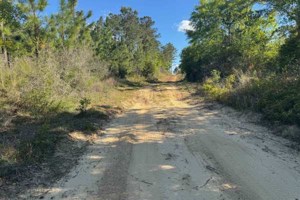
Duck Road Bypass
Bypass the Rocky Duck Road with an easy and scenic route through the coastal pine forests of South Alabama. Starts a little sandy, then moves to packed dirt. Most SUVs will have no issue on the trail. Has a nice overlook at the end. This trail will connect to Blue Lake Loop.
Learn more about Duck Road Bypass
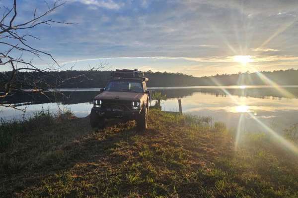
Peninsula Grove
Entering the trail will be a gate that should be unlocked depending on seasonal closures. Be sure to close the gate upon entering and leaving. The trail is mostly grassy with a few small ruts and a mixture of dirt and sand. Vehicles the size of a Jeep Cherokee or Toyota Rav 4 can fit down the trail ...
Learn more about Peninsula Grove
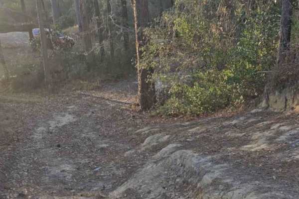
River Rat
This trail is short but technical. There is not very good cell service, but plenty of brush and trees to recover if necessary. There are also a few campsites along the short route. The campsites are big enough for 2 vehicles with the end opening up to a white sandy beach on a small river. There are ...
Learn more about River Rat
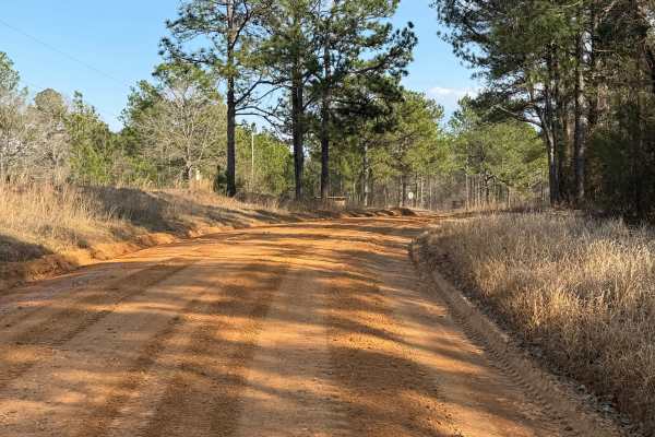
South Tank Trail - FS 35000
FS 35000 is a well-maintained 14-mile gravel road that runs east-west through the DeSoto National Forest. The road is well-traveled, with the western two-thirds running near/through the Mississippi National Guard's Camp Shelby Military Reservation. The eastern third offers a few easily accessible di...
Learn more about South Tank Trail - FS 35000
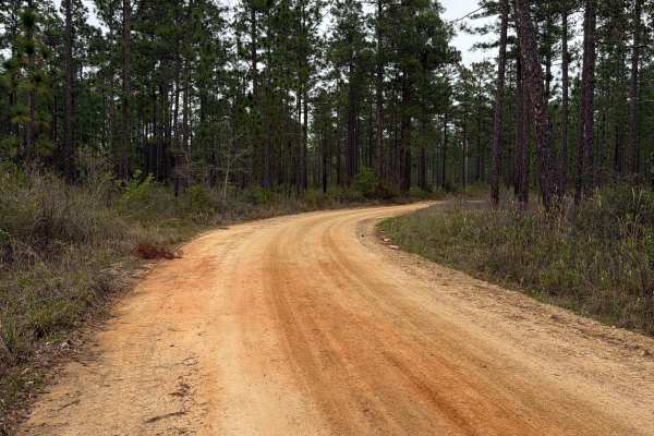
McDaniel Road
McDaniel Road connects Simmons Road at the north end and County Road 4 at the south end. It is a 2.5-mile-long road that takes you through the north-west part of the Blackwater River State Forest and gives you access to several trails and swimming spots along the Coldwater Creek District. The road c...
Learn more about McDaniel Road
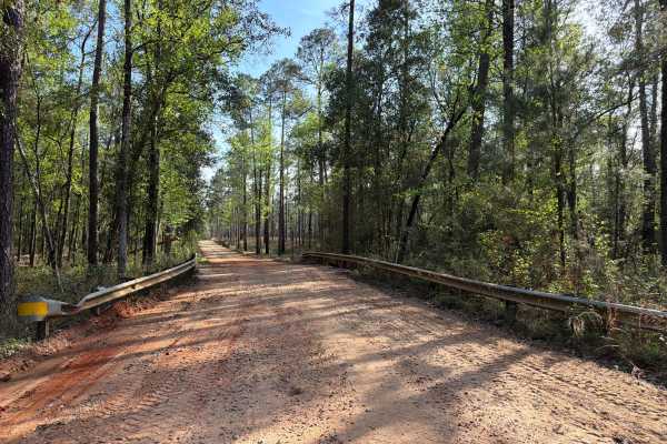
Three Notch Trail
The Three Notch Trail connects CR 191 at the north end and Buddy Hardy Road at the south end. It is a 14-mile-long road that takes you through the north-west part of the Blackwater River State Forest and gives you access to countless trails along the Coldwater Creek District and a natural spring. Th...
Learn more about Three Notch Trail
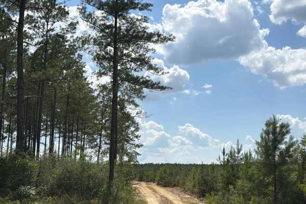
FS F16
Forest Road F16 connects Lee Hill Road at the east end and CR-191 at the west end. The trail takes you through the southwest part of the Blackwater River State Forest and gives you access to several trails in the area. The road conditions are a mixture of packed sand, loose sand, and some deep holes...
Learn more about FS F16
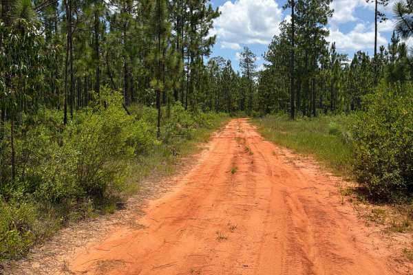
FS F10
Forest Road F10 connects FS F12 at the east end and CR-191 at the west end. The trail takes you through the southwest part of the Blackwater River State Forest and gives you access to several trails in the area. The road conditions are a mixture of packed sand, loose sand, some deep holes that can t...
Learn more about FS F10
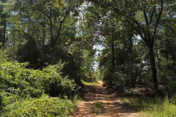
FS J2
Forest Road J 2 is a dead-end road that starts at Red Rock Road. The trail takes you through the southwest part of the Blackwater River State Forest. It gives you access to several trails in the area and follows the Mill Creek from the prairie into the forest. The road conditions are a mixture of pa...
Learn more about FS J2
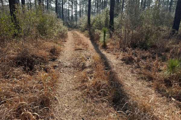
Right Branch - FS 308K
FS 308K is a short section of gravel road that leads to a pair of motorized use trails. The gravel portion is about a quarter of a mile long and is easily passable with any vehicle. The right branch, though mostly level, is more difficult due to downed trees and moderately deep mud holes. The mud ho...
Learn more about Right Branch - FS 308K
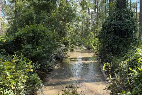
FS F7
Forest Road F7 is a dead-end road that starts at CR 191. The trail takes you through the southwest part of the Blackwater River State Forest along Pittman Creek. It gives you access to several trails in the area, a primitive campsite, and a few hiking trails to the Blackwater River. The road conditi...
Learn more about FS F7
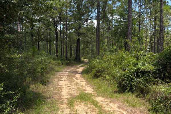
FS F8
Forest Road F 8 connects F 12 at the east end and CR-191 at the west end. The trail takes you through the southwest part of the Blackwater River State Forest and gives you access to several trails in the area. The road conditions are a mixture of packed sand, loose sand, some deep holes that can tur...
Learn more about FS F8
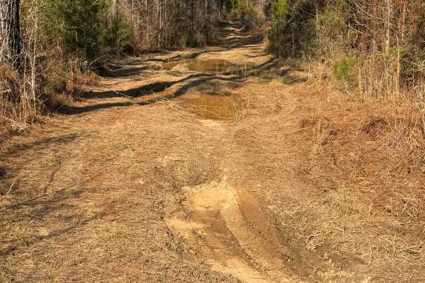
Left Branch - FS 308K
This is the left motorized use branch at the end of Forest Service Road 308K. It's an in-and-out trail about a mile long, with a nice distributed campsite area near the end. There are a few mud holes, 12 to 18 inches deep, some tight turns, and branches starting to encroach on the trail. Near the en...
Learn more about Left Branch - FS 308K
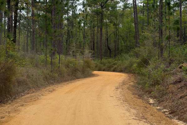
Simmons Road
Simmons Road connects Three Notch Trail at the east end and Mason West Road at the west end. It is a 6-mile-long road that takes you through the north-west part of the Blackwater River State Forest and gives you access to several trails along the Coldwater Creek District. The road conditions are a m...
Learn more about Simmons Road
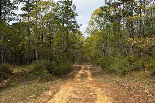
Jeff Capp Road - C133
Jeff Capp Road, also known as Forest Road C133 in the Blackwater River State Forest, connects Three Notch Trail at the west end and County Road 191 at the east end. It is a 2-mile-long road that takes you through the north-west part of the Blackwater River State Forest and gives you access to severa...
Learn more about Jeff Capp Road - C133
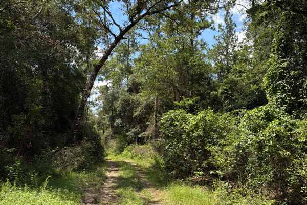
FS J4
Forest Road J4 is an access road that starts at Paulk Road. The trail takes you through the southwest part of the Blackwater River State Forest. It gives you access to several trails in the area and follows the Mill Creek from the prairie into the forest. The road conditions are a mixture of packed ...
Learn more about FS J4
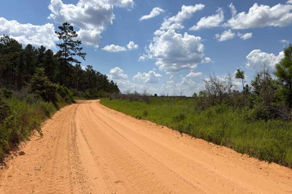
Paulk Road
Paulk Road is an access road that starts at Red Rock Road. The trail takes you through the southwest part of the Blackwater River State Forest. It gives you access to Forest Road J4. The road conditions are a mixture of packed sand, loose sand, and some deep holes that can turn into 1-foot-deep mud ...
Learn more about Paulk Road
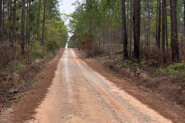
Coldwater Horse Trail
Coldwater Horse Trail connects Buddy Hardy Road at the west end and County Road 191 at the east end. It is a 4-mile-long road that takes you through the north-west part of the Blackwater River State Forest and gives you access to several trails along the Mason Branch District. The road conditions ar...
Learn more about Coldwater Horse Trail
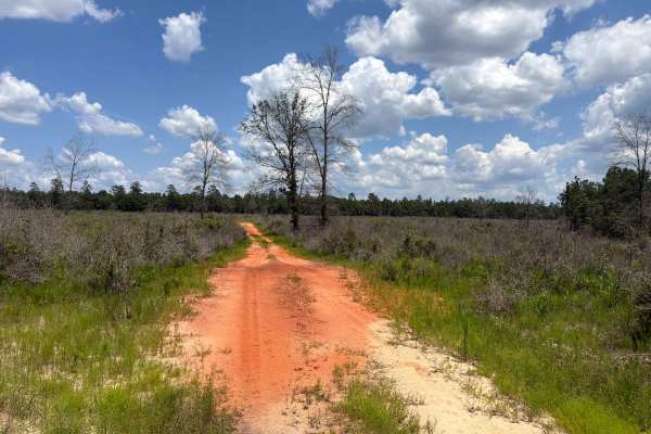
Prairie Trail
Prairie Trail is a short dead-end road that starts at Forest Road J 2. The trail takes you through the southwest part of the Blackwater River State Forest. It gives you access to the prairie in the forest. The road conditions are a mixture of packed sand, loose sand, and some deep holes that can tur...
Learn more about Prairie Trail
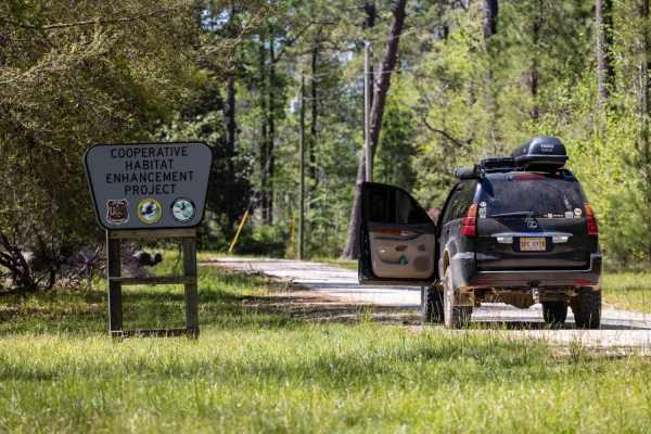
Ashe Lake Trail
This trail begins at Ashe Lake Recreational Area. The recreation area has a beautiful lake, walking trail, and working bathroom! As you begin this trail there you will see that it is easily 2 full-size vehicles wide. There is a public shooting range off of the north side of the road around .2 miles ...
Learn more about Ashe Lake Trail
ATV trails near Creola, Alabama
Explore ATV-friendly trails near you. These trails are accessible for vehicles up to 50 inches wide, perfect for ATVs and smaller off-road machines.
Duck Road Bypass
Bypass the Rocky Duck Road with an easy and scenic route through the coastal pine forests of South Alabama. Starts a little sandy, then moves to packed dirt. Most SUVs will have no issue on the trail. Has a nice overlook at the end. This trail will connect to Blue Lake Loop.
Learn more about Duck Road Bypass
Peninsula Grove
Entering the trail will be a gate that should be unlocked depending on seasonal closures. Be sure to close the gate upon entering and leaving. The trail is mostly grassy with a few small ruts and a mixture of dirt and sand. Vehicles the size of a Jeep Cherokee or Toyota Rav 4 can fit down the trail ...
Learn more about Peninsula Grove
River Rat
This trail is short but technical. There is not very good cell service, but plenty of brush and trees to recover if necessary. There are also a few campsites along the short route. The campsites are big enough for 2 vehicles with the end opening up to a white sandy beach on a small river. There are ...
Learn more about River Rat
South Tank Trail - FS 35000
FS 35000 is a well-maintained 14-mile gravel road that runs east-west through the DeSoto National Forest. The road is well-traveled, with the western two-thirds running near/through the Mississippi National Guard's Camp Shelby Military Reservation. The eastern third offers a few easily accessible di...
Learn more about South Tank Trail - FS 35000
UTV/side-by-side trails near Creola, Alabama
Find UTV and side-by-side trails near you. These trails accommodate vehicles up to 60 inches wide, ideal for UTVs, side-by-sides, and wider off-road rigs.
Duck Road Bypass
Bypass the Rocky Duck Road with an easy and scenic route through the coastal pine forests of South Alabama. Starts a little sandy, then moves to packed dirt. Most SUVs will have no issue on the trail. Has a nice overlook at the end. This trail will connect to Blue Lake Loop.
Learn more about Duck Road Bypass
Peninsula Grove
Entering the trail will be a gate that should be unlocked depending on seasonal closures. Be sure to close the gate upon entering and leaving. The trail is mostly grassy with a few small ruts and a mixture of dirt and sand. Vehicles the size of a Jeep Cherokee or Toyota Rav 4 can fit down the trail ...
Learn more about Peninsula Grove
River Rat
This trail is short but technical. There is not very good cell service, but plenty of brush and trees to recover if necessary. There are also a few campsites along the short route. The campsites are big enough for 2 vehicles with the end opening up to a white sandy beach on a small river. There are ...
Learn more about River Rat
South Tank Trail - FS 35000
FS 35000 is a well-maintained 14-mile gravel road that runs east-west through the DeSoto National Forest. The road is well-traveled, with the western two-thirds running near/through the Mississippi National Guard's Camp Shelby Military Reservation. The eastern third offers a few easily accessible di...
Learn more about South Tank Trail - FS 35000
The onX Offroad Difference
onX Offroad combines trail photos, descriptions, difficulty ratings, width restrictions, seasonality, and more in a user-friendly interface. Available on all devices, with offline access and full compatibility with CarPlay and Android Auto. Discover what you're missing today!
Open Trail Map