
Dirt Bike Trails
Near Conkling Park, Idaho
Explore All Dirt Bike Trails Near Conkling Park, Idaho
Dirt Bike Trails Near Conkling Park, Idaho
Discover the best dirt bike trails near you. Browse trail maps, check difficulty ratings, and find your next adventure — whether you're looking for a quick ride or an all-day expedition.
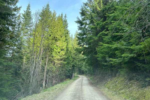
Carlin Creek/Carrill Ridge
This is a very nice easy drive through some beautiful thick forest. The road is mostly wide enough for easy passing and is mostly smooth. There are good views of the valleys and the rest of the mountain range. This is a great alternate route from Harrison to Carlin Bay for 4-wheel vehicles as well a...
Learn more about Carlin Creek/Carrill Ridge

Beauty Bay/Harrison
This is an easy backcountry route between Harrison and Beauty Bay. The route takes you through lots of dense forest and cedars with filtered views into the Rose Lake area. This route can be done with any type of vehicle as it is on well-maintained FS roads.
Learn more about Beauty Bay/Harrison
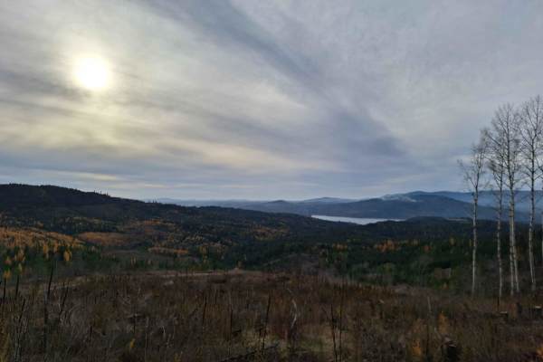
Mount Coeur d'Alene (439)
Mount Coeur d'Alene (439) is a single-width road that begins off East Burma Road and heads east up Mount Coeur d'Alene. After the peak of Mount Coeur d'Alene, it continues towards Red Horse Mountain, ending near Beauty Saddle at a large 4-way intersection with plenty of room to park and some breatht...
Learn more about Mount Coeur d'Alene (439)

Kalarney Lake to 4th of July
This is a very nice route through the mountains from the Rose Lake area to the top of 4th of July Pass. The climb out of Kalarney Lake has some amazing views of the small lakes on the valley floor. Once you cross over the ridge, you are greeted by great views of the surrounding mountains. The road ...
Learn more about Kalarney Lake to 4th of July

Beauty Creek Divide Trail
The Beauty Creek Divide Trail is southeast of the city of Couer d'Alene. The trail has multiple viewpoints of the mouth of the Couer d'Alene River. There are a couple of dispersed camp sights and wide pullouts to allow other users to get by. there are some rutty areas and steep cliffside sections. R...
Learn more about Beauty Creek Divide Trail
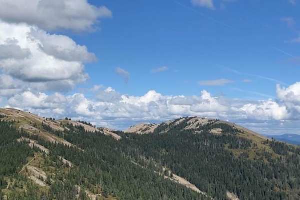
Saint Joe Baldy
If you're in search of breathtaking vistas that stretch as far as the eye can see, look no further than these magnificent trails. Nestled amidst nature's beauty, these paths offer an opportunity to connect with the great outdoors while taking in some of the most stunning panoramic views nature has t...
Learn more about Saint Joe Baldy
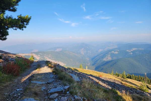
Twin Crags Road
Twin Crags Road is a moderate gravel and rock road in the St. Joe Mountains south of Cataldo, Idaho. This route is primarily on BLM and IDL land, with sections that are owned by various logging companies. This is the highest point you can drive to in Kootenai County. The road becomes overgrown for a...
Learn more about Twin Crags Road

Beauty-Cedar (1575)
This road starts out fairly easy but is progressively more challenging as you get deeper into the woods. If you can make it at least halfway, you'll be rewarded with a few breathtaking views of Lake Coeur d'Alene and other nearby mountains. Pay attention to the drive as these views are fleeting! Roa...
Learn more about Beauty-Cedar (1575)
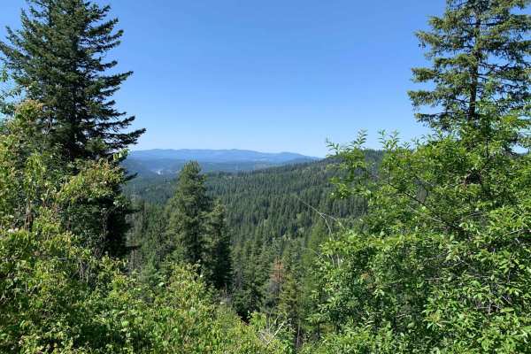
Marie Saddle (413)
Marie Saddle (413) takes you into the Coeur d'Alene National Forest from the Fourth of July Pass area. The road is a fairly easy climb and in decent shape in the summer and fall. This is one of many "entrances" into the Coeur d'Alene National Forest and will lead you to a network of several other tr...
Learn more about Marie Saddle (413)
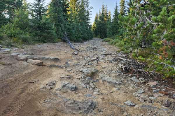
St. Joe Divide Access
The St. Joe Divide Access Road is a steep, brief, and rocky offshoot road from the Twin Crags road that gives access to the St. Joe Divide ridge line motorcycle trail. The rocks on the road are sharp and must be traversed with care. The most southern tip of the road is the ridge line access point, t...
Learn more about St. Joe Divide Access
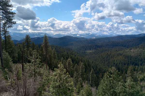
4th July - Copper Creek - 3097
This route starts out from the 4th of July Pass recreation parking lot and takes you through Curran Saddle over to Marie Saddle Road #412. From there, it's just 2.3 miles back to North Fork Coeur d'Alene River #209, which is a main route back towards town or I-90. This is one of many entrances to g...
Learn more about 4th July - Copper Creek - 3097
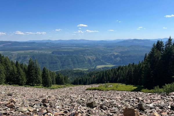
Cataldo to St. Joe Baldy
This is a nice, easy route from Cataldo to the top of St. Joe Baldy. There are 2 different hiking trails on the route that take you to Crystal Lake. The last mile or so becomes very exposed and rocky, but at the top, you can see up and down the St. Joe River for miles.
Learn more about Cataldo to St. Joe Baldy
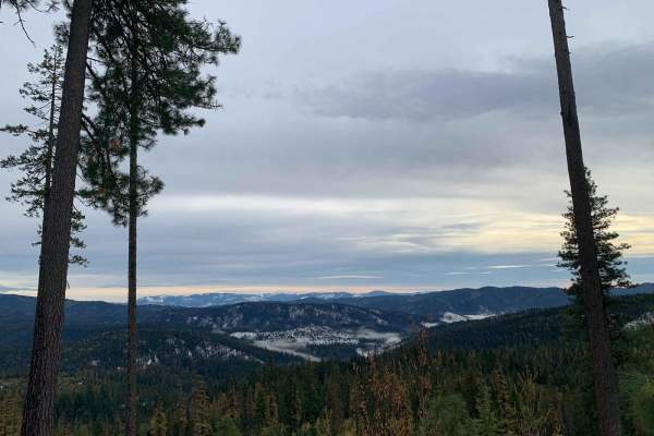
Blue Creek (499)
This route travels north through the Coeur d'Alene National Forest, just north of the Wolf Lodge area. It begins at Meyers Saddle and ends at Fernan Saddle, which is a large staging area with ample parking and a few intersecting trails. The road is a fairly easy climb and in decent shape. This is on...
Learn more about Blue Creek (499)
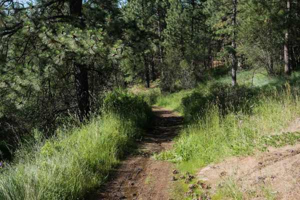
Straight Shot
This is a gradual and easy ATV route running north from the southern boundary of the ORV park. It begins as a wide, dry, and dusty path that traverses grassy slopes and sparse pine forest, maintaining a fairly straight and level course with only minor elevation changes. The trail is well-suited for ...
Learn more about Straight Shot
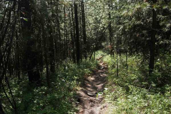
Trough Line
This trail feels more like single-track and is best suited for dirt bikes, though narrow ATVs may still get through. It's deeply troughed with uneven terrain and natural little drop-offs scattered throughout. Some loose rocks are present, and grassy sections are crisscrossed with rutted split lines....
Learn more about Trough Line
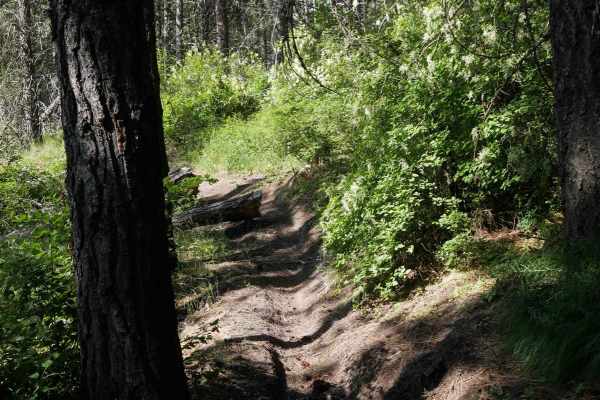
Rocky
This trail begins at the southern boundary with a wide, easy, and flowy path that weaves through open meadows, grassy hillsides, and sparse pine forest. It quickly narrows in places between trees, making it more of a dirt bike trail, and includes some flat embedded rock faces and light rutting. Afte...
Learn more about Rocky
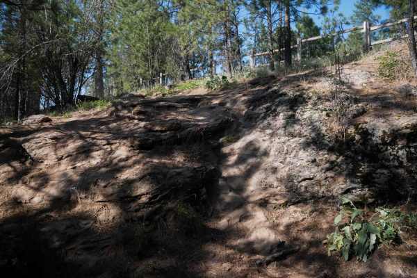
East Boundary (More Difficult)
This is a steep and challenging half-mile-long route that begins with a loose, steep climb full of rock faces and split lines that are narrow and rutted, leading up to the park's fence line on the eastern boundary of the ORV park. The trail goes south along the fence line, with a big optional rock o...
Learn more about East Boundary (More Difficult)
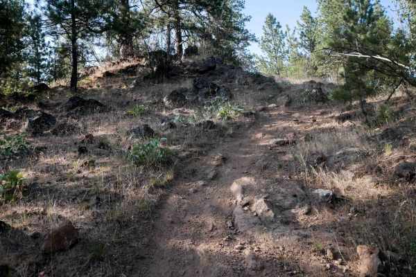
Lake View
This is a 0.7-mile route that offers a wide path with scenic views of the lake and a mix of moderately challenging terrain. It begins on the east side of the ORV park with a steep descent away from the fence line, featuring embedded rock, root bands, and a few unmarked intersections. It is consisten...
Learn more about Lake View
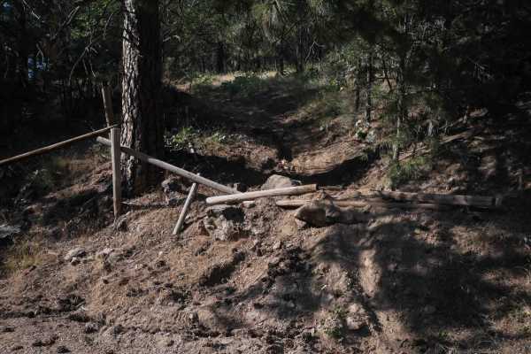
Fence Run
This trail runs across the ORV park from the west to east boundary, fenced in on both sides. Starting on the west side, the trail follows a moderately challenging path through forested terrain with embedded rock, a few steep sections, and occasional narrow spots, along with views of the lake. In the...
Learn more about Fence Run
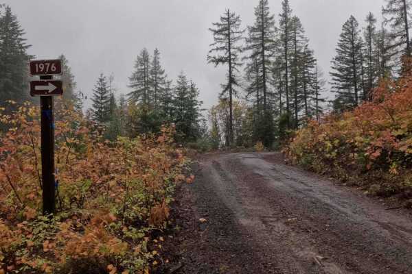
Hill Creek - FS 1976
1976 Hill Creek is a 1.9-mile out-and-back trail that starts at 377 Palouse Divide West, climbing around the west and north side of West Dennis, before ending at the border of PotlachDeltic timberland, where the trail becomes restricted to 50-inch and under OHVs. Hill Creek has recently had logging ...
Learn more about Hill Creek - FS 1976
ATV trails near Conkling Park, Idaho
Explore ATV-friendly trails near you. These trails are accessible for vehicles up to 50 inches wide, perfect for ATVs and smaller off-road machines.
Carlin Creek/Carrill Ridge
This is a very nice easy drive through some beautiful thick forest. The road is mostly wide enough for easy passing and is mostly smooth. There are good views of the valleys and the rest of the mountain range. This is a great alternate route from Harrison to Carlin Bay for 4-wheel vehicles as well a...
Learn more about Carlin Creek/Carrill Ridge
Beauty Bay/Harrison
This is an easy backcountry route between Harrison and Beauty Bay. The route takes you through lots of dense forest and cedars with filtered views into the Rose Lake area. This route can be done with any type of vehicle as it is on well-maintained FS roads.
Learn more about Beauty Bay/Harrison
Mount Coeur d'Alene (439)
Mount Coeur d'Alene (439) is a single-width road that begins off East Burma Road and heads east up Mount Coeur d'Alene. After the peak of Mount Coeur d'Alene, it continues towards Red Horse Mountain, ending near Beauty Saddle at a large 4-way intersection with plenty of room to park and some breatht...
Learn more about Mount Coeur d'Alene (439)
Kalarney Lake to 4th of July
This is a very nice route through the mountains from the Rose Lake area to the top of 4th of July Pass. The climb out of Kalarney Lake has some amazing views of the small lakes on the valley floor. Once you cross over the ridge, you are greeted by great views of the surrounding mountains. The road ...
Learn more about Kalarney Lake to 4th of July
UTV/side-by-side trails near Conkling Park, Idaho
Find UTV and side-by-side trails near you. These trails accommodate vehicles up to 60 inches wide, ideal for UTVs, side-by-sides, and wider off-road rigs.
Carlin Creek/Carrill Ridge
This is a very nice easy drive through some beautiful thick forest. The road is mostly wide enough for easy passing and is mostly smooth. There are good views of the valleys and the rest of the mountain range. This is a great alternate route from Harrison to Carlin Bay for 4-wheel vehicles as well a...
Learn more about Carlin Creek/Carrill Ridge
Beauty Bay/Harrison
This is an easy backcountry route between Harrison and Beauty Bay. The route takes you through lots of dense forest and cedars with filtered views into the Rose Lake area. This route can be done with any type of vehicle as it is on well-maintained FS roads.
Learn more about Beauty Bay/Harrison
Mount Coeur d'Alene (439)
Mount Coeur d'Alene (439) is a single-width road that begins off East Burma Road and heads east up Mount Coeur d'Alene. After the peak of Mount Coeur d'Alene, it continues towards Red Horse Mountain, ending near Beauty Saddle at a large 4-way intersection with plenty of room to park and some breatht...
Learn more about Mount Coeur d'Alene (439)
Kalarney Lake to 4th of July
This is a very nice route through the mountains from the Rose Lake area to the top of 4th of July Pass. The climb out of Kalarney Lake has some amazing views of the small lakes on the valley floor. Once you cross over the ridge, you are greeted by great views of the surrounding mountains. The road ...
Learn more about Kalarney Lake to 4th of July
The onX Offroad Difference
onX Offroad combines trail photos, descriptions, difficulty ratings, width restrictions, seasonality, and more in a user-friendly interface. Available on all devices, with offline access and full compatibility with CarPlay and Android Auto. Discover what you're missing today!
Open Trail Map