
Dirt Bike Trails
Near Chical, New Mexico
Explore All Dirt Bike Trails Near Chical, New Mexico
Dirt Bike Trails Near Chical, New Mexico
Discover the best dirt bike trails near you. Browse trail maps, check difficulty ratings, and find your next adventure — whether you're looking for a quick ride or an all-day expedition.
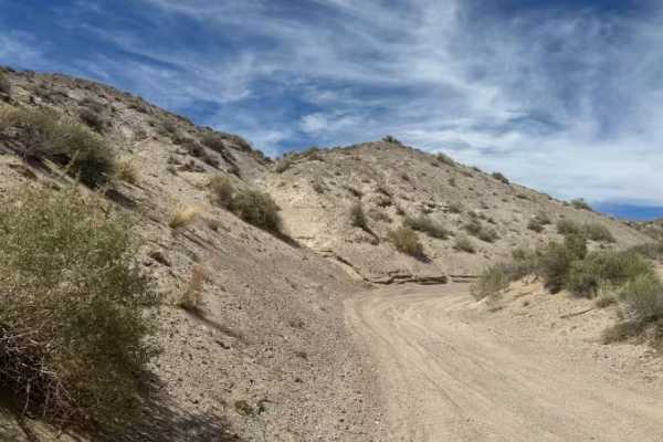
Center of the Earth
Center of the Earth is a quick technical sand section featuring deep sand and tight turns. This trail requires careful throttle control and maintaining momentum through softer and deeper areas. This runs at the base of the canyons and has some off-camber areas. It is a fun challenge for vehicles equ...
Learn more about Center of the Earth
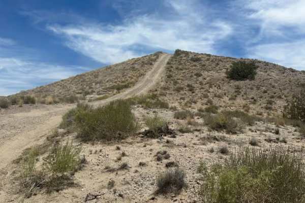
Above Earth
This scenic ridge-top trail features rolling ups and downs, hill climbs, and multiple offshoots leading down both sides of the hills. Terrain includes sections of light sand (around 4 inches deep) and varied elevation changes. The trail includes a long descent that connects to the Edge of the Earth ...
Learn more about Above Earth
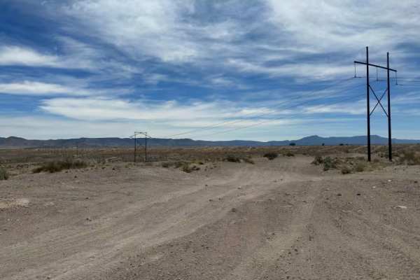
Top Of The World
This scenic ridge-top trail with wide views and mostly consistent elevation features some minor ruts but is generally smooth along the top of the hills. Multiple offshoots branch down both sides of the hills, offering access to different routes and obstacles. The trail ends at an area with multiple ...
Learn more about Top Of The World
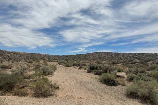
Earth Wash
Earth Wash Trail features sand sections where maintaining momentum can be important. A portion of the route is blocked, but following the mapped trail avoids the blocked portion and instead leads to an old water tank and back to the other trails and hills in the area. Mostly a sandy exploration rout...
Learn more about Earth Wash
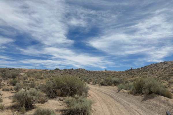
Through Mars
This is a river wash trail featuring deeper sand sections, winding turns, and gradual hill climbs near the end. The route runs along the bottom of two small hills with changing terrain throughout. Located in the Montessa OHV Park area and suitable for vehicles prepared for sandy conditions. "Big Dig...
Learn more about Through Mars
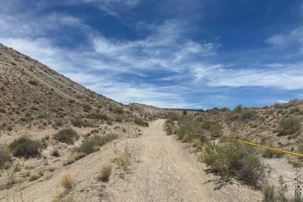
Edge of the Earth
This trail is a roller-coaster-style trail with constant ups and downs over small hills, deep ruts, and sandy terrain. Minimum 33-inch tires recommended due to the uneven terrain and deeper sand sections. Lockers are not required. The trail is mostly manageable until you drop into the wash, where a ...
Learn more about Edge of the Earth
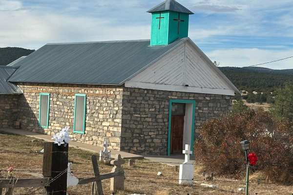
Fourth of July Campground
This route leads to the premier area to see the Big Tooth Maple in the Manzano Mountains. It is the largest stand of maples in New Mexico. The road is easy but narrow in spots. Camping is available from April through November for tents and tent trailers. There is also a parking area for some short h...
Learn more about Fourth of July Campground
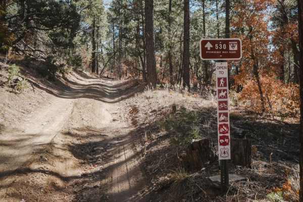
530 Road
530 Road is an old dirt road that is closed to motor vehicles other than motorcycles. It's super easy the whole way, being a smooth dirt road with only a couple of spots where there is flat embedded rock slab. The east end starts at the Mars Court Trailhead with space for horse trailers and several ...
Learn more about 530 Road
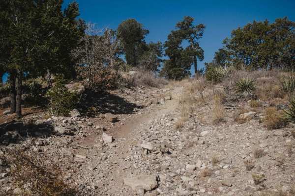
106 Road
106 Road is a dirt bike trail in the Manzanita Mountain Trail System near Albuquerque, New Mexico. It runs south to north and is a quick way to connect the southern trails to ones farther north. The southern half of the trail is a mix of old road and single track. There are rocky spots with tons of ...
Learn more about 106 Road
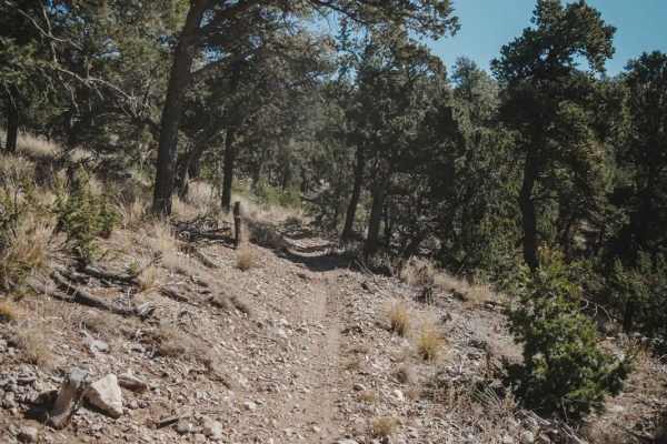
West Boundary
West Boundary is an easy single track in the Manzanita Mountain Trail System that goes north to south along the west boundary of this OHV area in the Cibola National Forest. The land on the west side of this trail belongs to the US Air Force, and there are signs every 50 feet stating not to enter be...
Learn more about West Boundary
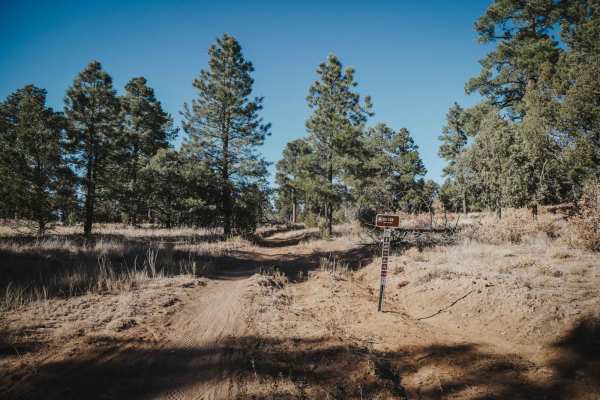
Drop In
Drop In is a fast and easy single track in the Manzanita Mountain Trail System by Albuquerque, New Mexico. This trail starts and ends off of 106 Road, which is also easy. It has fast sections on smooth dirt, and a few sections with some chunky rock, but has no big ledges or obstacles. It goes throug...
Learn more about Drop In
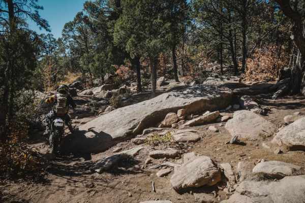
Cajun Pine
Cajun Pine is an easy trail in the Cibola National Forest near Albuquerque, New Mexico. For the most part, it's easy, with a few spots of embedded rock slabs, loose rocks, and small ledges. The south end is pretty full of loose chunky rocks and tight curves through the pine trees. It intersects with...
Learn more about Cajun Pine
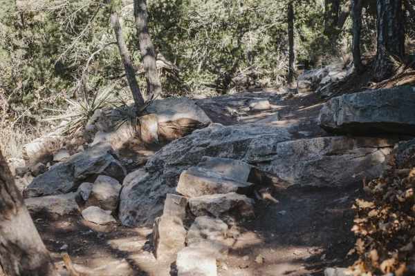
Gnasty W/AG
Gnasty W/AG is an intermediate single track with several rocky obstacles. It climbs up from the south end of Otero Canyon to meet back up with the Blue Ribbon trail. It's a steady climb, only gaining 220 feet of elevation. It has a steady flow of loose rocks though. The trail is narrow as it climbs ...
Learn more about Gnasty W/AG
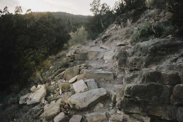
Birdhouse Ridge
Birdhouse Ridge is an intermediate trail in the Cibola National Forest that gains 650 feet over 2.7 miles as it heads south. It starts at the Tunnel Trailhead off State Highway 337 and continues as a very curvy, narrow, shelfy trail with difficult rock obstacles. There are lots of rocky sections wit...
Learn more about Birdhouse Ridge
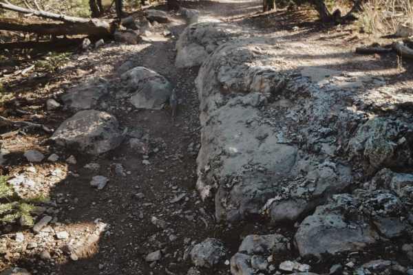
West Ridge
West Ridge is a 2.6-mile single track in the Manzanita Mountain Trail System near Albuquerque, New Mexico. The south end starts at the intersection with Otero Canyon and heads north. It starts on the south end by climbing up a few easy switchbacks. The switchbacks themselves aren't hard, but there a...
Learn more about West Ridge
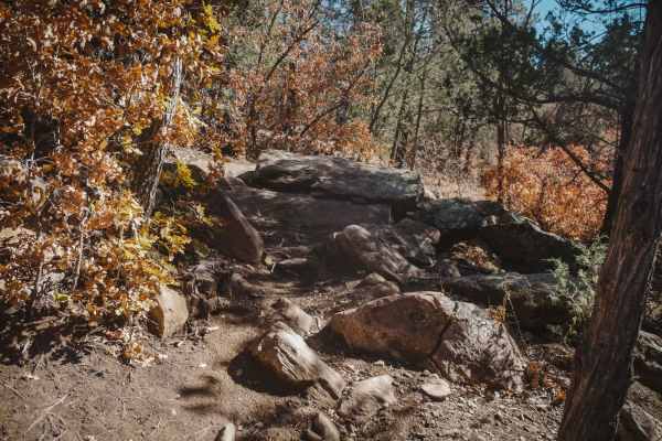
Southern Crossing
Southern Crossing is an intermediate single track that connects the east and west portions of the Manzanita Mountain trail system. The east end starts off super easy before crossing State Highway 337. Be careful crossing the highway because cross traffic does not stop. The trail picks up again direc...
Learn more about Southern Crossing
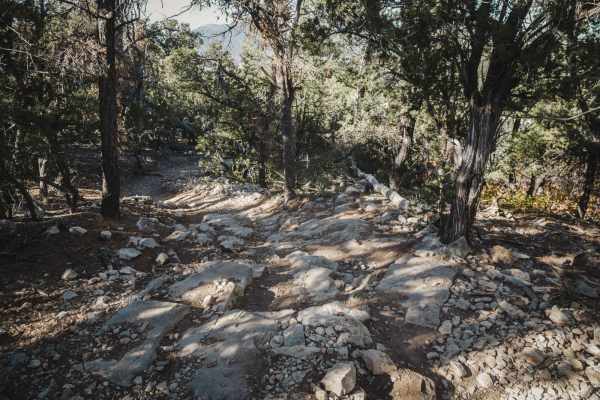
Blue Ribbon
The Blue Ribbon single track is a 2.5-mile trail in the Manzanita Mountain Trail System that starts on the north end near the Otero Trailhead. The south end starts off of 106 Road. Going south to north, it starts on top of a ridgeline and drops off the side of the hill with some side-hilling and sev...
Learn more about Blue Ribbon
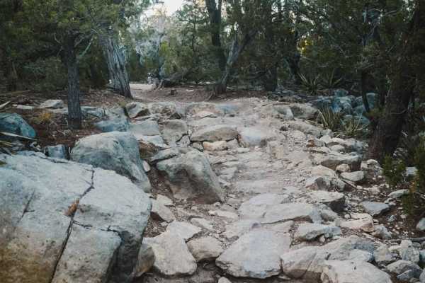
Tunnel
Tunnel is a 2.6-mile-long single track in the Manzanita Mountain Trail System. It is accessed either from the Tunnel Trailhead or Otero Trailhead off State Highway 337, south of the town of Tijeras, New Mexico. The trail is full of tight curves, switchbacks, and rock obstacles. The south end is pret...
Learn more about Tunnel

Otero Canyon
Otero Canyon is a really fun and easy trail in the Manzanita Mountain Trail System by Albuquerque, New Mexico. This one is scenic, fast, and flowy, with a few rocky sections. It starts from the north at the Otero Trailhead, which is a big pull-off on Highway 337 with space for lots of vehicles. You ...
Learn more about Otero Canyon
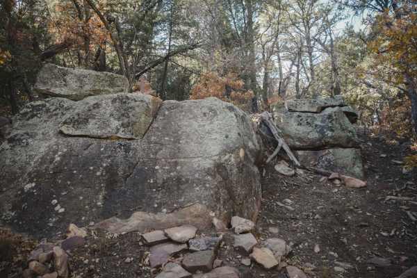
Three Bottles
Three Bottles is the hardest trail in the Manzanita Mountain Trail System near Albuquerque, New Mexico. This trail is best for running south to north, as it goes through several huge rock problems that are marked as directional in the south-to-north direction. The main trail is made up of lots of mo...
Learn more about Three Bottles
ATV trails near Chical, New Mexico
Explore ATV-friendly trails near you. These trails are accessible for vehicles up to 50 inches wide, perfect for ATVs and smaller off-road machines.
Center of the Earth
Center of the Earth is a quick technical sand section featuring deep sand and tight turns. This trail requires careful throttle control and maintaining momentum through softer and deeper areas. This runs at the base of the canyons and has some off-camber areas. It is a fun challenge for vehicles equ...
Learn more about Center of the Earth
Above Earth
This scenic ridge-top trail features rolling ups and downs, hill climbs, and multiple offshoots leading down both sides of the hills. Terrain includes sections of light sand (around 4 inches deep) and varied elevation changes. The trail includes a long descent that connects to the Edge of the Earth ...
Learn more about Above Earth
Top Of The World
This scenic ridge-top trail with wide views and mostly consistent elevation features some minor ruts but is generally smooth along the top of the hills. Multiple offshoots branch down both sides of the hills, offering access to different routes and obstacles. The trail ends at an area with multiple ...
Learn more about Top Of The World
Earth Wash
Earth Wash Trail features sand sections where maintaining momentum can be important. A portion of the route is blocked, but following the mapped trail avoids the blocked portion and instead leads to an old water tank and back to the other trails and hills in the area. Mostly a sandy exploration rout...
Learn more about Earth Wash
UTV/side-by-side trails near Chical, New Mexico
Find UTV and side-by-side trails near you. These trails accommodate vehicles up to 60 inches wide, ideal for UTVs, side-by-sides, and wider off-road rigs.
Center of the Earth
Center of the Earth is a quick technical sand section featuring deep sand and tight turns. This trail requires careful throttle control and maintaining momentum through softer and deeper areas. This runs at the base of the canyons and has some off-camber areas. It is a fun challenge for vehicles equ...
Learn more about Center of the Earth
Above Earth
This scenic ridge-top trail features rolling ups and downs, hill climbs, and multiple offshoots leading down both sides of the hills. Terrain includes sections of light sand (around 4 inches deep) and varied elevation changes. The trail includes a long descent that connects to the Edge of the Earth ...
Learn more about Above Earth
Top Of The World
This scenic ridge-top trail with wide views and mostly consistent elevation features some minor ruts but is generally smooth along the top of the hills. Multiple offshoots branch down both sides of the hills, offering access to different routes and obstacles. The trail ends at an area with multiple ...
Learn more about Top Of The World
Earth Wash
Earth Wash Trail features sand sections where maintaining momentum can be important. A portion of the route is blocked, but following the mapped trail avoids the blocked portion and instead leads to an old water tank and back to the other trails and hills in the area. Mostly a sandy exploration rout...
Learn more about Earth Wash
The onX Offroad Difference
onX Offroad combines trail photos, descriptions, difficulty ratings, width restrictions, seasonality, and more in a user-friendly interface. Available on all devices, with offline access and full compatibility with CarPlay and Android Auto. Discover what you're missing today!
Open Trail Map