
Dirt Bike Trails
Near Cass City, Michigan
Explore All Dirt Bike Trails Near Cass City, Michigan
Dirt Bike Trails Near Cass City, Michigan
Discover the best dirt bike trails near you. Browse trail maps, check difficulty ratings, and find your next adventure — whether you're looking for a quick ride or an all-day expedition.
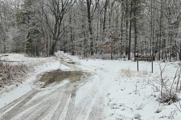
Old Sand Road
As the name implies, this is a sandy trail located primarily on public ground. This is the closest thing to a "trail" in Huron County. There are several whooped-out areas that require moderate ground clearance to pass without bottoming out. Most of the trail is dry, unless a recent rain event has oc...
Learn more about Old Sand Road
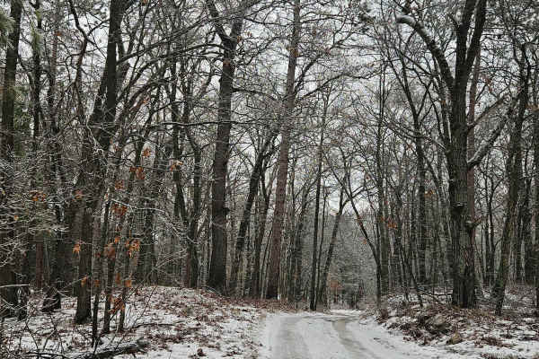
Rush Lake Access
This is a primarily sand two-track that leads back to the public access site of Rush Lake. The trail itself is passable with a vehicle having moderate ground clearance. There are some small holes along the way, but no major water holes on the trail itself. The area is all public land with rustic cam...
Learn more about Rush Lake Access
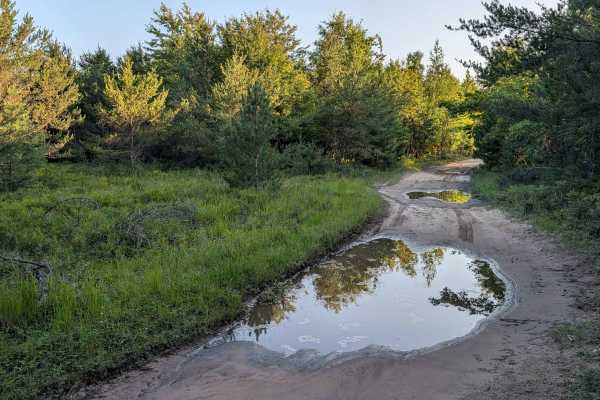
The Flats Trail
This Trail is a spur off Michigan Road with one shallow water hole after another. The deepest ran about 18 inches, but the average was about 12 inches; all have pretty solid bottoms. The trail maintains a minimum of one full-size vehicle wide. Explorers will find a handful of open areas big enough...
Learn more about The Flats Trail
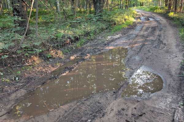
Stelmach Trail
This Trail is an out-and-back trail that no longer connects to Steimech Road at the south. Even though this Trail isn't going anywhere specific, it will still make for a good time. The dead end at the south end is in a wooded area that is a wetland. With that said, along the way you will find mult...
Learn more about Stelmach Trail
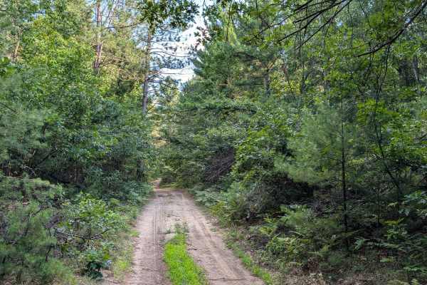
Walker Spur Trail
This track takes you off the seasonal Rd into the forest & back again. The trail width remains at least 1 full-size vehicle wide the entire way. Drivers will find a few slight elevation changes as they travel. They will also see many areas that could be used for small dispersed campsites. As well a...
Learn more about Walker Spur Trail
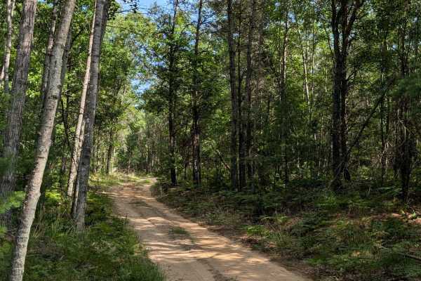
Plains Creek Trail
This track is a very enjoyable one that takes you between Knight Road and Main Street. If you're looking for an engaging ride through Michigan nature, this trail is for you. The trail's vegetation is very well maintained & is easily passable with any full-sized vehicle. The terrain is packed sand...
Learn more about Plains Creek Trail
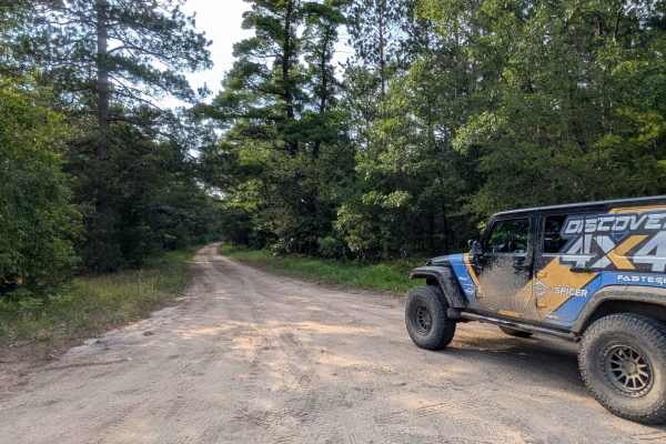
FS 4401
This forest road near Tawas provides a convenient connection between Plank Road and FS 4402, passing through mature forest to the south and younger growth to the north. The route consists of hard-packed sand and remains wide enough for two vehicles throughout, making for an easy drive. Unfortunately...
Learn more about FS 4401
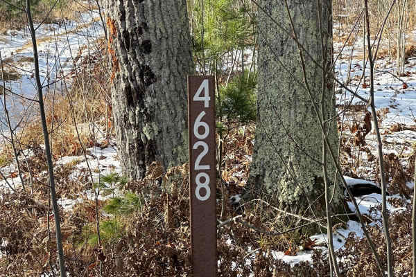
FS 4628
FS 4628 is a tight and twisty two track that takes you through the Huron National Forest. The trail has had some logging but is mostly made up of pines and hardwood. FS 4628 ends at FS 4512. FS 4512 is another trail that you can enjoy while exploring in this area. Remember to stay on the trails and ...
Learn more about FS 4628
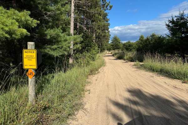
FS 4666-4663
This is a short, very easy but narrow trail that connects Monument Road with FS 4401. It goes through a typical Michigan forest area with trees all around and a loose sandy surface. It's mostly flat except for a small uphill but should be passable by any 4WD vehicle and when dry, most 2WD with good ...
Learn more about FS 4666-4663
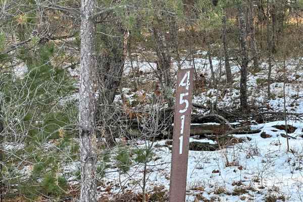
FS 4511 Loop
FS 4511 Loop is a two-track with a mix of pine and hardwood. This trail is part of the Huron National Forest. FS 4511 Loop connects with FS 4410, completing the loop. Both trails are mostly solid, but you could encounter some soft sand and water holes with mud. Please stay on the trail and follow th...
Learn more about FS 4511 Loop
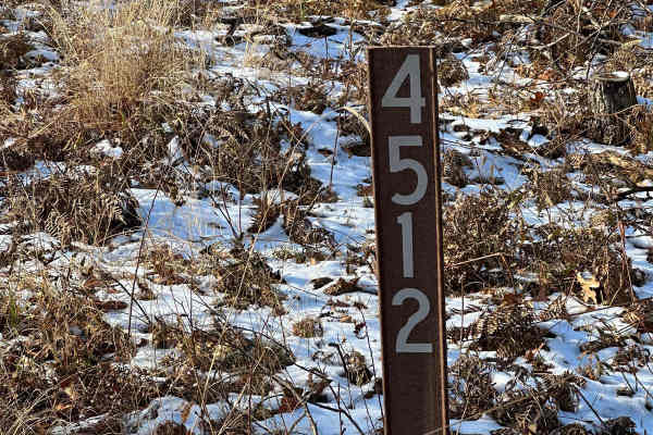
FS 4512
FS 4512 is a two-track with a mix of pine and hardwood. This trail is part of the Huron National Forest. FS 4512 trail is mostly solid with patches of soft sand. The trail is south of the Corsair Wrights Lake Cross Country ski trailhead where you can hike or cross-country ski in the winter.
Learn more about FS 4512
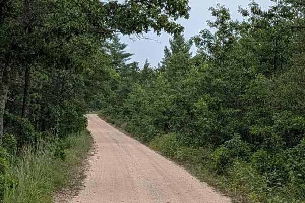
Brownell Road - FS 4510
This forest road is in the Huron National Forest and has a gravel base. There are very little elevation changes on the actual trail, but there are some nice rolling hills off to the side. This makes for a nice scenic drive. The trail is well maintained and is two vehicles wide.
Learn more about Brownell Road - FS 4510
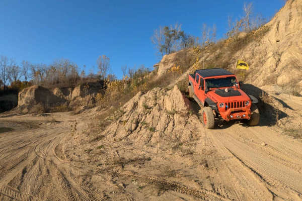
The Fish Bowl
This is an easy trail that loops around the wall edge of the open riding area in the far back corner of the park. The open riding area can be very mucky if it's been raining. This would be a good challenge for those who like to play in the mud.
Learn more about The Fish Bowl
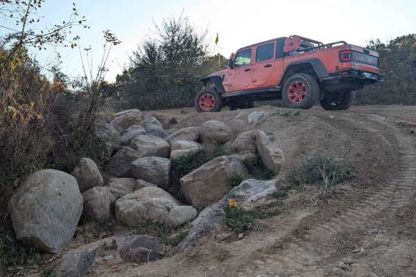
The Highway
This trail starts in the Northwest Corner area or off of West Side Drive. It is a multi-directional trail that runs through the trees with a couple of hills. If you're a full-size vehicle and like your paint job, this is not the trail for you. Expect some of that good ol' Michigan pinstriping. There...
Learn more about The Highway
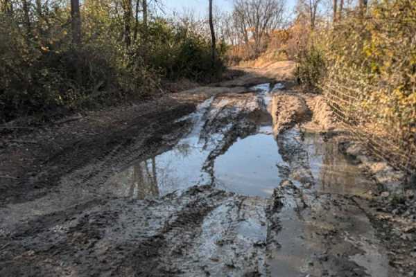
Mine View Trail
This trail is an in-and-out trail. Use caution at the end, there is a severe drop-off that is unpassable. There is also a good-sized mud hole that could be very very deep if it's been wet. We drove this trail when it was very dry and the mud hole still looked very deep and mucky.
Learn more about Mine View Trail
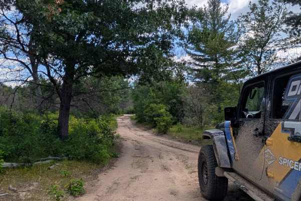
Cranberry Trail
This in-and-out sandy track starts and finishes on Jack Pine Road and is sure to show you a fun time. If you enjoy high-banked corners that invite you to drive fast, this spur is for you. You will find the width to be snug for a full-sized vehicle as it is only 1 vehicle wide most of the way. The...
Learn more about Cranberry Trail
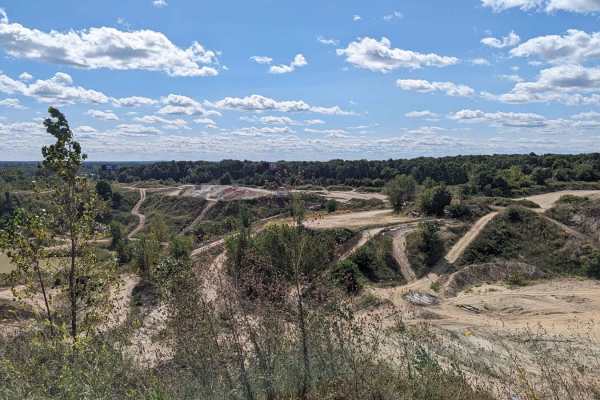
Skyline Drive
This is a nice beginner trail that offers a birdseye view of the park. It's also a nice route to consider when trying to make your way to the middle of the park without all of the traffic on the main roads. The trail begins on the backside of the water hole at the front of the park and offers multip...
Learn more about Skyline Drive
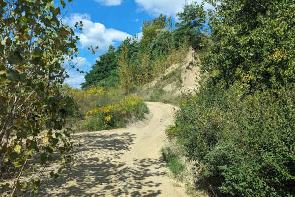
Cat Walk
This sandy trail can be found at the bottom of the Electric Slide and runs to the back portion of the park. It is sandy and there is a small rock in the middle of the trail creating a small washout. It's a great way to see the back side of the park and avoid traffic along the main hall road to the b...
Learn more about Cat Walk
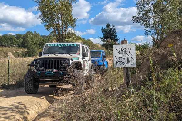
Work Around
Work Around is a very short trail that runs along the edge of the property and backs up to the area that is still being mined. It can be picked up at the end of Cat Walk and continues to the back of the park. It's more of a transition trail than a trail of substance. It does run along the top of a w...
Learn more about Work Around
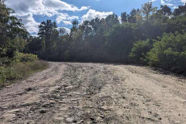
South Rim
South Rim is the main hall road that runs from the middle of the park to the back area. Many trails branch off of this road. There are some areas that are rutted and muddy, For the most part, this trail is wide enough for two vehicles and has two-way traffic.
Learn more about South Rim
ATV trails near Cass City, Michigan
Explore ATV-friendly trails near you. These trails are accessible for vehicles up to 50 inches wide, perfect for ATVs and smaller off-road machines.
Old Sand Road
As the name implies, this is a sandy trail located primarily on public ground. This is the closest thing to a "trail" in Huron County. There are several whooped-out areas that require moderate ground clearance to pass without bottoming out. Most of the trail is dry, unless a recent rain event has oc...
Learn more about Old Sand Road
Rush Lake Access
This is a primarily sand two-track that leads back to the public access site of Rush Lake. The trail itself is passable with a vehicle having moderate ground clearance. There are some small holes along the way, but no major water holes on the trail itself. The area is all public land with rustic cam...
Learn more about Rush Lake Access
The Flats Trail
This Trail is a spur off Michigan Road with one shallow water hole after another. The deepest ran about 18 inches, but the average was about 12 inches; all have pretty solid bottoms. The trail maintains a minimum of one full-size vehicle wide. Explorers will find a handful of open areas big enough...
Learn more about The Flats Trail
Stelmach Trail
This Trail is an out-and-back trail that no longer connects to Steimech Road at the south. Even though this Trail isn't going anywhere specific, it will still make for a good time. The dead end at the south end is in a wooded area that is a wetland. With that said, along the way you will find mult...
Learn more about Stelmach Trail
UTV/side-by-side trails near Cass City, Michigan
Find UTV and side-by-side trails near you. These trails accommodate vehicles up to 60 inches wide, ideal for UTVs, side-by-sides, and wider off-road rigs.
Old Sand Road
As the name implies, this is a sandy trail located primarily on public ground. This is the closest thing to a "trail" in Huron County. There are several whooped-out areas that require moderate ground clearance to pass without bottoming out. Most of the trail is dry, unless a recent rain event has oc...
Learn more about Old Sand Road
Rush Lake Access
This is a primarily sand two-track that leads back to the public access site of Rush Lake. The trail itself is passable with a vehicle having moderate ground clearance. There are some small holes along the way, but no major water holes on the trail itself. The area is all public land with rustic cam...
Learn more about Rush Lake Access
The Flats Trail
This Trail is a spur off Michigan Road with one shallow water hole after another. The deepest ran about 18 inches, but the average was about 12 inches; all have pretty solid bottoms. The trail maintains a minimum of one full-size vehicle wide. Explorers will find a handful of open areas big enough...
Learn more about The Flats Trail
Stelmach Trail
This Trail is an out-and-back trail that no longer connects to Steimech Road at the south. Even though this Trail isn't going anywhere specific, it will still make for a good time. The dead end at the south end is in a wooded area that is a wetland. With that said, along the way you will find mult...
Learn more about Stelmach Trail
The onX Offroad Difference
onX Offroad combines trail photos, descriptions, difficulty ratings, width restrictions, seasonality, and more in a user-friendly interface. Available on all devices, with offline access and full compatibility with CarPlay and Android Auto. Discover what you're missing today!
Open Trail Map