
Dirt Bike Trails
Near Candor, New York
Explore All Dirt Bike Trails Near Candor, New York
Dirt Bike Trails Near Candor, New York
Discover the best dirt bike trails near you. Browse trail maps, check difficulty ratings, and find your next adventure — whether you're looking for a quick ride or an all-day expedition.
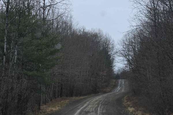
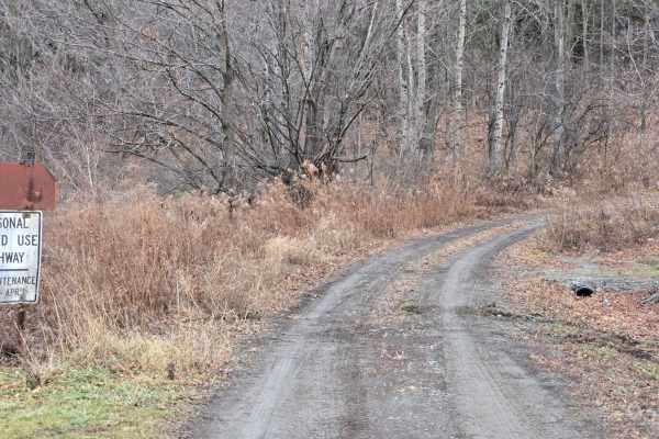
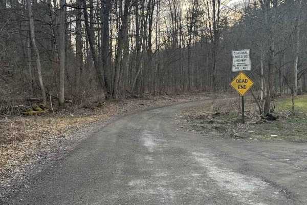
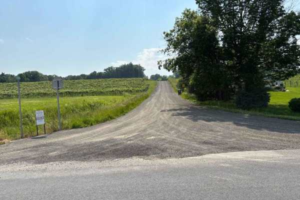
Templar Falls - Sugar Hill Road
This is an easy dirt road that will become rutted and muddy come spring. This section has access to primitive camping and multiple hiking trails including the Finger Lakes Trail, A-Trail, and Mohawk Trail. Mohawk trail activities include hiking, horseback, mountain biking, snowmobiling, and cross-co...
Learn more about Templar Falls - Sugar Hill Road
Chambers Road
This is a rough seasonal road frequented by local 4X4 enthusiasts. The trail starts at County Route 16 and continues through to Hornby Road in Beaver Dams. Just down Hornby Road is Beaver Dams Powersports and 5 miles from the trail is a Dandy Mart. This trail features several mud holes on either sid...
Learn more about Chambers Road
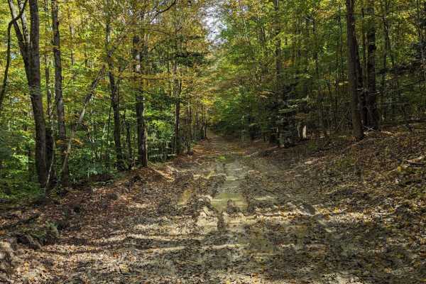
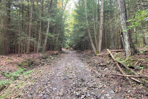
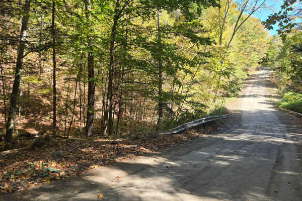
Cross Island Road
This is a seasonal gravel road that winds through the eastern section of Taylor Valley State Forest. The road starts with well-maintained gravel and transitions into a narrower two-track as it pushes deeper into the forest. Cross Island Road provides a scenic drive through mixed hardwoods and conife...
Learn more about Cross Island Road
Bellinger Road
This is a seasonal road connecting Miller Road and County Route 42 in the town of Hornby. The track passes farmland and hardwood forest. Caution should be exercised when driving from west to east, as there is a landowner driveway that can be confused with the main track. Stay to the left. Washouts a...
Learn more about Bellinger Road
Bigelow Hill Road
This is a seasonal road that becomes soft, slick, and washed out in the later Fall, Winter, and Spring. On the seasonal portion, this road is one vehicle width wide. Bigelow Hill Road can be accessed off NY-226. The surface is a mix of gravel and clay. During winter and the shoulder seasons, the roa...
Learn more about Bigelow Hill Road
Cook Road
This is a short and rocky seasonal road connecting Borden Hollow Road to West Hill Road in the town of Hornby. Often after heavy rain, washouts, loose rocks, and downed trees can be expected. Minimal maintenance is provided by the local township. There are homes present on the west end of the track,...
Learn more about Cook Road
Talbort Hill - Pulver - Losey Hill
This is a steep seasonal road coming out of Tyrone, NY. The road becomes heavily washed out in spring time and between November and May terrain becomes soft. The surface turns to clay at the top of the hill and becomes slick, a moderate challenge for ADV bikes. Within 1-2 miles of Waneta and Lamoka...
Learn more about Talbort Hill - Pulver - Losey Hill
Dennis Road
This is an easy-season road that provides access to primitive camping spots on the trail. This road dead ends. In addition to primitive camping, there is a lean-to not far off the trail, as well as access to the Finger Lakes trail. The trail is gated at the bottom as it abuts private land. The trail...
Learn more about Dennis Road
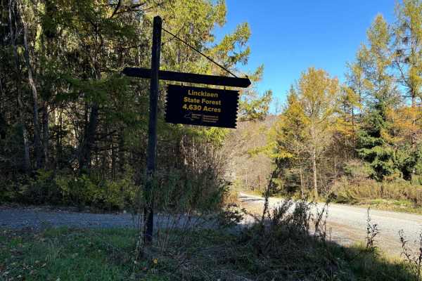
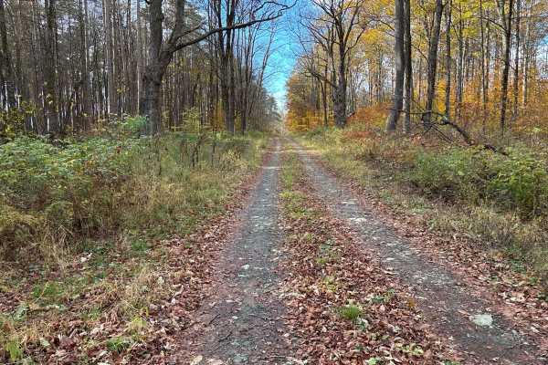
Linklaen State Forest
This route consists of seasonal gravel roads that are generally well-maintained in the summer. During the winter the roads are used for snowmobile trails. The roads lead to several side routes that are two-tracks, most are out-and-back routes and will add adventure to the ride. The main road is easi...
Learn more about Linklaen State Forest
Mills and Platt Hill Road
This is an easy seasonal road that becomes more technical in winter and spring. It features beautiful vistas looking down into the valley. Nearby attractions include Mud Creek Bison Ranch and camping nearby at Sanford Lake. In summer, this road is passable by 2WD vehicles with little issue. Come win...
Learn more about Mills and Platt Hill Road
Chrisler Road
This is an easy seasonal road. The conditions become more technical in the spring with washout. It leads down to Robie Road and Kettle Road, off of which there are nearby DEC camping sites. On Robie Road can be found Mud Creek Bison Ranch which offers self-guided farm tours with a restaurant and gif...
Learn more about Chrisler Road
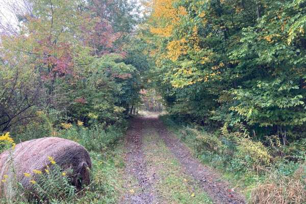
Van Amburg Road
The southern half of Van Amburg Road is seasonal, which can become impassible by passenger vehicles in winter due to snow drifts. This road offers Finger Lakes Trail Access along with Primitive Camping featuring a Lean-To and Outhouse. At the intersection of Van Amburg and North Urbana is Birdseye H...
Learn more about Van Amburg Road
Hamilton Road (Seasonal)
This seasonal road has a few interesting features but they aren't difficult to get by. The road starts as a typical dirt road, but a small pull-off area can be found just before traveling over a culvert pipe and stream. The road turns into gravel with a small stream running down it in wetter conditi...
Learn more about Hamilton Road (Seasonal)
Middle Road
This winding seasonal road is a side road off of County Road 76. It is easy to miss as it joins County Road 76 in the middle of the curve. This seasonal road offers great vistas and is fun to take if you are visiting Heron Hill Winery, Divided Sky Vineyard, or Barrelhouse 6 Distillery.
Learn more about Middle Road
Stephanie Grace Taylor Memorial Drive
This road offers some scenic views of the surrounding countryside on the west end and a gorgeous view of Keuka Lake on the east end. On the Keuka Lake end you can find one of the local wineries just down the road and several vineyards. During the Fall it offers great fall foliage and the smell of gr...
Learn more about Stephanie Grace Taylor Memorial Drive
Space Road
This is a short, seasonal road through farmland. There are several large open cornfields, an old abandoned barn, and sections of hardwood forest. This trail connects from County Rt. 4 to County Rt. 1. Often, after heavy rain, the trail can be washed out and be more difficult as water will expose lay...
Learn more about Space Road
Tobey Road
Traveling from the east end, you will drive by a neighborhood yard waste depot and then through a vineyard. The road will turn seasonal and take you through some more vineyards and offer a beautiful view of the area. The open fields offer an opportunity to observe birds and wildlife. The seasonal se...
Learn more about Tobey Road
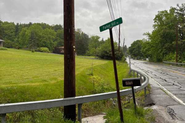
Parker Hill Road
This seasonal road climbs up the hill from 54a and the picturesque Keuka Lake. The road offers a beautiful ascent from the lake to the vineyards at the top of the hill. Its wooded sections will offer a colorful jaunt during the Fall. The road is maintained during the warmer months and could be hazar...
Learn more about Parker Hill Road
Woodbeck Road
This road is a seasonal road that is not maintained during the Winter months. A natural gas line intersects with the road at its midpoint. The road offers great views or the surrounding hills and farms. This road would be a great addition to anyone looking to see the fall colors.
Learn more about Woodbeck Road

Vogt Road
This is a relatively easy dirt road coming out of Hammondsport, New York. The initial climb is steep, but can be covered by a two-wheel drive vehicle outside of winter. In the winter, 4WD or AWD would be highly recommended. The Hammondsport end of this road is right across from Pleasant Valley Win...
Learn more about Vogt Road
ATV trails near Candor, New York
Explore ATV-friendly trails near you. These trails are accessible for vehicles up to 50 inches wide, perfect for ATVs and smaller off-road machines.
Cross Island Road
This is a seasonal gravel road that winds through the eastern section of Taylor Valley State Forest. The road starts with well-maintained gravel and transitions into a narrower two-track as it pushes deeper into the forest. Cross Island Road provides a scenic drive through mixed hardwoods and conife...
Learn more about Cross Island Road
Linklaen State Forest
This route consists of seasonal gravel roads that are generally well-maintained in the summer. During the winter the roads are used for snowmobile trails. The roads lead to several side routes that are two-tracks, most are out-and-back routes and will add adventure to the ride. The main road is easi...
Learn more about Linklaen State Forest
Van Amburg Road
The southern half of Van Amburg Road is seasonal, which can become impassible by passenger vehicles in winter due to snow drifts. This road offers Finger Lakes Trail Access along with Primitive Camping featuring a Lean-To and Outhouse. At the intersection of Van Amburg and North Urbana is Birdseye H...
Learn more about Van Amburg Road
Space Road
This is a short, seasonal road through farmland. There are several large open cornfields, an old abandoned barn, and sections of hardwood forest. This trail connects from County Rt. 4 to County Rt. 1. Often, after heavy rain, the trail can be washed out and be more difficult as water will expose lay...
Learn more about Space Road
UTV/side-by-side trails near Candor, New York
Find UTV and side-by-side trails near you. These trails accommodate vehicles up to 60 inches wide, ideal for UTVs, side-by-sides, and wider off-road rigs.
Templar Falls - Sugar Hill Road
This is an easy dirt road that will become rutted and muddy come spring. This section has access to primitive camping and multiple hiking trails including the Finger Lakes Trail, A-Trail, and Mohawk Trail. Mohawk trail activities include hiking, horseback, mountain biking, snowmobiling, and cross-co...
Learn more about Templar Falls - Sugar Hill Road
Cross Island Road
This is a seasonal gravel road that winds through the eastern section of Taylor Valley State Forest. The road starts with well-maintained gravel and transitions into a narrower two-track as it pushes deeper into the forest. Cross Island Road provides a scenic drive through mixed hardwoods and conife...
Learn more about Cross Island Road
Linklaen State Forest
This route consists of seasonal gravel roads that are generally well-maintained in the summer. During the winter the roads are used for snowmobile trails. The roads lead to several side routes that are two-tracks, most are out-and-back routes and will add adventure to the ride. The main road is easi...
Learn more about Linklaen State Forest
Van Amburg Road
The southern half of Van Amburg Road is seasonal, which can become impassible by passenger vehicles in winter due to snow drifts. This road offers Finger Lakes Trail Access along with Primitive Camping featuring a Lean-To and Outhouse. At the intersection of Van Amburg and North Urbana is Birdseye H...
Learn more about Van Amburg Road
The onX Offroad Difference
onX Offroad combines trail photos, descriptions, difficulty ratings, width restrictions, seasonality, and more in a user-friendly interface. Available on all devices, with offline access and full compatibility with CarPlay and Android Auto. Discover what you're missing today!
Open Trail Map