
Dirt Bike Trails
Near Alexander, Arkansas
Explore All Dirt Bike Trails Near Alexander, Arkansas
Dirt Bike Trails Near Alexander, Arkansas
Discover the best dirt bike trails near you. Browse trail maps, check difficulty ratings, and find your next adventure — whether you're looking for a quick ride or an all-day expedition.
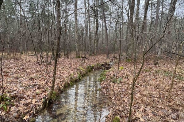
North Fork Pinnacle Road 132C
I started the trail in 2-wheel drive but not far into the trail, I had to put it in 4L. This is due to the clearance issues and needing to go slow for uneven ground. This trail closes in the summer and is open in the fall and winter. They use the trail during the summer as a hiking trail. Great trai...
Learn more about North Fork Pinnacle Road 132C
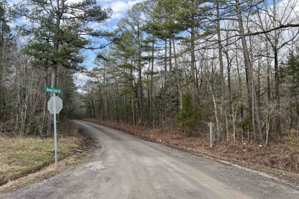
Brown Creek Road 805
Brown Creek winds you through the forest with beautiful views, lots of creek crossings, and campsites. This trail will also lead you to the Ouachita National Recreation trail which is a 223-mile trail, there are two entrance points along this route to access this trail. This route could be a basecam...
Learn more about Brown Creek Road 805
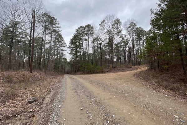
Alum Fork Road 114
Alum Fork or Forest Road 114 is an excellent way to navigate through the beautiful Ouachita National Forest without ever having to touch the pavement. It has several dispersed camping areas and winds its way around Lake Winona if you're wanting to catch some fish or get the kayak on the water. Wildl...
Learn more about Alum Fork Road 114
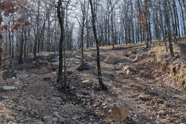
G4 Don's 101
G4 Don's 101 is a tight twisting trail at the northwest extreme corner of the park. It branches off of and rejoins G14 Road to Emmaus. G4 Don's 101 has quite a few rock obstacles and also an off-camber portion that can be challenging, especially when wet. Most obstacles have multiple lines of varyin...
Learn more about G4 Don's 101
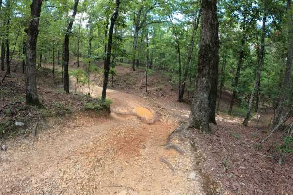
G3 Fun Run
You will find ups, downs, and all arounds. You'll see some granite rock slabs climbs, and some off-camber twists and turns. Overall, the description is in the name at just under a mile long, this trail has a little something for everyone. Probably the second most difficult (or easiest) of the Jeep ...
Learn more about G3 Fun Run
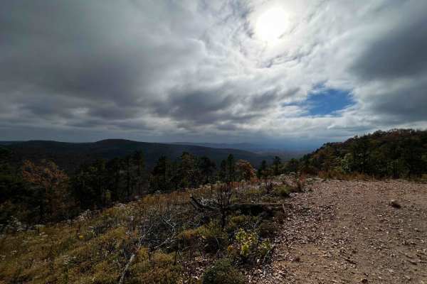
AR 5 - Main Park Road
This is the main road that runs along the top ride of the east side of the park. Many of the trails start and begin off this road. Many of the advanced park trails are directional, so be mindful of that when navigating from one trail to the next. This road is rough in some areas but most vehicles at...
Learn more about AR 5 - Main Park Road
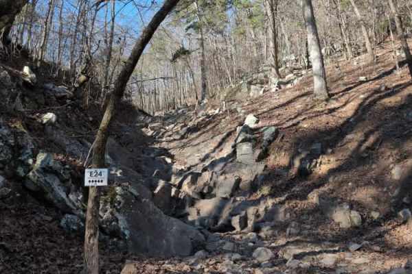
E24 Vertical Challenge
E24 Vertical Challenge lives up to its name. It is a steep, rocky climb you can attempt towards the end of D1 Rubicon Ridge. It begins with a steep descent down to the bottom, where you will see E25 Warn Hill directly ahead, while E24 turns left to begin the climb. The very first rock ledge is the m...
Learn more about E24 Vertical Challenge
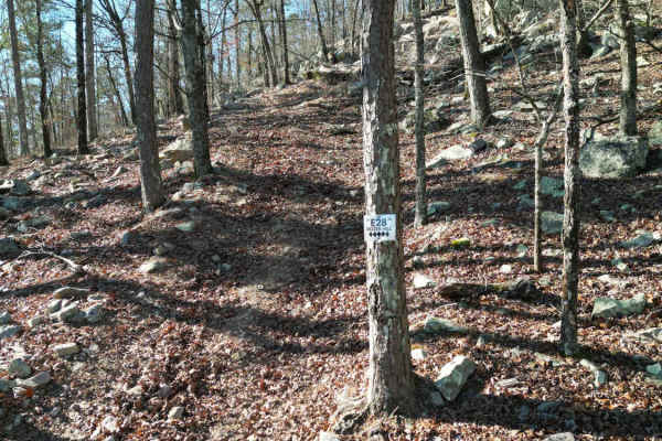
E28 Dozer Hill
E28 Dozer Hill is a short one-way hill climb near the end of D1 Rubicon Ridge and ends near the Prothane Point overlook. It is steep and covered with loose rocks and downed tree limbs. There are multiple lines near the top, but all are difficult.
The park rating for this trail is 5 diamonds.
A Par...
Learn more about E28 Dozer Hill
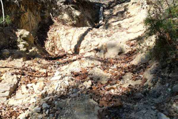
E25 Warn Hill
E25 Warn Hill is another one-way steep hill climb near the end of D1 Rubicon Ridge. You begin by descending down a steep hill towards E24 Vertical Challenge, which you will see on your left as you continue straight onto E25 Warn Hill. You will encounter multiple near-vertical rock walls and ledges t...
Learn more about E25 Warn Hill
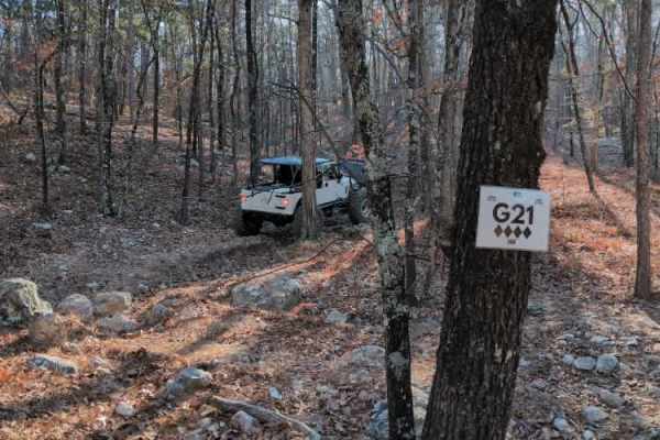
G21
G21 branches off of G2 Four Fingers before the final stretch of obstacles near the exit. It is a wooded path that leads up the hill and eventually comes out onto G9 Pipeline near the Four Fingers exit. The most difficult part of G21 is an off-camber spot near a tree that can cause body damage.
The ...
Learn more about G21
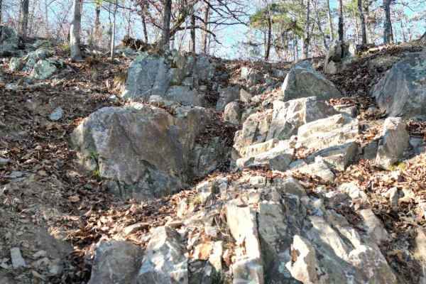
E17 Winch Hill
E17 Winch Hill is another difficult early exit off of D1 Rubicon Ridge. It is a very steep and rocky climb that lives up to its name. You better have a winch to get over the largest rocks about halfway through this trail. This is a one-way trail starting on D1 and ending at Prothane Point. The park ...
Learn more about E17 Winch Hill
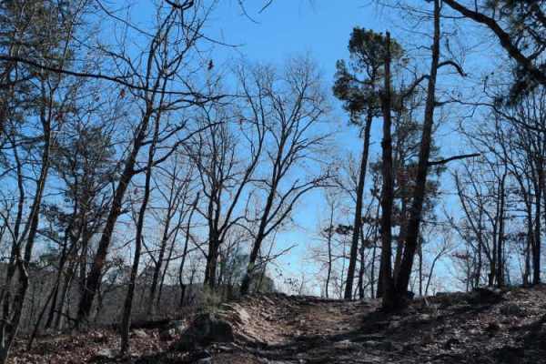
E20 Road to Prothane
E20 Road to Prothane is an easy trail through the woods, primarily used by those finishing D1 Rubicon Ridge as a direct route to the overlook at Prothane Point. It is mostly dirt with a few small rocks. The park rating for this trail is 2 diamonds.
A Park Day-Use Trail Pass is required to access th...
Learn more about E20 Road to Prothane

G15 Road to Adventure
G2 Road to Adventure is a mild trail that gently flows through the woods. It is relatively flat and does not offer any major challenges beyond trees close to the edge of the trail.
The park rating for this trail is 2 diamonds. A Park Day-Use Trail Pass is required to access this system of trails. C...
Learn more about G15 Road to Adventure
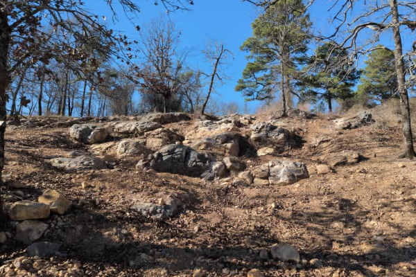
E18
E18 is a relatively short one-way trail through the woods that begins near the end of D1 Rubicon Ridge and ends with a fun rock climb with multiple lines to exit. This is a good trail for groups with mixed levels of drivers and vehicles due to the variety of options to exit this trail. The park rati...
Learn more about E18
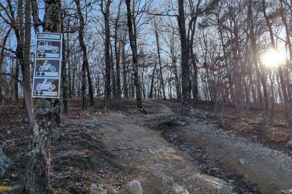
G20
G20 is a shortcut trail that branches off of G6 Squid's Jaunt and goes up into the woods near the end of F52 Head Banger and the beginning of F57. It is a little steep at the beginning, but the trail is pretty smooth overall.
The park rating for this trail is 2 diamonds. A Park Day-Use Trail Pass i...
Learn more about G20
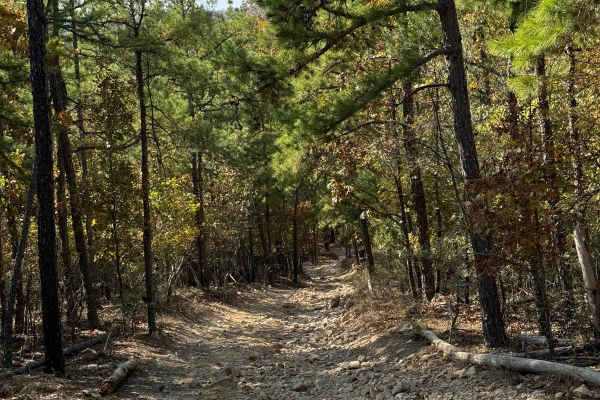
F41 Compass Canyon
This trail provides a fairly easy connection between the east and west sides of the park. It is one vehicle wide with plenty of places to pass since it is two-way traffic. On its eastern end it connects to AR Highway 5 trail and the western end connects to Lash's Loop F17 near the intersection with...
Learn more about F41 Compass Canyon
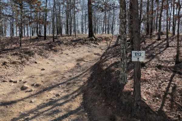
E12 Prothane Point
E12 Prothane Point is an easy trail through the woods that takes you to a scenic overlook. It provides a nice scenic exit from D1 Rubicon Ridge. It is a great place to stop for lunch and enjoy the view.
The park rating for this trail is 1 diamond. A Park Day-Use Trail Pass is required to access thi...
Learn more about E12 Prothane Point
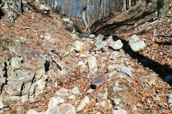
E1 Too Easy
Don't let the name fool you. E1 Too Easy is far from easy. It is a very difficult climb up from D1 Rubicon Ridge up to the top of Prothane Point. The beginning is very steep, loose chunks of rock, but towards the top, it turns into a tangled mess of trees with no clear way out. In the middle of the ...
Learn more about E1 Too Easy
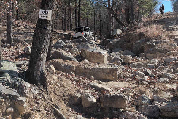
G12 Greg's Rock
G12 Greg's Rocks is a very rocky trail that runs parallel to G7 Squid's Jaunt. You enter the one-way trail near G13 Rock Garden and continue all the way to the main trail, Arkansas-5. The most difficult part is the minefield of large boulders you must navigate to enter the trail at the beginning. Af...
Learn more about G12 Greg's Rock
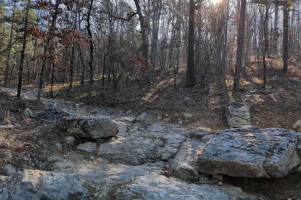
G2 Four Fingers
G2 Four Fingers is a popular, difficult trail at the park. You can begin it after finishing G1 Ultimate Adventure or get to it from G8 Pipeline. G2 Four Fingers is a very rocky trail through the woods, offering many lines along the way. The first major obstacle is a steep, smooth "boat ramp" that ty...
Learn more about G2 Four Fingers
ATV trails near Alexander, Arkansas
Explore ATV-friendly trails near you. These trails are accessible for vehicles up to 50 inches wide, perfect for ATVs and smaller off-road machines.
North Fork Pinnacle Road 132C
I started the trail in 2-wheel drive but not far into the trail, I had to put it in 4L. This is due to the clearance issues and needing to go slow for uneven ground. This trail closes in the summer and is open in the fall and winter. They use the trail during the summer as a hiking trail. Great trai...
Learn more about North Fork Pinnacle Road 132C
Brown Creek Road 805
Brown Creek winds you through the forest with beautiful views, lots of creek crossings, and campsites. This trail will also lead you to the Ouachita National Recreation trail which is a 223-mile trail, there are two entrance points along this route to access this trail. This route could be a basecam...
Learn more about Brown Creek Road 805
Alum Fork Road 114
Alum Fork or Forest Road 114 is an excellent way to navigate through the beautiful Ouachita National Forest without ever having to touch the pavement. It has several dispersed camping areas and winds its way around Lake Winona if you're wanting to catch some fish or get the kayak on the water. Wildl...
Learn more about Alum Fork Road 114
G4 Don's 101
G4 Don's 101 is a tight twisting trail at the northwest extreme corner of the park. It branches off of and rejoins G14 Road to Emmaus. G4 Don's 101 has quite a few rock obstacles and also an off-camber portion that can be challenging, especially when wet. Most obstacles have multiple lines of varyin...
Learn more about G4 Don's 101
UTV/side-by-side trails near Alexander, Arkansas
Find UTV and side-by-side trails near you. These trails accommodate vehicles up to 60 inches wide, ideal for UTVs, side-by-sides, and wider off-road rigs.
North Fork Pinnacle Road 132C
I started the trail in 2-wheel drive but not far into the trail, I had to put it in 4L. This is due to the clearance issues and needing to go slow for uneven ground. This trail closes in the summer and is open in the fall and winter. They use the trail during the summer as a hiking trail. Great trai...
Learn more about North Fork Pinnacle Road 132C
Brown Creek Road 805
Brown Creek winds you through the forest with beautiful views, lots of creek crossings, and campsites. This trail will also lead you to the Ouachita National Recreation trail which is a 223-mile trail, there are two entrance points along this route to access this trail. This route could be a basecam...
Learn more about Brown Creek Road 805
Alum Fork Road 114
Alum Fork or Forest Road 114 is an excellent way to navigate through the beautiful Ouachita National Forest without ever having to touch the pavement. It has several dispersed camping areas and winds its way around Lake Winona if you're wanting to catch some fish or get the kayak on the water. Wildl...
Learn more about Alum Fork Road 114
G4 Don's 101
G4 Don's 101 is a tight twisting trail at the northwest extreme corner of the park. It branches off of and rejoins G14 Road to Emmaus. G4 Don's 101 has quite a few rock obstacles and also an off-camber portion that can be challenging, especially when wet. Most obstacles have multiple lines of varyin...
Learn more about G4 Don's 101
The onX Offroad Difference
onX Offroad combines trail photos, descriptions, difficulty ratings, width restrictions, seasonality, and more in a user-friendly interface. Available on all devices, with offline access and full compatibility with CarPlay and Android Auto. Discover what you're missing today!
Open Trail Map