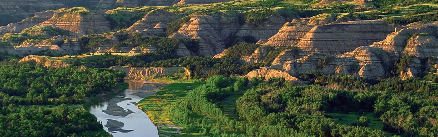
Beginner Off-Road Trails
Near Wilton, Minnesota
Explore All Beginner Trails Near Wilton, Minnesota
Beginner Off-Road Trails Near Wilton, Minnesota
Discover the best beginner-friendly off-road trails near you. These easier, lower-rated trails are a great place to start — browse trail maps, check difficulty ratings, and find your next adventure.
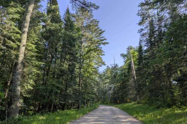
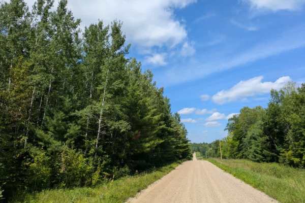
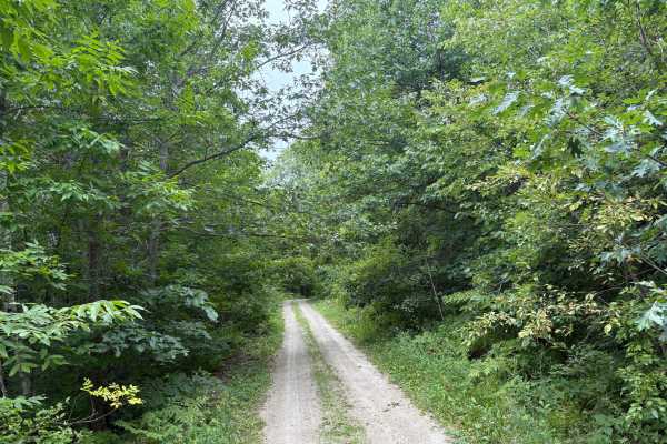
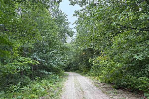
413
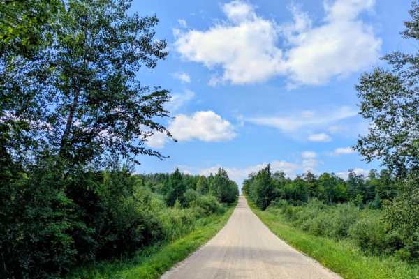
The 413/Lamon trail runs between Powers Dam Road NE and eventually comes to a dead end at private property. The route is surfaced with well-maintained gravel and is very wide, making it easy to navigate. It features large corners and sweeping curves, with gentle ascents and descents that give the dr...
Learn more about 413
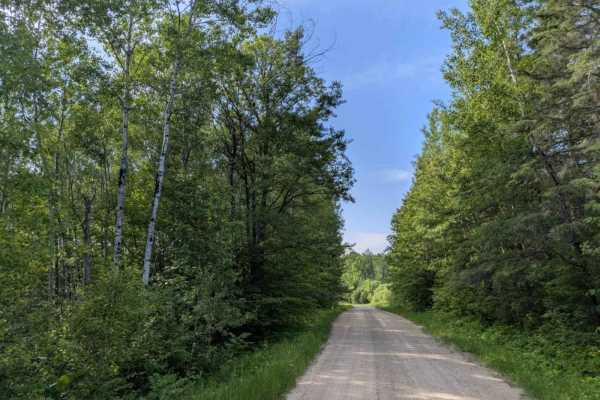
Oman Road Northeast
Oman Road Northeast is a straightforward forest trail that begins by crossing Birchmont Road, which is paved. From there, the route continues into wooded terrain, remaining wide enough for two vehicles. The surface is well-maintained gravel, and the trail runs mostly straight, with occasional ascent...
Learn more about Oman Road Northeast
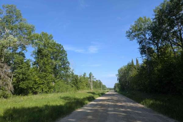
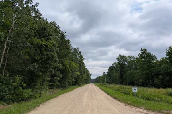
County Road 22
This trail is one of the main arteries in the area and is long, wide, and made up mostly of well-maintained gravel. It travels through a mix of open fields, forested stretches, and past a few rural homesteads. While the route is generally straight, there are occasional twists and turns. Drivers shou...
Learn more about County Road 22
Bald Eagle Drive Southeast
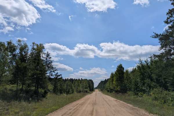
The Bald Eagle trail is a wide, well-maintained gravel route. Along the way, drivers will encounter some residential properties, and the presence of homes means that vehicle and pedestrian traffic can be frequent. Extra care should be taken when navigating this area to ensure safety. The trail winds...
Learn more about Bald Eagle Drive Southeast
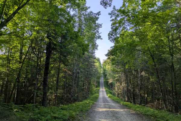
Ten Lake Trail East
Ten Lake Trail East begins as a wide, well-maintained gravel route. The surface is generally smooth, and the trail winds gently through forested terrain with only slight ascents and descents. Its straightforward path makes for a leisurely drive, and the scenery is primarily made up of woodland stret...
Learn more about Ten Lake Trail East
Andrusia Road Northeast
Andrusia Road Northeast is a wide, well-maintained gravel trail that runs through forested terrain before leading to the lake. In June 2025, the area experienced significant storm damage. Although the main route remains passable, travelers will notice debris and signs of downed trees along the way. ...
Learn more about Andrusia Road Northeast
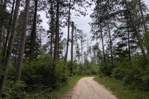
Hales Road Northeast
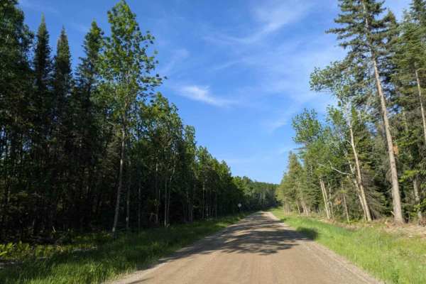
This trail begins with a smooth, wide surface but soon narrows and becomes noticeably bumpier, with sections of exposed round, small rocks and some mud. As the route continues, drivers will encounter a relatively steep and uneven ascent followed by a descent just before reaching the boat launch and ...
Learn more about Hales Road Northeast
County Road 307
This trail winds through a forested area with a series of gentle ascents and descents, passing by several homesteads along the way. The surface is well-maintained and mostly smooth, with only a few minor bumps to navigate. Drivers should be cautious of local traffic and deer, which are commonly seen...
Learn more about County Road 307
FS 2390
This trail is wide and generally well-maintained, with a smooth surface throughout most of its length. There are some sections with light corrugation, but overall, the drive is easy and comfortable. It passes a couple of homesteads but remains largely quiet and scenic, offering a peaceful route thro...
Learn more about FS 2390
FS 2213
This trail is long and wide, made up mostly of well-maintained gravel, and passes through a mix of open fields, wooded areas, and rural homesteads. While the route is generally straight, there are a few twists and turns, along with gentle ascents and descents. The forested sections provide welcome s...
Learn more about FS 2213
Forest Road 3448
This trail is a narrow, single-vehicle gravel route that is mostly smooth but has sections that can become sandy or muddy. It winds through dense forest, and in many places the vegetation has grown close to the track, leaving branches that may cause pinstriping on vehicles. The trail features slight...
Learn more about Forest Road 3448
Black Bird Road Northeast
This trail is a wide route surfaced with fine gravel and sand, making it suitable for two vehicles to pass comfortably. The terrain features steady ascents and descents, although nothing is overly steep, and the trail maintains a manageable flow throughout. Residential properties line parts of the r...
Learn more about Black Bird Road Northeast
Bayview Loop
The surface is well-maintained and alternates between single and two-vehicle widths, though it can feel narrow in certain sections. Vegetation crowds the edges in many places, giving the impression of being overgrown, but it does not leave pinstripes on vehicles. Several smaller trails branch off th...
Learn more about Bayview Loop
FS 2420
This trail is made up of well-maintained gravel, though it can be bumpy in spots due to corrugation, especially near the many homesteads in the area. It provides access to a lake with a boat launch and travels through forested terrain with a series of rolling hills. The combination of trees and elev...
Learn more about FS 2420
County Road 55
This trail is long, wide, and mostly made up of well-maintained gravel. It passes through a mix of open fields, forested areas, several homesteads, and runs alongside a lake. The route is popular with off-roaders, and during our drive, we encountered members of the local ATV club using the trail. It...
Learn more about County Road 55
Heart Lake Trail
Heart Lake Trail is a narrow forestry road near Itasca State Park. The trail is very narrow in spots with overgrown vegetation. The fall colors and Wildlife along this trail are definitely worth the travel. In the Spring thaw and heavy rain periods, some of the trail can have some overflow and ruts....
Learn more about Heart Lake Trail
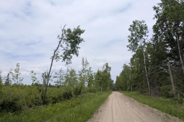
144 Street Northwest
This trail is accessed directly from the highway and runs mostly straight for its length, making it an easy route to follow. It is well-maintained and two vehicles wide, allowing for steady travel without much difficulty. Along the way, the trail passes through a variety of landscapes, including res...
Learn more about 144 Street Northwest
FS 2206
This trail is composed of well-maintained fine gravel and tends to be quite dusty, especially in dry conditions. It passes several homesteads and sees a fair amount of traffic, particularly on weekends. According to the USDA map, there is a dispersed campsite located along the route, but the access ...
Learn more about FS 2206
2136
This trail is relatively long and offers a variety of different conditions along its route. One section is narrow and straight, running through dense forest on a well-maintained gravel surface that appears to see little traffic. Another portion is wider and straighter, but more heavily corrugated du...
Learn more about 2136
Otterkill Trail
The Otterkill trail is a gravel forestry trail with some tight vegetation in spots. This trail is easy to navigate but may get overgrown depending on the year. It is located near Itasca State Park, making it a beautiful Fall color tour trail to take. Closed December 1 to March 31.
Learn more about Otterkill Trail
Beginner ATV trails near Wilton, Minnesota
Explore ATV-friendly trails near you. These trails are accessible for vehicles up to 50 inches wide, perfect for ATVs and smaller off-road machines.
County Road 55
This trail is long, wide, and mostly made up of well-maintained gravel. It passes through a mix of open fields, forested areas, several homesteads, and runs alongside a lake. The route is popular with off-roaders, and during our drive, we encountered members of the local ATV club using the trail. It...
Learn more about County Road 55
Heart Lake Trail
Heart Lake Trail is a narrow forestry road near Itasca State Park. The trail is very narrow in spots with overgrown vegetation. The fall colors and Wildlife along this trail are definitely worth the travel. In the Spring thaw and heavy rain periods, some of the trail can have some overflow and ruts....
Learn more about Heart Lake Trail
Otterkill Trail
The Otterkill trail is a gravel forestry trail with some tight vegetation in spots. This trail is easy to navigate but may get overgrown depending on the year. It is located near Itasca State Park, making it a beautiful Fall color tour trail to take. Closed December 1 to March 31.
Learn more about Otterkill Trail
2415
This trail is a designated OHV route, consisting primarily of well-maintained gravel, although some sections are bumpy. It winds through the landscape with a few gentle climbs and descents, and several smaller trails branch off from the main route. One of these side trails provides access to the lak...
Learn more about 2415
Beginner UTV/side-by-side trails near Wilton, Minnesota
Find UTV and side-by-side trails near you. These trails accommodate vehicles up to 60 inches wide, ideal for UTVs, side-by-sides, and wider off-road rigs.
County Road 55
This trail is long, wide, and mostly made up of well-maintained gravel. It passes through a mix of open fields, forested areas, several homesteads, and runs alongside a lake. The route is popular with off-roaders, and during our drive, we encountered members of the local ATV club using the trail. It...
Learn more about County Road 55
Heart Lake Trail
Heart Lake Trail is a narrow forestry road near Itasca State Park. The trail is very narrow in spots with overgrown vegetation. The fall colors and Wildlife along this trail are definitely worth the travel. In the Spring thaw and heavy rain periods, some of the trail can have some overflow and ruts....
Learn more about Heart Lake Trail
Otterkill Trail
The Otterkill trail is a gravel forestry trail with some tight vegetation in spots. This trail is easy to navigate but may get overgrown depending on the year. It is located near Itasca State Park, making it a beautiful Fall color tour trail to take. Closed December 1 to March 31.
Learn more about Otterkill Trail
2415
This trail is a designated OHV route, consisting primarily of well-maintained gravel, although some sections are bumpy. It winds through the landscape with a few gentle climbs and descents, and several smaller trails branch off from the main route. One of these side trails provides access to the lak...
Learn more about 2415
The onX Offroad Difference
onX Offroad combines trail photos, descriptions, difficulty ratings, width restrictions, seasonality, and more in a user-friendly interface. Available on all devices, with offline access and full compatibility with CarPlay and Android Auto. Discover what you're missing today!
Open Trail Map