
Beginner Off-Road Trails
Near Tuckahoe, Virginia
Explore All Beginner Trails Near Tuckahoe, Virginia
Beginner Off-Road Trails Near Tuckahoe, Virginia
Discover the best beginner-friendly off-road trails near you. These easier, lower-rated trails are a great place to start — browse trail maps, check difficulty ratings, and find your next adventure.

Big Woods Loop
Big Woods Loop is a route that passes through the Big Woods State Forest and Big Woods Wildlife Management Area. The route is a basic forest road, with the surface being slightly rougher on the state forest side. The route passes through typical southeast Virginia woodland and skirts the Big Woods s...
Learn more about Big Woods Loop
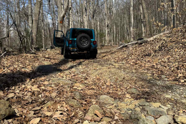
Browns Gap Turnpike
Browns Gap Turnpike, also known as Route 629, is a dead‑end route that terminates at Shenandoah National Park. The route begins as a maintained gravel driveway for roughly the first 10 percent of the trail, with difficulty increasing to about 2/10 due to washouts and channels approximately 6 inches ...
Learn more about Browns Gap Turnpike

Crabtree Meadows
This route is one side of the old Shoe Creek Trail that is now gated in the middle at private property. The surface is gravel from the state road to the parking area for the Upper Crabtree Falls and is fairly easily passable. There are a couple of small creek crossings with loose rock before the par...
Learn more about Crabtree Meadows

Chowan Game Lands - Bear Spotter
Bear Spotter is a seasonal section of trails in the Chowan Swamp Game Lands. It's a scenic area of the game lands that are generally only open during deer season. The trail starts at the Gatlington Boat Ramp and proceeds down season paths that are primarily hunter access roads and are also designate...
Learn more about Chowan Game Lands - Bear Spotter

Tuckaho
Tuckaho Road is a short, 0.9-mile gravel road managed by the U.S. Forest Service within George Washington National Forest. The surface is smooth and well-maintained, suitable for full-width 4×4 vehicles, high-clearance rigs, SxS, ATVs, dirt bikes, and even non-4x4 vehicles. There are no major obstac...
Learn more about Tuckaho

Chowan Gamelands - Deer Spotter
This area of the Chowan Swamp Gamelands is a seasonal trail that is open primarily during deer season. As the name suggests, one can expect to see a great many deer. Care should be taken not to strike deer with your vehicle. A wide array of other animals can be seen as well, including bears. Be mind...
Learn more about Chowan Gamelands - Deer Spotter

Cub Run
Maintained gravel forest service road. This route includes numerous hiking trailheads. The southern portion of the route has very spotty cell service, which improves in the northern portion. The northern portion includes many dispersed camping areas located along a small creek. The route is well-tra...
Learn more about Cub Run

Chowan Swamp Gamelands
The Chowan Swamp Gamelands are a state-administered game area in Gates County, North Carolina. The trail system is seasonal, and one can expect various areas to be open or closed depending on what hunting season it is. The area offers excellent fishing along the Chowan River, along with scenic areas...
Learn more about Chowan Swamp Gamelands

Emerald Pond
Dead end route to a mountain pond. This route gradually climbs the mountain and ends at multiple locked gates. The route has some exposed base stone and muddy sections but generally maintained gravel forest service route. The route follows a creek with several dispersed camping areas along the creek...
Learn more about Emerald Pond

Greasy Springs
Out-and-back trails are primarily used to access the Appalachian Trail crossing. This is a narrow 2-track that is muddy in places and has numerous short side trails. There are many nice camping spots throughout the length of the trail. Near the start, you'll have limited cell service. The trail cont...
Learn more about Greasy Springs

FR1176
FR 1176 leads from Big Piney up to a peak where cell towers can be found. The drive up includes several rocky sections, some steep sections and rock ledges. This trail also provides access to Greasy Springs Trail.
Learn more about FR1176

FR51-AT
This short offshoot from Hog Camp Trail leads to the Mount Pleasant Scenic Area with opportunities for hiking and camping.
Learn more about FR51-AT

Coal Road
Coal Road is a 13-mile-long forest service road near Shenandoah Acres Campground and Sherando Lake. Any vehicle type should be able to travel the gravel sections, and the road is paved on either end. You will find many hiking and biking trailheads along the road, the most notable being Cellar Mounta...
Learn more about Coal Road

St. Mary's
St. Mary's Road is a trail leading to the parking area for the St. Mary's Wilderness area. It is a short gravel forest road with little to no cell service and a large trailhead parking lot at the end. One vehicle-accessible campsite is located just before the parking lot along the creek, and another...
Learn more about St. Mary's

Big Piney
Big Piney is a gravel road passing through a portion of the George Washington National Forest, offering access to hiking, camping and swimming. The trail is rocky and typically unmaintained after rain or snow. You may encounter shallow water crossings and obstacles under 12" on the trail, including ...
Learn more about Big Piney

Hog Camp
Hog Camp Road provides access to a variety of hiking and camping opportunities in the George Washington National Forest. The south end is well traveled and easily passable, however north of the Mount Pleasant Scenic Area, expect more rugged terrain.
Learn more about Hog Camp

Cow Camp Road
This is a rocky fire road in the George Washington National Forest, connecting Highway 60 to Wiggins Hill Road. It is typically unmaintained after rain or snow and you may encounter shallow water crossings and obstacles under 12" on the trail, including small ledges. The road is typically one to two...
Learn more about Cow Camp Road

Big Mary
This is a gravel forest service road that follows Big Mary Creek. Several walk-in campsites are located just off the trail. There is good fishing and hiking along the trail, and decent cell service in the area. Near the beginning of the trail you'll see a nature camp. Several good swimming spots can...
Learn more about Big Mary

Chrisman Hollow - FS 274
The Chrisman Hollow Trail, also known as FS 274, connects US 211 at the south end and State Road 674 at the north end of the trail. It takes you to several trailheads, including the Lion's Tale Trail, which offers an ADA-accessible, half-mile trail along the Passage Creek. There are several primitiv...
Learn more about Chrisman Hollow - FS 274

Swapping Camp
This trail is mostly graded gravel, with some dirt and a few rocky sections. There are multiple water features, small waterfalls along the trail, one-lane bridges, and scenic waysides. There are dispersed campsites in abundance in the area, and the trailhead to the Appalachian Trail is on Swapping C...
Learn more about Swapping Camp
Beginner ATV trails near Tuckahoe, Virginia
Explore ATV-friendly trails near you. These trails are accessible for vehicles up to 50 inches wide, perfect for ATVs and smaller off-road machines.

Tuckaho
Tuckaho Road is a short, 0.9-mile gravel road managed by the U.S. Forest Service within George Washington National Forest. The surface is smooth and well-maintained, suitable for full-width 4×4 vehicles, high-clearance rigs, SxS, ATVs, dirt bikes, and even non-4x4 vehicles. There are no major obstac...
Learn more about Tuckaho

FR1176
FR 1176 leads from Big Piney up to a peak where cell towers can be found. The drive up includes several rocky sections, some steep sections and rock ledges. This trail also provides access to Greasy Springs Trail.
Learn more about FR1176

FR51-AT
This short offshoot from Hog Camp Trail leads to the Mount Pleasant Scenic Area with opportunities for hiking and camping.
Learn more about FR51-AT

Big Piney
Big Piney is a gravel road passing through a portion of the George Washington National Forest, offering access to hiking, camping and swimming. The trail is rocky and typically unmaintained after rain or snow. You may encounter shallow water crossings and obstacles under 12" on the trail, including ...
Learn more about Big Piney
Beginner UTV/side-by-side trails near Tuckahoe, Virginia
Find UTV and side-by-side trails near you. These trails accommodate vehicles up to 60 inches wide, ideal for UTVs, side-by-sides, and wider off-road rigs.

Tuckaho
Tuckaho Road is a short, 0.9-mile gravel road managed by the U.S. Forest Service within George Washington National Forest. The surface is smooth and well-maintained, suitable for full-width 4×4 vehicles, high-clearance rigs, SxS, ATVs, dirt bikes, and even non-4x4 vehicles. There are no major obstac...
Learn more about Tuckaho

FR1176
FR 1176 leads from Big Piney up to a peak where cell towers can be found. The drive up includes several rocky sections, some steep sections and rock ledges. This trail also provides access to Greasy Springs Trail.
Learn more about FR1176

Big Piney
Big Piney is a gravel road passing through a portion of the George Washington National Forest, offering access to hiking, camping and swimming. The trail is rocky and typically unmaintained after rain or snow. You may encounter shallow water crossings and obstacles under 12" on the trail, including ...
Learn more about Big Piney

Hog Camp
Hog Camp Road provides access to a variety of hiking and camping opportunities in the George Washington National Forest. The south end is well traveled and easily passable, however north of the Mount Pleasant Scenic Area, expect more rugged terrain.
Learn more about Hog Camp
The onX Offroad Difference
onX Offroad combines trail photos, descriptions, difficulty ratings, width restrictions, seasonality, and more in a user-friendly interface. Available on all devices, with offline access and full compatibility with CarPlay and Android Auto. Discover what you're missing today!
Open Trail Map