
Beginner Off-Road Trails
Near Stantonville, Tennessee
Explore All Beginner Trails Near Stantonville, Tennessee
Beginner Off-Road Trails Near Stantonville, Tennessee
Discover the best beginner-friendly off-road trails near you. These easier, lower-rated trails are a great place to start — browse trail maps, check difficulty ratings, and find your next adventure.

Road 105
Road 105 is an ideal scenic route for novice off-roaders and those seeking a low-stress dirt road drive through the dense forests of northwest Alabama near Pickwick Lake. The route provides a perfect training ground for inexperienced drivers to build confidence behind the wheel while navigating a mo...
Learn more about Road 105
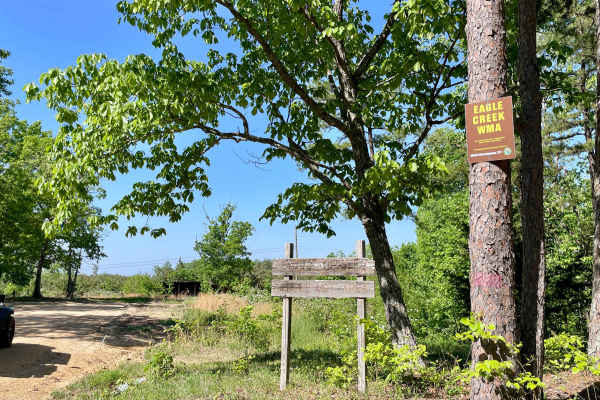
Copeland Ridge Road–Eagle Creek WMA
Access to Eagle Creek Wildlife Management Area requires a valid Tennessee hunting or fishing license and is limited to one-half hour before sunrise through one-half hour after sunset. Street-legal vehicles may use WMA roads with this license, while UTVs and other off-highway vehicles require a High ...
Learn more about Copeland Ridge Road–Eagle Creek WMA

Woods
Woods Trail is a narrow gravel route characterized by large, chunky rocks that create a noticeably loose driving surface. Traction can vary throughout the trail due to the size and depth of the gravel, requiring steady throttle control and attention to steering input. The road narrows to a single la...
Learn more about Woods
Thorn
Thorn Trail is a mixed gravel and dirt route that offers a scenic and slightly more engaging drive for those exploring the area. The surface varies between compacted gravel and dirt, with sections that can become soft depending on recent weather. A large open expanse along the trail provides an exce...
Learn more about Thorn
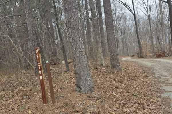
Melton
Melton Trail is an easy mixed-surface route featuring gravel and dirt with a solid, well-maintained base. Recent grading has introduced sections of larger gravel and fresh dirt, providing consistent traction under normal conditions. The trail experiences moderate elevation changes, gaining approxima...
Learn more about Melton

Shiloh Trail
Shiloh Trail is an easy mixed-surface route located within Natchez Trace State Park, offering a quiet drive through wooded terrain with gentle elevation changes. The surface consists of dirt, gravel, and occasional sandy stretches, creating a varied but approachable experience for most drivers. Larg...
Learn more about Shiloh Trail
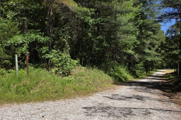
Cub Lake Trail
Tucked within the serene expanse of Natchez State Forest, this off-road trail offers a peaceful drive ideal for beginners and those looking for a more relaxed adventure. The road is well-graded with dirt and gravel, making for smooth travel without technical obstacles. Towering mature trees line the...
Learn more about Cub Lake Trail

Rattlesnake Green Trail
This is a great beginners' trail. It has just about all types of obstacles but they are perfect for first-time off-roaders or those just learning. It is stock friendly and has many beautiful areas along the trail to stop and see. Many places along this trail show newer off-roaders just how capable t...
Learn more about Rattlesnake Green Trail
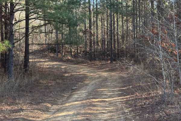
#21 Maynard's Trail
Maynard's trail is one of the longest trails in the park. This trail does a loop and dumps you out where it starts. This trail is all heavily wooded until you reach the end of the trail and then there is a big clearing. There are no major obstacles on this trail.
Learn more about #21 Maynard's Trail
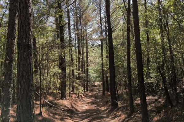
#18 Gate Road
Trail #18 – Gate Road primarily serves as a return route for Trail #20 (Sidewinder) and Trail #19 (Viper). It’s a smooth, wooded dirt road that provides an easy connection back to the main Trail #1. Although it includes a few mild grades, the surface is generally well-packed and should pose no issue...
Learn more about #18 Gate Road
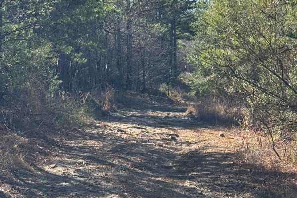
#93 Upper Access
This trail connects #90 to #94 It is a fairly easy trail with no major obstacles. There is a part that branches off and is not on the main trail of #93, which doesn't get much traffic and has become very rutted out and sketchy. It has a boulder around 3 feet and is on a very steep incline, almost be...
Learn more about #93 Upper Access
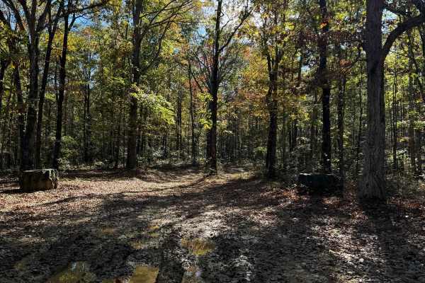
#81 Ridgeline Trail
This Trail is a connector trail that connects two parts of the outfitter trail. This trail follows the ridgeline of Hawkpride Mountain, so it is very flat and forested. The entrance is marked by two big tractor tires sitting on each side of the road. The trail is short and easy to follow since there...
Learn more about #81 Ridgeline Trail
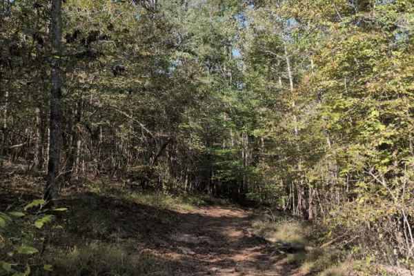
#101 Lower Ridge Line
Trail #111 – Lower Ridgeline is a steep access trail that leads to the start of Trail #100 (Whiskey Run) and several challenging hill climbs located at the north end of the park. While primarily used as a connector, it still offers a bit of character — with a few washouts, small rock obstacles, and ...
Learn more about #101 Lower Ridge Line
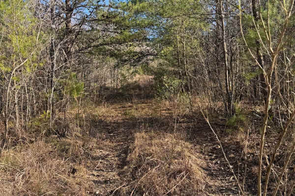
#106 The Bush
This trail is a connector trail in between trails #91 and #92. The entrance of this trail tends to be hard to find due to the entrance being overgrown. There is no room to pass on this trail. There are lots of low branches on this trail that could scratch your paint.
Learn more about #106 The Bush
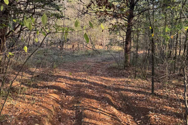
#61 Bridge Street
Bridge Street Is a short connector trail in between trails #91 and #92, it is mostly flat and wooded with dirt and pine straw covering the ground. This trail is infrequently used so it can sometimes be grown up and rutted out. The trail itself does not have any major obstacles on it.
Learn more about #61 Bridge Street
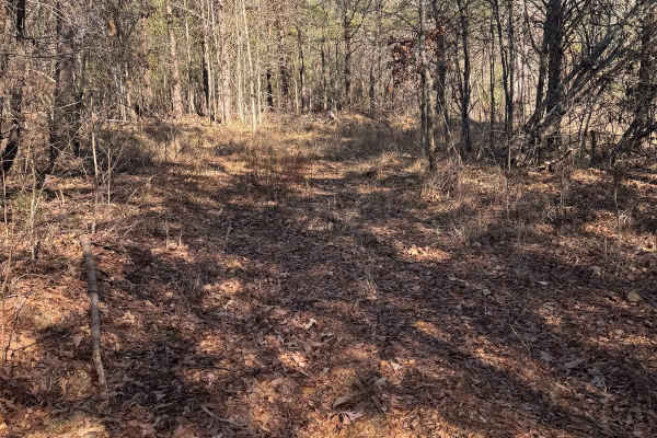
#60 Opryland Mills
This short trail connects trails #92 and #91. It is lightly used, leading to overgrowth and limited visibility. The trees are tight on both sides, leaving no room for passing. Due to its brief length, it can be completed quickly, however, you will need careful navigation to not get scratches.
Learn more about #60 Opryland Mills
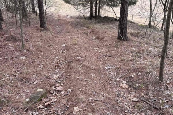
#7c Diamondback - Easy Out
Trail #7c, Diamondback - Easy Out, offers a reprieve for those seeking to avoid # the challenging start of #7. This lightly rutted dirt trail, while slightly overgrown in areas, provides an accessible and easy bypass around Diamondback's intermediate difficulty beginning section. Expect a more relax...
Learn more about #7c Diamondback - Easy Out
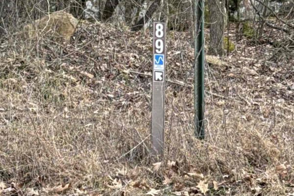
#89 Gobbler's Ridge
Trail #89, Gobbler's Ridge, offers a relatively smooth dirt surface, making it accessible to a wide range of vehicles. However, drivers should be aware of small ruts and some washout as they approach the intersection with trail #90. Could be muddy after a heavy rain. Entrances from #30 and #90.
Learn more about #89 Gobbler's Ridge
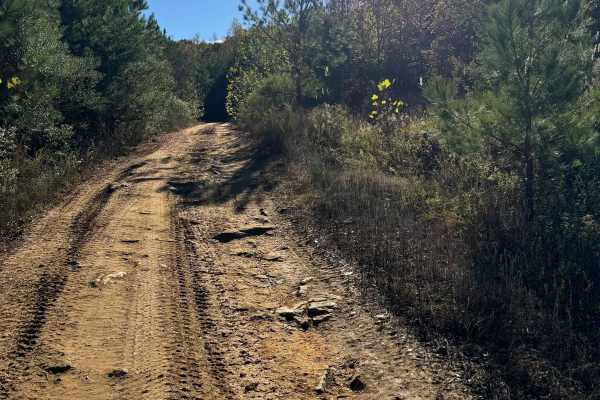
#88 John's Way
This trail starts at the red barn right off the main road. This trail is very popular since it is an easy way to go from one side of the park to another. The trail ends at trail #65 Bacon which is a pretty steep hill that is quite hard to do in the wet. If you do not want to attempt #65 there are ma...
Learn more about #88 John's Way
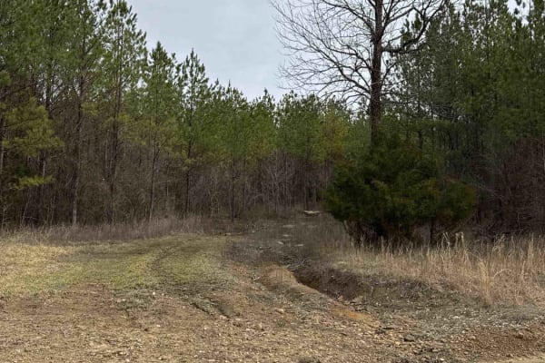
#7d Diamondback - Easy Out Lower
Trail #7e, Diamondback--Easy Out Lower, offers an easy route. This slightly rutted and rock-strewn dirt path winds its way through a wooded landscape. It serves as a connector, linking the main trail #1 to the middle section of #7 Diamondback while also providing access to the lower sections of trai...
Learn more about #7d Diamondback - Easy Out Lower
Beginner ATV trails near Stantonville, Tennessee
Explore ATV-friendly trails near you. These trails are accessible for vehicles up to 50 inches wide, perfect for ATVs and smaller off-road machines.
Road 105
Road 105 is an ideal scenic route for novice off-roaders and those seeking a low-stress dirt road drive through the dense forests of northwest Alabama near Pickwick Lake. The route provides a perfect training ground for inexperienced drivers to build confidence behind the wheel while navigating a mo...
Learn more about Road 105
Copeland Ridge Road–Eagle Creek WMA
Access to Eagle Creek Wildlife Management Area requires a valid Tennessee hunting or fishing license and is limited to one-half hour before sunrise through one-half hour after sunset. Street-legal vehicles may use WMA roads with this license, while UTVs and other off-highway vehicles require a High ...
Learn more about Copeland Ridge Road–Eagle Creek WMA
Woods
Woods Trail is a narrow gravel route characterized by large, chunky rocks that create a noticeably loose driving surface. Traction can vary throughout the trail due to the size and depth of the gravel, requiring steady throttle control and attention to steering input. The road narrows to a single la...
Learn more about Woods
Thorn
Thorn Trail is a mixed gravel and dirt route that offers a scenic and slightly more engaging drive for those exploring the area. The surface varies between compacted gravel and dirt, with sections that can become soft depending on recent weather. A large open expanse along the trail provides an exce...
Learn more about Thorn
Beginner UTV/side-by-side trails near Stantonville, Tennessee
Find UTV and side-by-side trails near you. These trails accommodate vehicles up to 60 inches wide, ideal for UTVs, side-by-sides, and wider off-road rigs.
Copeland Ridge Road–Eagle Creek WMA
Access to Eagle Creek Wildlife Management Area requires a valid Tennessee hunting or fishing license and is limited to one-half hour before sunrise through one-half hour after sunset. Street-legal vehicles may use WMA roads with this license, while UTVs and other off-highway vehicles require a High ...
Learn more about Copeland Ridge Road–Eagle Creek WMA
Woods
Woods Trail is a narrow gravel route characterized by large, chunky rocks that create a noticeably loose driving surface. Traction can vary throughout the trail due to the size and depth of the gravel, requiring steady throttle control and attention to steering input. The road narrows to a single la...
Learn more about Woods
Thorn
Thorn Trail is a mixed gravel and dirt route that offers a scenic and slightly more engaging drive for those exploring the area. The surface varies between compacted gravel and dirt, with sections that can become soft depending on recent weather. A large open expanse along the trail provides an exce...
Learn more about Thorn
Melton
Melton Trail is an easy mixed-surface route featuring gravel and dirt with a solid, well-maintained base. Recent grading has introduced sections of larger gravel and fresh dirt, providing consistent traction under normal conditions. The trail experiences moderate elevation changes, gaining approxima...
Learn more about Melton
The onX Offroad Difference
onX Offroad combines trail photos, descriptions, difficulty ratings, width restrictions, seasonality, and more in a user-friendly interface. Available on all devices, with offline access and full compatibility with CarPlay and Android Auto. Discover what you're missing today!
Open Trail Map