
Beginner Off-Road Trails
Near Springbrook, Wisconsin
Explore All Beginner Trails Near Springbrook, Wisconsin
Beginner Off-Road Trails Near Springbrook, Wisconsin
Discover the best beginner-friendly off-road trails near you. These easier, lower-rated trails are a great place to start — browse trail maps, check difficulty ratings, and find your next adventure.
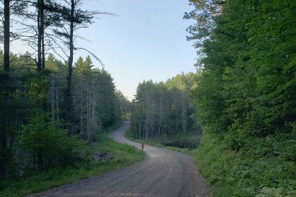
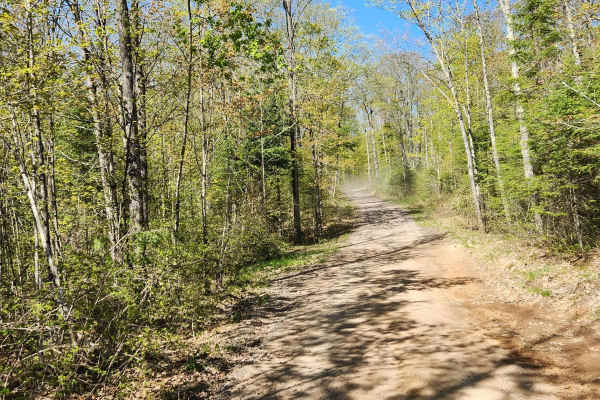
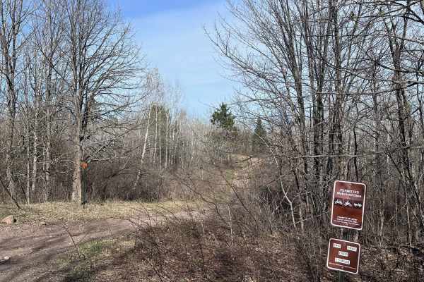
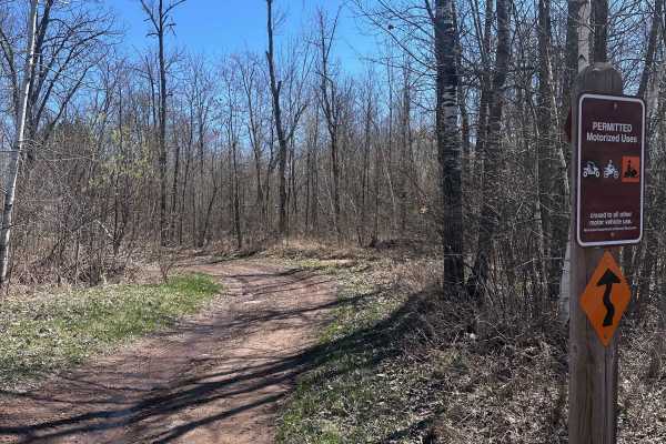
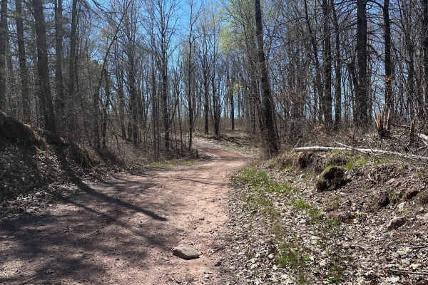
Phipps Fire Lane
This is a beautiful, winding gravel road through Northern Wisconsin that gives a beautiful view without significant danger to your vehicle. This trail is lined with a lovely variety of northern hardwoods and evergreens. Wildlife here is plentiful and it is very likely that you may see a few whitetai...
Learn more about Phipps Fire Lane
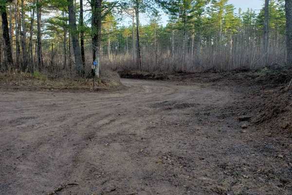
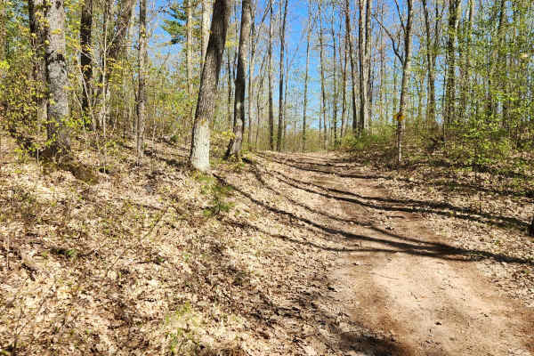
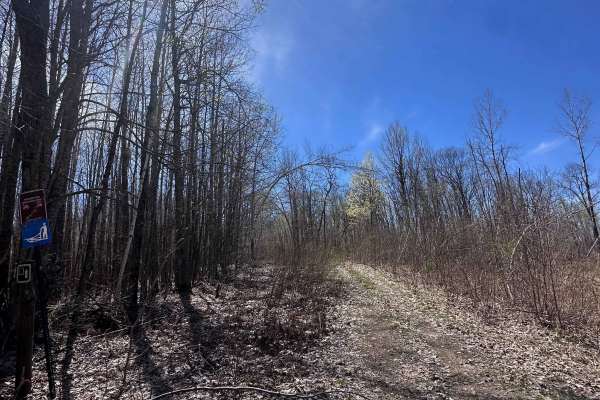
Trail 31 Segment 2
Segment 2 of Trail 31 is the perfect go-to for a relaxing afternoon drive and lies between Phipps Fire Lane and Thannum Fire Lane. T-Mobile seems to have good service most of the time, but it's unclear how well other providers work. It is well-marked with signs and poses no threat to the casual offr...
Learn more about Trail 31 Segment 2
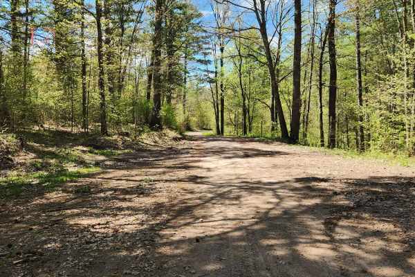
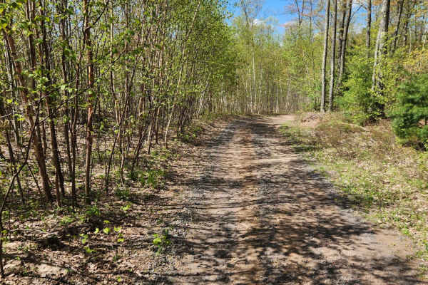
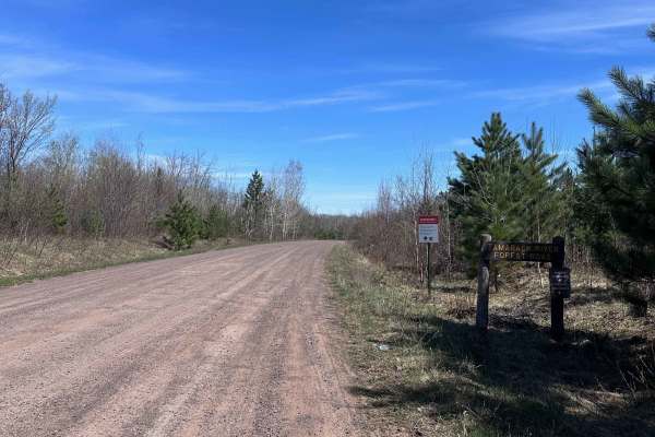
Trail 31 - Part 1
Trail 31 is the perfect go-to for a relaxing afternoon drive between Chippewa Trail & Thannum Fire Lane and joins Phipps Fire Lane for a short stretch. This trail is accessible to all vehicles except for dirt bikes. Near the Chippewa Trail end, there is a generous cul-de-sac with pit toilets, a pavi...
Learn more about Trail 31 - Part 1
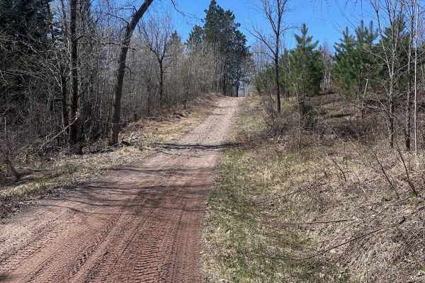
Trail 77
Trail 77 is a gravel connecting route from Trail 8 to County Road OO or Trail 31. It is one of the longer connecting trails and has nice easy rolling terrain to get you over to the town of Phipps and ultimately will get you to Hayward using Trail 31 and 30.
Learn more about Trail 77
Trail 8
Trail 8 is a long dirt/gravel mix trail connecting 2 roads that could be used for access. It is mostly a dirt trail, and it is easy to navigate with plenty of spots to pull off to the side for a trail break. No area should really be an issue to pass another machine on the trail but prepare for plent...
Learn more about Trail 8
Trail 57
This is a short loop trail that connects Camp 38th to Randysek Road allowing you to get off the automobile-shared route. There are a few more narrow spots where meeting another machine will require someone to give way to the other. The trail surface is pretty typical for northern Wisconsin with a di...
Learn more about Trail 57
Bayfield Timber Trail
The Timber Trail which combines with Randysek Road starts out like a normal trail with some narrow and mostly dirt terrain. However, as you get closer to the cable this intersects with Randsek Rd. and turns to a wide gravel road shared with automobiles. This is great access to Cable where you can fi...
Learn more about Bayfield Timber Trail
East Arm Forest Road
East Arm Forest Road connects Mallard Lake Forest Road and the Gandy Dancer Trail. It is fairly smooth in the western half, then gets progressively rockier as you travel east. This route is the primary way to access the eastern side of St. Croix State Forest when traveling on the Gandy Dancer Trail....
Learn more about East Arm Forest Road
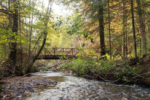
Trout Brook Trail
Trout Brook Trail is a short out-and-back that spurs off the Gandy Dancer Trail. Expect some medium-sized rocks and several mud holes that can get deep depending on the time of year. There is a go-around for the deeper one towards the end of the trail. OHV access ends short of Trout Brook, but you c...
Learn more about Trout Brook Trail
Gandy Dancer Trail
The Minnesota portion of the Gandy Dancer trail is an easy 30-mile ride. The trail is open year-round to ATV/UTV/ORV and bikes. In winter, the trail is groomed and shared with snowmobiles. The trail connects to other trails in the Danbury area, Nemadji State Forest, and Douglas County, WI. The trail...
Learn more about Gandy Dancer Trail
Mallard Lake Spur B
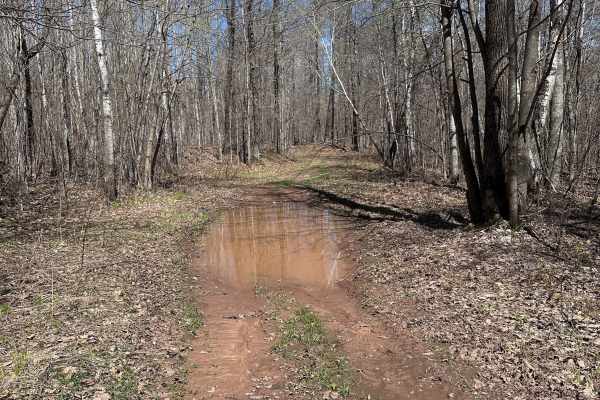
Mallard Lake Spur B is a short trail section with a few mud holes along the way. You can use this route to connect up to St.Croix High Line S from Mallard Lake Road. The mud holes vary in depth depending on the time of year, but are generally less than a foot deep. There are several large clearings ...
Learn more about Mallard Lake Spur B
St. Croix High Line South
St. Croix High Line South is the southern portion of the trail, which begins at the staging area along Mallard Lake Forest Road. It ends at a large clearing with a small shelter and a vault toilet. OHV riders can continue beyond that point, but 4x4 drivers will have to use this as an out-and-back, a...
Learn more about St. Croix High Line South
Saint Croix High Line
The Saint Croix High Line is one of the higher elevation trails in the forest, featuring lots of small to medium-sized rocks and moderate puddles throughout. This is one of the first trails you pass if you access the forest from Mallard Lake Trail. There is a parking lot at the trailhead where you c...
Learn more about Saint Croix High Line
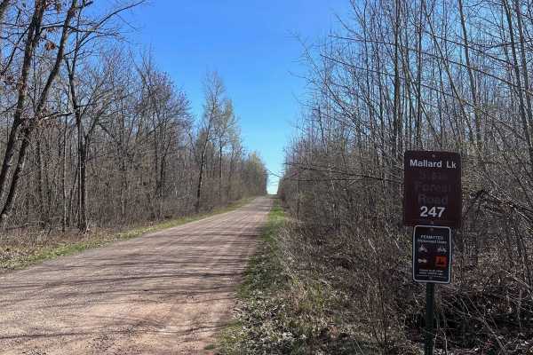
Mallard Lake Forest Road
Mallard Lake Forest Road is the main north/south forest road for the eastern side of the Tamarack River. It has mostly gentle grades but does have a fair amount of bumps and rough spots where erosion can make for a rougher ride. 4x4's towing campers or trailers will want to take it slower, while OHV...
Learn more about Mallard Lake Forest Road
Tamarack Sandway
Tamarack Sandway is a long sand track that runs adjacent to the Lower Tamarack River. The trail begins at the end of St.Croix High Line South and is OHV only. Expect rolling terrain with deep, sugary sand that's loose and dusty in dry conditions. There are lots of blind corners and hills, so be sure...
Learn more about Tamarack Sandway
Hay Creek Trail
Hay Creek Trail is mostly a tame route with several mud holes along the way but there is a creek crossing at Longstrem Brook that can be a little intimidating. It's not deep but the steep approach makes it seem worse than it is. It can be used as a low consequence confidence booster for newer riders...
Learn more about Hay Creek Trail
Churchill Lake Trail
Churchill Lake Trail is a fairly relaxed route that connects Grace and Churchill Lakes via Tamarack Forest Road and Grace Lake Road. It's mostly sand and has fewer rocks than most of the trails in this system. There are a few shallow water crossings, most of which have by-passes. There is one sectio...
Learn more about Churchill Lake Trail
Hunter's Spur
This is a short spur trail off the main trail that leads to a small clearing. There are often a number of grouse in the middle of the trail. There are many birch trees that line this route, which fall across the trail frequently and may be in the way if they haven't been cleared recently.
Learn more about Hunter's Spur
Tamarack River Forest Road
Tamarack River Forest Road is a smooth gravel road with gentle grades. It serves as one of the main roads through St. Croix State Forest with many trail crossings along the way. It begins at Grace Lake Road and ends at Boulder Campground and Rock Lake. Note that OHVs are not permitted inside the cam...
Learn more about Tamarack River Forest Road

Barron to Cameron - Blueberry Trail Extension
This is an easy trail with sections of red rock gravel base. Plenty of wetter areas to keep the ride interesting, and many winding trails through the trees and edges of farmers' fields. This segment is bookended by picnic areas at Anderson Park in Barron and a pavilion just off the Red Cedar River o...
Learn more about Barron to Cameron - Blueberry Trail Extension
Beginner ATV trails near Springbrook, Wisconsin
Explore ATV-friendly trails near you. These trails are accessible for vehicles up to 50 inches wide, perfect for ATVs and smaller off-road machines.
Phipps Fire Lane
This is a beautiful, winding gravel road through Northern Wisconsin that gives a beautiful view without significant danger to your vehicle. This trail is lined with a lovely variety of northern hardwoods and evergreens. Wildlife here is plentiful and it is very likely that you may see a few whitetai...
Learn more about Phipps Fire Lane
Trail 31 Segment 2
Segment 2 of Trail 31 is the perfect go-to for a relaxing afternoon drive and lies between Phipps Fire Lane and Thannum Fire Lane. T-Mobile seems to have good service most of the time, but it's unclear how well other providers work. It is well-marked with signs and poses no threat to the casual offr...
Learn more about Trail 31 Segment 2
Trail 31 - Part 1
Trail 31 is the perfect go-to for a relaxing afternoon drive between Chippewa Trail & Thannum Fire Lane and joins Phipps Fire Lane for a short stretch. This trail is accessible to all vehicles except for dirt bikes. Near the Chippewa Trail end, there is a generous cul-de-sac with pit toilets, a pavi...
Learn more about Trail 31 - Part 1
Trail 77
Trail 77 is a gravel connecting route from Trail 8 to County Road OO or Trail 31. It is one of the longer connecting trails and has nice easy rolling terrain to get you over to the town of Phipps and ultimately will get you to Hayward using Trail 31 and 30.
Learn more about Trail 77
Beginner UTV/side-by-side trails near Springbrook, Wisconsin
Find UTV and side-by-side trails near you. These trails accommodate vehicles up to 60 inches wide, ideal for UTVs, side-by-sides, and wider off-road rigs.
Phipps Fire Lane
This is a beautiful, winding gravel road through Northern Wisconsin that gives a beautiful view without significant danger to your vehicle. This trail is lined with a lovely variety of northern hardwoods and evergreens. Wildlife here is plentiful and it is very likely that you may see a few whitetai...
Learn more about Phipps Fire Lane
Trail 31 Segment 2
Segment 2 of Trail 31 is the perfect go-to for a relaxing afternoon drive and lies between Phipps Fire Lane and Thannum Fire Lane. T-Mobile seems to have good service most of the time, but it's unclear how well other providers work. It is well-marked with signs and poses no threat to the casual offr...
Learn more about Trail 31 Segment 2
Trail 31 - Part 1
Trail 31 is the perfect go-to for a relaxing afternoon drive between Chippewa Trail & Thannum Fire Lane and joins Phipps Fire Lane for a short stretch. This trail is accessible to all vehicles except for dirt bikes. Near the Chippewa Trail end, there is a generous cul-de-sac with pit toilets, a pavi...
Learn more about Trail 31 - Part 1
Trail 77
Trail 77 is a gravel connecting route from Trail 8 to County Road OO or Trail 31. It is one of the longer connecting trails and has nice easy rolling terrain to get you over to the town of Phipps and ultimately will get you to Hayward using Trail 31 and 30.
Learn more about Trail 77
The onX Offroad Difference
onX Offroad combines trail photos, descriptions, difficulty ratings, width restrictions, seasonality, and more in a user-friendly interface. Available on all devices, with offline access and full compatibility with CarPlay and Android Auto. Discover what you're missing today!
Open Trail Map