
Beginner Off-Road Trails
Near Snowflake, Arizona
Explore All Beginner Trails Near Snowflake, Arizona
Beginner Off-Road Trails Near Snowflake, Arizona
Discover the best beginner-friendly off-road trails near you. These easier, lower-rated trails are a great place to start — browse trail maps, check difficulty ratings, and find your next adventure.
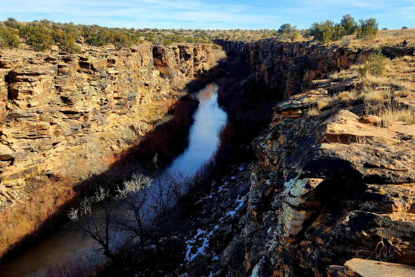
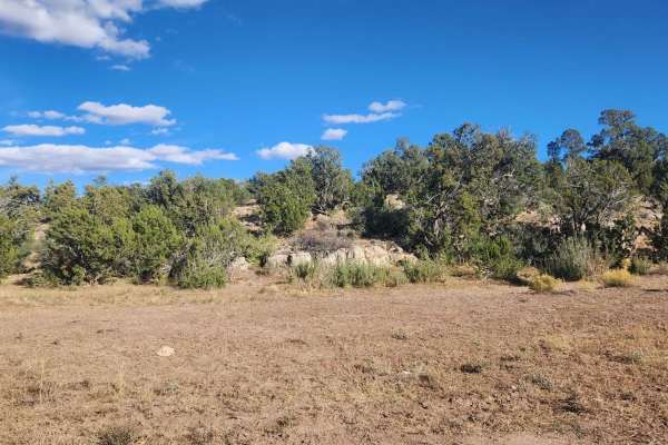
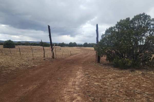
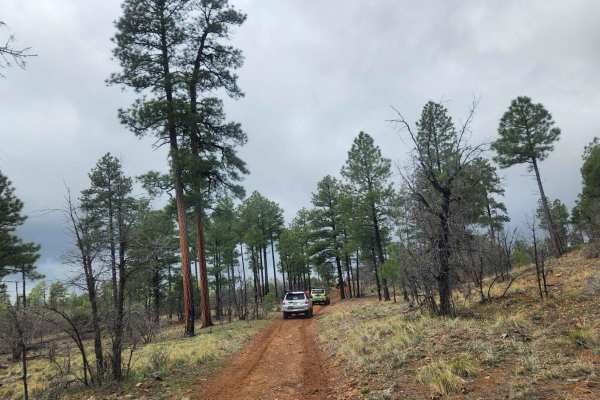
Five Mile Draw
This trail makes a great side trek for those passing through the area with about an hour to spare, though it can easily take longer depending on how much time is spent exploring. The route is only 2.2 miles, but the canyon offers plenty to see on foot, and the short loop can take around 45 minutes t...
Learn more about Five Mile Draw
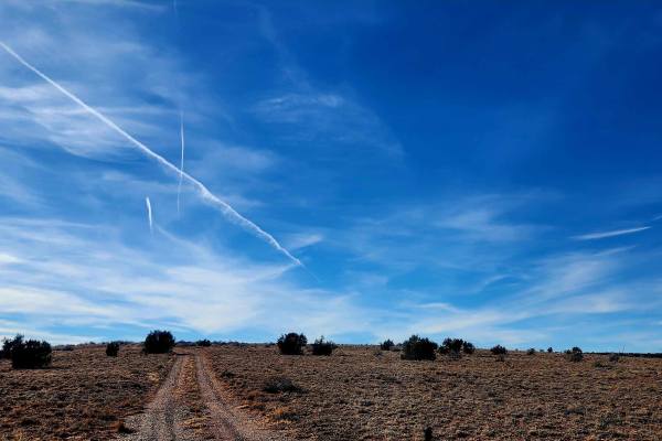
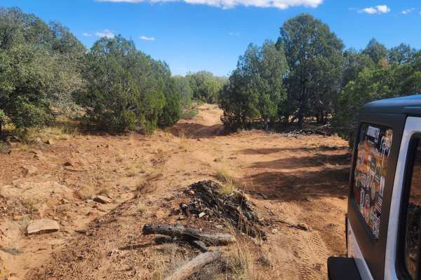
Mill Road
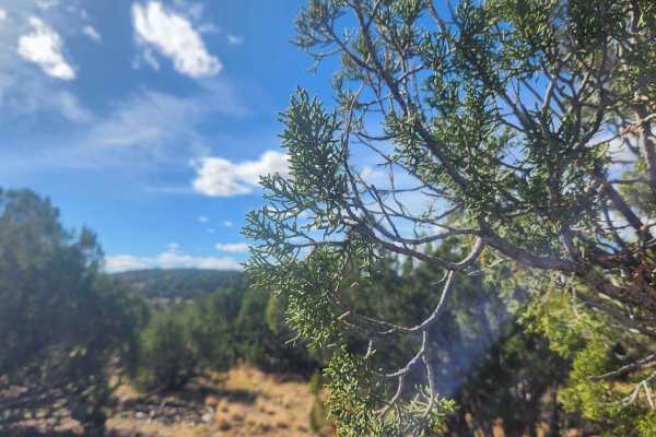
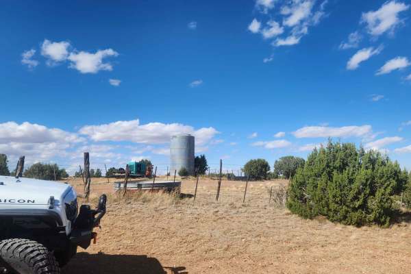
This trail follows a 3-mile road through the land north of Snowflake and Taylor, Arizona, traveling from east to west with a variety of open desert views. Along the route are broad mesas, expansive blue skies, and several windmills that define the landscape. Early on, the road passes a clearly marke...
Learn more about Mill Road
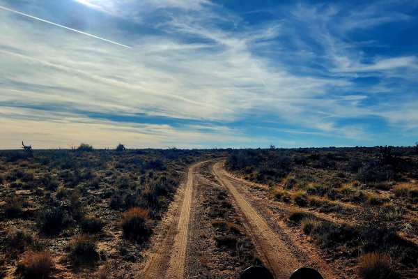
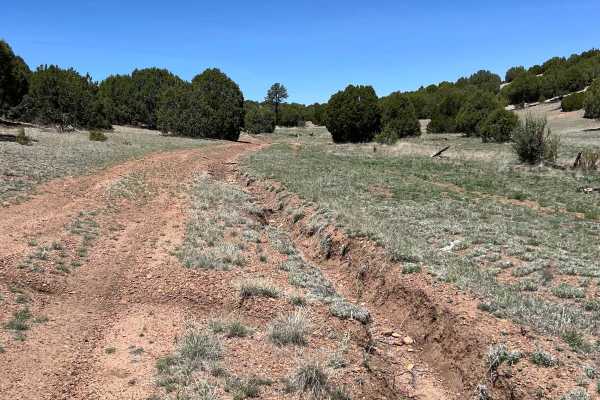
Way Out
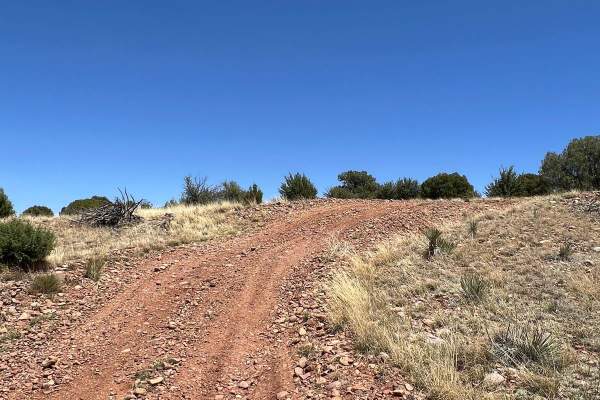
This trail is aptly named and serves as an alternate route out of the area after exploring Mill Road, avoiding the need to backtrack. The northern section runs north to south and remains a true off-road route with single-vehicle width, washouts, ruts, and wide-open high desert views, along with feat...
Learn more about Way Out
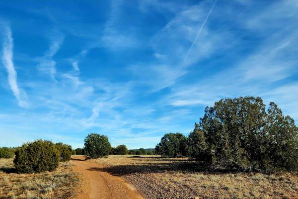
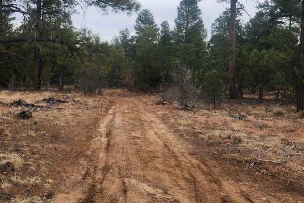
Thistle Hollow - FS 229
This trail travels through Thistle Hollow, an area transitioning from high desert into the lower elevations of the White Mountains. Starting on the north end near Pinedale Road and traveling south toward Lone Pine Dam Road, the landscape gradually shifts from scrub brush and cactus to juniper and sc...
Learn more about Thistle Hollow - FS 229
Bull Ranch Draw
This is an awesome trail for views. Almost every part of this trail has views one way or another. This trail offers views of canyons, mountains, rock out cropping's, and Trees. Unfortunately, this trail ends up on a closed road so it is an out-and-back trip. There are some hills to climb and descen...
Learn more about Bull Ranch Draw
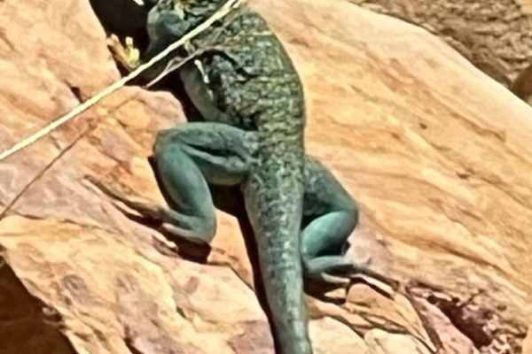
Lazy Lizard - FR 9600S
This easy trail showcases the beautiful, open views of the desert southwest. The green trees are contrasted with the black, tangled roots of dead trees, serving as sentinel to their past. Watch the large rocks carefully in this area for the brilliant green Eastern Collared Lizard sunning itself. The...
Learn more about Lazy Lizard - FR 9600S
Red Dirt Road
This peaceful, scenic, open route connects the Lazy Lizard FR 9600S to Cactus Flats. There is one very rutted section midway through the route that increases the difficulty. There are numerous overland camping spots on the western side of the trail. Antelope are frequently racing across the open ter...
Learn more about Red Dirt Road
Thistle Well Tank
This is another great out-and-back trail from the Thistle Hollow Road to Thistle Well Tank. It meets up with a closed road on the west side by Thistle Well Tank. The drive back heading East is well worth the trip out and back with spectacular views to the North overlooking the Snowflake-Taylor area....
Learn more about Thistle Well Tank
Thistle Camp
This is a shortcut across from Cactus Flats to FS655 - also known as the Maverick Trail. This is a great side trip to explore while making a day out of all the trails in the area. This trail is recommended for UTV, ATV, and dirt bikes since once you leave the Cactus Flats trail you will run into the...
Learn more about Thistle Camp
Antelope Shortcut
This shortcut connects West Pinedale Road with the Cactus Flats trail. West Pinedale Road is paved and has easy access to AZ Highway 260. The route is rocky with some ruts. Antelope, coyotes, and hawks can be seen from this route. If you stop along this route, watch out for the giant ant hills.
Learn more about Antelope Shortcut
Thistle Hollow
Most of this trail is an easy-going forest road until it heads west, when it becomes a bit of rocky terrain --nothing extreme, just a small rock. The trail is mainly in Juniper/Pinion pines and has some good views of the North, looking towards Snowflake-T lor. It's a nice afternoon drive--be prepare...
Learn more about Thistle Hollow
Hunt Tank Shortcut
This shortcut trail connects the northern and southern routes of Cactus Flats at the western end. It avoids the western trailhead, which can get busy on weekends. It is an easy trail with a few ruts. As a shortcut, it will take 4.5 miles off the trip. Most of the area is open with beautiful wildflow...
Learn more about Hunt Tank Shortcut
North Fool Hollow
Should you decide to take this trail, please know it is very slow going due to the amount of Malapais and rock in the trail. If you air down, it might help. Along this trip, you will cross over into the Apache-Sitgreaves Forest and see some wonderful Juniper, and if you get out and hike a short dist...
Learn more about North Fool Hollow
Joe Tank Road (FR136)
Joe Tank is a good access road to places to hike, bike, horseback ride, 4-wheel, and camp, and includes many side trails. Many of them are spur trails created for hiking and biking. Some of the hiking, biking, and horseback trails share 2-track roads, so be cautious of hikers, bikers, and horseback ...
Learn more about Joe Tank Road (FR136)
FR135
FR135 is another great connection between Rim Road (FR300) and Joe Tank Road (FR136). This has a greater change in elevation than FR140 and in the winter can become impassable due to snow and the grade combined. This trail has several really cool side trails and some spurs as well. It's great to exp...
Learn more about FR135
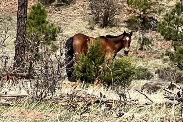
FS 46 Wild Horse Haven
This level, the easy short route follows FS 46 Stinson Road west from FS 139. It is through prime wild horse habitat. Driving slowly will increase your chances of viewing the majestic animals that have lived wild in the area for almost 300 years. The horses are wild and should not be approached. Th...
Learn more about FS 46 Wild Horse Haven
Decon1
This trail seems like it will lead to a dead end;there's a lot of overgrowth and many downed trees on and near the road. Surprisingly, it continues through. There's nothing hard about this trek and it has a great view of a prairie-type land at the north end.
Learn more about Decon1
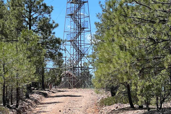
FS 161 West Fork
This beautiful, easy route connects FS 139 Cottonwood Wash with the East Mogollon Rim Road. The decommissioned Deer Springs Fire Lookout rises stoically above the far western side of this route overlooking the Mogollon Rim. This historic forest fire lookout was built in 1923 and listed on the Nation...
Learn more about FS 161 West Fork
FR140
Use FR140 to cross between Joe Tank Road (FR136) and Rim Road (FR300)--it is a good access road to some great side trips for a day of exploring. Wild horses and bald eagles are present in the area. Bringing a motorhome or car back here for camping is not recommended, but it is a good area for overla...
Learn more about FR140
FS 139 Cottonwood Wash
This trail starts at Arizona Highway 260. There is a parking area and staging spot at the turnoff. This trail meanders toward the Mogollon Rim. The area was ravaged by the Rodeo-Chediski Fire in 2002 which burned 410,000 acres. It was the largest fire in Arizona until it was surpassed in 2011. The f...
Learn more about FS 139 Cottonwood Wash
Beginner ATV trails near Snowflake, Arizona
Explore ATV-friendly trails near you. These trails are accessible for vehicles up to 50 inches wide, perfect for ATVs and smaller off-road machines.
Five Mile Draw
This trail makes a great side trek for those passing through the area with about an hour to spare, though it can easily take longer depending on how much time is spent exploring. The route is only 2.2 miles, but the canyon offers plenty to see on foot, and the short loop can take around 45 minutes t...
Learn more about Five Mile Draw
Mill Road
This trail follows a 3-mile road through the land north of Snowflake and Taylor, Arizona, traveling from east to west with a variety of open desert views. Along the route are broad mesas, expansive blue skies, and several windmills that define the landscape. Early on, the road passes a clearly marke...
Learn more about Mill Road
Way Out
This trail is aptly named and serves as an alternate route out of the area after exploring Mill Road, avoiding the need to backtrack. The northern section runs north to south and remains a true off-road route with single-vehicle width, washouts, ruts, and wide-open high desert views, along with feat...
Learn more about Way Out
Thistle Hollow - FS 229
This trail travels through Thistle Hollow, an area transitioning from high desert into the lower elevations of the White Mountains. Starting on the north end near Pinedale Road and traveling south toward Lone Pine Dam Road, the landscape gradually shifts from scrub brush and cactus to juniper and sc...
Learn more about Thistle Hollow - FS 229
Beginner UTV/side-by-side trails near Snowflake, Arizona
Find UTV and side-by-side trails near you. These trails accommodate vehicles up to 60 inches wide, ideal for UTVs, side-by-sides, and wider off-road rigs.
Five Mile Draw
This trail makes a great side trek for those passing through the area with about an hour to spare, though it can easily take longer depending on how much time is spent exploring. The route is only 2.2 miles, but the canyon offers plenty to see on foot, and the short loop can take around 45 minutes t...
Learn more about Five Mile Draw
Mill Road
This trail follows a 3-mile road through the land north of Snowflake and Taylor, Arizona, traveling from east to west with a variety of open desert views. Along the route are broad mesas, expansive blue skies, and several windmills that define the landscape. Early on, the road passes a clearly marke...
Learn more about Mill Road
Way Out
This trail is aptly named and serves as an alternate route out of the area after exploring Mill Road, avoiding the need to backtrack. The northern section runs north to south and remains a true off-road route with single-vehicle width, washouts, ruts, and wide-open high desert views, along with feat...
Learn more about Way Out
Thistle Hollow - FS 229
This trail travels through Thistle Hollow, an area transitioning from high desert into the lower elevations of the White Mountains. Starting on the north end near Pinedale Road and traveling south toward Lone Pine Dam Road, the landscape gradually shifts from scrub brush and cactus to juniper and sc...
Learn more about Thistle Hollow - FS 229
The onX Offroad Difference
onX Offroad combines trail photos, descriptions, difficulty ratings, width restrictions, seasonality, and more in a user-friendly interface. Available on all devices, with offline access and full compatibility with CarPlay and Android Auto. Discover what you're missing today!
Open Trail Map