
Beginner Off-Road Trails
Near SeaTac, Washington
Explore All Beginner Trails Near SeaTac, Washington
Beginner Off-Road Trails Near SeaTac, Washington
Discover the best beginner-friendly off-road trails near you. These easier, lower-rated trails are a great place to start — browse trail maps, check difficulty ratings, and find your next adventure.
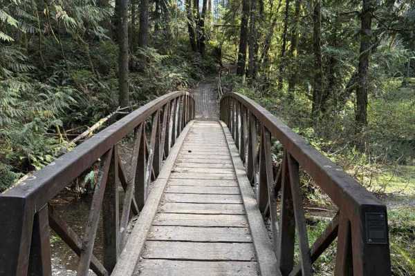
Overland Trail East
NOTE: Tahuya ORV Park Trails are two-way trails and have several blind corners. Keep your eyes up! There are also several single-track trails that spur off the edge to keep an eye out for crossing traffic. This section of the trail starts on Sandhills Road and ends on Sandhills Road. This is the Eas...
Learn more about Overland Trail East
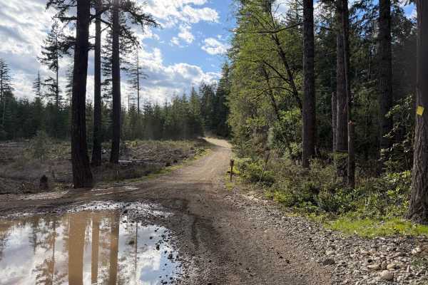
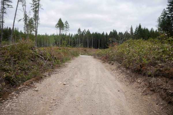
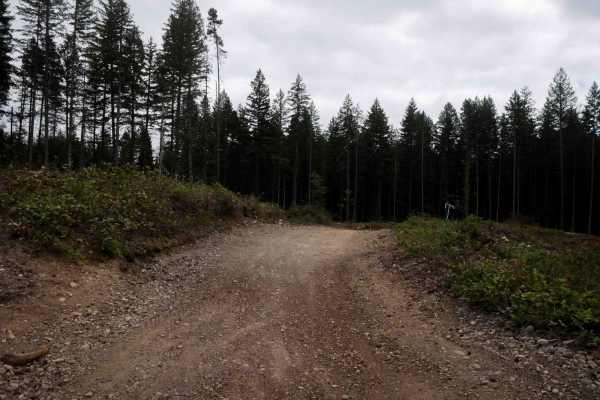
NF 7720000
This is a forest road leading from Wilkeson up into the mountains. The trail starts off nice and wide (approx 3 car widths) and continues up varying paths that wiggle down to a single lane. There is a variety of terrain in this section from dirt, gravel, loose rock, and mud. At this point in the sea...
Learn more about NF 7720000
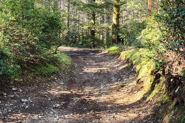
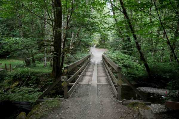
Mission Creek
This section of mission creek has some steep exposure that is clearly marked with caution signs. Keep in mind, Tahuya ORV park is 48” max width. The trail follows the river and weaves between the trees. You can expect exposed roots, tight trees, large rocks and whoops. The trail crosses a road a cou...
Learn more about Mission Creek
North Fork Road
This road takes you from Columbia Falls to the Canadian Border. This is a fun drive with lots of great stops, and two entrances to Glacier National Park. The most popular stop is Polebridge, MT, where you can try a huckleberry bear claw from the world famous Polebridge Mercantile. You can also enter...
Learn more about North Fork Road
Overland Trail South
NOTE: Tahuya ORV Park Trails are two-way trails and have several blind corners. Keep your eyes up! This is the Southern section of The Overland Trail, and it “Starts” mid-trail at the “Mission Creek Junction” OR At Sand Hill staging. You can expect standing water throughout the fall, winter, and sp...
Learn more about Overland Trail South
Loop Trail
This is an easy warm-up trail, accessible from 2 trail heads off the Sand Hill Pit staging area. Perfect area to get new riders to get familiar with what you will find around Tahuya. There are some roots and river rock throughout, but easily navigable for new riders. The trail loops around back to i...
Learn more about Loop Trail
Overland Trail
Flowy double track that is good for all skill levels. The trail is only wide enough for ATVs and dirt bikes. Can be ridden as fast or as slow as comfortable. Roots and softball-sized rocks are scattered throughout. Concrete pavers in a couple of areas to help the trail maintain shape in wetter areas...
Learn more about Overland Trail
Overland Trail (North)
This is the northern section of The Overland Trail. You can expect standing water throughout the fall, winter, and spring, with several deep puddles as deep as 12 inches in some areas during the wet season. There are several exposed roots as well as rutted sections from the rain. The trail is beginn...
Learn more about Overland Trail (North)
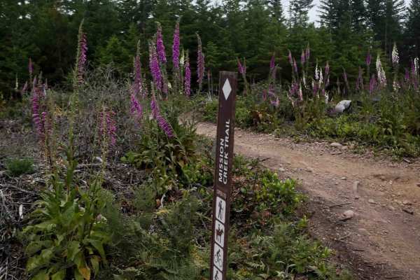
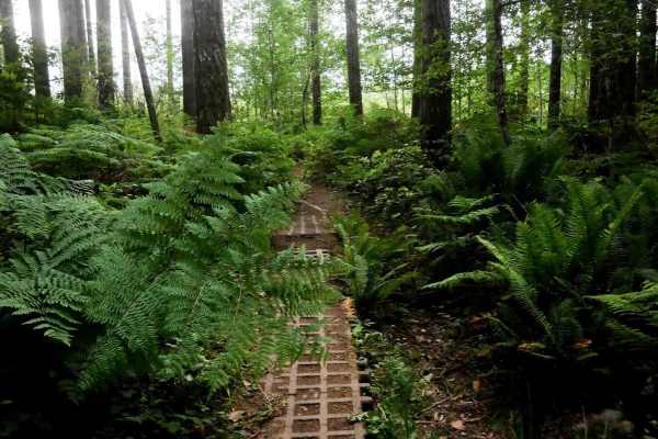
Mission Creek
This is a scenic 2-mile segment of Mission Creek Trail featuring a mix of open logged hillsides and forested terrain. The trail is a wide, easy two-track lined with purple foxgloves, offering fast and flowy riding. Expect sections with embedded rock, roots, and small loose rock throughout. Curves ra...
Learn more about Mission Creek
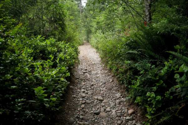
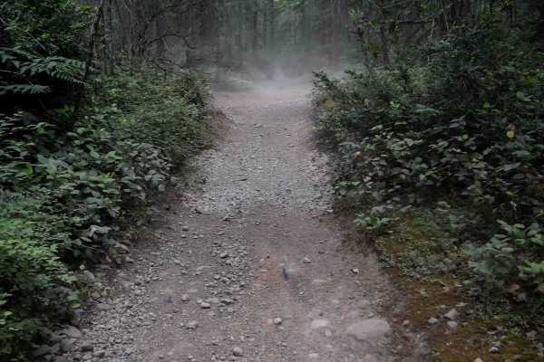
Salmon
Salmon is a 1.3-mile easy ATV trail that begins as a wide two-track curving tightly through the forest with banked corners, small rocks, pea gravel, and occasional whoops. After the first quarter mile, the trail transitions into a gravelly road with deeper loose rock and larger whoops as it descends...
Learn more about Salmon
Goat Ranch Road
This road is a main gravel road used to connect several spurs and side single tracks. It is a gravel road with loose rock. Goat ranch road is a two-way road, so it has very heavy traffic, so keep your eyes open. It has no obstacles, and pot holes are minimal. This road is only open to dirt bikes and...
Learn more about Goat Ranch Road
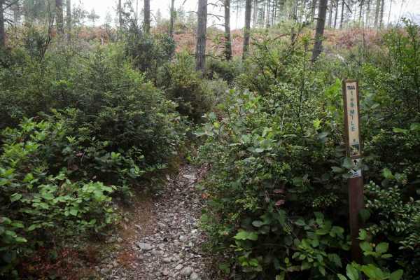
1.9 Mile
1.9 Mile is a primitive dirt bike trail weaving through dense pine trees and tight brush, with sharp turns and blind corners. It features small loose rocks and a few roots scattered across the path, as it winds through a logged area with piles of dead trees. The trail narrows into an overgrown grass...
Learn more about 1.9 Mile
Mission Creek Staging
This 1.6-mile easy ATV trail connects the Elfendahl Staging Area to the start of Mission Creek Trail. It begins as a wide path through a logged area with uneven terrain, occasional whoops, gravel, and small loose rock. The route features gradual curves and open visibility--ideal for beginners. As th...
Learn more about Mission Creek Staging
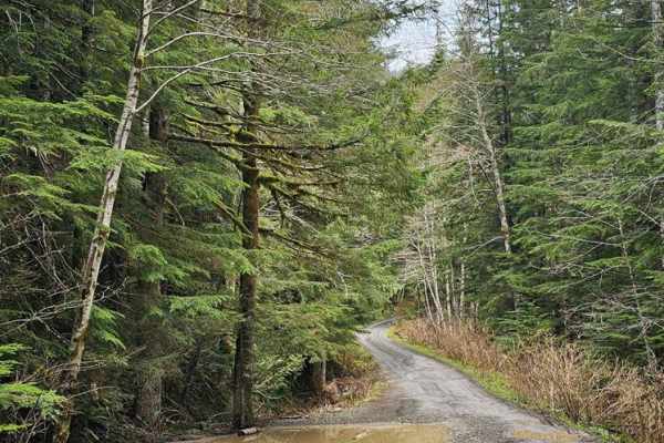
NF 7720000 Spur
This is a well-maintained new branch of 7720000 that was opened in Spring of 2024. Every fork off this road is valid. These forks are much narrower and might require high-clearance 4x4 in some cases. There are a few spots open for day camping, but nothing worth staying overnight.
Learn more about NF 7720000 Spur
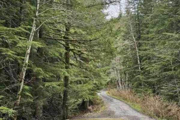
NF7720000 Overlook
The forks off of NF 7720000 are much narrower and might require high-clearance 4x4 in some cases. There are a few spots open for day camping, but nothing worth staying overnight. This particular spur leads to a nice overlook. Beware that there is a lot of trash at the trailhead--please pack out what...
Learn more about NF7720000 Overlook
Connector
This one-mile ATV trail segment connects two portions of the Mission Creek trail and provides an easy ride with a few moderate features. The trail surface includes small loose polished river rock, scattered roots, brake bumps, embedded rock, and uneven ground. While the trail remains mostly manageab...
Learn more about Connector
Tahuya River Staging
This is a short 0.7-mile trail through a logged area with a widened and cleared path that remains easy overall. The route includes twisting turns, loose round river rock, embedded rock, roots, and banked corners. Riders pass a scenic swampy pond and sections of cement pavers. Tight blind corners lin...
Learn more about Tahuya River Staging
Northwest Passage
Northwest Passage is a 2.4-mile dirt bike route that offers a fast and flowy ride through a logging area with open views and tall ferns. The trail features tight, quick curves and brake bumps, with mostly smooth dirt and some small loose rocks. Intersections are generally marked, though a few unmark...
Learn more about Northwest Passage
Staging Access Trail
This is a short, quarter-mile ATV route featuring a fast and wide path with small loose rocks and occasional whoops. It travels through forested terrain and serves as a straightforward connection to the staging area and campground. The trail provides easy access from the Elfendahl parking lot to Goa...
Learn more about Staging Access Trail
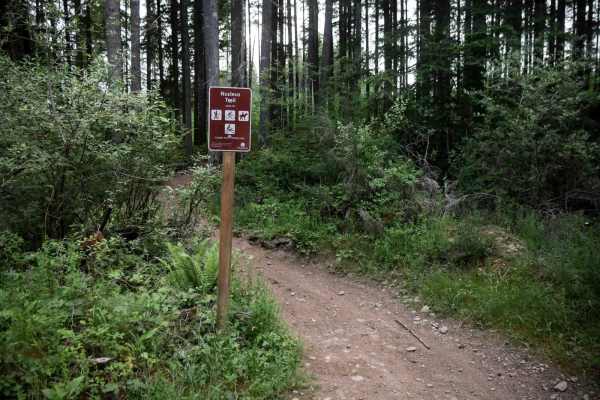
Nucleus
Nucleus Trail is a 1.3-mile dirt bike trail that winds through forested terrain featuring small loose rocks, embedded roots, and quick curves. Riders will encounter polished river rocks and a brief section that coincides with a road. Located near the Elfendahl staging area, this trail is popular and...
Learn more about Nucleus
Beginner ATV trails near SeaTac, Washington
Explore ATV-friendly trails near you. These trails are accessible for vehicles up to 50 inches wide, perfect for ATVs and smaller off-road machines.
Overland Trail East
NOTE: Tahuya ORV Park Trails are two-way trails and have several blind corners. Keep your eyes up! There are also several single-track trails that spur off the edge to keep an eye out for crossing traffic. This section of the trail starts on Sandhills Road and ends on Sandhills Road. This is the Eas...
Learn more about Overland Trail East
NF 7720000
This is a forest road leading from Wilkeson up into the mountains. The trail starts off nice and wide (approx 3 car widths) and continues up varying paths that wiggle down to a single lane. There is a variety of terrain in this section from dirt, gravel, loose rock, and mud. At this point in the sea...
Learn more about NF 7720000
Mission Creek
This section of mission creek has some steep exposure that is clearly marked with caution signs. Keep in mind, Tahuya ORV park is 48” max width. The trail follows the river and weaves between the trees. You can expect exposed roots, tight trees, large rocks and whoops. The trail crosses a road a cou...
Learn more about Mission Creek
North Fork Road
This road takes you from Columbia Falls to the Canadian Border. This is a fun drive with lots of great stops, and two entrances to Glacier National Park. The most popular stop is Polebridge, MT, where you can try a huckleberry bear claw from the world famous Polebridge Mercantile. You can also enter...
Learn more about North Fork Road
Beginner UTV/side-by-side trails near SeaTac, Washington
Find UTV and side-by-side trails near you. These trails accommodate vehicles up to 60 inches wide, ideal for UTVs, side-by-sides, and wider off-road rigs.
NF 7720000
This is a forest road leading from Wilkeson up into the mountains. The trail starts off nice and wide (approx 3 car widths) and continues up varying paths that wiggle down to a single lane. There is a variety of terrain in this section from dirt, gravel, loose rock, and mud. At this point in the sea...
Learn more about NF 7720000
NF 7720000 Spur
This is a well-maintained new branch of 7720000 that was opened in Spring of 2024. Every fork off this road is valid. These forks are much narrower and might require high-clearance 4x4 in some cases. There are a few spots open for day camping, but nothing worth staying overnight.
Learn more about NF 7720000 Spur
84 N Trail
This 1.1-mile point-to-point trail is part of the Tahyua State Forest off-road vehicle trail system. This trail takes you through the middle of the north off-road area and gives access to several other trails, including the Twin Rock Hill Climb obstacle. This narrow trail winds between trees and stu...
Learn more about 84 N Trail
4x4 Play Area Entrance Road
This short 0.6 mile point-to-point trail is part of the Tahuya State Forest ORV trail system. This trail takes you to an open 4X4 play area with a good sized rock garden and other obstacles (rating 4-7 in difficulty) to traverse. The trail going to the 4X4 play area is a narrow single vehicle trail ...
Learn more about 4x4 Play Area Entrance Road
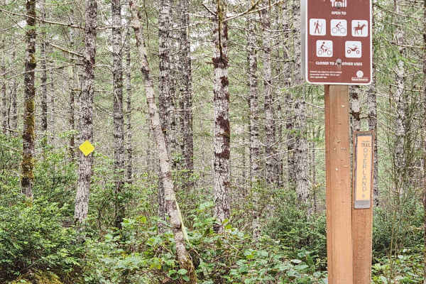
The onX Offroad Difference
onX Offroad combines trail photos, descriptions, difficulty ratings, width restrictions, seasonality, and more in a user-friendly interface. Available on all devices, with offline access and full compatibility with CarPlay and Android Auto. Discover what you're missing today!
Open Trail Map