
Beginner Off-Road Trails
Near Roosevelt, Utah
Explore All Beginner Trails Near Roosevelt, Utah
Beginner Off-Road Trails Near Roosevelt, Utah
Discover the best beginner-friendly off-road trails near you. These easier, lower-rated trails are a great place to start — browse trail maps, check difficulty ratings, and find your next adventure.
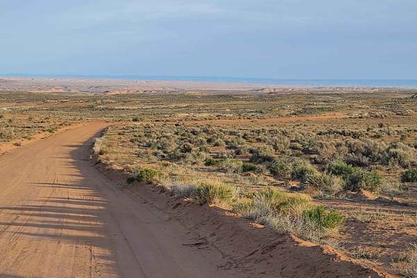
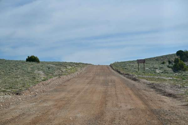
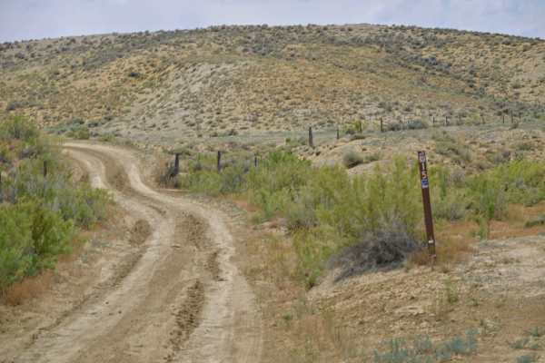
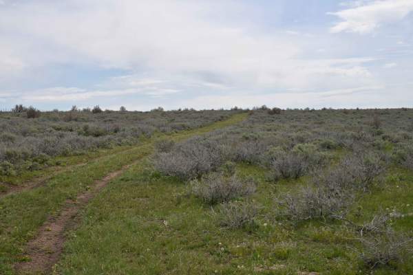
Halfway Hollow Road - Uintah County 2230
This road is graded and suitable for all types of vehicles. The width of the road is adequate for passing. Campers and trailers can traverse this road. This area is dry desert sagebrush terrain (no trees). Rock formations with varied colors make the desert look like it is in bloom. Rock spires and s...
Learn more about Halfway Hollow Road - Uintah County 2230
Ice Peak Cave
This is an easy, well-traveled dirt road. It takes you to a lookout where you can turn around and come back. You can walk up to the lookout and if you are daring enough, you can drive your machine up to the ledge for a great photo op.
Learn more about Ice Peak Cave
Red Cloud Loop
Red Cloud Loop (FS 10018) is a laidback forest road route perfect for beginners or anyone looking for an easy 4x4 trail near Vernal. Winding through the southeastern section of Ashley National Forest, this loop offers a scenic, low-stress drive through mixed forest with occasional rocky patches and ...
Learn more about Red Cloud Loop
Red Mountain West Access-Vernal
Red Mountain West Access is a 1-mile point-to-point trail rated 3 of 10 located in Uintah County, Utah. This trail provides access from the pavement on the west side of Red Mountain up to the Red Mountain Loop trail. Running the loop west to east is the easier direction (rated 6) as the most difficu...
Learn more about Red Mountain West Access-Vernal
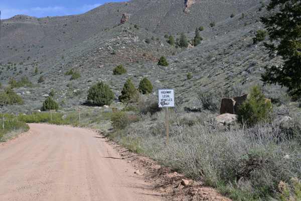
Taylor Mountain Road - FS 10044
Taylor Mountain Road is a scenic Forest Service road rated 1/10 in the Ashley National Forest. It connects Vernal to the south and FS 10018 at its northern terminus. It is passable by most any vehicle, although the USFS does restrict travel to legally tagged vehicles. The road passes numerous majest...
Learn more about Taylor Mountain Road - FS 10044
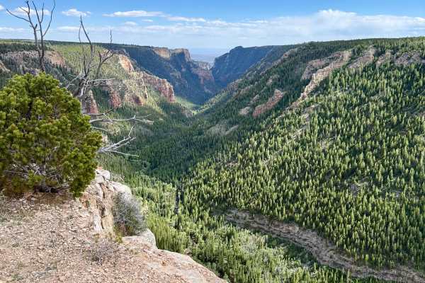
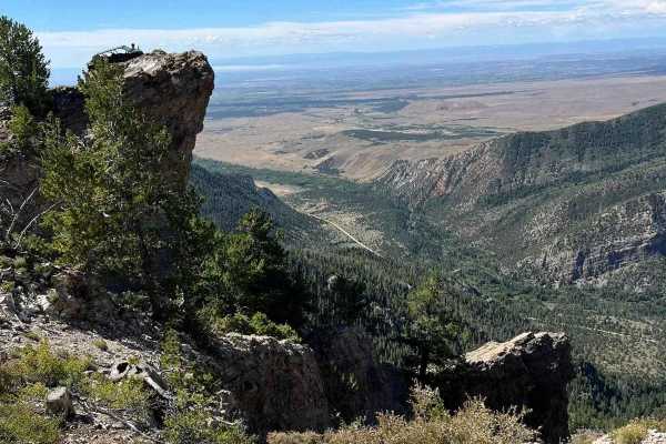
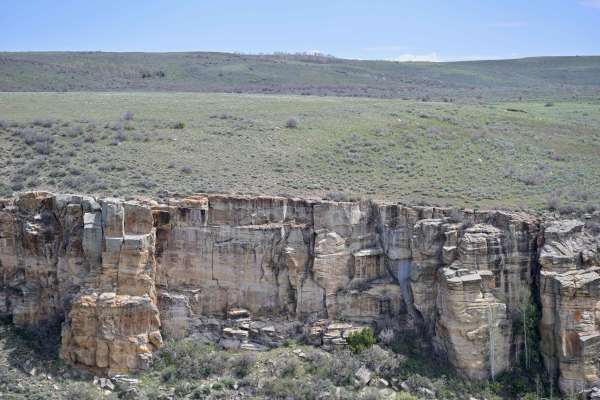
Ashley Gorge Viewpoint
This is a lollipop loop trail that leads to a stunning overlook of the Ashley Gorge. It is an easy trail with a few steep climbs, some tight turns through the trees, and potential for pinstripes. There is an outcropping of rock at the overlook that makes for a great vehicle photo opportunity. The t...
Learn more about Ashley Gorge Viewpoint
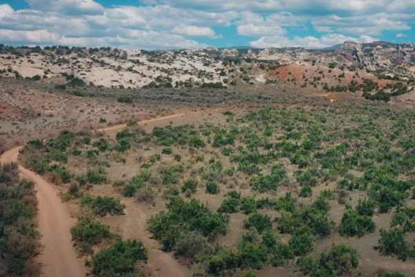
Lake Canyon Road - 10700S
This trail is an easy cruise through the Wilderness Management Area. There are several oil pumpers along this trail as well. The trail passes by Lake Canyon Lake which offers some good fishing. Past the lake, a bit of the trail crosses into National Forest Land, and there are plenty of places to cam...
Learn more about Lake Canyon Road - 10700S
East Park - FS 10020
East Park is a moderately maintained Forest Service road rated 2/10 in the Ashley National Forest. Generally smooth and easily traversed in 2WD without high clearance required. Much of the trail is at 9,000ft elevation, so it is subject to the vagaries of weather at high altitude and inconsistency i...
Learn more about East Park - FS 10020
Little Valley Road
Little Valley Road is a point-to-point trail in the Honda Hills area, just south of Red Fleet State Park near Vernal, Utah. As part of the Outlaw Trail system, it’s marked as Outlaw Trail 15 and winds its way along several ridgelines. Along the route, you can catch glimpses of Red Fleet State Park, ...
Learn more about Little Valley Road
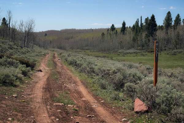
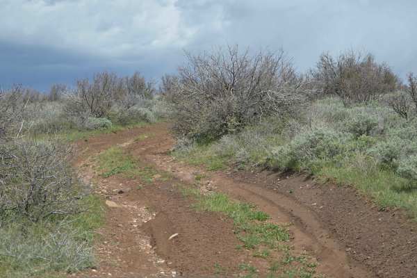
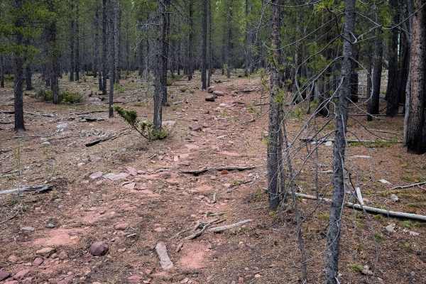
Kabell Hollow #551
Trail 551 starts off of FS 10019 at a trail marker and starts traversing across a hillside covered in sagebrush. The trail is rutted in spots, with 1-2 foot deep ruts often running on one side of the trail, where you are constantly crossing over to avoid the ruts. ATVs can easily straddle the ruts, ...
Learn more about Kabell Hollow #551
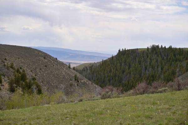
Barker Ridge - FS 10583
Barker Ridge - FS 10583 is an out-and-back trail rated 2/10 in the Ashley National Forest, offering a scenic overlook of the Uinta Valley, including Red Fleet State Park and Steinaker State Park. Popular for sightseeing, it’s the first trail you’ll encounter when heading north from Vernal into the f...
Learn more about Barker Ridge - FS 10583
Barker Spring Loop - FS 10050
Barker Spring Loop - FS10050 is a 1/10 rated trail on the east side of Ashley National Forest. As defined by the USFS, it consists of 3 separate trails: Barker Spring Loop - FS 10050, Little Brush Creek - FS 10052, and Dutch Charles Cutoff - FS 10582. The layout of the loop affords beautiful scenic ...
Learn more about Barker Spring Loop - FS 10050
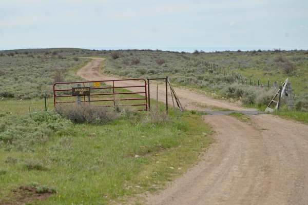
Dutch Charles Cutoff - FR10582
Dutch Charles Cutoff - FR 10582 is a point-to-point trail rated 1/10 on the east side of Ashley National Forest. This narrow, two-track path connects Little Brush Creek - FR 10052 and Barker Spring Loop - FR 10051 to form the loop named by the USFS. It’s an intriguing route, seemingly seldom travele...
Learn more about Dutch Charles Cutoff - FR10582
Little Brush Creek - FS 10052
Little Brush Creek - FS 10052 is a point-to-point trail with a 2/10 difficulty rating in the Ashley National Forest. It stretches from US191 to a hiking and overlook spot. One unique highlight is a Utah Wildlife/USFS area called an "exclosure" rather than an enclosure, with a somewhat mysterious his...
Learn more about Little Brush Creek - FS 10052
Buckboard Ridge - FS 10051
Buckboard Ridge - FS 10051 is an out-and-back trail in Ashley National Forest, rated 2/10. It begins as a smooth gravel road but soon turns into a rocky two-track with some loose obstacles. Winding mostly through sagebrush rangeland, the trail ends at a scenic overlook with beautiful views of the Ui...
Learn more about Buckboard Ridge - FS 10051
Burnt Cabin Gorge Overlook - FS 10060
Burnt Cabin Gorge Overlook is a 1/10 two track out and back trail that takes you to the top of a plateau overlooking Burnt Cabin Gorge and further into the Uinta Valley near Red Fleet State Park and Vernal on a clear day. While it is a two-track trail for its entire distance it is smooth and navigab...
Learn more about Burnt Cabin Gorge Overlook - FS 10060
Round Park South #10
Trail 10 makes a short 1.5 mile loop off of Trail 17, and is mostly just a wide and gradual dirt trail that winds through the lodgepole pines. The trail has a light layer of embedded rocks in it, but is not nearly as rocky as some of the other nearby ATV trails. It is mostly smooth dirt and fast and...
Learn more about Round Park South #10
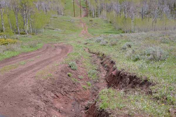
Power Line - FS 10574
Powerline Road - FS 10574 is a point-to-point trail rated 2/10 in the Ashley National Forest. It follows a functional power line across the terrain and is subject to all its terrain vagaries as a result, as it travels in its north/south path. Almost completely a two-track trail, it is deeply rutted ...
Learn more about Power Line - FS 10574
Little Brush Creek #153
This is a short section of ATV trail through a forest of pines and sagebrush, riding across a low hilltop. The two-track is mostly dirt, with small embedded rocks, shallow ruts and dips, and gradual curves. It goes through some wide open meadows on the hilltop that have nice views, then goes through...
Learn more about Little Brush Creek #153
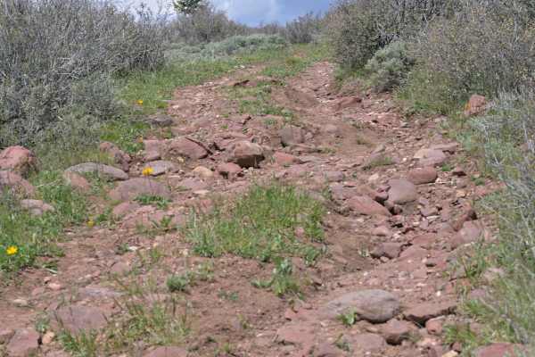
Range Study Loop - FS 10217
Range Study Loop is a 2/10 rated single width out and back looped dirt trail in the Ashley National Forest. Surface consistency is generally smooth dirt, with a rocky cobble descent at its southern end. The trail can be very muddy after precipitation, which can occur unexpectedly at its altitude. Th...
Learn more about Range Study Loop - FS 10217
Beginner ATV trails near Roosevelt, Utah
Explore ATV-friendly trails near you. These trails are accessible for vehicles up to 50 inches wide, perfect for ATVs and smaller off-road machines.
Halfway Hollow Road - Uintah County 2230
This road is graded and suitable for all types of vehicles. The width of the road is adequate for passing. Campers and trailers can traverse this road. This area is dry desert sagebrush terrain (no trees). Rock formations with varied colors make the desert look like it is in bloom. Rock spires and s...
Learn more about Halfway Hollow Road - Uintah County 2230
Ice Peak Cave
This is an easy, well-traveled dirt road. It takes you to a lookout where you can turn around and come back. You can walk up to the lookout and if you are daring enough, you can drive your machine up to the ledge for a great photo op.
Learn more about Ice Peak Cave
Red Cloud Loop
Red Cloud Loop (FS 10018) is a laidback forest road route perfect for beginners or anyone looking for an easy 4x4 trail near Vernal. Winding through the southeastern section of Ashley National Forest, this loop offers a scenic, low-stress drive through mixed forest with occasional rocky patches and ...
Learn more about Red Cloud Loop
Taylor Mountain Road - FS 10044
Taylor Mountain Road is a scenic Forest Service road rated 1/10 in the Ashley National Forest. It connects Vernal to the south and FS 10018 at its northern terminus. It is passable by most any vehicle, although the USFS does restrict travel to legally tagged vehicles. The road passes numerous majest...
Learn more about Taylor Mountain Road - FS 10044
Beginner UTV/side-by-side trails near Roosevelt, Utah
Find UTV and side-by-side trails near you. These trails accommodate vehicles up to 60 inches wide, ideal for UTVs, side-by-sides, and wider off-road rigs.
Halfway Hollow Road - Uintah County 2230
This road is graded and suitable for all types of vehicles. The width of the road is adequate for passing. Campers and trailers can traverse this road. This area is dry desert sagebrush terrain (no trees). Rock formations with varied colors make the desert look like it is in bloom. Rock spires and s...
Learn more about Halfway Hollow Road - Uintah County 2230
Ice Peak Cave
This is an easy, well-traveled dirt road. It takes you to a lookout where you can turn around and come back. You can walk up to the lookout and if you are daring enough, you can drive your machine up to the ledge for a great photo op.
Learn more about Ice Peak Cave
Red Cloud Loop
Red Cloud Loop (FS 10018) is a laidback forest road route perfect for beginners or anyone looking for an easy 4x4 trail near Vernal. Winding through the southeastern section of Ashley National Forest, this loop offers a scenic, low-stress drive through mixed forest with occasional rocky patches and ...
Learn more about Red Cloud Loop
Red Mountain West Access-Vernal
Red Mountain West Access is a 1-mile point-to-point trail rated 3 of 10 located in Uintah County, Utah. This trail provides access from the pavement on the west side of Red Mountain up to the Red Mountain Loop trail. Running the loop west to east is the easier direction (rated 6) as the most difficu...
Learn more about Red Mountain West Access-Vernal
The onX Offroad Difference
onX Offroad combines trail photos, descriptions, difficulty ratings, width restrictions, seasonality, and more in a user-friendly interface. Available on all devices, with offline access and full compatibility with CarPlay and Android Auto. Discover what you're missing today!
Open Trail Map