
Beginner Off-Road Trails
Near Riggins, Idaho
Explore All Beginner Trails Near Riggins, Idaho
Beginner Off-Road Trails Near Riggins, Idaho
Discover the best beginner-friendly off-road trails near you. These easier, lower-rated trails are a great place to start — browse trail maps, check difficulty ratings, and find your next adventure.
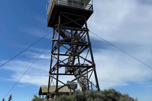
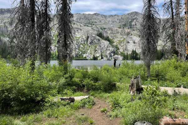
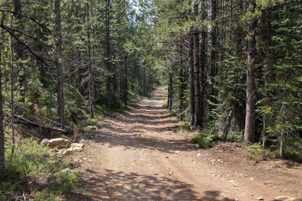
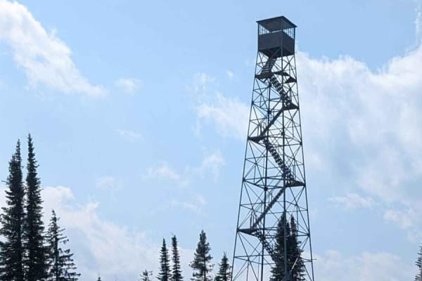
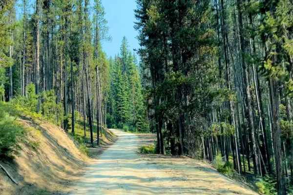
Chair Point Lookout
This 14 mile road will take you to the Chair Point Lookout in the Nez Perce National Forest with amazing views of the Salmon River. The road is an easy gravel road that rises to an elevation of just under 7,000 feet. The lookout was constructed in 1931, with the present structure being remodeled i...
Learn more about Chair Point Lookout
Nut Basin - FR 441
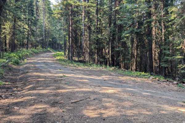
FR 441/Nut Basin Road is a sand road that meanders through the Nez Perce National Forest. Parts are lined with trees on both sides. The road gets rougher with ruts and some baseball-sized rocks when approaching the summit for the turn to the Nut Basin Lookout Ruins. There are places to dry camp alon...
Learn more about Nut Basin - FR 441
NF 221 - C/FDR Grangeville - Salmon Road
To connect to NF 221 - C/FDR Grangeville - Salmon Road, Turn East off Hwy 95 onto NFD 1614/Big Salmon Road and proceed 9.8 miles. This road is pavement. Before reaching Allison Creek Campground, there is a large sandy area on the right side of the road with ample room for unloading and loading offro...
Learn more about NF 221 - C/FDR Grangeville - Salmon Road
FS 536-Keating Ridge Road
FS 536/Keating Ridge Road turns North off NF221 C/FDR Grangeville-Salmon Road approximately 9.4 miles from FDR 1614/Big Salmon Road. Keating Ridge is 3.8 miles long (one way) and ties into FR 441-Nut Basin. The road is a mix of sand and dirt. There are a few minor ruts. The scenery is beautiful as t...
Learn more about FS 536-Keating Ridge Road
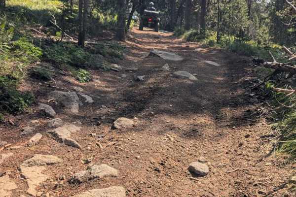
Hard Butte ATV
The Hard Butte ATV Trail features some tight and slightly off-camber turns, loose rocky hills, and more advanced creek crossing sections with large rocks and steeper exits, making it more difficult than the Elk Lake ATV Trail that is used to access this area. It goes south for 1.2 miles, gradually l...
Learn more about Hard Butte ATV
Elk Lake ATV
The Elk Lake ATV Trail is easy and straightforward, with no significant obstacles. It includes a few small muddy creek crossings and minor rocky areas, but nothing overly challenging. The trail is mostly straight and flat, with no off-camber sections or other considerable difficulties, making it an ...
Learn more about Elk Lake ATV
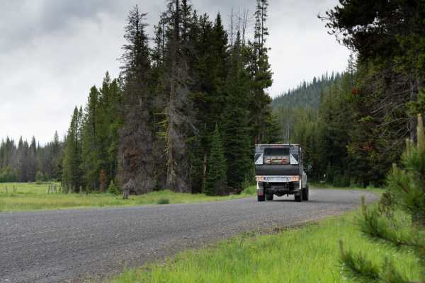
Big Salmon Road - 1614
Road 1614, also known as Big Salmon Road starts at Highway 95 at the South end of Riggins, Idaho. The first 12.5 miles from Highway 95 is paved. This track begins where Road 1614 turns to dirt just before the bridge for Road NF 257 and ends at French Creek. Road 1614 is the main road that accesses r...
Learn more about Big Salmon Road - 1614

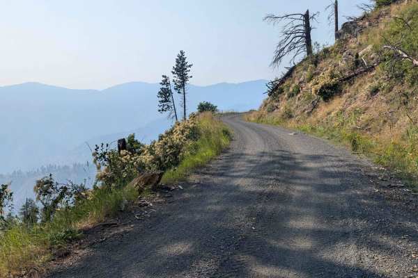
Wind River- NF 1614
NF-1614, also known as Salmon River Road, winds upstream from Riggins along the Wild & Scenic Salmon River, delivering sweeping canyon vistas and constant views of the river’s rapids. The drive is mostly graded gravel, with stretches of potholes, washboards, and narrow shelf roads where rockfall is ...
Learn more about Wind River- NF 1614
Clayburn Creek West
The west segment of the Clayburn Creek singletrack from the Clayburn Trailhead until Lava Ridge is an easy 2.4 miles of trail, and much easier than the eastern half of the trail after Lava Ridge, which is an advanced trail that should only be ridden by expert riders. This segment of the trail is mos...
Learn more about Clayburn Creek West
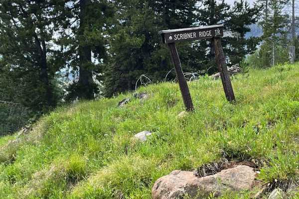
Scribner Ridge
The Scribner Ridge singletrack is an easy trail that begins with a shallow, rutted, and slightly rocky section. It then leads into a thick, heavily forested area for the majority of the trail. Although there is a significant amount of downfall, it has thankfully been cleared for the season, making t...
Learn more about Scribner Ridge
Big Hazard ATV
The Big Hazard ATV Trail is a 1.3-mile long two-track in the Payette National Forest north of McCall, Idaho. It starts with a creek crossing that is now blocked by boulders, making the original entrance inaccessible. However, there is a reroute across the creek to the south/right that also has some ...
Learn more about Big Hazard ATV
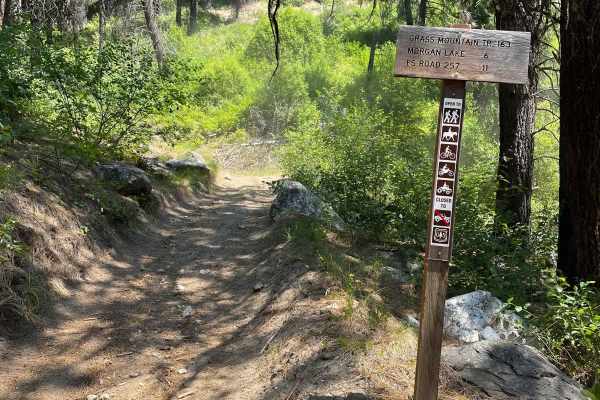
Grass Mountain ATV
The Grass Mountain ATV Trail features an upper section of smooth and fairly level switchbacks starting near Morgan Lake and extending west to the trailhead, which appears to be well-trafficked. Keep an eye out for deer on the trail; this is most likely a popular hunting area with evidence of a primi...
Learn more about Grass Mountain ATV
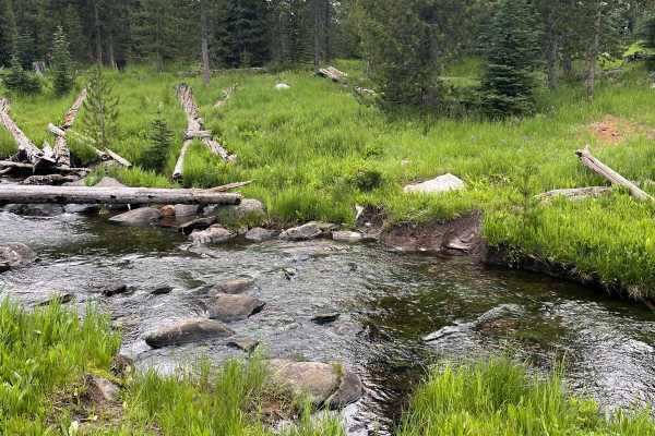
Vance Creek
The Vance Creek trail begins unmarked from Goose Lake Road but is a well-defined single-track path. It's a smooth and flowy ride through a grassy hillside. As you progress towards the middle of the trail, you will encounter some scattered embedded and loose rocks, and a few wet and muddy sections th...
Learn more about Vance Creek
Forest Service Road 50329 (FSR 329/Willow Creek Road
Forest Service Road 50329 (FSR 329/Willow Creek Road) intersects with Burgdorf to French Creek Road (FSR 50246) 5.4 miles after turning off Warren Wagon Road. This is a broader dirt road with semi-frequent places to pull over to allow the passing of other vehicles if necessary. We didn't encounter o...
Learn more about Forest Service Road 50329 (FSR 329/Willow Creek Road
Carey Dome Lookout
This trail runs through the Bureau of Land Management land adjacent to the Payette National Forest with ends connecting to Forest Service Road 50321 and FS 318. The trail is open to ATV and motorcycle traffic. Other motorized vehicles are not allowed. The trail is dirt with several areas and medium...
Learn more about Carey Dome Lookout
Forest Service Road 50321 (FS 321) Carey Dome
To reach Forest Service Road 50321 (FS 321) Carey Dome, drive approximately 6.8 from Warren Wagon Road on Burgdorf to French Creek. Turn right onto Forest Service Road 50318 (FS 318), proceed approximately 4 miles, and turn left onto FS 321/Carey Dome. FS 321 is a dirt road that winds through a fore...
Learn more about Forest Service Road 50321 (FS 321) Carey Dome
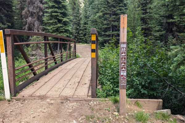
Trail 136
Trail 136 begins at the end of FSR 50329 (FSR 329/Willow Creek Road). It is accessed by crossing Willow Creek on a narrow bridge. The bridge is only wide enough to accommodate ATVs, motorcycles, bicycles, horseback riders, and hikers. No Side x Sides or larger off-road vehicles are allowed. This tra...
Learn more about Trail 136
Crystal Mountain
This is a short trail that can be combined with the War Eagle Lookout Trail. The trail is gravel/dirt and leads you up to a mountain full of Crystals called Crystal Mountain. After you have spent the day hunting crystals head back down the mountain and stop at the Secesh Stop for some great food or ...
Learn more about Crystal Mountain
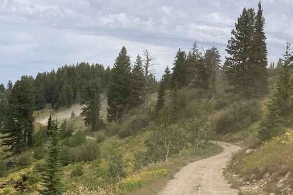
Burgdorf to French Creek
Traveling from east to west, this route begins with a flat, wide forest service road that slowly climbs through lush meadows, easily accessible camping and evergreen forest. The route eventually narrows to a single track that winds its way to higher elevations and incredible views. Heading back down...
Learn more about Burgdorf to French Creek
Sheep Rock
This trail is a mostly dirt and gravel, with sections that narrow quickly. Expect some washboard texture and occasional loose scree patches. The road isn’t deeply technical, but its tightness and erosion-prone features demand attentive driving. Not ideal for low-clearance vehicles, this route is bes...
Learn more about Sheep Rock
Beginner ATV trails near Riggins, Idaho
Explore ATV-friendly trails near you. These trails are accessible for vehicles up to 50 inches wide, perfect for ATVs and smaller off-road machines.
Chair Point Lookout
This 14 mile road will take you to the Chair Point Lookout in the Nez Perce National Forest with amazing views of the Salmon River. The road is an easy gravel road that rises to an elevation of just under 7,000 feet. The lookout was constructed in 1931, with the present structure being remodeled i...
Learn more about Chair Point Lookout
Nut Basin - FR 441
FR 441/Nut Basin Road is a sand road that meanders through the Nez Perce National Forest. Parts are lined with trees on both sides. The road gets rougher with ruts and some baseball-sized rocks when approaching the summit for the turn to the Nut Basin Lookout Ruins. There are places to dry camp alon...
Learn more about Nut Basin - FR 441
NF 221 - C/FDR Grangeville - Salmon Road
To connect to NF 221 - C/FDR Grangeville - Salmon Road, Turn East off Hwy 95 onto NFD 1614/Big Salmon Road and proceed 9.8 miles. This road is pavement. Before reaching Allison Creek Campground, there is a large sandy area on the right side of the road with ample room for unloading and loading offro...
Learn more about NF 221 - C/FDR Grangeville - Salmon Road
FS 536-Keating Ridge Road
FS 536/Keating Ridge Road turns North off NF221 C/FDR Grangeville-Salmon Road approximately 9.4 miles from FDR 1614/Big Salmon Road. Keating Ridge is 3.8 miles long (one way) and ties into FR 441-Nut Basin. The road is a mix of sand and dirt. There are a few minor ruts. The scenery is beautiful as t...
Learn more about FS 536-Keating Ridge Road
Beginner UTV/side-by-side trails near Riggins, Idaho
Find UTV and side-by-side trails near you. These trails accommodate vehicles up to 60 inches wide, ideal for UTVs, side-by-sides, and wider off-road rigs.
Chair Point Lookout
This 14 mile road will take you to the Chair Point Lookout in the Nez Perce National Forest with amazing views of the Salmon River. The road is an easy gravel road that rises to an elevation of just under 7,000 feet. The lookout was constructed in 1931, with the present structure being remodeled i...
Learn more about Chair Point Lookout
Nut Basin - FR 441
FR 441/Nut Basin Road is a sand road that meanders through the Nez Perce National Forest. Parts are lined with trees on both sides. The road gets rougher with ruts and some baseball-sized rocks when approaching the summit for the turn to the Nut Basin Lookout Ruins. There are places to dry camp alon...
Learn more about Nut Basin - FR 441
NF 221 - C/FDR Grangeville - Salmon Road
To connect to NF 221 - C/FDR Grangeville - Salmon Road, Turn East off Hwy 95 onto NFD 1614/Big Salmon Road and proceed 9.8 miles. This road is pavement. Before reaching Allison Creek Campground, there is a large sandy area on the right side of the road with ample room for unloading and loading offro...
Learn more about NF 221 - C/FDR Grangeville - Salmon Road
FS 536-Keating Ridge Road
FS 536/Keating Ridge Road turns North off NF221 C/FDR Grangeville-Salmon Road approximately 9.4 miles from FDR 1614/Big Salmon Road. Keating Ridge is 3.8 miles long (one way) and ties into FR 441-Nut Basin. The road is a mix of sand and dirt. There are a few minor ruts. The scenery is beautiful as t...
Learn more about FS 536-Keating Ridge Road
The onX Offroad Difference
onX Offroad combines trail photos, descriptions, difficulty ratings, width restrictions, seasonality, and more in a user-friendly interface. Available on all devices, with offline access and full compatibility with CarPlay and Android Auto. Discover what you're missing today!
Open Trail Map