
Beginner Off-Road Trails
Near Pocatello, Idaho
Explore All Beginner Trails Near Pocatello, Idaho
Beginner Off-Road Trails Near Pocatello, Idaho
Discover the best beginner-friendly off-road trails near you. These easier, lower-rated trails are a great place to start — browse trail maps, check difficulty ratings, and find your next adventure.
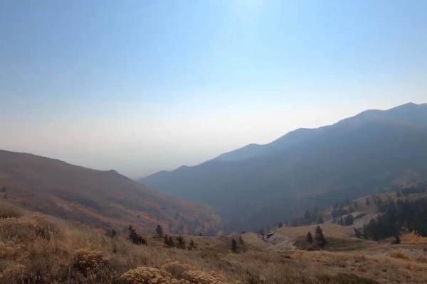
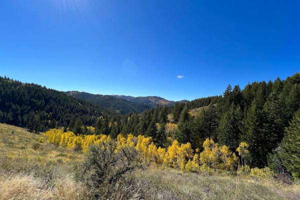
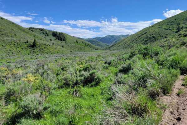
Scout Mountain
This trail is just outside of Pocatello. It goes into the National Forest, so there is some free camping in this area. On this trail, you will gain 3,000 feet in elevation. You start down in the forest trees, working your way up an easy dirt road. You will get epic views as you climb the mountain. I...
Learn more about Scout Mountain
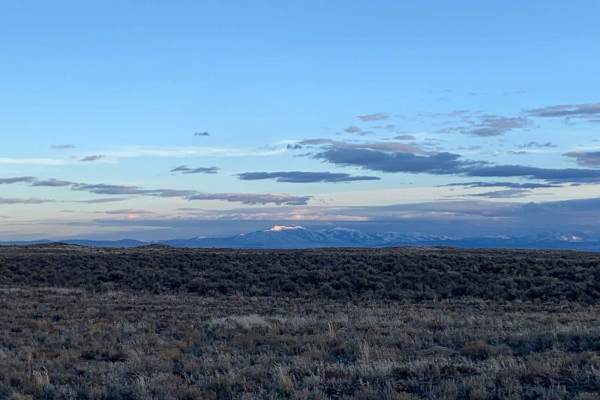
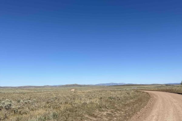
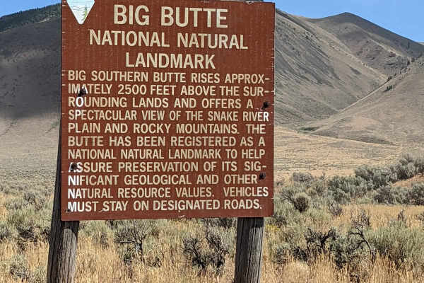
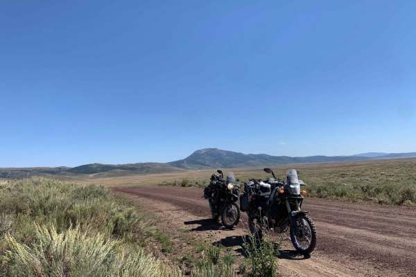
Springfield to Big Southern Butte
The route takes you from Springfield, Idaho to Big Southern Butte via part of Goodale's Cutoff. For a brief history of the cutoff see below. This trail is best ridden in the spring when the snow has melted until it gets hot and then in the late fall. There are awesome picturesque views of the entire...
Learn more about Springfield to Big Southern Butte
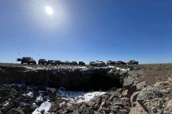
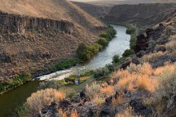
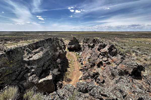
Bear Trap Cave North
Bear Trap Cave is one of many lave caves located in southeast Idaho. This trail begins from Coffee Point and winds southwest across the desert to the Bear Trap cave. It is a relatively easy-going trail, with a mostly dirt road that is only challenging in snow or mud. There are plenty of scenic oppor...
Learn more about Bear Trap Cave North
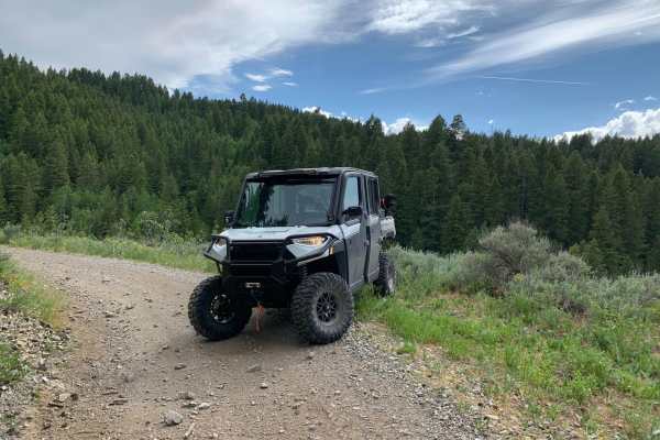
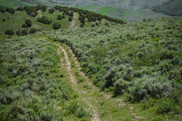
Houtz Canyon
Houtz Canyon from the Rockland side is a great off-road adventure for all vehicles, but it can become narrow due to brush. The BLM provides plenty of parking at the start of the trail. The trail takes you from high desert sagebrush and junipers into the pine forest. The trail is dirt/rock gravel and...
Learn more about Houtz Canyon
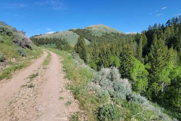
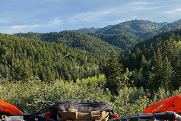
Green Canyon
This trail from Rockland, Idaho, via Green Canyon to Sheep Canyon, will take you from the high desert landscape and dry farms of southern Idaho up into the trees of the Sawtooth National Forest. The road from Rockland starts as a nice, well-maintained gravel road, and as you make your way up Green C...
Learn more about Green Canyon
Idaho Falls to Wolverine Canyon
This route takes you from Idaho Falls up Bone Road, past the Bone Store, and up the Wolverine Canyon. It is a fun ride to take all year round for a Sunday drive or a quick ride up in the mountains. You drive past the old settlement of Ozone which was a fairly large city until a drought in 1920 made ...
Learn more about Idaho Falls to Wolverine Canyon
Indian Creek - Cow Camp
This is the most easily runnable Public-Land only route from 10 Mile Pass / Indian Creek area to the Cow Camp area. It is all dirt starting from the Indian Creek trailhead off of 10-mile pass road. This route skirts the northeastern base of the Chesterfield range. You will pass through a variety of...
Learn more about Indian Creek - Cow Camp
Sheep Canyon 1
This section of trail is one continuous, long hill climb/descent depending which direction you're going. (West to East is uphill). There are some loose rocky patches scattered throughout and a few small mud ruts here and there. The summit of the trail offers amazing views of the surrounding mountain...
Learn more about Sheep Canyon 1
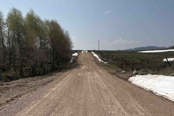
Cranes Flat Cutoff
This trail is a graded gravel cutoff road between Blackfoot Reservoir Road and Bone / Grays Lake Road. It is a generally smooth road through a mix of private cattle ranches and public land. It provides quick access to the Brockman and Caribou Basin areas from Wolverine Canyon and Brush Creek roads,...
Learn more about Cranes Flat Cutoff
Sheep Canyon 2
This curvy and windy section of Sheep's Canyon hugs alongside the slope of the mountainside, offering beautiful views of the surrounding Sawtooth National Forest. There are loose rocky patches, especially around some of the corners. Mud ruts exist here and there. Caution of standing water/mud holes,...
Learn more about Sheep Canyon 2
Bone to Wolverine Brush Creek Run
This route is easily passable by any overland rig and most family SUVs. It takes you through a mix of private cattle ranches and public land. You will pass through rolling sagebrush hills and several campsites, including a BLM campground. The latter half of the trail borders the Blackfoot River Cany...
Learn more about Bone to Wolverine Brush Creek Run
Cedar Butte Road to Big Southern Southside
This is a cutoff road from Cedar Butte to Big Southern Southside. You can access the old Goodale's Cutoff trail (Webb Springs trail), Big Southern Springfield Road headed south, or Atom Cox Well Road headed west. This is part of the easiest way to get to Frenchman's Cabin. It's an easily accessed, w...
Learn more about Cedar Butte Road to Big Southern Southside

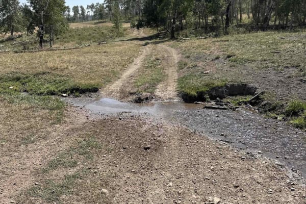
South Heglar Canyon
Starting from the Raft River Side, you will pass by dry farms on a well-maintained gravel road as you make your way up the Sawtooth National Forest. It quickly transitions from sagebrush into Aspens and Pine trees as you leave the high desert. One small creek crossing is effortless to make it throug...
Learn more about South Heglar Canyon
Bone to Caribou Loop
This route takes you from Bone Road to the Caribou Loop. It is in a gorgeous valley with mountains to the West that stay green year-round and are very pretty as the leaves turn in the fall. It may be tempting to take Blackfoot Reservoir Road to access Grey's Lake and the reservoir as it is more of a...
Learn more about Bone to Caribou Loop
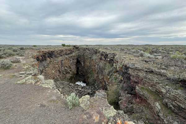
Bear Trap/Crystal Ice Cave Trail
This dirt road follows the route from Bear Trap Cave to Crystal Ice Caves and King's Bowl. The route can be traveled in either direction, as it is accessed by various BLM roads and trails. Watch for the deep chasm of King's Bowl Rift as you near the Wapi Lava Flow. In the 1970s, people often crowded...
Learn more about Bear Trap/Crystal Ice Cave Trail
North Heglar
Starting From the Raft River Side, you will pass by dry farms on a well-maintained gravel road as you make your way up the Sawtooth National Forest. As you make your way from the high desert and into more forest, full of aspens and pine trees, the elevation of the limestone mountains around you dras...
Learn more about North Heglar
Noise Park - Outer 6 Miles loop
Noise ORV is single track trail loop and features whoops, volcanic rock, sand, and hard dirt. It can get quite dusty, so the best times to ride are early in the morning or after it has rained. Idaho ORV decals are required to ride. The trails are beginner and kid friendly. It's always windy. There i...
Learn more about Noise Park - Outer 6 Miles loop
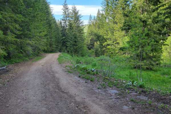
Heglar Canyon
This section of trail connects to a handful of other trails in the area. The northern half is more mountainous terrain as it winds its way up/down. There are mud ruts, erosion spots, and rocky patches here and there. Caution in the early seasons. The southern half is a wide-open, easy dirt road that...
Learn more about Heglar Canyon
Deep Creek/White Canyon
This is an easy ATV trail in the Caribou National Forest near Malad, Idaho. The south end of the trail connects to the Trail Hollow to Maple Hollow ATV trail, and it crosses Maple Hollow about halfway through. The north end of the trail is fainter and starts to peter out before it ends at private pr...
Learn more about Deep Creek/White Canyon
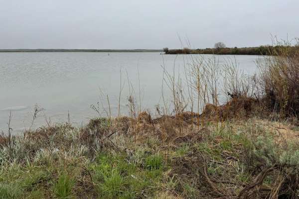
Lake View
A very well-maintained gravel road leads right to the lake through the bird refuge. Although this is a short trip off the main road, it gives you access to the lake, which is very limited due to the wildlife refuge. You would not know this area was here unless you took this trail to a shallow reserv...
Learn more about Lake View
Beginner ATV trails near Pocatello, Idaho
Explore ATV-friendly trails near you. These trails are accessible for vehicles up to 50 inches wide, perfect for ATVs and smaller off-road machines.
Scout Mountain
This trail is just outside of Pocatello. It goes into the National Forest, so there is some free camping in this area. On this trail, you will gain 3,000 feet in elevation. You start down in the forest trees, working your way up an easy dirt road. You will get epic views as you climb the mountain. I...
Learn more about Scout Mountain
Springfield to Big Southern Butte
The route takes you from Springfield, Idaho to Big Southern Butte via part of Goodale's Cutoff. For a brief history of the cutoff see below. This trail is best ridden in the spring when the snow has melted until it gets hot and then in the late fall. There are awesome picturesque views of the entire...
Learn more about Springfield to Big Southern Butte
Bear Trap Cave North
Bear Trap Cave is one of many lave caves located in southeast Idaho. This trail begins from Coffee Point and winds southwest across the desert to the Bear Trap cave. It is a relatively easy-going trail, with a mostly dirt road that is only challenging in snow or mud. There are plenty of scenic oppor...
Learn more about Bear Trap Cave North
Houtz Canyon
Houtz Canyon from the Rockland side is a great off-road adventure for all vehicles, but it can become narrow due to brush. The BLM provides plenty of parking at the start of the trail. The trail takes you from high desert sagebrush and junipers into the pine forest. The trail is dirt/rock gravel and...
Learn more about Houtz Canyon
Beginner UTV/side-by-side trails near Pocatello, Idaho
Find UTV and side-by-side trails near you. These trails accommodate vehicles up to 60 inches wide, ideal for UTVs, side-by-sides, and wider off-road rigs.
Scout Mountain
This trail is just outside of Pocatello. It goes into the National Forest, so there is some free camping in this area. On this trail, you will gain 3,000 feet in elevation. You start down in the forest trees, working your way up an easy dirt road. You will get epic views as you climb the mountain. I...
Learn more about Scout Mountain
Springfield to Big Southern Butte
The route takes you from Springfield, Idaho to Big Southern Butte via part of Goodale's Cutoff. For a brief history of the cutoff see below. This trail is best ridden in the spring when the snow has melted until it gets hot and then in the late fall. There are awesome picturesque views of the entire...
Learn more about Springfield to Big Southern Butte
Bear Trap Cave North
Bear Trap Cave is one of many lave caves located in southeast Idaho. This trail begins from Coffee Point and winds southwest across the desert to the Bear Trap cave. It is a relatively easy-going trail, with a mostly dirt road that is only challenging in snow or mud. There are plenty of scenic oppor...
Learn more about Bear Trap Cave North
Houtz Canyon
Houtz Canyon from the Rockland side is a great off-road adventure for all vehicles, but it can become narrow due to brush. The BLM provides plenty of parking at the start of the trail. The trail takes you from high desert sagebrush and junipers into the pine forest. The trail is dirt/rock gravel and...
Learn more about Houtz Canyon
The onX Offroad Difference
onX Offroad combines trail photos, descriptions, difficulty ratings, width restrictions, seasonality, and more in a user-friendly interface. Available on all devices, with offline access and full compatibility with CarPlay and Android Auto. Discover what you're missing today!
Open Trail Map