
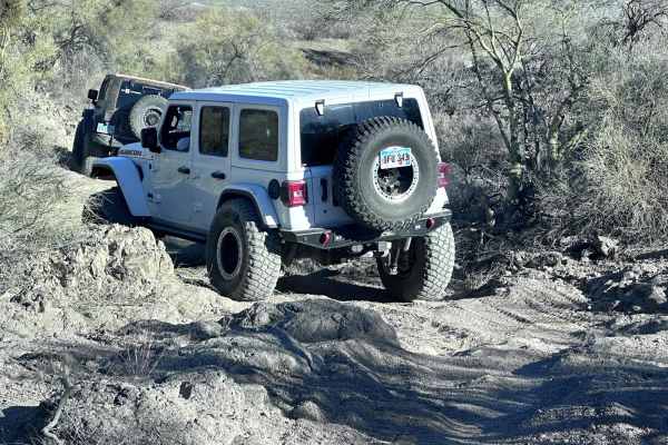
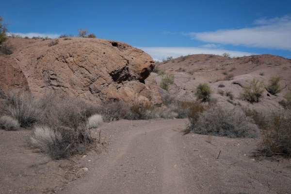
Beginner Off-Road Trails
Near Parker, Arizona
Explore All Beginner Trails Near Parker, Arizona
Beginner Off-Road Trails Near Parker, Arizona
Discover the best beginner-friendly off-road trails near you. These easier, lower-rated trails are a great place to start — browse trail maps, check difficulty ratings, and find your next adventure.
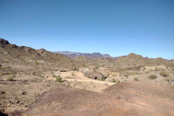
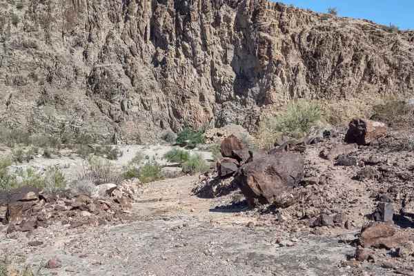
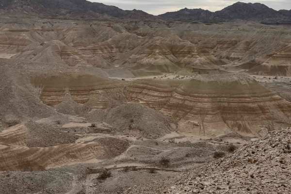
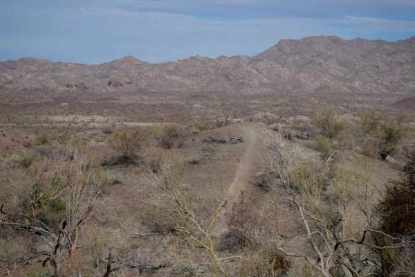
Swansea Townsite
The Swansea Townsite Trail is a historical and scenic route through the remote Arizona desert, offering a mix of graded access road, rugged shelf sections, and challenging terrain, specifically beyond the ghost town. This trail is ideal for those interested in blending light off-roading with a step ...
Learn more about Swansea Townsite
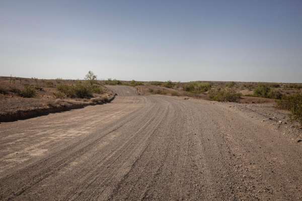
Osborne Wash
This 3.7-mile track, which goes through the Osborne Wash for part of the trail, provides a cut-across trail to get back into Parker or get out to the Swansea Townsite Trail, without having to go clear around to Shea Road. The track is on BLM and Arizona State Trust Lands. The BLM trail numbers are H...
Learn more about Osborne Wash
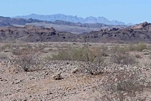
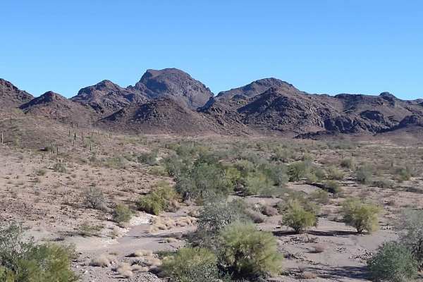
Gibraltar Mountain Wanderings
This 4-mile RT trail uses Trail Hs360 to get a little further into the Gibraltar Mountain Wilderness. This wilderness area is BLM land, and the wildlife possibilities include bighorn sheep, wild donkeys, burros, wild horses, quail, and roadrunners. In the AZ desert, be sure to watch for rattlesnakes...
Learn more about Gibraltar Mountain Wanderings
Midland Vidal Road
Used by early settlers to travel between Vidal, California, and the now-ghost town of Midland, the Midland-Vidal Road was perhaps also used by Wyatt Earp, who lived in Vidal for a time. Along the drive, there are wonderful panoramas across Rice Valley and a marvelous perspective of the Rice Valley D...
Learn more about Midland Vidal Road
Cienega Springs to Shea
This 9-mile (each way) trail connects Cienega Springs Road and the Back Way to Desert Bar Trail with Shea Road and the Swansea Townsite Trail. You skirt along the edge of the Gibraltar Mountain Wilderness on BLM and Arizona State Trust Lands. The trail is dirt and sand, with rocks in some areas. In ...
Learn more about Cienega Springs to Shea
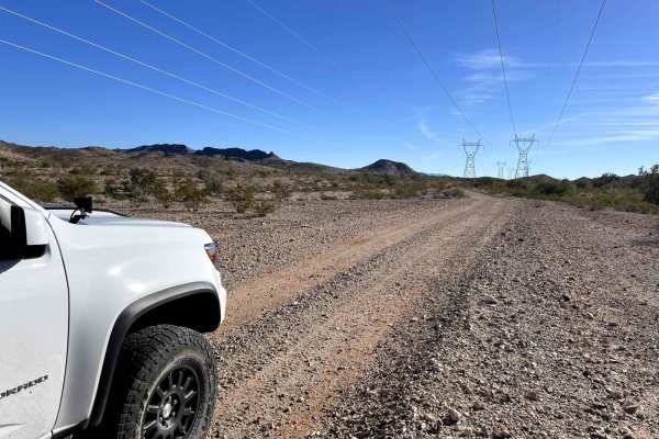
Hightower Trail
This is a fun trail that follows the high line poles out into the desert. If coming from Lake Havasu on the Whipple Mountain Loop Trail, you can stay straight and follow this trail down. Views are incredible, and the road is maintained by the power companies, so it's a pleasant Overlanding type of t...
Learn more about Hightower Trail
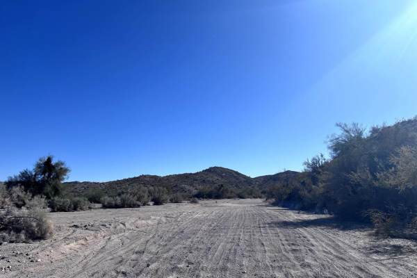
Mohave Wash
This trail leaves straight off of Highway 95 and takes you through three distinct washes. Its a very popular area for ATVs, UTVs and dirt bikes, and with it being close to town, it can become crowded on weekends. There are regulations posted at the start of the trail.
Learn more about Mohave Wash
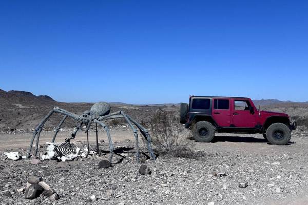
Mohave Powerline
This short 2.7-mile point-to-point trail connects the Mohave Wash to Planet Ranch Road. This trail is full of ups and downs as you run along a set of power lines towards the Mohave Wash. Right before you arrive at the Mohave Wash, there is a giant spider placed on the ridge that you can get good pho...
Learn more about Mohave Powerline
Painted Mountains
This track takes you north out of Quartzsite, Arizona, across the desert to the amazing Painted Mountains and canyons surrounding Mesquite Mountain. You will be on the reservation of the Colorado River Indian Tribe (CRIT) and you will need a CRIT sticker. They're $25/year and allow access to all the...
Learn more about Painted Mountains
Four Peaks to Plomosa Road
This 3-mile trail provides an alternate route to get from the Four Peaks area back to Plomosa Road. It will provide different scenery and a slightly different view from the other trails in this area simply because the desert is so unique. Taking the same trail in the opposite direction, or finding a...
Learn more about Four Peaks to Plomosa Road
Blackfalls Loop
This short 1.8 mile point-to-point trail is an optional route to access the Mohave Wash area. This follows a smaller wash instead of driving on over the high ground. This trail has a few narrow passages and small obstacles up to 12" in height to negotiate. This is a good side trail while heading out...
Learn more about Blackfalls Loop
Hn710
This 2-mile loop is within the Open Area of the Standard Wash OHV Area, thus there are lots of different tracks to follow and explore. It makes a loop through the washes and rolling hills, starting in a wider sandy wash. Parts of the trail are wider like the Jeep trail, and parts are narrow single t...
Learn more about Hn710
Hn475
This short dirt bike trail near Standard Wash is an easy mix of narrow singletrack, gravelly two-track, and wide sandy washes. It's mostly easy throughout the 2.5-mile route, with a bit of steep climbing in the beginning but more gradual throughout the rest of the trail. It starts off wide from the ...
Learn more about Hn475
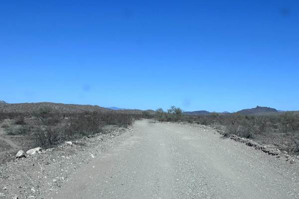
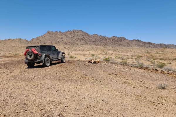
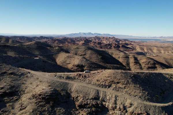
Planet Ranch Road
This 23.3-mile point-to-point section of the Planet Ranch Road is a quick way to traverse the open desert from the Mohave Wash Area to the Alamo Lake Area. This road is a maintained County Highway 133. There is very little washboarding along this trail allows the traveler to drive at speeds of 25-35...
Learn more about Planet Ranch Road
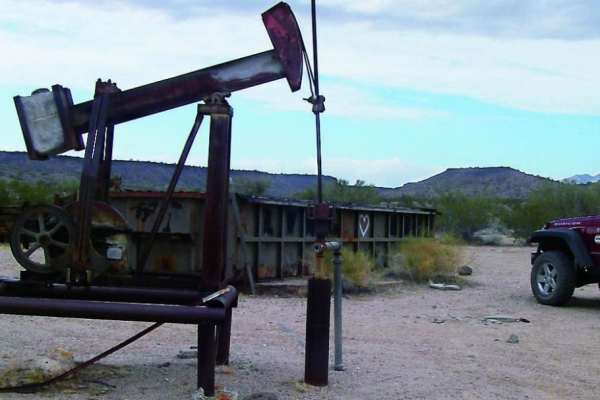
Lower Mohave Wash
This 11.4 point-to-point trail follows the Mohave Wash down to the Bill Williams River National Wildlife Area. This trail is a wide open wash with deep sand that is washboarded. There are several historical items to see along this trail. One of the favorite stops along this trail is Woody's Cabin. W...
Learn more about Lower Mohave Wash
Long Way Around
This trail starts in a sandy wash on LP4180. It is sandy until you turn out of the wash onto LP089. Then you drive up into the desert terrain. Parts of this trail are flat, and other parts are up and down in and out of washes. Watch out for the whoop de doos! There is one tight turn into a wash that...
Learn more about Long Way Around
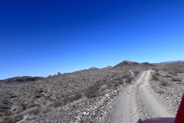
Peace Trail West
This trail is a flat and straight powerline service road, with no technical sections with a couple of small curves that can be fun to take with a little speed if clear. However, there are some cattle gates and wildlife around so stay vigilant. A few really cool more difficult and tight trails shoot ...
Learn more about Peace Trail West
Hn984
This short dirt bike trail climbs up from a sandy wash into the rolling hills of the Standard Wash OHV Area. It follows a narrow and faint single track for 2 miles from north to south. It has some ruts, v-bottom dips into ravines, a constantly loose surface, and lots of wash crossings. It goes throu...
Learn more about Hn984
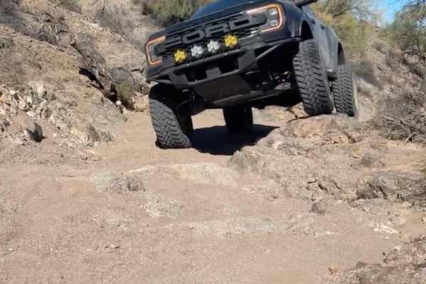
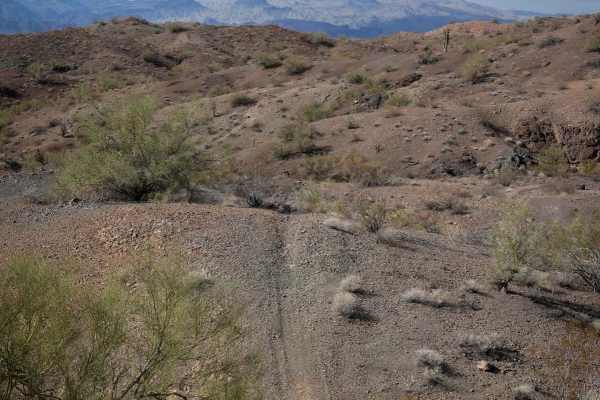
Boulder Gulch
The beginning of the trail starts off similar to the connecting trail "Mohave Wash," which is one of the many ways to get here. Boulder Gulch is a single-vehicle wide sandy trail with multiple whoops and incredible views. There are a few rock garden sections that will absolutely require 4WD and high...
Learn more about Boulder Gulch
Castaneda Hills
This 9.1-mile point-to-point trail takes you from the Castaneda Wash through the Castaneda foothills, pass Castaneda Peak, and into the Mohave Wash. This trail is a great side route of the Arizona Peace Trail and is used more by 4X4 vehicles than SXS. There are a couple of small rock gardens to navi...
Learn more about Castaneda Hills
Beginner ATV trails near Parker, Arizona
Explore ATV-friendly trails near you. These trails are accessible for vehicles up to 50 inches wide, perfect for ATVs and smaller off-road machines.
Swansea Townsite
The Swansea Townsite Trail is a historical and scenic route through the remote Arizona desert, offering a mix of graded access road, rugged shelf sections, and challenging terrain, specifically beyond the ghost town. This trail is ideal for those interested in blending light off-roading with a step ...
Learn more about Swansea Townsite
Osborne Wash
This 3.7-mile track, which goes through the Osborne Wash for part of the trail, provides a cut-across trail to get back into Parker or get out to the Swansea Townsite Trail, without having to go clear around to Shea Road. The track is on BLM and Arizona State Trust Lands. The BLM trail numbers are H...
Learn more about Osborne Wash
Gibraltar Mountain Wanderings
This 4-mile RT trail uses Trail Hs360 to get a little further into the Gibraltar Mountain Wilderness. This wilderness area is BLM land, and the wildlife possibilities include bighorn sheep, wild donkeys, burros, wild horses, quail, and roadrunners. In the AZ desert, be sure to watch for rattlesnakes...
Learn more about Gibraltar Mountain Wanderings
Midland Vidal Road
Used by early settlers to travel between Vidal, California, and the now-ghost town of Midland, the Midland-Vidal Road was perhaps also used by Wyatt Earp, who lived in Vidal for a time. Along the drive, there are wonderful panoramas across Rice Valley and a marvelous perspective of the Rice Valley D...
Learn more about Midland Vidal Road
Beginner UTV/side-by-side trails near Parker, Arizona
Find UTV and side-by-side trails near you. These trails accommodate vehicles up to 60 inches wide, ideal for UTVs, side-by-sides, and wider off-road rigs.
Swansea Townsite
The Swansea Townsite Trail is a historical and scenic route through the remote Arizona desert, offering a mix of graded access road, rugged shelf sections, and challenging terrain, specifically beyond the ghost town. This trail is ideal for those interested in blending light off-roading with a step ...
Learn more about Swansea Townsite
Osborne Wash
This 3.7-mile track, which goes through the Osborne Wash for part of the trail, provides a cut-across trail to get back into Parker or get out to the Swansea Townsite Trail, without having to go clear around to Shea Road. The track is on BLM and Arizona State Trust Lands. The BLM trail numbers are H...
Learn more about Osborne Wash
Gibraltar Mountain Wanderings
This 4-mile RT trail uses Trail Hs360 to get a little further into the Gibraltar Mountain Wilderness. This wilderness area is BLM land, and the wildlife possibilities include bighorn sheep, wild donkeys, burros, wild horses, quail, and roadrunners. In the AZ desert, be sure to watch for rattlesnakes...
Learn more about Gibraltar Mountain Wanderings
Midland Vidal Road
Used by early settlers to travel between Vidal, California, and the now-ghost town of Midland, the Midland-Vidal Road was perhaps also used by Wyatt Earp, who lived in Vidal for a time. Along the drive, there are wonderful panoramas across Rice Valley and a marvelous perspective of the Rice Valley D...
Learn more about Midland Vidal Road
The onX Offroad Difference
onX Offroad combines trail photos, descriptions, difficulty ratings, width restrictions, seasonality, and more in a user-friendly interface. Available on all devices, with offline access and full compatibility with CarPlay and Android Auto. Discover what you're missing today!
Open Trail Map