
Beginner Off-Road Trails
Near Madrone, New Mexico
Explore All Beginner Trails Near Madrone, New Mexico
Beginner Off-Road Trails Near Madrone, New Mexico
Discover the best beginner-friendly off-road trails near you. These easier, lower-rated trails are a great place to start — browse trail maps, check difficulty ratings, and find your next adventure.
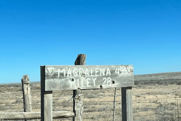
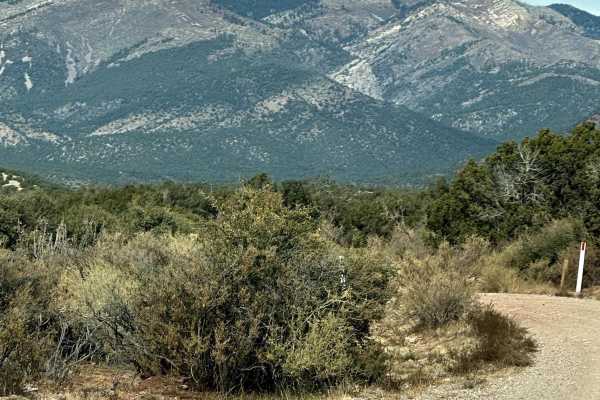
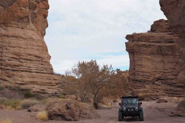
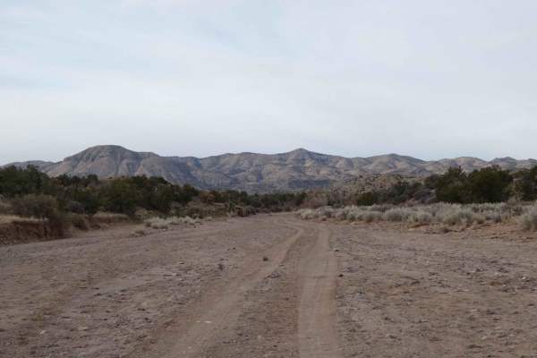
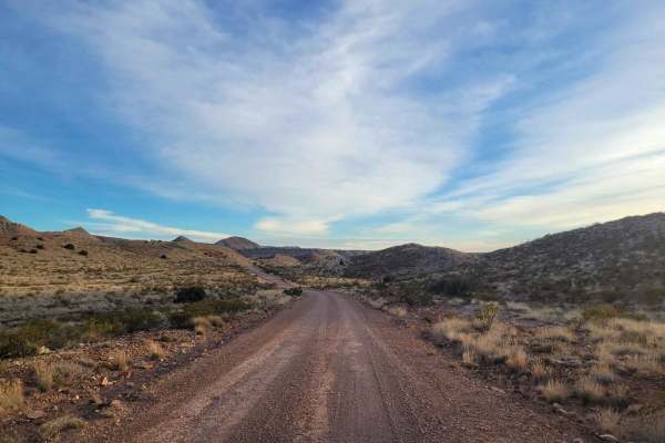
Riley CR 12
This is a wide-open sky drive that starts on the northwest side of the Sevilleta Wildlife Refuge. It winds around the striking Ladron (Thieves) Mountain. There are a few scattered ranches but most of the area is owned by the federal Bureau of Land Management that borders the Wildlife Refuge. The Lad...
Learn more about Riley CR 12
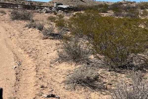
Windmill
This is a spur trail off Riley CR 12. It winds around some small hills and ends at a picturesque windmill, watering tank, and building ruins. The majestic Ladron mountains create the backdrop. Locals target shoot in this area so listen for shooting before venturing onto this trail.
Learn more about Windmill
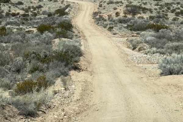
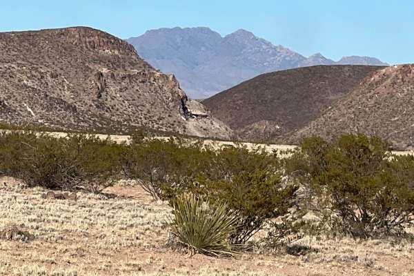
Ladron View
This spur route heads south from Riley County Road 12. It leads to gorgeous views of the Ladron Mountains and open areas for hiking and exploring. There are some old uranium prospects and mines in the area as well. Driving off the designated roads is prohibited. Road conditions vary due to erosion ...
Learn more about Ladron View
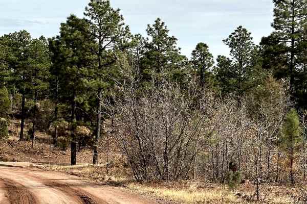
Red Canyon Campground
This is an easy route to the beautiful, well-shaded, and peaceful Red Canyon Campground. The campground is at 7,600 feet in elevation. It can accommodate RVs up to 22 feet. It is easy access to the Manzano Wilderness on the Red and Spruce Canyon trails on foot or horseback. The campground has corr...
Learn more about Red Canyon Campground
FS 422 Priest Canyon
This route travels through the southern tip of the Manzano Mountains and connects the village of Manzano on State Highway 131 with State Highway 60. It travels along a right-of-way through private property on both ends before entering the Cibola Forest. The trail can be dusty and has a few low water...
Learn more about FS 422 Priest Canyon
Fourth of July Campground
This route leads to the premier area to see the Big Tooth Maple in the Manzano Mountains. It is the largest stand of maples in New Mexico. The road is easy but narrow in spots. Camping is available from April through November for tents and tent trailers. There is also a parking area for some short h...
Learn more about Fourth of July Campground
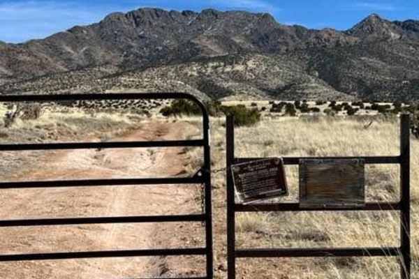
Ladron Wilderness Access
This spur route travels southeast from Riley CR 12 toward Ladron Mountain. The road continues into the Ladron Wilderness Study Area and can serve as the starting point for a hike into the rugged wilderness. There are no designated hiking trails in this area and cell phone activity can be limited.
Learn more about Ladron Wilderness Access
Ladron Wilderness Shortcut
This trail is a shortcut to the Ladron Wilderness Study Area and parking for hiking into the Ladron Wilderness. There are many stories and legends of treasure hidden in this area. The name Ladron translates into Thieves Mountain. According to lore, thieves would rob the wagon trains, travelers, and ...
Learn more about Ladron Wilderness Shortcut
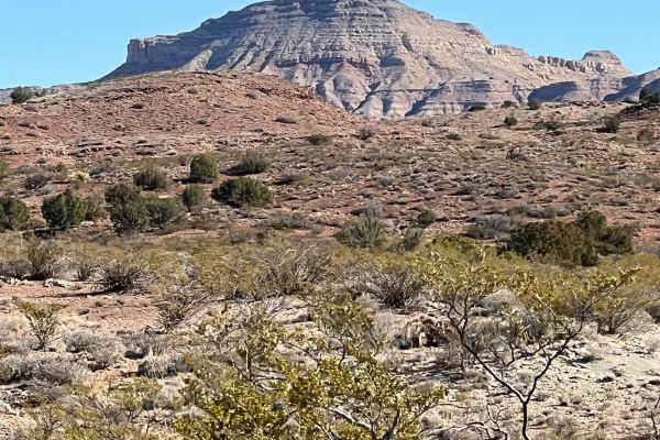
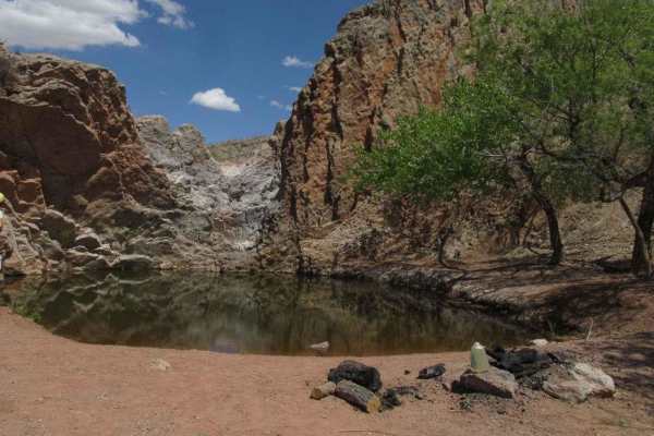
San Lorenzo Canyon
San Lorenzo Canyon is a series of rock formations and canyons on the southern border of Servilleta Wildlife Refuge. This area features numerous hiking and camping opportunities in a unique landscape not far from Albuquerque. It's a favorite day trip for locals, and you will often find others here hi...
Learn more about San Lorenzo Canyon
Puertecito of Bowling Green
This relatively flat, sandy route travels on the east side of the Veranito Wilderness Study Area and the south side of the Sevilleta National Wildlife Refuge. There are some erosion issues, especially toward the end of the route. It dead ends at a geological gap curiously named Puertecito of Bowling...
Learn more about Puertecito of Bowling Green
Smooth Sailing
This route is officially WSMR P Route 5 but most of the signs are gone. It is a smooth sailing, picturesque route that travels along ridges and drops into arroyos and drainages. The vegetation is the upper Chihuahua Desert biome. The route is sandy in spots with erosion ruts along the sides. There a...
Learn more about Smooth Sailing
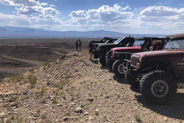
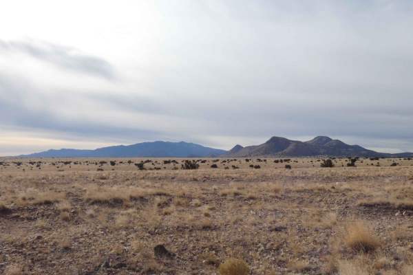
Coyote Exit
Coyote Exit begins just off the Quebradas Backcountry Byway, works its way around the Cerillos de Coyote plateaus, and culminates into a panorama overlook of the surrounding mountain ranges. This includes the Sierra de la Campana, Fra Cristobal, Chupadera, San Mateo, Magdalena, and Sierra Ladrones M...
Learn more about Coyote Exit

Johnson Hill View
As this route climbs Johnson Hill, it follows the National Historical Trail the El Camino Real de Tierra Adentro. This translates to The Royal Road of the Interior Land. It was also known as the Silver Route. It is a 1,590-mile road between Mexico City and San Juan Pueblo (Ohkay Owingeh), New Mexico...
Learn more about Johnson Hill View
Short Wash
Short Wash is just as exactly as it's named. The very short wash track will take drivers over a very soft sand and shale surface through some great scenery that will easily be completed by most AWD and 4WD or 4X4 vehicles. While the center of the track has no major obstacles, the outer edges of the ...
Learn more about Short Wash
Lower Arroyo de Los Pinos
Lower Arroyo de Los Pinos is an essential trail often used to access the larger trail system in the area. It branches directly off Quebradas Backcountry Byway Road and is located just shortly after the major staging area. This trail is relatively easy but does begin with a somewhat steep descent int...
Learn more about Lower Arroyo de Los Pinos
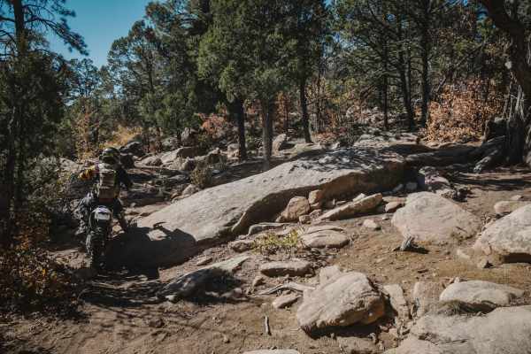
106 Road
106 Road is a dirt bike trail in the Manzanita Mountain Trail System near Albuquerque, New Mexico. It runs south to north and is a quick way to connect the southern trails to ones farther north. The southern half of the trail is a mix of old road and single track. There are rocky spots with tons of ...
Learn more about 106 Road

530 Road
530 Road is an old dirt road that is closed to motor vehicles other than motorcycles. It's super easy the whole way, being a smooth dirt road with only a couple of spots where there is flat embedded rock slab. The east end starts at the Mars Court Trailhead with space for horse trailers and several ...
Learn more about 530 Road
Jack's Valley
Jack's Valley begins on a wide-open and almost unobstructed two-track trail that gradually becomes extremely narrow once in the canyon. The beginning of the trail is a combination of dirt and rocks with only a couple of small washes and no major obstacles. After 3.5 miles into the track, there are s...
Learn more about Jack's Valley
Quebradas Backcountry Byway
The Quebradas Backcountry Byway is a National Scenic Byway, starting north of Socorro and zipping through the desert down to Highway 380. Along the way, you will see a variety of desert landscapes, with rainbow-hued stratification visible on the mountains to the east. The start of the route also ser...
Learn more about Quebradas Backcountry Byway
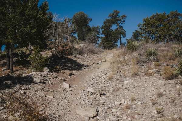
Cajun Pine
Cajun Pine is an easy trail in the Cibola National Forest near Albuquerque, New Mexico. For the most part, it's easy, with a few spots of embedded rock slabs, loose rocks, and small ledges. The south end is pretty full of loose chunky rocks and tight curves through the pine trees. It intersects with...
Learn more about Cajun Pine
Beginner ATV trails near Madrone, New Mexico
Explore ATV-friendly trails near you. These trails are accessible for vehicles up to 50 inches wide, perfect for ATVs and smaller off-road machines.
Riley CR 12
This is a wide-open sky drive that starts on the northwest side of the Sevilleta Wildlife Refuge. It winds around the striking Ladron (Thieves) Mountain. There are a few scattered ranches but most of the area is owned by the federal Bureau of Land Management that borders the Wildlife Refuge. The Lad...
Learn more about Riley CR 12
Windmill
This is a spur trail off Riley CR 12. It winds around some small hills and ends at a picturesque windmill, watering tank, and building ruins. The majestic Ladron mountains create the backdrop. Locals target shoot in this area so listen for shooting before venturing onto this trail.
Learn more about Windmill
Ladron View
This spur route heads south from Riley County Road 12. It leads to gorgeous views of the Ladron Mountains and open areas for hiking and exploring. There are some old uranium prospects and mines in the area as well. Driving off the designated roads is prohibited. Road conditions vary due to erosion ...
Learn more about Ladron View
Red Canyon Campground
This is an easy route to the beautiful, well-shaded, and peaceful Red Canyon Campground. The campground is at 7,600 feet in elevation. It can accommodate RVs up to 22 feet. It is easy access to the Manzano Wilderness on the Red and Spruce Canyon trails on foot or horseback. The campground has corr...
Learn more about Red Canyon Campground
Beginner UTV/side-by-side trails near Madrone, New Mexico
Find UTV and side-by-side trails near you. These trails accommodate vehicles up to 60 inches wide, ideal for UTVs, side-by-sides, and wider off-road rigs.
Riley CR 12
This is a wide-open sky drive that starts on the northwest side of the Sevilleta Wildlife Refuge. It winds around the striking Ladron (Thieves) Mountain. There are a few scattered ranches but most of the area is owned by the federal Bureau of Land Management that borders the Wildlife Refuge. The Lad...
Learn more about Riley CR 12
Windmill
This is a spur trail off Riley CR 12. It winds around some small hills and ends at a picturesque windmill, watering tank, and building ruins. The majestic Ladron mountains create the backdrop. Locals target shoot in this area so listen for shooting before venturing onto this trail.
Learn more about Windmill
Ladron View
This spur route heads south from Riley County Road 12. It leads to gorgeous views of the Ladron Mountains and open areas for hiking and exploring. There are some old uranium prospects and mines in the area as well. Driving off the designated roads is prohibited. Road conditions vary due to erosion ...
Learn more about Ladron View
Red Canyon Campground
This is an easy route to the beautiful, well-shaded, and peaceful Red Canyon Campground. The campground is at 7,600 feet in elevation. It can accommodate RVs up to 22 feet. It is easy access to the Manzano Wilderness on the Red and Spruce Canyon trails on foot or horseback. The campground has corr...
Learn more about Red Canyon Campground
The onX Offroad Difference
onX Offroad combines trail photos, descriptions, difficulty ratings, width restrictions, seasonality, and more in a user-friendly interface. Available on all devices, with offline access and full compatibility with CarPlay and Android Auto. Discover what you're missing today!
Open Trail Map