
Beginner Off-Road Trails
Near Louisa, Kentucky
Explore All Beginner Trails Near Louisa, Kentucky
Beginner Off-Road Trails Near Louisa, Kentucky
Discover the best beginner-friendly off-road trails near you. These easier, lower-rated trails are a great place to start — browse trail maps, check difficulty ratings, and find your next adventure.
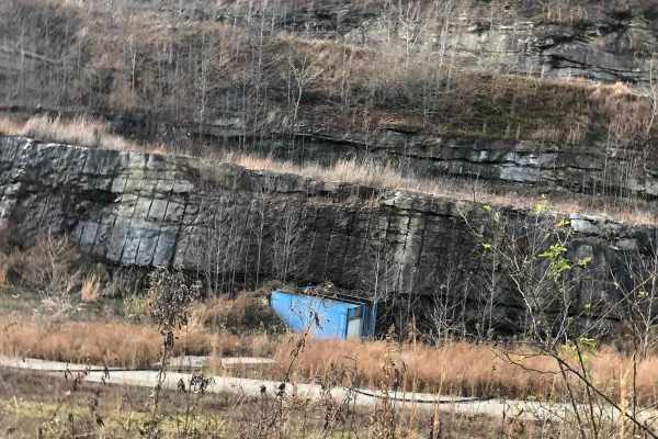
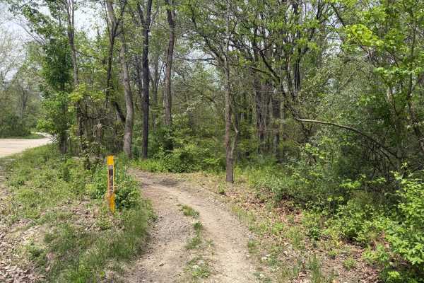
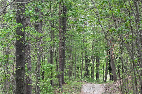
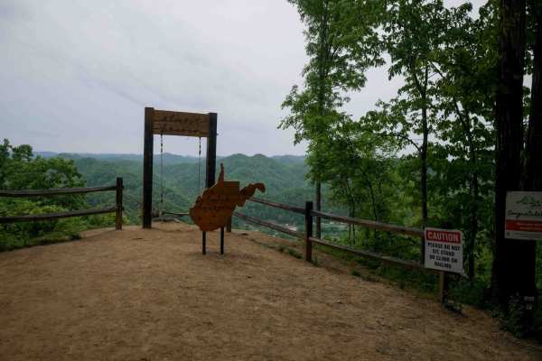
Lycans Ridge
This trail is Easy/Medium in terms of difficulty. The trail starts on a paved road, then quickly turns to dirt for the majority of the trail. There are hills, mud and woods that have to be navigated as you get farther down the trail. There is much more exploring to do along the trail as the area is ...
Learn more about Lycans Ridge
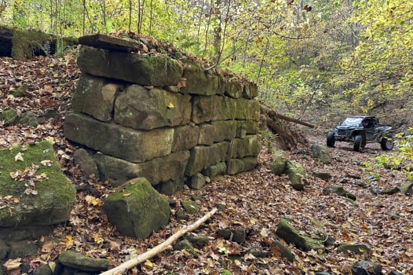
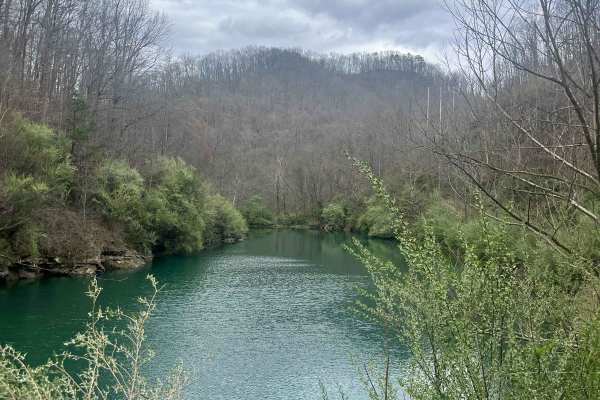
Stonebridge Trail
On this very scenic ride down along the creek, you will pass the remains of two bridges. The first will be on the left and is the larger of the two. The next will be on the right and is slightly smaller. This is an awesome place to get out and look around. This is a really mild trail little to no ob...
Learn more about Stonebridge Trail
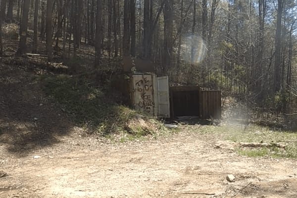
Puncheon Camp Branch
The route is very scenic and fun to travel, with many hidden gems along the way if you know where to look for them. A Bunker is built into the side of the mountain that is fully accessible; the rest are less obvious.
Learn more about Puncheon Camp Branch
Wade Adkins Branch Road
This trail is Easy/Medium. We started on a paved road then it turned to dirt. As we went farther the trail was more off-road and we came across some water crossings, hills, mud and woods that had to be navigated. We have much more exploring to do as the area was beautiful. At the end of the trail we...
Learn more about Wade Adkins Branch Road
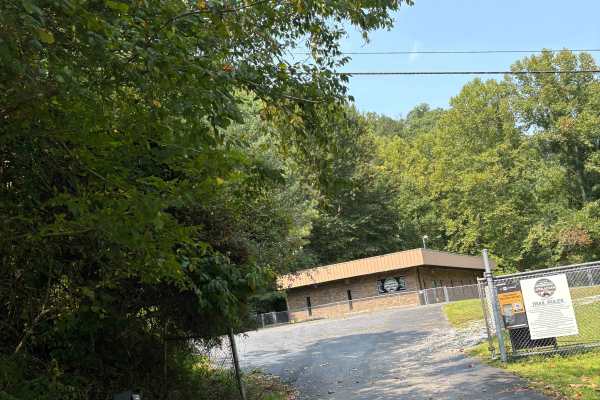
Martin County Trailhead to Trail 1
This is the First Frontier Appalachian Trails office/trailhead. This route takes you from the parking lot to Trail 1. Office/trailhead is located off Route 3 in Martin County. 3548 Davella Road, Debord, KY. There is a porta-john at the trailhead parking. Very easy parking is available in a gravel l...
Learn more about Martin County Trailhead to Trail 1
White Oak Branch Raod
The trail begins in White Oak Branch, where you will cross a small creek. After traveling through the creek, a small pond will be on the right. The road is in great shape for UTVs and even Jeeps. Once you ascend to the top of the mountain, it opens up to amazing views. The rest of the trail is old s...
Learn more about White Oak Branch Raod

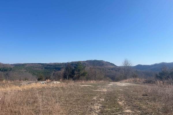
Trail 33
Trail 33 is a green trail and is just a small loop off Trail 15. Has a great lookout point. It is an old haul road from the mining days and a spot where they used to house equipment. Free range cattle like to hang out back here off the main trail.
Learn more about Trail 33
Trail 22 (Lovers Lane)
Trail 22 is a short green trail. When you travel this trail in late summer, early fall, you see why it's called lovers lane with its picturesque views and field of wildflowers. It's a great trail to ride out to the lookout point and have a picnic. You never know what kind of wildlife you will see he...
Learn more about Trail 22 (Lovers Lane)
Emily Creek
This trail will take you from "mud hole point" down to the "Right Fork of Hell Creek" to gain quick access out of the hills for help or repair. It does not have any side rides to confuse you and is pretty straightforward.
Learn more about Emily Creek

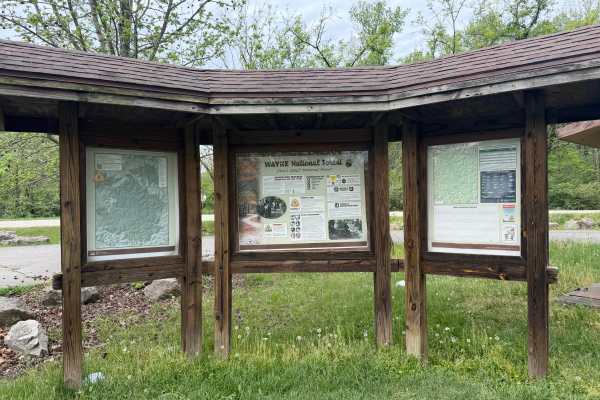
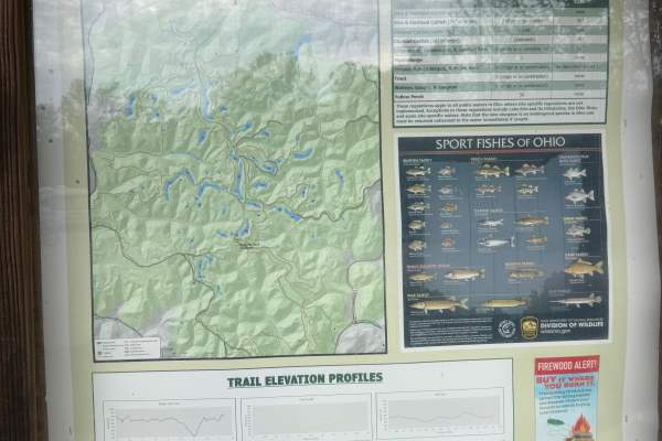
Hanging Rock Trail
Welcome to the Wayne National Forest Hanging Rock OHV Trail System. Wayne National Forest OHV trails require a trail pass that can be purchased from Forest headquarters or local vendors. All trails are limited to a width of 50 inches or less. All trails are two-way. The Hanging Rock Trail is the pri...
Learn more about Hanging Rock Trail
Gas Well Loop
Gas Well Loop (FS 20) is a solid pick for intermediate riders looking to explore southeastern Ohio's Wayne National Forest on an ATV or dirtbike. The loop starts at the Hanging Rock Trailhead and winds southeast through mixed hardwood forest, offering a mix of terrain that keeps things interesting w...
Learn more about Gas Well Loop
Saw Mill Trail
Welcome to the Wayne National Forest Hanging Rock OHV Trail System. Wayne National Forest OHV trails require a trail pass that can be purchased from Forest headquarters or local vendors. All trails are limited to a width of 50 inches or less. All trails are two-way. This short trail cuts off the eas...
Learn more about Saw Mill Trail
Right Fork of Hell's Creek to Hell's Knob
The elevation slowly climbs from the creek bed to the top of the mountain. The dirt is hard-packed with a couple of rocky spots. Anyone with experience can do this without worrying. This is another quick route to the hard top in a need-to situation.
Learn more about Right Fork of Hell's Creek to Hell's Knob
Lake View Trail
Welcome to the Wayne National Forest Hanging Rock OHV Trail System. Wayne National Forest OHV trails require a trail pass that can be purchased from Forest headquarters or local vendors. All trails are limited to a width of 50 inches or less. All trails are two-way. The Lake View Trail twists its wa...
Learn more about Lake View Trail
Pine Cutoff
The Pine Cut off is just what its name says. If you need to get back to the trail head or latrine in a hurry from the Power Line Trail, this trail will get you there. This trail is wide and easy. It does come in handy if you need to get back to the parking lot quickly. Also can be used to re-ride yo...
Learn more about Pine Cutoff
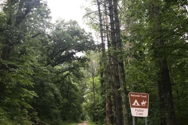
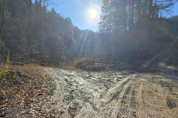
Paddle Creek
Along the dark, desolate, and often foggy Elkins Creek Road sits a hidden gem that is well worth checking out. This deeply rutted, loose-gravel road has several washed-out sections, while Paddle Creek runs alongside it and may flood. Stay straight on Elkins Creek Road, cross the bridge over the smal...
Learn more about Paddle Creek
BM 37
BM 37 is a 0.6-mile connector between BM 36 and BM 10, offering an easy alternative route on the west side of the Buffalo Mountain Trail System. The trail passes a radio tower and runs beneath open skies along the power lines, with a wide, smooth, and gradual surface throughout. It's a simple, sceni...
Learn more about BM 37
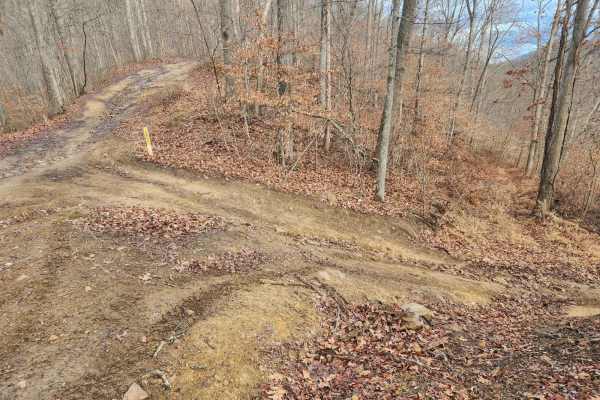
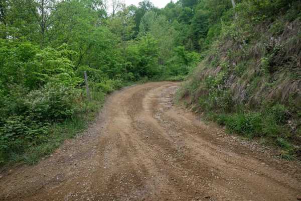
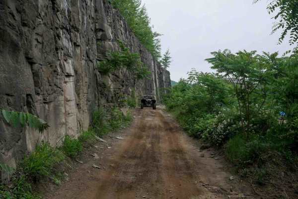
Kimble Ridge
At the fork, turn left onto Kimble Ridge Road and look for signs marking the forest area boundaries and national forest preserve. Take the deeply rutted left turn, and just past the horse trails, a cemetery will be visible on the hill to the left. A gated road will be on the right, so continue left ...
Learn more about Kimble Ridge
BM 36
BM 36 is a short but steep 0.8-mile climb from south to north, zigzagging up the mountainside on the far west side of the Buffalo Mountain Trail System near Williamson. The trail is narrow and winds through lush forest with tight switchbacks, loose rock, and shallow ruts. A scenic viewpoint on the n...
Learn more about BM 36
BM 10
BM 10 is a long, easy access route connecting the town of Williamson to the Buffalo Mountain Trail System. Primarily wide, smooth, and gradual with sweeping corners, it serves as a convenient community connector for riders seeking food, fuel, or access to trails on the far west side of the trail sys...
Learn more about BM 10
Beginner ATV trails near Louisa, Kentucky
Explore ATV-friendly trails near you. These trails are accessible for vehicles up to 50 inches wide, perfect for ATVs and smaller off-road machines.
Lycans Ridge
This trail is Easy/Medium in terms of difficulty. The trail starts on a paved road, then quickly turns to dirt for the majority of the trail. There are hills, mud and woods that have to be navigated as you get farther down the trail. There is much more exploring to do along the trail as the area is ...
Learn more about Lycans Ridge
Stonebridge Trail
On this very scenic ride down along the creek, you will pass the remains of two bridges. The first will be on the left and is the larger of the two. The next will be on the right and is slightly smaller. This is an awesome place to get out and look around. This is a really mild trail little to no ob...
Learn more about Stonebridge Trail
Puncheon Camp Branch
The route is very scenic and fun to travel, with many hidden gems along the way if you know where to look for them. A Bunker is built into the side of the mountain that is fully accessible; the rest are less obvious.
Learn more about Puncheon Camp Branch
Martin County Trailhead to Trail 1
This is the First Frontier Appalachian Trails office/trailhead. This route takes you from the parking lot to Trail 1. Office/trailhead is located off Route 3 in Martin County. 3548 Davella Road, Debord, KY. There is a porta-john at the trailhead parking. Very easy parking is available in a gravel l...
Learn more about Martin County Trailhead to Trail 1
Beginner UTV/side-by-side trails near Louisa, Kentucky
Find UTV and side-by-side trails near you. These trails accommodate vehicles up to 60 inches wide, ideal for UTVs, side-by-sides, and wider off-road rigs.
Lycans Ridge
This trail is Easy/Medium in terms of difficulty. The trail starts on a paved road, then quickly turns to dirt for the majority of the trail. There are hills, mud and woods that have to be navigated as you get farther down the trail. There is much more exploring to do along the trail as the area is ...
Learn more about Lycans Ridge
Stonebridge Trail
On this very scenic ride down along the creek, you will pass the remains of two bridges. The first will be on the left and is the larger of the two. The next will be on the right and is slightly smaller. This is an awesome place to get out and look around. This is a really mild trail little to no ob...
Learn more about Stonebridge Trail
Puncheon Camp Branch
The route is very scenic and fun to travel, with many hidden gems along the way if you know where to look for them. A Bunker is built into the side of the mountain that is fully accessible; the rest are less obvious.
Learn more about Puncheon Camp Branch
Martin County Trailhead to Trail 1
This is the First Frontier Appalachian Trails office/trailhead. This route takes you from the parking lot to Trail 1. Office/trailhead is located off Route 3 in Martin County. 3548 Davella Road, Debord, KY. There is a porta-john at the trailhead parking. Very easy parking is available in a gravel l...
Learn more about Martin County Trailhead to Trail 1
The onX Offroad Difference
onX Offroad combines trail photos, descriptions, difficulty ratings, width restrictions, seasonality, and more in a user-friendly interface. Available on all devices, with offline access and full compatibility with CarPlay and Android Auto. Discover what you're missing today!
Open Trail Map